
This rocky little 1594-ft. peak, the lowest and southernmost spur of the Carr Mountain ridge in the southwestern Whites, is better known for the super-popular "Rumney Rocks" sport-climbing area than for hiking. But the Rattlesnake Mountain Trail is a great option when you want a short morning or afternoon hike that provides both a good workout and excellent views. It's just 2.5 miles round trip with 1000 ft. of elevation gain, most of which is accomplished in the middle part of the trail.
The trailhead is on Buffalo Road in Rumney, which runs along the north side of the Baker River. Don't be fooled by the rock-climbing parking areas - the hiking trail parking spot, marked by a sign, is another 1.8 miles west along the road past the main climber's lot. It's a small and rough parking area; for this hike, on a sunny cool and very windy morning, I parked a short distance east of the trailhead by the Nathan Clifford Birthplace historic marker. From here a connecting path led up to the main trail.

After passing through a nice white pine grove, the trail comes near a small, attractive brook....

...and climbs alongside it through nice hemlocks.
 I spotted two Jack-in-the-Pulpits beside the trail. I've very seldom seen this unique flower in the Whites.
After pulling away from the brook the trail makes a sustained stiff climb. Numerous waterbars put in a few years ago by the WMNF Pemi District trail crew have kept erosion at bay, resulting in surprisingly good footing.
 The trail eases off as it approaches the broad crest of the ridge.
 Up here there were several colonies of Dwarf Ginseng, another fairly uncommon flower in the mountains. (This is not the ginseng with medicinal qualities.)
 The trail makes a loop of about 0.8 mi. around the summit of Rattlesnake.
 I usually take the right (west) fork to the top, which crosses this open ledge partway across.
 My favorite perch on Rattlesnake is a west-facing ledge, reached by a lightly-used side path on the right just before the main trail turns left to climb onto the summit ledges. It was very windy here, almost lost my baseball cap several times. Rt. 25 is seen leading out to Smarts Mtn. (L) and Mt. Cube (R).
 A closer look at Smarts and its long north ridge, which is traversed by the Appalachian Trail.
 Mt. Cube, showing the open ledges on its North Peak. Black Hill is to the L.
 My favorite views from Rattlesnake are looking north to the many trailless ridges and spurs of the Carr Mountain ridge. Fresh spring greens were surging up the slopes.
In this photo, Bald Ledge (not living up to its name from this angle) is on the L and Ames Mountain peers over on the R.
 A few years ago I bushwhacked to Bald Ledge (1740 ft.) from the Rattlesnake trail. There are still some open areas on the flat summit, this one with a view towards Smarts.
 On two other occasions whacks have led me to the ledgy crest of Ames Mountain (2070 ft.), where I found this unusual view NE to the main ridgecrest of Carr Mountain.
 After passing the side path to the west ledge, the Rattlesnake Mountain Trail scrambles up onto the summit ledges, with Stinson Mountain looming to the NE. Peregrine falcons nest on the south-facing cliffs of Rattlesnake most every year, but I was not fortunate enough to catch a glimpse of one today.
These expansive ledges have wide views over the Baker River valley, looking back towards Plymouth.
 The actual summit of Rattlesnake is one of the knobby ledges along the crest.
 Far to the north you can see Scar Ridge (L) and North Hancock (R).
 In 2008 a human-caused fire scorched 54 acres on the south side of Rattlesnake, burning right up to the summit crest. The scars are healing, but some evidence of the blaze remains.
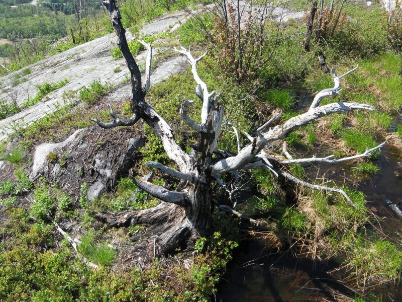
From the summit ledges there's an excellent look north at the ridges of Carr.
 Four Carr summits can be seen here: a nameless 2488-ft. knob in back on the L; Upper Rattlesnake Mtn. (2140 ft.) in front to the L of center; part of the main summit ridge of Carr up in back; and Willoughby Mountain (2340 ft.) on the R.
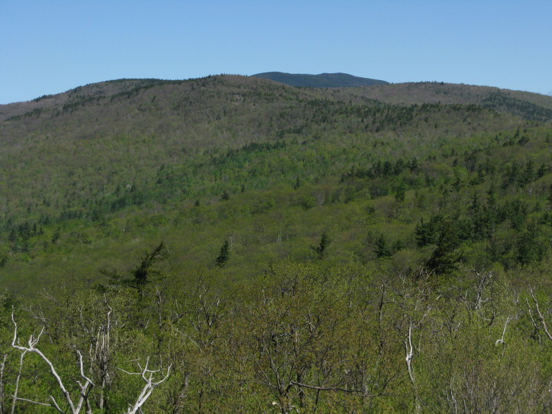
I have long been fascinated by the eight-mile-long Carr ridge, and one of my most memorable off-trail adventures was in August 2005, when I accompanied master bushwhacker J.R. Stockwell on a six-mile ridgecrest exploration from the summit of Rattlesnake to the summit of Carr. Along the way we visited numerous view ledges, the first being this spot on Upper Rattlesnake looking back at Rattlesnake proper (lower L).
 The best of perhaps a dozen vantage points was this one high up on the south shoulder of Carr, looking back over much of the ridge that we had traversed to this point.
A bit farther north, and still a mile or more from the summit and the Carr Mountain Trail, we found what appeared to be the site of a U.S. Coastal Survey station from the late 1800s., marked by an iron bolt and a triangle chiseled into the rock. This spot also had a view north all the way to Mt. Washington. From here it was a long struggle through sometimes-dense conifers to the summit of Carr.
 Back to Friday's hike - heading east down off the Rattlesnake summit ledges.
 You look down on the center of Rumney, a classic New England village.
 Heading back along the east loop you cross one nice flat open ledge with a good view of Stinson.
 The trail then meanders across the interesting summit plateau, eventually bringing you back to the loop junction and the quick descent back to the car.
Are there rattlesnakes on Rattlesnake Mountain? I didn't think there were any left in the Whites, but there have been unconfirmed sightings by rock climbers in talus areas among the higher cliffs.


Steve, thank you for taking us along on this journey. Rattlesnake (Rumney) is one of the many places that I have yet to visit in my short 5 years of hiking the Whites. I've been curious what can be seen from this little mountain. Your report did a fine job of detailing the sights along the way, as well as the views from the top!
ReplyDeleteAs a bonus feature, you also satisfied my curiosity about other points of interest along the Carr ridge. That indeed must have been quite an off-trail adventure with J.R. back in August 2005 when you did a 6-mile ridgecrest exploration from the summit of Rattlesnake to the summit of Carr!
John
1HappyHiker
Thanks, John - it's a neat little mountain. I wouldn't mind going back to part or all of the whack along those southern ridges of Carr. Several fine ledge viewpoints to visit. That area can also be approached from a spot on Stinson Lake Road.
ReplyDeleteSteve
Thanks for posting Steve! I think I smell a hike brewing here. I've had my eye on exploring summit ridge of Carr Mountain especially since it is fairly short drive for me coming from Waltham as I do. Your post has re-wetted my appetite for such a trip. It does sound like a seldom visited area for being so accessible. Should you ever wish to make it a threesome, please drop me a line. If work happens to be slow I’d be available for a mid-week romp in the woods.
ReplyDeleteJazzbeaux
Thanks Ray - it's was a long day traversing that ridge, but a great whack. On another trip I did part of the south ridge out-and-back from Stinson Lake Road. I'll let you know if we plan something up there.
ReplyDeleteSteve
Hi Steve
ReplyDeleteI finally took an after work opportunity to hike Rattlesnake and was not disappointed.
Other than black flies announcing their right to exist the stroll to the summit was good. Views from the ledges were better than expected for a small mountain.
BV
Hi Bill,
DeleteGlad you got up there. It's a great little peak, pretty good views for a not-quite-1600-footer. Good workout too, in that middle section.
Steve