WHITE MOUNTAIN CROPWALK XXVII -- MOUNT PAUGUS LOOP: 10/24/15
On a sunny and crisp fall morning, five of us gathered at the Bickford Trail trailhead in Wonalancet for the 27th annual White Mountain Cropwalk, a "hike for hunger" that benefits the programs of Church World Service. This year's participants included Thom Davis, Roger Doucette, Dennis Lynch, Gary Tompkins and this correspondent. Our route followed a variety of trails in a Sandwich Range Wilderness loop that took in the view ledges and summit of Mount Paugus - one of the most underrated peaks in the Whites - and the neat boulder assemblage called Big Rock Cave. Below is Mount Paugus seen from a ledge on Mount Chocorua's Farlow Ridge.

Since its inception in 1989 our walk has raised more than $69,000 for the anti-hunger programs of Church World Service, with more than $17,000 of that provided to local food pantries in the western White Mountains. Every year some 1,600 CROP Walks are held across the U.S. Ours is the only one in which walkers hike on mountain trails. We owe the success of our walk to the consistent generosity of our sponsors. The CROP Walk theme is “Ending hunger, one step at a time.” To make a donation for our walk, visit
http://hunger.cwsglobal.org/site/TR?fr_id=19834&pg=entry
Our trek started at about 8:45 am with a roly-poly two-mile traverse across the lightly-used Bickford Trail to the Bolles Trail, through a beautiful forest of hardwoods and hemlocks. At the far end was this classic Wonalancet Out Door Club trail sign.
We hopped rocks across Whitin Brook and reached the junction with the Bolles Trail, which follows the route of an ancient logging road.
A short distance north along the Bolles Trail we made a short side trip to the sawdust pile left over from the Paugus Mill operation of the early 1900s. A huge boiler used here was hauled in by a team of 14 horses. Timber was harvested from all the slopes surrounding the Paugus Brook valley between Mount Paugus and Mount Chocorua.
We enjoyed leafy strolling under a high canopy of hardwoods along the gentle Bolles Trail.
After more mellow walking along the Bee Line Cutoff eased us into the Sandwich Range Wilderness, we turned left onto the Bee Line for a serious climb of 1100 ft. in 0.9 mile.
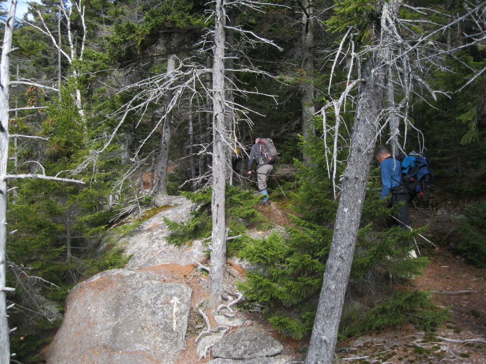
The grade was relentless on this wild, seldom-traveled trail.
Steep climbing continued on the rugged Old Paugus Trail.
At 2800 ft. we scrambled up to a fine outlook ledge facing south and southwest, including this framed view of Mount Whiteface.
Peering south to the Ossipee Range.
Thom, Roger and Dennis take in the view.
Leaving the outlook, headed for the south summit of Paugus.
The group ascends a steep, slippery ledge along the Old Paugus Trail.
A wild spruce forest cloaks the upper slopes of the mountain.
Scrambling up to the south summit knob.
Mount Chocorua dominates the view to the east.
A tree-fringed expanse of ledge caps the south summit knob (3100 ft.). Views are limited here, but about 50 yards to the southwest, reached by a somewhat obscure route, is one of the great viewing ledges in the Whites.
To get to the view ledges, we descended past this assemblage of frost-riven rocks.
This huge open granite slab offers a great view west across the Sandwich Range, including Sandwich Dome, Mount Whiteface above the Wonalancet Range and the nearby crags of The Overhang, and Mount Passaconaway looming above the big cliff face of Square Ledge.
From a lower ledge you can see all the way out to the Franconia Range.
A closer look at Mount Passaconaway and Square Ledge.
A cloudbank hovered out over the Lakes Region, with Mount Mexico and Whitin Ridge in the foreground.
Thom, a glacial geologist and professor at Bentley University, pointed out some dramatic examples of sub-glacial erosion in the Mount Osceola Granite.
The professor in his classroom.
The Wonalancet Range, Mount Whiteface and Sandwich Dome, with Mount Israel on the far left.
Before we headed out, Gary set up his camera on self-timer for our traditional group photo.
Thom was interested in making the fairly short (0.3 mile each way) but reportedly thick bushwhack to the wooded true summit of Mount Paugus. Though I had been to the view ledges at least a half-dozen times I had never whacked to the true summit. We headed down the Lawrence Trail a short way, and four of us struck off into the spruces. Dennis, more sensible, continued along the trail and waited for us at the Cabin Trail junction.
The route we followed was quite thick in places. At one point we skirted around this blowdown patch.
One of the more open sections on the whack.
Signing in at the summit jar of this 3000-footer.
We followed a different route down to the trail, and the upper part was very thick and prickly with lots of blowdown, slow and at times bloody going. Farther down the woods were better, though this cliff band had to be skirted.
Back on the Lawrence Trail, we descended over several excellent relocations fashioned in 2006 and 2008 by the Wonalancet Out Door Club.
An interesting rock along the Lawrence Trail below The Overhang.
After reuniting with Dennis following our longer-than-expected bushwhack diversion (sorry about that!), we headed down Whitin Ridge on the Cabin Trail, passing this view of the dramatic cliffs and slides on the SW face of Mount Paugus.
Next we dropped down the Whitin Brook Trail through blowdown-strewn spruce forest into the remote Whitin Brook valley. The walk down the valley was easy and pleasant.
The junction with the Big Rock Cave Trail is easily missed. Thom and Gary were ahead and went past the junction and were well down the valley before realizing it. So they simply returned to Rt. 113A via our morning route on the Bickford Trail, in the reverse direction. Roger, Dennis and I mushed up the fairly steep climb to Big Rock Cave, one of the more remarkable rock formations in the Whites. After a break we continued up over Mount Mexico, then down to the Cabin Trail and out to the road, negotiating the last 3/4 mile by headlamp. It was a most interesting day in the Sandwich Range!