Wednesday, November 29, 2023

Mount Liberty Slide: 11/28/23

A winter preview bushwhack to a favorite slide high on the SW slope of Mount Liberty. Snow cover was pretty consistent, ranging from a few inches around the Flume to 6-8" above 3000 ft. I bare-booted all the way, though snowshoes would have been useful on the upper reaches.
 
I started from the Flume Visitor Center parking lot, descending to the Flume Covered Bridge with the classic view of Mount Liberty, its slide partly revealed, rising above.


From the upper end of the network of paths around the Flume, I bushwhacked up the slope through open hardwoods to the Flume Slide Trail. There was 4-5" of mealy snow atop a spongy layer of leaf litter, making for fairly tedious going.


A wet open area in a mini-col partway up the slope.


Good hardwood whacking.


Bear tree.


A magnificent maple.


Bear tracks beside the Flume Slide Trail.


Human hikers are not the only woods travelers who use the trail.


Deer!


The trail passes a scoured-out gully at the lower end of the slide track.


At the start of the bushwhack up to the slide, I scrambled over a debris flow levee - a little ridge of boulders deposited alongside the track. These lateral moraines are found along the lower edges of many a slide.


After a brief climb through hardwoods...


...I picked up the trace of an early 1900s logging sled road that I would follow up towards the slide.


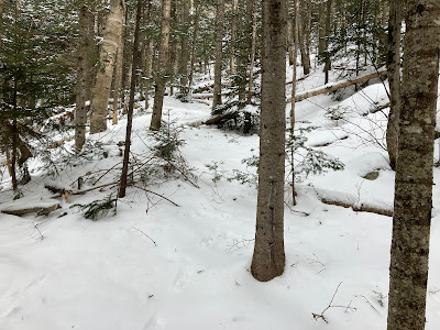
Looking like winter up here.


This is one of a network of old logging sled roads constructed on the south side of Mount Liberty, probably around 1900-1905.


Snowshoes might have been useful here.


The sled road is steeper than it looks in this photo. Hauling logs with horses down this pitch must have been quite the challenge.


I followed a branching sled road up and across towards the slide.


Upon emerging at the lower edge of the slide, I was startled by a confusion of tracks in the snow. Upon closer examination, it was clear that a bear had been wandering out on the steep, snowy swath!


Looking up the slide, I could see that the bruin had wandered down from above.


There was quite a trampling evident on a shelf near the bottom of the slide, suggesting that some kind of foraging was happening down there.


Side view of the slide, which came crashing off Mount Liberty in June 1883, during the same storm that triggered the huge slides on the west face of Mount Flume. The outflow from the Liberty slide surged through the Flume, scouring its walls and dislodging the famed suspended boulder.


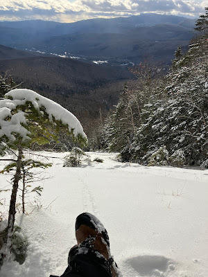
The slide commands a fine view to the SW, dominated by the broad spread of Mount Moosilauke. Snow squalls were sweeping across from the west.


Kicking steps into firm crunchy snow, I paralleled the bear tracks up to a comfortable shelf for a late lunch. In summer this swath is wet, slick ledge and essentially unclimbable.


Close-up of the upper bear tracks. It wisely made switchbacks down the 30-degree snow slope.


Ice bulges guard the upper end of the slide's lower swath.


The sun emerged and cleared out the view. The North Lincoln "strip" along Route 3 is seen down in the Pemigewasset River valley.


I thought about making the steep and strenuous climb through the woods, around the ledge band, to the middle and upper parts of the slide, as I'd done on three previous visits. But the short daylight hours made the decision easy - stay here and savor the sun and views for a while before heading down. 


Descending along the steep old logging sled road.


Down through the hardwoods towards the Flume.


Twilight view of Liberty and Flume from the parking lot. 


The Liberty slide shows up well in winter; perhaps the best view of it is from the parking lot of Indian Head Resort on the west side of Route 3.


This postcard view from the Indian Head tower, probably from the 1920s, shows the main Liberty slide on the right and two tributary slides on the left. Part of a steep logging sled road can be seen to the right of the lower part of the slides.


Wednesday, November 22, 2023

Mittersill Peak Ledges: 11/21/23

My objective for this day's hike was to find a good view, looking from across the valley, of the new slide that fell on the north side of the Cannon Balls last summer. A perusal of Google Earth revealed a large patch of open ledge on the flank of Mittersill Peak, the NW spur of Cannon Mountain. These ledges are almost directly across the Coppermine Brook valley from the slide, suggesting that they would offer an excellent perspective on the barren swath of the slide.

To approach the ledges, I hiked up the Tucker Brook Trail, a backcountry ski route that leads from Tucker Brook Road in Franconia to the Taft Trail on Cannon Mountain near the summit of Mittersill Peak. Parts of this historic route were cut by the Civilian Conservation Corps in the 1930s. It is a locally legendary backwoods ski descent that is described in David Goodman's Best Backcountry Skiing in the Northeast. Unlike many backcountry ski trails, it is mainly dry, with less mucky going than many a hiking trail. Its first half mile follows an old road on private land, intersecting several X-C ski trails of the Franconia Inn network. Shortly after it enters the WMNF, it passes through a gorgeous little valley lined with an open, mature hardwood forest  


A steep slope with some interesting ledges rises to the right. The forest here is wonderfully open, reminiscent of the Catskills.


The trail then gets down to business with some serious climbing.


The width on this section of the trail allows skiers to make wide, sweeping turns.


Birches and fallen ferns higher up on the trail. There is a defined treadway, suggesting that the trail receives some foot and mountain bike traffic outside of the skiing season.


A park-like corridor up around 2700 ft.


At 2800 ft. the trail makes a narrow, rocky sidehill traverse, becoming more like a typical Cannon hiking trail. Good snow cover is needed in here to make it skiable.


I went partway up the steep, upper section of the trail, famed for its "13 turns," where its sidecut angle makes it less pleasant for foot travel.


I chose a spot with friendly woods to launch the quarter-mile bushwhack across the slope to the ledges.


The woods soon turned scrappy and prickly, and remained that way for the balance of the traverse.


Along the way I crossed not one, but two hacked-out bootleg ski trails shooting up the slope. With many cut stubs sticking up, neither looked like it would offer very good skiing.


The terrain became rough and rocky as I approached the ledges. Slow going.


Long, bony spruce branches presented more obstacles.


After an hour of whacking I found the expansive granite ledges.


They offered a nice perspective on Coppermine Col, between Cannon Mountain and the Northeast Cannon Ball.


Looking NW, with Vermont's Mount Mansfield visible in the distance.


Long view to the west beyond the Coppermine Brook valley and Cooley and Cole Hills. The other four Vermont 4000-footers were clearly visible. Black Mountain in Benton is seen on the far left.


The view I came here for did not disappoint. There is the new, wide slide, under the Middle Cannon Ball. The Northeast Cannon Ball is to the left, the West Cannon Ball to the right, with the top of North Kinsman peering over. Snowy South Kinsman lurks in the back.


A closer look at the new slide, which merges with the older, narrow slide on its left. The older slide, which is occasionally skied by backcountry adventurers when the cover is good, looked like one long ice flow this day. The new slide was triggered sometime this past summer or fall, possibly during one of the big rainfalls in July. Despite a chilly wind, I was able to savor the unique view from these ledges for 50 minutes.


Weaving through an area of blowdowns on the way back to the Tucker Brook Trail.


Descending the park-like corridor along the Tucker Brook Trail. This will soon be the exclusive domain of backcountry skiers.