Friday, September 30, 2022

Mount Osceola: 9/29/22

With a forecast of partly to mostly sunny skies, a hike up old favorite Mount Osceola for its stellar views beckoned. A bonus would be an off-trail visit to the top of the big Dogleg Slide on the north side of the mountain, with more views.

There were sunny breaks along the rocky lower part of the trail from Tripoli Road. But as I got high up on the mountain, the clouds were resurgent, and Mount Tecumseh was soon smothered in fog.


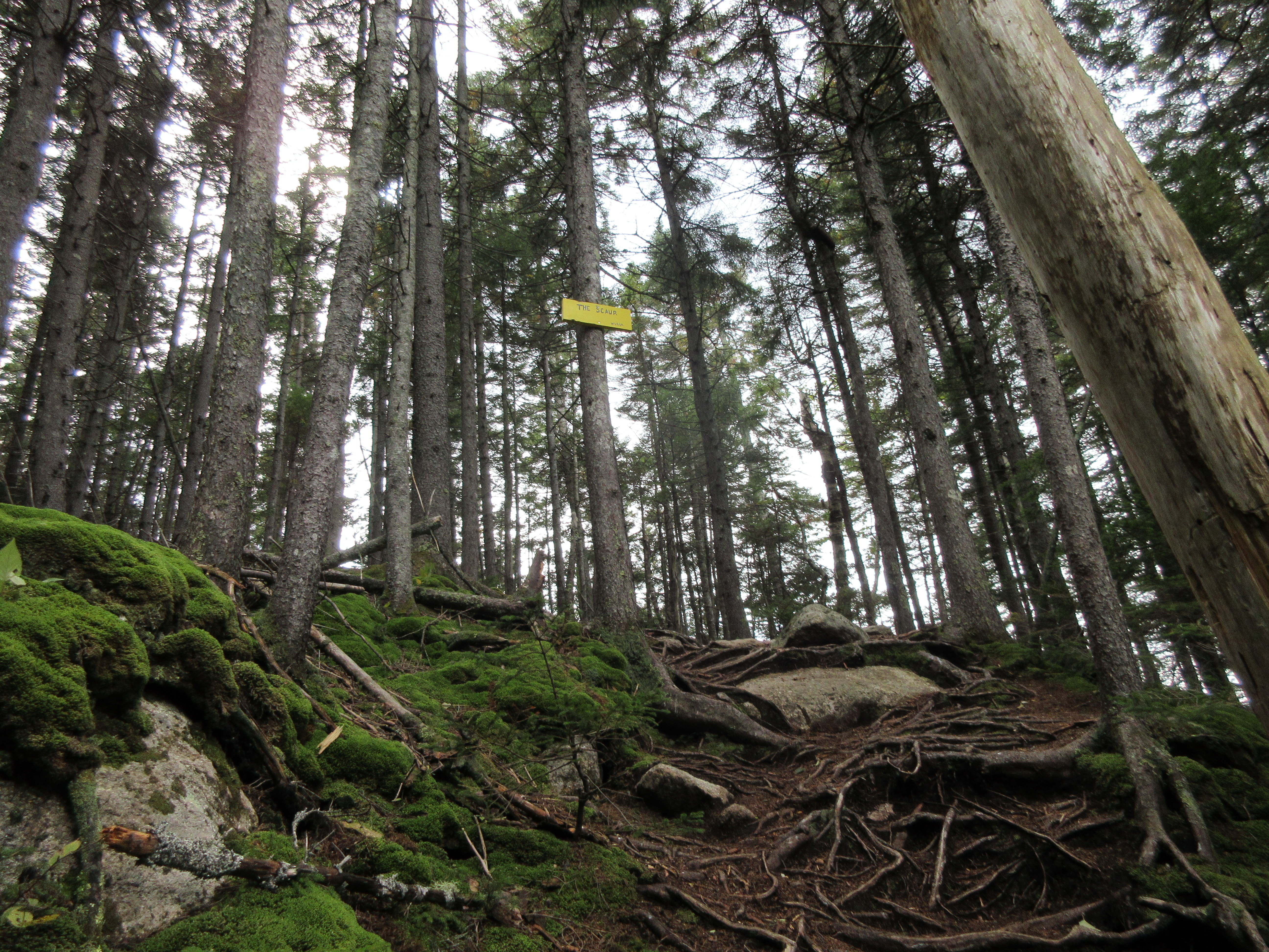
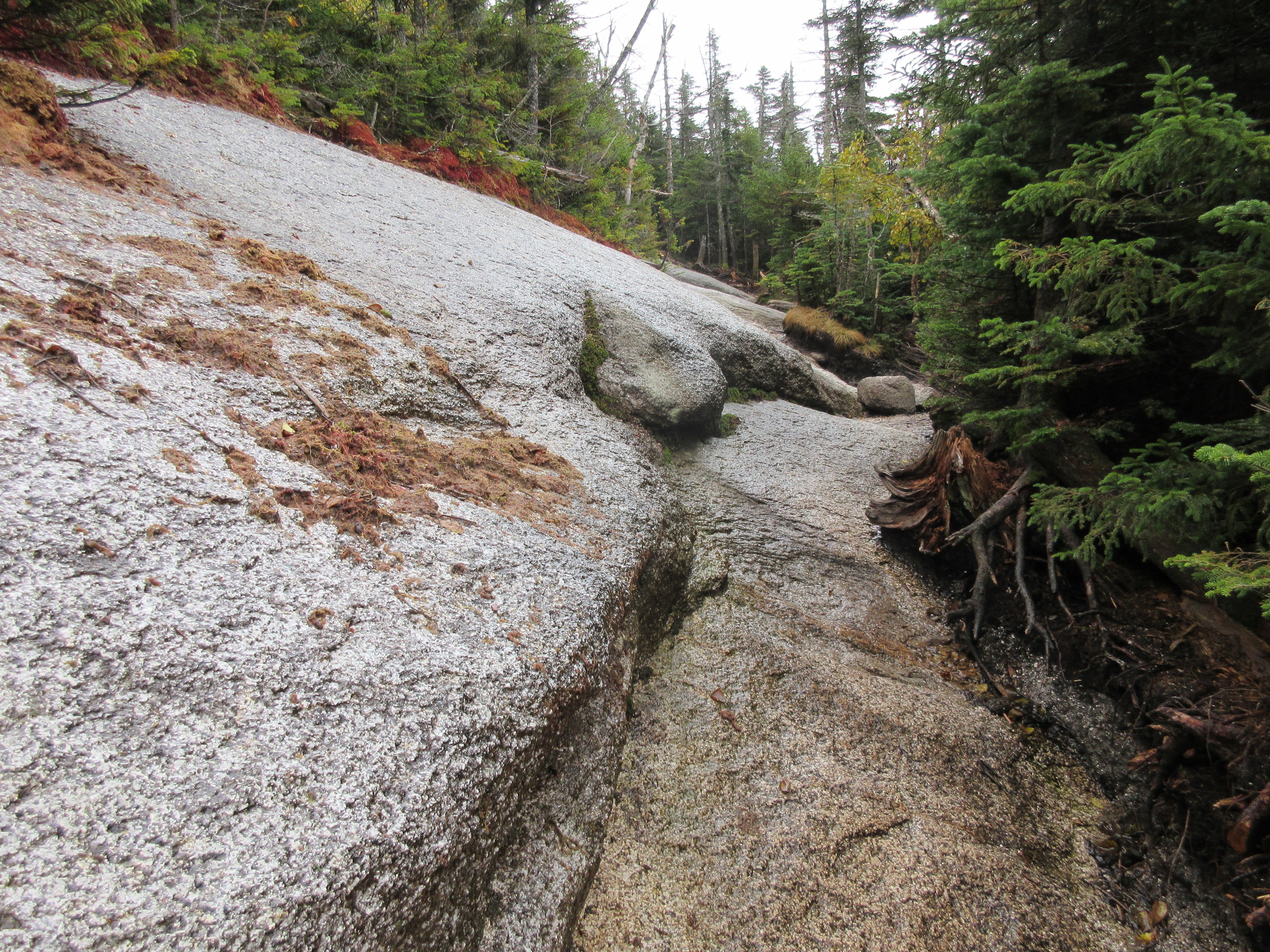
Angled ledge slabs are a notable feature of the upper switchbacks along the trail.


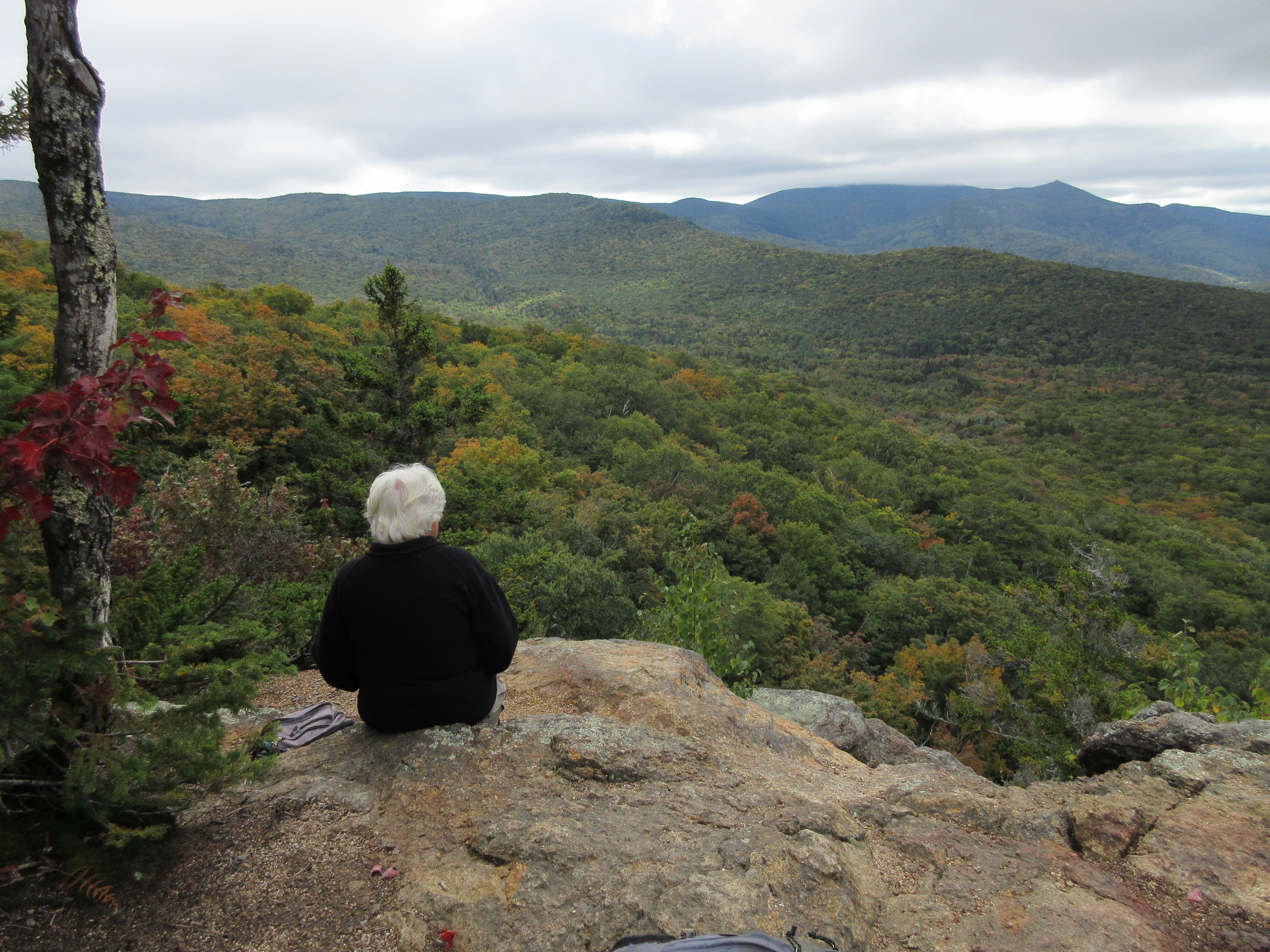
At the big summit ledge, several of us waited patiently to see if the clouds would break.


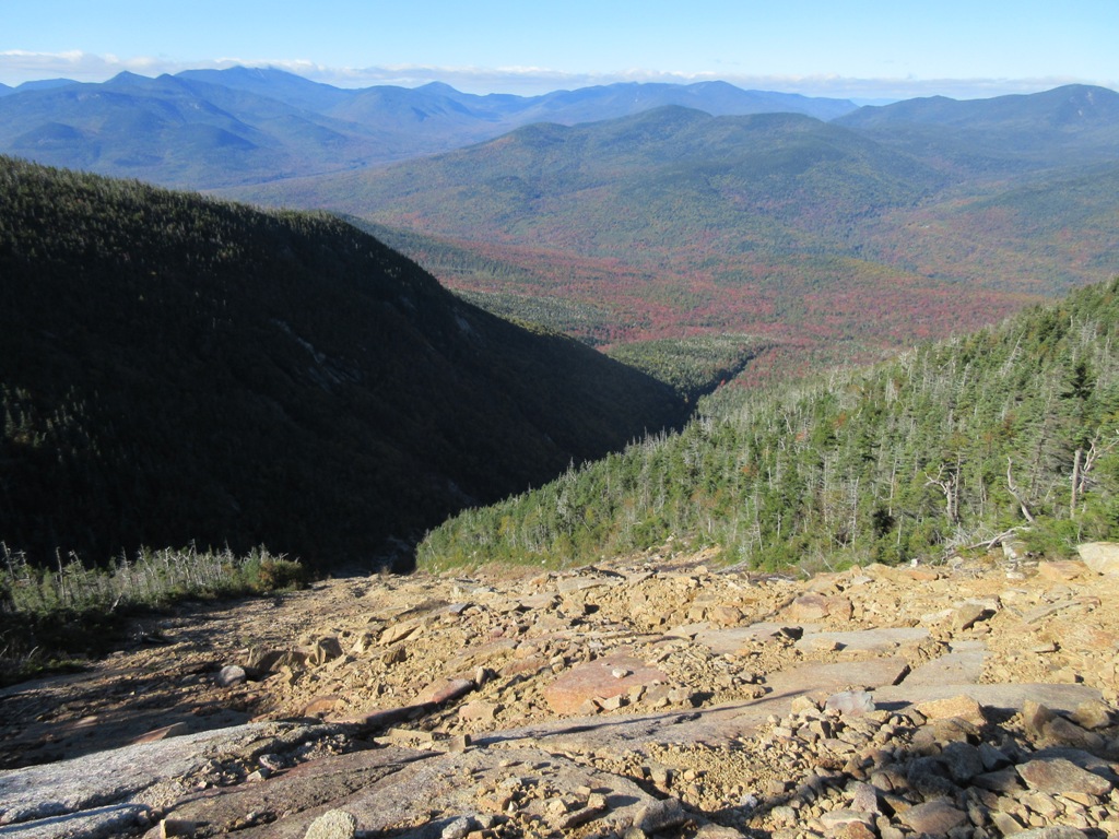
Looking better, as the Osceola Brook valley comes into view below.


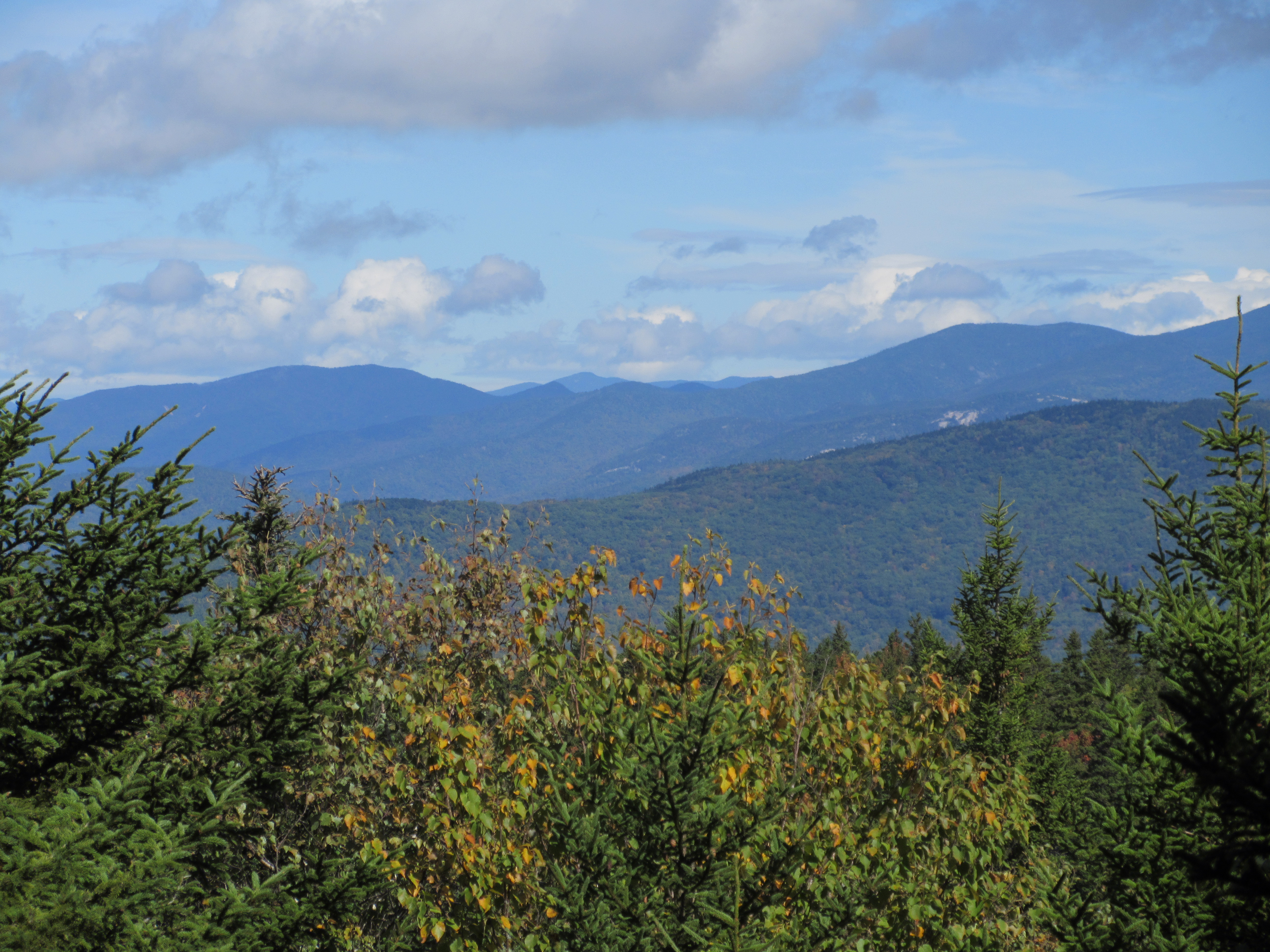
The clouds lift to reveal East Osceola and some distant peaks.


A few minutes later, the skies had almost completely cleared.


The classic eastern view to Mount Tripyramid with Mount Chocorua in the distance.  I stayed to savor the newly revealed views for quite a while.


Then I carefully descended, partly by bushwhack, then along a rough bootleg path apparently cut by backcountry skiers years ago, to the top of the Dogleg Slide. This huge slide fell during a massive rainstorm in October 1995. The upper 500 ft. of elevation is a wide and steep swath of gravel and broken rock with some ledge slabs mixed in. This is prominently seen from the Hancock Overlook on the Kanc Highway and from many viewpoints to the north. Below the upper swath the slide makes a bend to the right (hence the Dogleg name) and continues on a narrower course down over steep tiers of mostly wet ledge, with several lofty waterfalls. Below the lowest waterfall, at ~3000 ft., the runout continues as an open brookbed for nearly a mile, forming the central branch of Pine Brook.


I've probed up the lower part of the Dogleg Slide three times on snowshoes. It's a spectacular place hemmed in by high, cliffy mountain slopes. The highest I've reached was a point below the 35-foot waterfall at ~3200 ft., where Mark Klim and I agreed that this was the limit for snowshoeing; above here is ice axe and crampon territory. I've seen several photo reports on ascending through here in summer, and it's too wet and dicey for my taste. So I figured the only way I would see the dramatic upper swath of the slide was coming from above. 


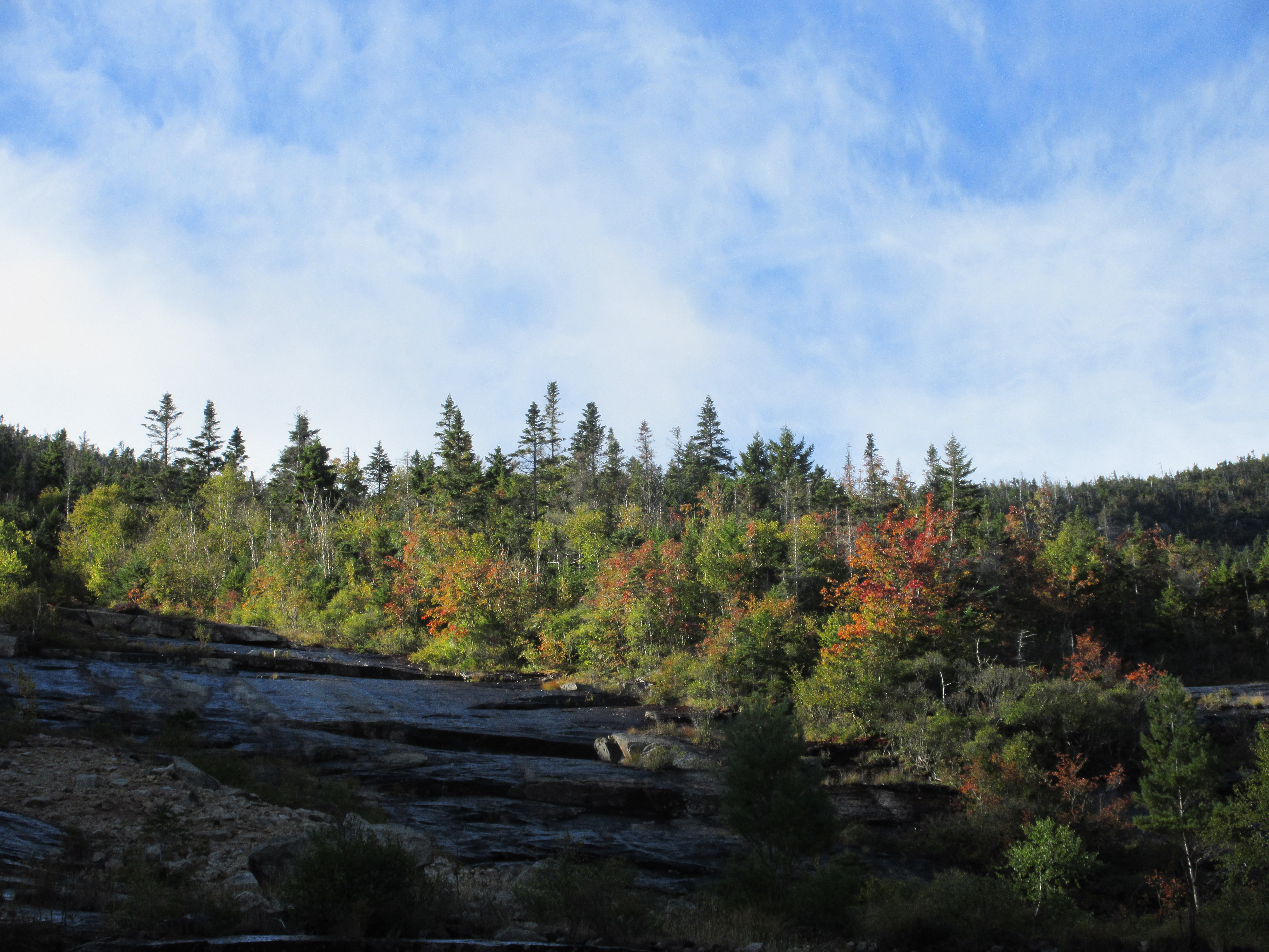
The scenery here did not disappoint.


I picked my way carefully down 100 ft. in elevation to obtain the widest view. The slope here is ~32 degrees.


The peak of Middle Osceola looms nearby to the west.


Looking down to the dogleg turn, cast in shadow in the lowering sun of autumn.


To the right a steep slope drops away from Osceola's Split Cliff.


A zoom on the Split Cliff, and beyond to Mount Carrigain and Mount Washington, peeking out from its shawl of fog.


Mount Washington.


I was interested in traversing across to check out the narrow swath of a much older slide, nearby to the west. I presume this was the slide descended by AMC explorer W. L. Hooper and a companion in July 1882. They ascended Osceola by the trail from Waterville Valley, and spent the night at the summit. “The next morning, we struck down into the great ravine on the north side of the mountain,” he wrote in Appalachia, “and at an altitude of about five hundred feet below the summit, entered the slide that forms the upper part of Pine Brook.” Hooper noted that the slide was easily seen from viewpoints to the north, and that it in turn provided “very wild and grand” views to the Hancock and Twin Ranges. He and his friend encountered some tough sledding: “We found the traveling rather difficult, the choice being between the steep rocky bed of the stream and the tangled growth and fallen timber above its banks….beneath our feet the water jumped from rock to rock in a succession of diminutive cascades, or plunged perpendicularly downward over a huge ledge a distance of forty or fifty feet.” 

A brief probe revealed that between the slides was near-impassable Adirondack style cripplebrush, with dangerous holes underfoot. Nope.


I returned to my seat on the rocks and savored the views a while longer, as the lower ravine fell into shadow.


Heading back up to the top of the slide, I enjoyed a bit of scrambling on dry ledge slabs.


Back at the summit of Osceola, there was no one around.


I took in the magnificent late afternoon views for a half-hour before making the rocky descent back to Tripoli Road.


Wednesday, September 28, 2022

Mount Prospect (Holderness): 9/27/22

Over more than four decades of hiking in the White Mountains, I had never climbed Mt. Prospect (2064 ft.), a once -renowned little peak in Holderness, just  west of the south end of the Squam Range. It took the placement of two relatively new geocaches there by "barefoot gal" (thank you!)  to pique Carol's interest in climbing this peak. I readily signed on to the idea. The mountain is located on private land, some of which is under conservation easement, and the trail up it is not officially maintained and is not included in guidebooks; it is primarily a "local's hike." It turned out to be a very enjoyable trek on a well-used and well cared for trail, with some nice views near the top.

From roadside parking on Mt. Prospect Road in Holderness, we found the trailhead cache and then followed the main trail as it climbs moderately for the first mile on an old woods road with unusually good footing. There is much beautiful hemlock forest along this section. Various side paths intersected along the way. They  had the look of mountain bike paths, but recent signage at the trailhead prohibits the use of bikes.


Higher up, the route becomes more of a foot trail, and the woods transition to open spruce forest that has the look of old pastureland, similar to that found in some areas of Sandwich Notch, though we saw no stone walls.


Partway along the right hand fork of a loop over the summit, a side path leads to this nice open ledge with a view southeast over the Lakes Region. From here, beyond the south end of the Squam Range one can see the Ossipee Range, Red Hill, parts of Squam Lake, a spread of Lake Winnispesuakee, the Belknap Range, and assorted hills in southern New Hampshire.


Along the summit crest the loop passes through this attractive red maple and fern glade.


The trail crosses another ledge with a more restricted view.


After reaching the wooded summit, where there is a U.S, Coast & Geodetic Survey benchmark, Carol dashed off and quickly found the summit geocache.


We then followed a ~0.1 mile spur path downhill to the north to a limited view north to several White Mountain peaks; this photo takes in Scar Ridge, North Twin, South Twin, West Bond and West Tecumseh. Also visible from here are the Franconia Range peaks, Mt. Garfield and Owl's Head. In the late 1800s, the summit area of Mount Prospect was open, presumably cleared for pastureland, and the view was accounted one of the best in the region. Moses Sweetser's classic guidebook, The White Mountains: A Handbook for Travellers, first published in 1876, included a 1 1/2 page description of the view from Prospect, plus a fold-out panoramic sketch identifying the visible peaks. Professor Joshua H. Huntington, a key contributor to Sweetser's guide, listed Mt. Prospect as one of his choices for the six best viewpoints in the Whites.


From here I followed a steep and narrow continuation of the spur path down to an excellent open eastern and northeastern view ledge.


The Squam Range rises beyond a spur of Prospect known as "The Button."


The broad mass of Sandwich Dome rises to the northeast. Mt. Whiteface, wreathed in cloud, is seen in the distance.


We then headed back to the southeastern view ledge along the summit loop, and relaxed for a long time in the sun on this fine early fall afternoon.


Parting shot before an easy 1.6 mile descent back to the trailhead.


Saturday, September 24, 2022

Kettles Path: 9/23/22


On a windy, cloudy afternoon Carol and I enjoyed a hike up the Livermore Trail and Kettles Path to The Scaur, a favorite viewpoint of ours in Waterville Valley. Along the way I did some maintenance work on the Kettles Path, which I adopted this year. Some trail work seemed appropriate on the day before National Public Lands Day.

We passed by some good axe work performed by the OBP Trailworks crew earlier this year, taking out two blowdowns that were too large for my Silky saw.


Did some brushing along a section where beech saplings have been creeping into the trail corridor. Before...


...and after.


A WVAIA sign marks the short, steep spur that ascends to The Scaur.


The south-facing ledges of The Scaur were largely protected from the strong NW winds. The summit of Sandwich Dome was socked in, though the nubble of Jennings Peak was in the clear. A nice spot to hang out for a while.


A hint of early fall color, looking out towards Lost Pass.


Leaving The Scaur.


On the way down I cut up a yellow birch blowdown.


Cleared. I did some more brushing on the way down, but soon the wind gusts ramped up and we heard the cra-a-a-ck of a tree falling in the forest. The rest of the brushing can wait - time to hustle back to the car!


Thursday, September 22, 2022

Scenes from the SW Slide, Mt. Osceola: 9/21/22

 The massive slide unleashed by Hurricane Carol in 1954 on the south side of Mt. Osceola is one of the most impressive in the Whites. I've been here several times in the last few years. A visit always provides a visual feast.

Trees flattened by a small avalanche that scoured the base of the slide last winter.


Recent rains created a cascade on the massive footwall ledge.


Looking up the larger left fork of the slide, the part that fell in 1954.


Pothole pool above the footwall.


Another cascade on the very steep footwall of the older east fork of the slide, which may date back to the late 1800s.


Wet slabs are slick as ice, a no-go for climbing. The slide was wetter then usual after the recent rains, requiring me to stick to areas of gravel and broken rock and patches of dry ledge.


View of Sandwich Dome.


View across where the two forks of the slide meet.


Down-look.


Crumbling granite known as rottenstone.


Looking up to the top of the slide from the point where I stopped, two-thirds of the way up.


I lounged in the sun for more than an hour, taking in the view across Waterville Valley to the Tripyramids, the Sleepers, Flat Mountain and Sandwich Dome.


The Tripyramids, which I had looped over the week before.


The great North Slide on North Tripyramid.


The ledge-dotted crest of Mt. Osceola looms above.


On the slow and careful descent, looking back up.


Looking down.


Smooth slabs.


Fall is coming.