Tuesday, May 24, 2022

Mt. Flume via Osseo Trail: 5/23/22


A crisp spring day, with 100-mile visibility reported by the Mt. Washington Observatory, called out for a hike to a high peak with far-reaching views. I hadn't been up Mt. Flume in four years, and I've always liked the Osseo Trail, so after a short drive from home I was on my way up the Lincoln Woods Trail. The washout along the East Branch 0.7 mile from the trailhead is getting worse, and the Forest Service has plans to fix it this summer. Note that the project listing states that the first 0.7 mile of Lincoln Woods Trail could be closed for 9-12 weeks during the project, which will involve major excavation equipment, probably during low water time in late summer.  This will obviously impact hikes to Owl's Head, 13 Falls, the Bonds, Flume via Osseo, and the Pemi Loop, so hikers should plan accordingly.


Onto the Osseo.


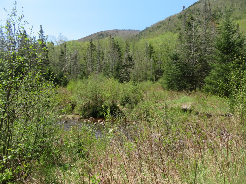
The trail makes a long approach up the valley of Osseo Brook, but only comes close to it in the first 0.2 mile.


A partly buried bed frame from Camp 8 of the East Branch & Lincoln Railroad.


Partway up the valley, the trail follows one switchback of a gravity-powered incline logging railroad built by the J.E. Henry logging operation in 1901. This line only operated for a couple of years; it was abandoned when a brakeman was killed after a car loaded with logs careened out of control on the way down. I believe this is the switchback the incline railroad followed down below the trail, towards the floor of the valley.


Most of the first two miles of Osseo are at easy grades with good footing, paralleling Osseo Brook up its long valley. I walked this trail shortly after it was opened in 1983, replacing the original Osseo Trail over Whaleback Mtn., which was abandoned due to condo construction on its lower section. (Osseo, supposedly meaning "Son of the Evening Star," is another name for Whaleback Mountain.) I remember the soft duff footing down most of the length of the trail. It's rougher and more eroded now up on the ridge, but those lower two miles are still pretty smooth sailing.


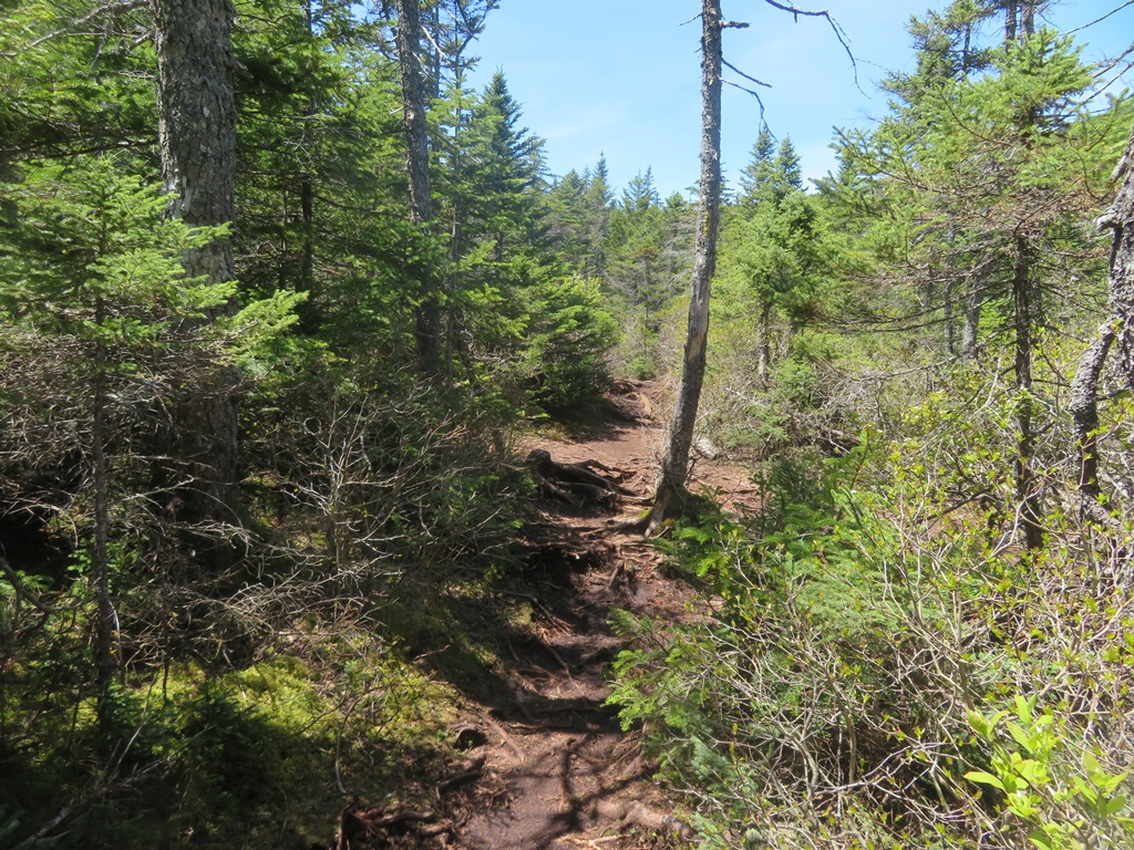
Four decades of hiker traffic and many heavy rainfalls have taken their toll in places on the ridgecrest part of the trail.


The obligatory Osseo ladder/staircase shot as it climbs up the narrow and precipitous nose of this spur ridge. Every time I hike this trail I'm amazed at the steep and rugged terrain it negotiates.


At 4.6 miles from the parking lot, elevation 3500 ft., is this notable viewpoint.


A great vista across the Pemigewasset Wilderness, surging with spring greens in the valleys. The Twin-Bond Range takes center stage, with Owl's Head in a supporting role on the left.


Mt. Flume is still a a mile away and 800 ft. higher.


More ladders above the Downlook.


At the top of these, a short side path on the left leads to a stunning viewpoint looking SE down the curving Osseo Brook valley to multiple peaks on the horizon.


Zoom on a monster slab that adorns the slope on the south side of the valley.


Above the ladders the trail levels on a scrubby shoulder with many black spruces.


Before heading to the summit, I spent some time at a crag to the south accessed by a side path at the very top of the Flume Slide Trail.


Like the summit ledges, this crag has a magnificent view down into the Flume Brook valley and out to Mt. Moosilauke, the Kinsmans and distant horizons. The 100-mile visibility revealed such far-off peaks as Mt. Monadnock, Stratton Mountain, Mts. Abraham and Ellen, and Mt. Mansfield.


And it was an Adirondack day, with the broad bulk of Dix Mountain seen beyond the Green Mountains, through Lincoln Gap.


The sharp profile of Mt. Liberty.


A hiker takes in the view from the top of Liberty.


As you approach the summit of Flume on the Franconia Ridge Trail, crags on the left provide a striking profile of the west-facing cliffs, with Mts. Lincoln and Lafayette beyond.


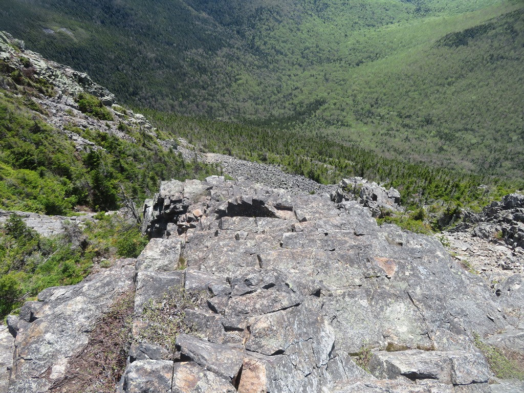
Looking down the Flume slides, most of which came crashing down in a June 1883 rainstorm.


Peering down a gully from the trail.


You clamber up blocky ledges to access the summit crest.


Looking back to the south.


The ragged, rocky crest of Flume may be the coolest summit in the Whites.


Looking back across.


For views east into the Pemi, you have to stand and peer over or between the trees. Here there is a long look up the East Branch valley to the Nancy Range.


The upper Franconia Range and Mt. Garfield. By moving around, one can spot the summits of 33 NH 4000-footers.


Peering straight down from the summit crags. On this crystal-clear day it was great to spend a couple of hours enjoying the views from different perspectives around the summit area.


On the way down the Osseo Trail, a view into the slide-scarred basin of Redrock Brook from the Downlook.


Parting view of the Bonds, displaying the "Guitar Slide" on West Bond and a 2011 Irene slide on the flank of Mt. Bond. The Osseo Trail route to Mt. Flume is 11.2 miles round trip with 3150 ft. of elevation gain.


Saturday, May 21, 2022

Tunnel Brook and Mt. Clough Slide: 5/20/22

A sunny and breezy day for a return to a favorite backcountry nook: Tunnel Brook Notch, the deep valley between Mt. Moosilauke and Mt. Clough, a realm dominated by beaver ponds and massive rock slides. I came in via the north end of the Tunnel Brook Trail, which follows the route of Tunnel Brook Road for 2.3 miles before reaching the trail proper.


The first 0.7 mile of Tunnel Brook Trail follows a decommissioned section of Tunnel Brook Rd., part of which was badly washed out by Tropical Storm Irene in 2011. Nature is reclaiming this section, and it's a rather pleasant walk.


A view of Tunnel Brook.


The rest of the road walk section is your standard USFS gravel logging road.


Along the way I made a short detour on this abandoned roadbed, which once was a crescent-shaped driveway for a small summer hotel called the Parker House. This was opened in 1903 by Lebina Parker along what was then a recently completed road connecting Wildwood and Glencliff via Tunnel Brook Notch. The three-story structure had accommodations for 40 guests, with rates of $2.00 per day and $8.00-$12.00 per week. Its brochure boasted of “a cozy parlor, and a wide piazza on three sides of the house, baths, hot and cold water, and toilet rooms.” Other amenities included croquet and tennis, daily mail and Boston newspapers, and fresh food from its own farm.


Part of the foundation can be seen on the west side of the old driveway. The Parker House operated into the 1920s. The parcel was sold to the Forest Service in 1928, and the abandoned hotel was subsequently burned down.


At a hairpin turn in the road the trail ducks into the woods and becomes an easygoing and pleasant footpath.


The hardwoods were coming alive with fresh spring greenery.


I made a short bushwhack to a brushy beaver meadow along Tunnel Brook with a view of Mt. Clough's ridges.


Looking upstream towards a shoulder of Mt. Moosilauke.


Late May is Painted Trillium time.


This artful cairn has been a Tunnel Brook Trail landmark for many years.


Still some Red Trilliums in bloom.


A mile and a half from the start of the footpath section, the trail reaches the first of seven or eight beaver ponds that are strung along the floor of the notch. In recent years the northernmost ponds have had low water levels with mud flats showing, but this spring they are filled to the brim. The first ponds provide view of several of the eight (by my count) slides on the steep east face of Mt. Clough. In this view are Slide #6 (left) and Slide #7 (right), counting from south to north.


Mt. Clough rivals Mt. Osceola, West Bond and the upper Franconia Range for the title of Slide Capital of the Whites. Its two northernmost slides came down in 1927, and the rest in 1938 (possibly) and 1942. There's an excellent view of the slides, as well as the southernmost beaver ponds, from the South Peak of Mt. Moosilauke.


This view looks at Slide #5, the largest of them all, on the left, and Slide #6 on the right.


Another angle on Slide #5. In 1990 I ascended this slide to its top and continued up to the summit of Mt. Clough, a route I would not recommend.


Two years ago I went most of the way up Slide #4, which features huge, steep slabs of rock, its pitch approaching 40 degrees near the top. Yikes!


The crossing of Tunnel Brook partway along the beaver ponds is a wade at present. Glad I brought the Crocs.


A peaceful scene that reminded me of the old Pink Floyd acoustic song, "Grantchester Meadows."


Parts of the Tunnel Brook Trail are a bit obscure.


Lots of blowdown along the next beaver pond.


I left the trail past the south end of this beaver pond, aiming for Slide #3 on Mt. Clough, one of two that I had not yet visited. Lots of birch on the gentle beginning to the slide approach.


As the steep climb began I got lazy with my navigation - didn't get the compass out - and paid the price, drifting too far to the north and ending up in a nasty conifer area full of jumbled boulders and hidden leg-eating holes, where every foothold had to be carefully placed. I persisted on this dumb route until hitting a dead-end. It was too difficult to make a sideways traverse to where I should have been, so I dropped a couple hundred feet back down to the notch floor to start over.


This time I had the compass out and kept on a more southerly course, which ascended steeply through a rocky birch forest.


I slowly made my way up to the lowest ledges on the slide.


Typical of the Clough slides, it's steep bedrock - averaging 34 degrees overall and 37 degrees on this lower part, with some impassable (for me) ledge barriers. 


First views of Moosilauke's South Peak and the big slide in Slide Ravine.


I worked my way up alongside the slide through wild rocky terrain.


I went out to the edge for another look. Nope, not going out there.


But farther up, at ~2580 ft., I came upon a big dry, grippy slab with a gentler pitch. It seems every Clough slide has a couple of more comfortable spots like this.


The slide steepens again right above this perch.


This was a fine spot to relax for an hour in the sun, with a view down to several beaver ponds and up to the South Peak.


Zoom on the slide in Slide Ravine, another steep one but different in nature, with lots of loose rock.


The world dropping away at my feet.


Beaver ponds zoomed. No moose sighted today.


Late afternoon, shadows getting long.


A deliberate descent is required in this crazy terrain.  The slow pace made me an easy target for the emerging black flies.


Looking back at an "interesting" part of the route.


Before heading out on the trail, I went a short distance south for a break at a nice open spot by the next beaver pond, where a welcome breeze kept the black flies at bay.


Looking down the string of ponds to the south end of the notch. From here it was an easy 4 mile walk back to the car.