Continuing a series of explorations on the ridges and slopes of Mt. Tripyramid, I bushwhacked more or less along an old route to the North Slide described in the 1955 AMC White Mountain Guide:
(From the Livermore Trail) “continue on the main logging road above the Forest Service road, which leads to the logging operations on the NW slopes of Tripyramid, and which climbs in zigzags. Select one of the highest corners on the L, and, leaving the road L, contour through the woods, without trail, reaching the N Slide in less than ¼ mi."
White Cascade on Slide Brook was on its way to becoming Ice Cascade.
Just a dusting of snow on Livermore Trail made for easy walking.
The brook crossing was too sketchy at the south end of Mount Tripyramid Trail, so I whacked along Avalanche Brook, seeking a better crossing, passing this peek at the trio of Tripyramid summits.
A pretty stream. I eventually found a way to cross dryshod, using 'spikes to hop icy rocks.
The trees were the stars of the show today, starting with this elbow trunk.
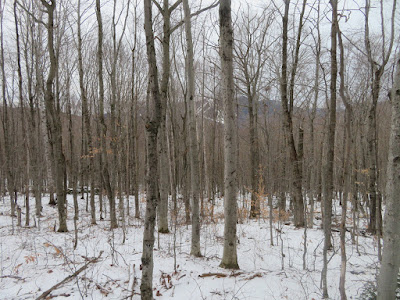
Wonderfully open hardwood whacking on the lower western slope of Tripyramid.
Boulder collection.
One of several obvious old logging roads traversing across the slope. These probably date back to the 1940s/1950s. This entire area is now within the Sandwich Range Wilderness.
Not many bushes to whack in these woods.
An especially wide old logging road.
Remains of a stump from that long-ago logging operation.
Higher up the slope, yet another road.
Nice jointing on this boulder.
An old bear tree.
Looking back to the Waterville Valley ski slopes on Mt. Tecumseh.
A "bear nest" in a tall beech, with North Tripyramid in the background.
These are not sleeping locations; they are created when black bears gather branches together while feeding on beech nuts high in a favorite tree.
Tuning fork tree.
I reached the "summit" of a 2600-ft. shoulder on the western flank of North Tripyramid.
A high hardwood plateau.
Corkscrew tree.
Some large sugar maples on the slope above the shoulder.
I ascended to an upper logging road, which I followed NE and then east, pushing through many small conifers that have populated the roadbed.
Battered by many storms...
...but still standing proud.
Many trees with character, up here at 2900 ft.
Another road diverged to the south. It looked inviting, but wasn't going my way.
Approaching the 3000-ft. level.
Snowshoe hare territory.
Final approach to a hairpin turn on the road - likely one of the "highest corners" mentioned in the 1955 AMC Guide description.
A bushwhack of only 80 yards across the slope brought me to the North Slide, about 1/3 of the way up, at 3080 ft.
Zoom on the open slabs above. This would be a treacherous ascent with the prevailing conditions of thin snow cover and abundant hidden ice.
Looking down the slide. I made a seat in the snow for a late lunch. While I was there a young man came laboring up in Microspikes. I warned him about dangerous terrain above. He only went a little farther up and turned back after encountering a sheet of ice
A crisp view of Mt. Osceola (with the tip of the Southwest Slide visible) and East Osceola.
I descended through the
woods next to the slide, where a few inches of crunchy snow provided much better footing than the icy rocks of the slide track.
Where the Mount Tripyramid Trail meets the bottom of the slide.
A favorite trail sign, in the traditional WVAIA black-on-yellow.
I made a short side bushwhack up Avalanche Ravine, gaining this up-look at the wide ledges high on the North Slide.
Cold icy beauty on the East Fork of the North Slide.
Gnarled old yellow birches overlook the Mount Tripyramid Trail as it traverses Avalanche Ravine below the North Slide.
Walking into sunset on Livermore Trail.
Lidar hillshade image from New Hampshire Stone Wall Mapper (via the NH Granit website), showing old logging roads on the NW slope of North Tripyramid.


