
BALD MOUNTAIN & ARTIST'S BLUFF: 3/27/12
I needed to stay short and close to home for a hike on this sunny, cold and windy day. Perhaps the best trek in this category in the Lincoln-Franconia Notch area is the 1.6 mi. loop over Bald Mountain and Artist's Bluff at the north end of the Notch. This mini-range, which tops out with three little peaks at about 2340 ft., offers great views, especially from the bare, rocky summit of Bald. Though short, this loop has its share of steep, rocky trail sections along its mere 600 ft. of elevation gain.
The two major destinations are Bald Mountain, seen here from the parking area beside NH 18...

...and Artist's Bluff, a cliff at the SE end of the ridge, seen here from the road leading down to the Gallen Memorial overlook.
 The Cannon Peabody slopes parking lot was open, so I was able to park right at the start of the trail. Normally, hikers must park in a designated area beside NH 18. The trail has usually been called the "Bald Mountain-Artist's Bluff Path," but in 2011 it was renamed the "Veterans Trail" in honor of New Hampshire's veterans. The signage with the new name is not yet in place.
 The first 0.3 mi. climbs up a rocky old carriage road through fine hardwoods. This was built about 1859 by the management of the nearby grand hotel, the Profile House. (For history and much more on Bald Mountain & Artist's Bluff, click here.)
 At the top of the little ridge, the spur trail to Bald Mountain splits left, soon climbing to this ledge scramble.
 A bit farther up, as the trail breaks into the open, this south-facing perch looks across at Cannon Mountain, whose ski trails had now closed for the season.
 Some fairly steep ledge scrambling leads to the top of Bald Mountain. The rock has good grain and excellent grip, at least when dry. It's a great hike for kids who love clambering up the rocks.
 Looking east to Scarface Mountain, Big Bickford Mountain and Mt. Garfield. North Twin peeks over to the L of Garfield.
 Bald provides a grandstand seat for viewing Mt. Lafayette, which rises above Eagle Cliff and the slide-scarred ravine of Lafayette Brook.
 Bald has a long view out to the NE, focused on the Pilot and Pliny Ranges.
 I thought I would get blown off the summit by the gusty NW winds, but the south-facing trail was protected all the way up, and even at the top the wind was quite tolerable despite a temperature around 30 degrees. I was able to linger for a while and enjoy the views south into Franconia Notch...
 ...and northwest and west to Vermont, where snowy Mt. Mansfield and the tip of Camel's Hump were spotted on the horizon.
 A wider shot of Lafayette, rising above the nearby hump of Artist's Bluff Ridge. After enjoying the summit views, I spent additional time lounging on sunny, south-facing ledges a short distance down the trail.
 Back at the ridgetop junction, I continued on towards Artist's Bluff, pausing to admire these hardwoods in the Bald-Artist's col.
 Though short, the trail heading towards Artist's Bluff has a nice ridgecrest look to it. With the ground hard-frozen and a dusting of snow on top, it felt more like early December than late March.
 You cross over two wooded humps before descending to the Artist's Bluff cliff. The first hump has an outlook towards Cannon.
 The second hump has a fine standing view south to Echo Lake and the Notch, with Mt. Liberty's sharp peak filling the gap.
 The descent towards Artist's Bluff is steep and rocky.
 A painted arrow points the way to the side path.
 An interesting boulder is perched at the spot where you emerge onto the cliff.
 The gorgeous view over Echo Lake and the Notch inspired Profile House guests to ascend this cliff to paint or sketch the scene. Of course, in those days there was no parkway or exit interchange, with attendant vehicle noise, to disturb the tranquility.
 Looking NE across the ledges.
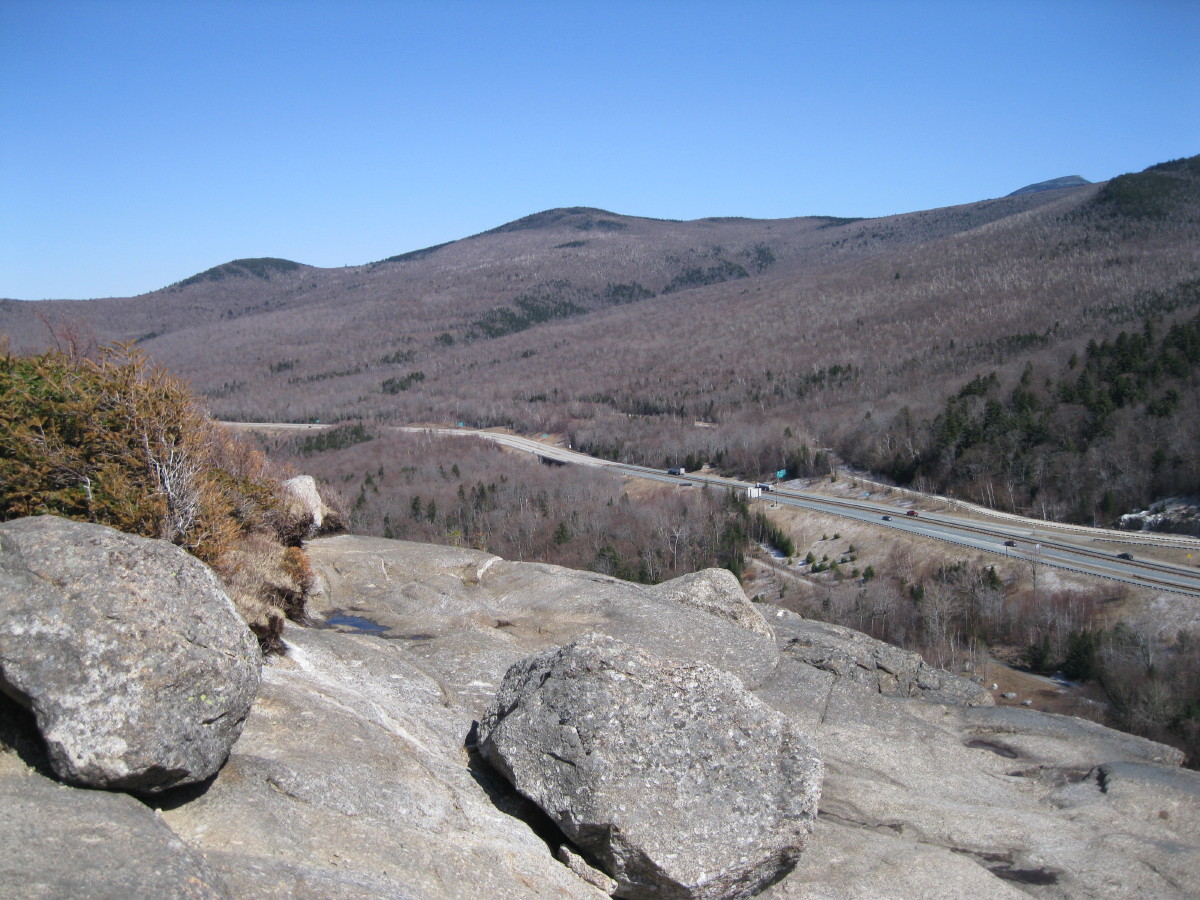 From Artist's Bluff, the trail drops steeply over a well-constructed rock treadway. This excellent work was performed by the Trailwrights, with assistance from a NH state prison crew. Here the trail passes under a cliff called "Little Monalisa" by climbers.
 Farther down there are glimpses of the main Artist's Bluff cliff through the trees.
 A partially new route called the Loop Trail now connects the two ends of the Veterans Trail. The first 0.2 mi. follows an older route previously called the Short Circuit.
 The second 0.2 mi. of the Loop Trail is on new treadway recently constructed by the Trailwrights and friends. It comes out just above the trailhead at the Peabody slopes parking lot, completing a rewarding 1.6 mi. loop.


