On one of the rare nice days this July, Ray "Jazzbo" Caron and I took a long walk out through Carrigain Notch and down into the eastern Pemi Wilderness. In addition to immersing ourselves in the solitudinous woods of the eastern Pemi, we climbed partway up an old slide on the steep slope of Mt. Lowell for some unique views of the Carrigain Notch area.
Ray heads onto the trail. There were 17 cars in the lot at 9:00 am; evidently all these folks were headed to Mt. Carrigain as we saw no one on Carrigain Notch Trail.
Looking down at a cascade on Whiteface Brook, along Signal Ridge Trail.
Crossing Carrigain Brook.
View of Signal Ridge from a beaver meadow near the trail.
The junction of Signal Ridge Trail and Carrigain Notch Trail was relocated in 2012. Signal Ridge Trail now follows a relocation that was cut that year.
In its first mile, Carrigain Notch Trail runs at easy grades through fine hardwoods featuring some elders of the forest.
Excellent walking through here.
A peculiarity of this trail is the dry stony brookbeds it crosses farther up the valley.
Artifacts from a logging camp site near the trail, presumably from the Saunders Co./Sawyer River Railroad.
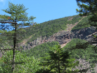
Partway up the climb to the top of Carrigain Notch we saw this view of cliffs and slides on Mt. Lowell.
The summit of Lowell and the spooky-looking cut known as The Chute.
Into the Wilderness.
Near the height-of-land we left the trail for a bushwhack to a slide on the face of Mt. Lowell. This impressive peak was described in Charles H. Hitchcock's massive The Geology of New Hampshire, published in the 1870s:.
"Directly opposite to Mt. Carrigain upon the east rises a noble summit, scarred with tremendous slides, and forming with Carrigain a notch not inferior in depth or abruptness to the White Mountain Notch itself. This fine summit we named Mt. Lowell, in honor of one of the oldest and most enthusiastic among White Mountain explorers,-Abner Lowell, Esq. of Portland."
Whacking across the floor of the notch.
Ray emerges at the bottom of the slide, which is composed of very loose gravel and rock.
Vose Spur looms large across the notch.
Signal Ridge juts out to the left.
Ray hung out on the lower open patch of the slide while I pushed steeply up through birch scrub and out to the larger open part of the slide above.
A patch of bluebells was in bloom on the dry and desolate slidescape.
Up here a view opened NW across the Pemi to the Bond Range.
Visible peaks included Lafayette, Bondcliff, Bond. Guyot, South Twin, North Twin and Zealand.
Zoom on Lafayette.
This slide is steep with very sketchy loose footing.
Emerging from the scrub higher up.
Looking down.
Peering up to a cliff band not far above. Rockfall is a concern in a spot like this, so I didn't stay too long.
Signal Ridge and Mt. Carrigain.
Mts. Passaconaway and Whiteface seen to the south from the lower part of the slide.
Parting shot.
Ray checks our location as we descend Carrigain Notch Trail into the eastern Pemi.
The downgrade is mostly gentle, and overall Carrigain Notch Trail is in excellent shape, with evidence of recent brushing and blowdown removal.
There are acres and acres of stark, wild spruce woods out here, with a back-of-beyond feeling..
Junction with Nancy Pond Trail. Here we turned right along an old logging railroad grade towards Camp 19.
Railroad grade tunnel.
The woods on either side here would be a bushwhacking nightmare.
Ray takes in the scene at the crossing of the East Branch of the Pemigewasset, below the confluence of Anderson Brook and Norcross Brook.
Peaceful.
Arrow-straight and good walking.
The brushy site of the East Branch & Lincoln Railroad's Camp 19. This location housed J.E. Henry's logging crews during the 1910s.
The clearing was so overgrown we made no effort to look for artifacts. Best time is spring or late fall.
Just beyond the camp is Anderson Brook, a remote headwater stream.
Time to relax for a while before making the 6.5 mile trek back to Sawyer River Road.
This artifact was located quite a distance away from Camp 19. As always, note that it is illegal to remove historic artifacts from the WMNF.
Crossing back over the East Branch.
Wild!
On the long, easy climb back to Carrigain Notch.
Late day sun on the Lowell cliffs.


