Sunday, July 28, 2013


GALEHEAD MOUNTAIN: 7/26/13

With a storm moving up the coast, the higher summits were forecast to be in the clouds, and there was a chance of showers, especially to the east. West was best today, and a hike to the relatively low summit of Galehead - which I hadn't been to in a few years - seemed like a good choice. And there was the option to re-visit the big 1954 slide in the Gale River valley on the way down.

In the morning the temperature was in the 60s with a high overcast, low humidity, and no bugs - pretty decent hiking conditions compared to the recent heat wave. The first two miles, which I had just hiked a week earlier, went by fairly quickly. As it was last week, the first half of the 2011 relocation was quite muddy, while the second half had generally great footing and nice woods, such as this lush glade.


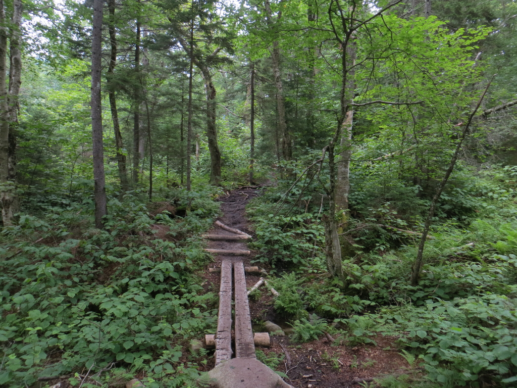
After rejoining the original route, the trail crosses a small brook that drains an old slide.


A bit farther along, the trail emerges in an open gravelly area at the base of the aforementioned 1954 slide, which fell during Hurricane Carol in August. (More on this later.) From this spot you can look down at the North Branch of the Gale River and up at the high, wooded ridges of the Twins.


I dropped down for a closer look at the river. This is a neat, remote part of the valley.


At the bottom of the steep rocky climb to the Garfield Ridge Trail junction, Nate, an avid bushwhacker, caught up to me. He was heading up to climb East Garfield (aka Mt. Pam) and West Garfield, two peaks on the NH 100 Highest list. He was also thinking of continuing on to Mt. Garfield. Nate travels light and fast, unlike this writer, who plods along with a 25-lb. day pack. We hiked together up to the junction, talking about various bushwhacks.


After a rough and rocky traverse (is there any other kind) on the Garfield Ridge Trail, I arrived at the junction by Galehead Hut.


The hut was fairly quiet at lunchtime. This is the most remote of the eight AMC high-country hostelries, which are celebrating their 125th Anniversary this year.


Though the lofty Twins were smothered in cloud, the fog parted at times to reveal the neat view offered by the clearing in front of the hut. I had forgotten how nice this vista was, looking down the Twin and Franconia Brook valleys between the slopes of Southwest Twin and Galehead Mountain.


The vista includes (L to R) Scar Ridge, Loon Mountain, Whaleback Mountain, Owl's Head and Mt. Flume.


Galehead Mountain, nearby to the SW.


Another look at Galehead, from a fir wave along the Frost Trail.


The Frost Trail, which was built by hut visitors Jack and Ruth Frost in the early 1950s, has one good steep, rocky pitch.


The outlook on the Frost Trail is perched on the edge of a very steep slope carpeted with bonsai-size scrub. It's a unique spot with a view across the deep Twin Brook valley to the massive SW ridge of South Twin. Mts. Osceola and Tecumseh can be seen off to the south.


A look down at the hut set on its little wooded hump.


The down-look into the Twin Brook valley.


I continued a few minutes up to the wooded summit of Galehead. When the Frost Trail opened 60 years ago, this spot reportedly offered quite a panorama to the west. The trees are now grown to the point where the summit is totally and irredeemably viewless.


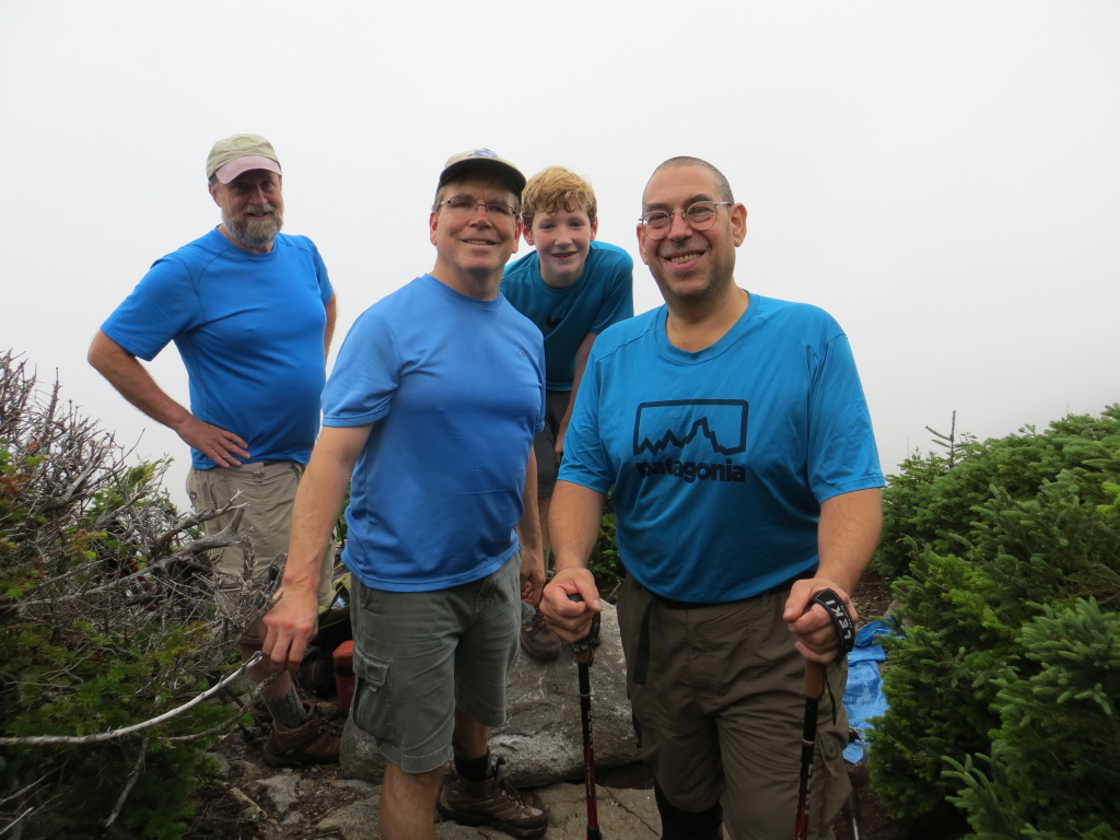
When I came back to the outlook, I ran into Marty and Ann, a delightful couple from Brooklyn who had come into my store the day before. They were inspired to visit the White Mountains by reading Tom Ryan's book, Following Atticus, and were starting a several day hut-to-hut trip at Galehead. We chatted about various subjects such as the scrubby trees around the outlook, the state of music education in NYC (Marty is a music teacher), and their beloved pet rats. They are enthusiastic hikers in the Bear Mountain-Harriman area of New York; Galehead would be their first NH 4000-footer.


A father and son came by, and since we all had blue shirts on, Ann took a photo of the Galehead Blue Man Group.


Looking at the outlook and its sitting rock from the trail.


Some open ferny fir forest along the Frost Trail.


Back at the hut, weird light on Owl's Head.


On the way back down the Gale River Trail, I bushwhacked up to the open part of the 1954 slide. As related in a 1957 article in Appalachia, an AMC hutman packing up supplies was almost swept away in a flood when this slide came crashing down. Former hutman Alex MacPhail, an avid hiker and naturalist, has been documenting the revegetation on this slide as related on his excellent and informative blog, White Mountain Sojourn. This gravel bank is on the lower part of the slide.


The upper part of the slide is still quite open, though the wet ledges are extremely slippery. Back in 1995 I ascended this slide to its top and bushwhacked up to the Garfield Ridge Trail; it seemed much wetter today, perhaps due to the rainy early summer.


Looking across the slide - don't step out there!


Though the upper ridge of North Twin was socked in, I had a fine view across to a cliff-faced spur of the mountain.


A close-up of the wild cliffs on the spur. They look pretty inaccessible on top, but it might be worth a try....lots of neat places to explore in the Gale River valley.


Tuesday, July 23, 2013


THE SUGARLOAVES: 7/22/13

The short, moderately strenuous and very rewarding hike to these two rocky little peaks near Twin Mountain was a trip up memory lane for me. From 1986-2005, my friend Bill Vecchio and I were the adopters of the Sugarloaf Trail, and we climbed the Sugarloaves dozens of times. This was my first trip back since 2005, and it was neat to see the trail with fresh and carefree eyes.


 The Sugarloaf Trail starts with a scenic 0.2 mi. section along the Zealand River.


 The Forest Service crew recently did some nice turnpiking along a swampy section.


A cool split boulder near the start of the climb.


The trail climbs fairly steeply to the col between Middle Sugarloaf and North Sugarloaf.


A neat section heading across the saddle towards Middle 'loaf.


At the top of the last short but steep climb to Middle, a ladder helps up a steep ledge.


The top of Middle Sugarloaf is a huge expanse of granite, exposed by a 1903 forest fire. Mt. Hale is close by to the south, though the true summit can't be seen, over the northeast peaks. The East Peak of Hale juts out on the left.


Looking up the Zealand Valley to the Rosebrook Range and Mts. Tom & Field.


North Twin rises massively to the SW, with the top of its 1995 northern slide visible. Peak Above the Nubble is on the R.


Lots of ledge to wander on here! This is a perch on the western side.


Looking towards North Sugarloaf with Cherry Mountain beyond.


The south cliffs of Middle 'loaf are impressive and are well-known to rock climbers.


A good dropoff here! And blueberries, too!


Looking up the ridge to South Sugarloaf and the spurs of Hale. I spent an hour on Middle 'loaf and had it to myself thanks to an early start.


Before heading down, I made the trip across to North Sugarloaf. The trail wraps around the west side of the peak before climbing to the top.


North 'loaf has a great open ledge area at its south end. From here, Middle 'loaf looks wooded.


Vista of the partly socked-in Presidentials beyond Route 302 and Mt. Deception.


On the way down, I ran into old friend John Dickerman, manager of Crawford Notch State Park and brother of Mike D. Before heading home and to work, I followed the flat 0.25 mi. trail to Wildlife Pond, which starts across Zealand Road just north of the Sugarloaf parking area. This is a real pretty spot, with a broad view of Mt. Hale.


Middle Sugarloaf can be seen to the west, with its cliffs well-displayed.


A closer look at the cliffs.


There was a bruin calling card right on the trail. Berry season is in! The Sugarloaves and Wildlife Pond make a great combination for a half-day hike of about 4 miles with 1100 feet of elevation gain. Click here for more on Middle and North Sugarloaf.


Sunday, July 21, 2013


GARFIELD STREAM & FLAT TOP MOUNTAIN SLIDE: 7/19/13

Carol sprung me free for an afternoon hike on what was said to be the hottest day of the summer. With temps expected to top 90 and high humidity, I didn't want to undertake a major climb starting at midday. Instead, I opted for a return to an off-trail area I had visited several times before in the Gale River valley.

Even the easy hardwood forest walking on the Gale River Trail had me panting on this sweltering early afternoon.


At the crossing of Garfield Stream (a western tributary of the Gale River) on the recently relocated section of the Gale River Trail, I headed off-trail up this side valley. This valley was the original route of the Gale River Trail, up past Hawthorne Falls to the Garfield Ridge Trail in the col east of Mt. Garfield. (The trail to Galehead Hut was then called the Galehead Trail.) This trail section was abandoned in the late 1950s. Some parts of the footway are still evident, if you're accustomed to tracing obscure routes, while other sections have been swallowed by the forest. Some distance up the valley I made my way over to the base of a fine cascade.


I bushwhacked above the cascade through the woods alongside the brook, past broad sloping granite slabs.


I emerged at the top of the slabs and worked partway down on swaths of dry, grippy ledge. Where the ledges were wet, they were extremely slippery. From one spot Mt. Garfield could be seen far up at the head of the valley.


It was blazing hot in the sun on the ledges - too hot to hang out.


I found a shady spot on the other side of the brook and relaxed for a while, listening to the sound of the water rushing by me on either side.


Above the slabs I bushwhacked a short way to the track of an old slide on the south face of Flat Top Mountain (3248 ft.), a trailless northeastern spur of Mt. Garfield. Partway up the old track were these rocks tinted red by some type of lichen.


Revegetation is well underway on much of the slide. My best guess is that this slide fell at the same time as the Gale River slide of 1954, which plunged down  to the Galehead Trail (today's Gale River Trail), about three miles in, during torrential hurricane rains. On a 1964 aerial photo, both of these slides look quite recent.


I worked my way up the slide, taking to dense woods along the side to avoid one section of slick ledges. Farther up I passed this interesting wall of dirt that was packed almost as hard as cement.


The most open part of the slide is split by a spine of gravel in the middle.


Here there was a nice view of the Twins, rising high and massive from the Gale River valley.


A closer look at North Twin.


A zoom on South Twin and its two uppermost SW spurs. The roof of Galehead Hut can be seen on the saddle under the spurs.


Interesting cliffs on a lower spur of North Twin. I once did a winter bushwhack to the lower set, finding interesting views of the Gale River and Garfield Stream valleys and Mt. Garfield.


View of the Twins from the top of the open part of the slide.


Pearly Everlasting is one of the pioneer plants on the gravel.


Looking up at the wild cliffs on Flat Top Mountain. Years ago I struggled up to some great perches up there through some very thick and gnarly terrain. It was just too hot to expend that kind of effort today.


After descending the slide track I came out on Garfield Stream at a small cascade a bit upstream from the slabs.


North Twin has its own version of the Giant Stairs - seen from the relocated section of the Gale River Trail. An interesting valley!