With deep snow in the mountains and a recent thaw-freeze cycle, I hoped to find good conditions for snowshoe bushwhacking out on the west side of Mount Tripyramid, a favorite haunt of mine. This 30th day of March saw midwinter weather, with highs in the 20s in the valleys and a biting wind. Snow conditions were a mixed bag on a mile-plus bushwhack up Avalanche Ravine, followed by a quick late-day visit to the summit of North Tripyramid.
The groomed section of Livermore Trail looked great for skiing. I saw a half-dozen skiers along this 2.2 mile section, then no one else for the rest of the day.

New signage.
Beyond the groomed section, Livermore Trail had an old uneven ski track, but the untrodden snow beside it was firm and made for excellent snowshoeing.
Slide Brook was still pretty well buried at White Cascade.
Farther up the trail North Tripyramid and its North Slide hove into view.
I began the bushwhack at the junction with the trail leading to the North Slide.
I followed a familiar route along an old logging road on the north side of Avalanche Brook.
Plenty o' snow here at 2500 ft.
North Tripyramid through the trees.
A small brook cuts through the snowpack.
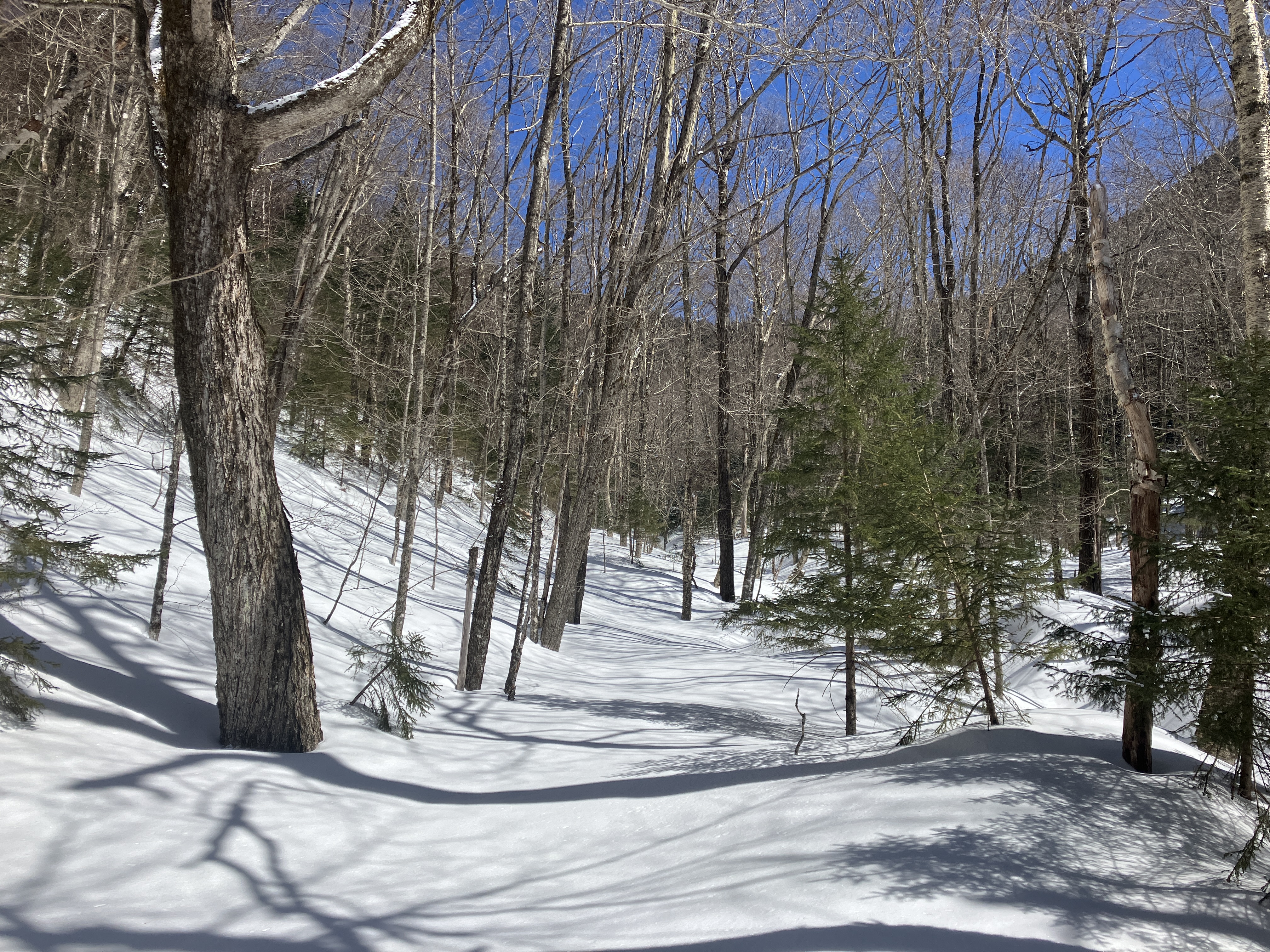
Brilliant sun and deep blue skies in a favorite hardwood glade.
Wandering at will on firm sun-baked snow.
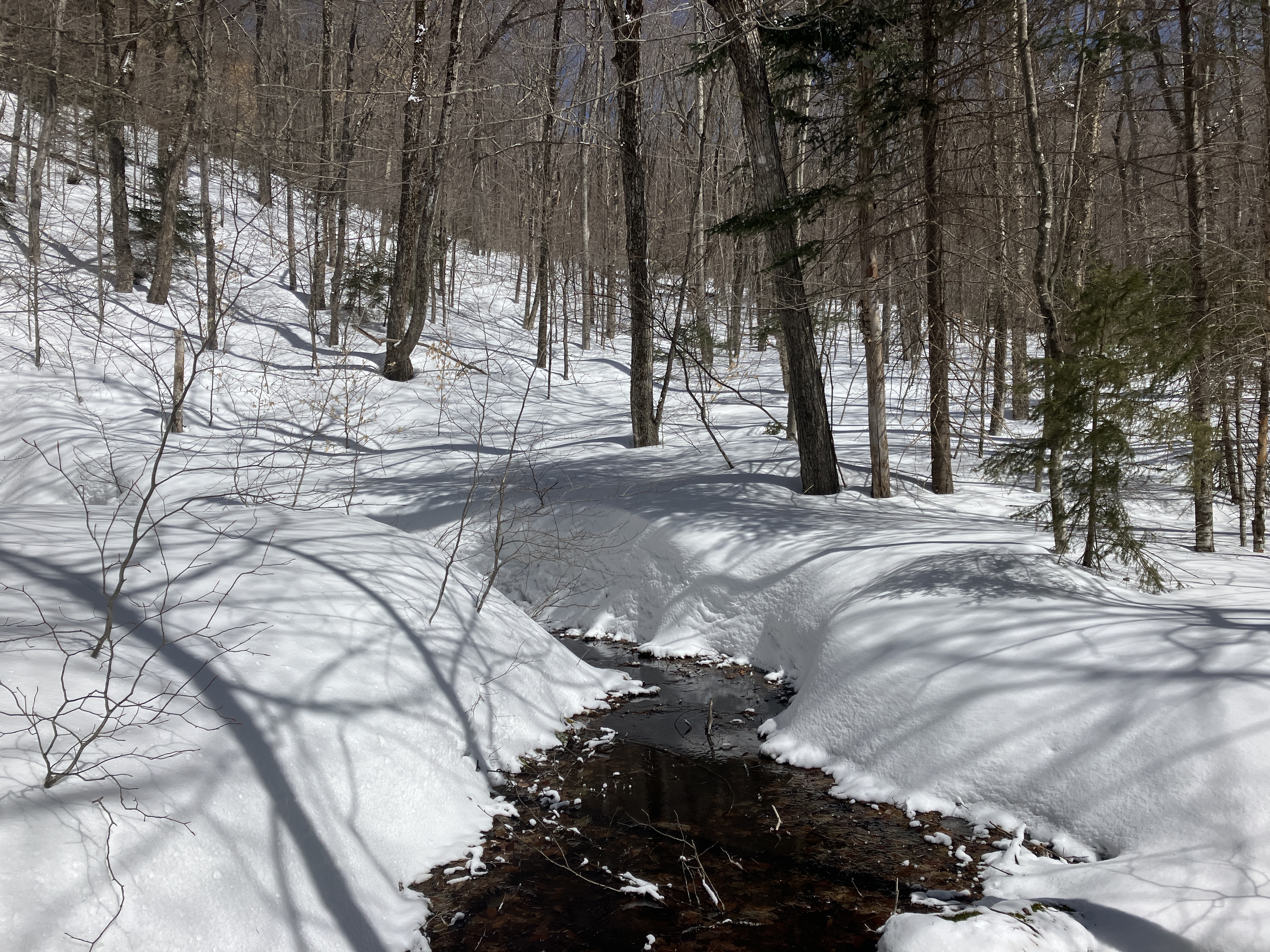
Crossing the crevassed brook that drains the ravine under Scaur Peak.
A half-mile up Avalanche Ravine I emerged in this inner sanctum glade.
A magnificent old sugar maple.
Spring snowshoeing doesn't get better than this.
A peek up at the North Slide.
The snowbound East Fork of the North Slide.
Close-up.
From here the bushwhack led up a much narrower part of the ravine. I had followed this route partway up two years ago in March, and found solid snowpack along the bottom of the drainage even with the temperature hitting the fifties. Today the snow conditions in the drainage were soft, deep and unconsolidated - completely different from the previous trip, and from the open hardwoods I had just traversed. So far this spring there had been no melt-freeze cycle in this deep basin.
Looking ahead, I wasn't sure I wanted to continue.
I was able to make slow progress by weaving up and down along the banks, avoiding soft low spots that could swallow my snowshoes.
Drifts.
The long and winding road.
Took the high route here.
No choice but to go up the throat.
A respite from the V-shaped cut.
Some of the more strenuous breaking I've done this season.
At 3100 ft. I climbed up onto a remnant open patch. gravelly in summer, from one of eight smaller slides that fell in Avalanche Ravine in the same 1885 storm that unleashed the famed North Slide. The more formal name used after that was the "Ravine of Avalanches." Here the sun-baked snow was almost too firm, requiring vigorous stomping of the snowshoes.
A nice view of Mount Tecumseh down the valley. Looking through Thornton Gap, Mount Moosilauke was veiled in cloud.
A bit farther up the ravine I climbed steeply through deep soft snow towards the slide that fell on the ravine headwall in 1885.
Emerging at the bottom of the slide.
For safety's sake I stayed along the edges of the slide, which has a slope of 32 degrees.
A smooth and steep snow-slope.
Down-look.
Nearing the top of the open section. The wind was rather brisk up here.
Good view of the Osceolas, with the Kinsmans in the distance to the right.
Zoom on the Osceolas.
From the top of this open section I climbed through boreal fir forest.....
....to the less steep upper open swath of the old slide.
The view from the upper part of this swath reveals a number of summits on either side of nearby Scaur Peak.
The Hancocks and Mount Carrigain.
Open woods on the bushwhack to the trail.
I reached the Pine Bend Brook Trail at 4:00 pm and after mulling it over, decided to make the half-mile, 500-ft. climb to the summit of North Tripyramid. The snow on the somewhat choppy track was quite grippy, and ascending a mostly packed trail seemed relatively easy after breaking trail up the ravine.
Approaching the summit.
Mostly buried trail signs have been a familiar sight of late in the high country.
The wooded summit of North Tri.
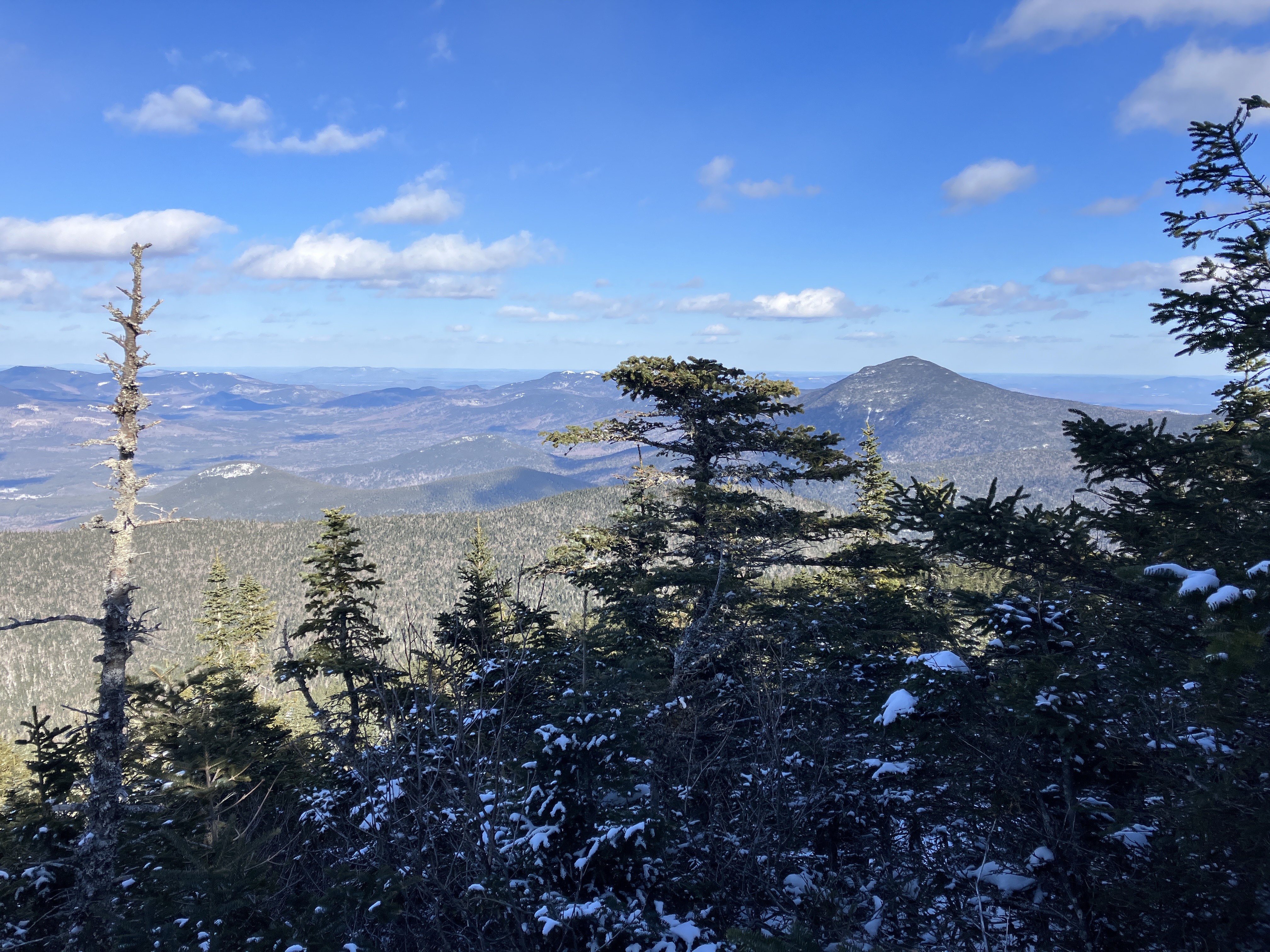
Thanks to the deep snowpack, the viewpoint on the NE side - quite restricted in summer - offered a sweeping panorama.
Looking more to the east.
Zoom on Mount Passaconaway, with part of its little-known Northwest Slide visible.
Thanks to the grippy snow, I was able to make it standing up as I descended the steep pitches on the upper Pine Bend Brook Trail, even the butt-slid sections. On the narrow ridge traverse leading towards the Scaur Ridge Trail junction, I caught this view of Mount Washington emerging from its all-day veil of wind-driven cloud.
Just before the junction with the Scaur Ridge Trail, I made a short side trip to an open glade that provides a nice view to the north in late winter.
Closer look at Mount Lowell on the east side of Carrigain Notch.

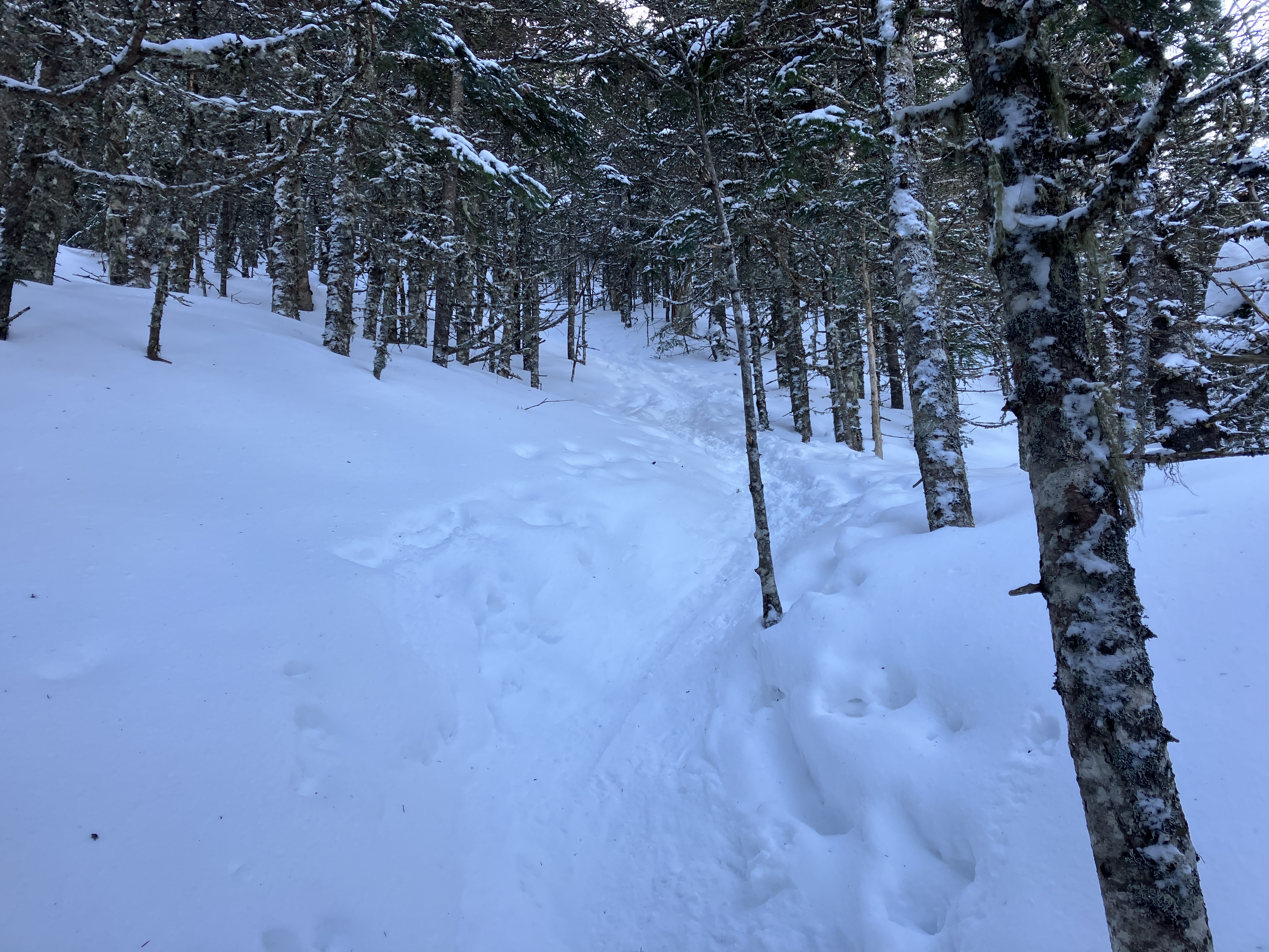
A surprise awaited at the junction with the Scaur Ridge Trail. The trail was completely unbroken, with no evidence of an old track. It seemed like no one had been through here in months. I plowed down the slope through deep powder, on and at times off the trail, which was difficult to follow in the open woods.
Beautiful open woods down through here.
The trail becomes easier to follow after it turns right and heads down to a small brook crossing at the head of the ravine under Scaur Peak.
Picturesque old yellow birches.
Halfway down, the Scaur Ridge Trail emerges from a stretch of conifers and continues down through open hardwood forest, with nearly continuous views through the trees to North Tripyramid and the North Slide. The change in snow conditions here was remarkable - in the conifers I was sinking a foot or more into the powder, while in the sun-exposed hardwoods I was barely denting the surface of the hardpacked snow.
Sinking sun.
A look back at North Tripyramid.
Rambling down on solid snowpack through open hardwoods to shortcut a long switchback on the Livermore Trail. I navigated the last 1.5 miles of this wide, easy trail by the light of a three-quarters moon.