A major rainstorm and thaw followed by a quick hard freeze set up firm snow conditions ideal for snowshoe bushwhacking. I took advantage of this gift from Mother Nature and made a long bushwhack into the Dry Brook ravine, between Mt. Lincoln and Little Haystack Mountain, and visited a large landslide that fell off the west ridge of Little Haystack in the October 2017 "Halloween storm."
A shorter bushwhack would have been possible by following Falling Waters Trail up to its last brook crossing, but that would entail a route directly up the brook after its snow bridges had been blown out and replaced with icy rocks. And I wanted to avoid the several brook crossings on the trail as well as presumably icy steep pitches alongside the waterfalls. So I spiked just a half-mile up the choppy, hard-frozen trail, and was glad to get off it, donning snowshoes and heading up into the hardwoods on the lower part of Mt. Lincoln's western ridge. This is unofficially known as "Carpenter's Ridge," after Frank O. Carpenter, who built a trail up it in 1897, only to see it obliterated by logging within a few years.
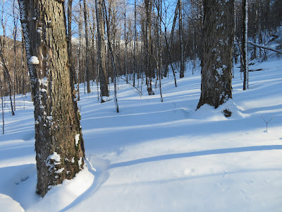
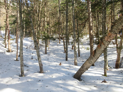
My snowshoes were barely denting the surface of the snow, but had excellent grip. Wander at will!
The lower western slopes of the Franconia Range do support a fine hardwood forest.
Above the end of the hardwoods at ~2600 ft., my plan was to follow an old logging road angling upward along the steep slope on the north side of the Dry Brook valley. The road (and a parallel road above it) shows prominently on the Lidar hillshade map. I knew it could be on a slanted sidehill of firm snow, and overrun with clinging conifers, and that did prove to be the case.
Some sections provided better going and I was making slow but steady progress up the ravine.
At ~3000 ft. the terrain got rougher, and there were more blowdowns to contend with.

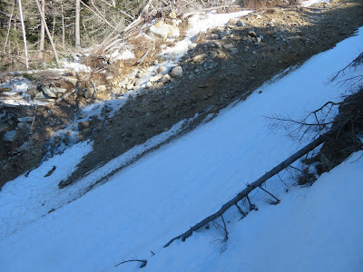
Then the old road disappeared in a mess of blowdowns on a steep sidehill. This photo was taken at that spot, looking back at the last followable part of the road. To continue on this tedious course, without knowing the condition for the next half-mile to a point across from the slide, seemed foolish. The woods looked reasonably open on the steep slope below, so I decided to descend to Dry Brook and hope it would be feasible to cover the remaining distance along the drainage.
After a steep descent, I proceeded a short way up the north side of the valley floor, then made an easy crossing to the south side when the north side became too steep. Up this high, Dry Brook was fairly small.
On the south side I encountered a mess of blowdown and thought my alternate route was not going to pan out. The snow was 3+ feet deep here but thankfully was firm. In soft snow this would be a nightmare.

After weaving through the blowdowns I was delighted to discover an open corridor leading up the south side of the drainage.
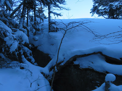
After following this for a while, I came to a spot along the brook where there was a weird expanse of frozen dirt. I thought it might be debris from the 2017 slide, redeposited by the two recent rainstorms.
Frozen chunks of snow and dirt dumped along the brookbank.
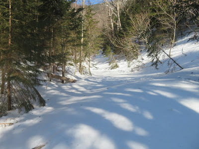
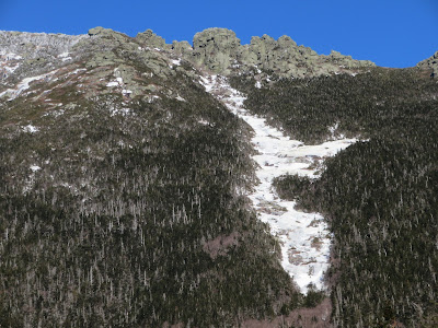
Just above, I came to the open gullied track, 0.2 mile long, carved out of the brookbed below by the 2017 slide. The headwall of the Dry Brook ravine was in sight ahead.
I crossed back to the north side of the drainage and enjoyed great snowshoeing up a broad part of the valley floor, cloaked in open woods - an inner sanctum of the Franconia Range.
Approaching the base of the slide, I looked back down the gullied track to North Kinsman.
I soon came to the edge of a spacious, gently sloping open area cleared out by the slide as it came surging down off the slope to the south.
Piles of mangled trees littered the edge of the clearing.
A view of the Kinsmans from the upper edge.

A wonderful spot to hang out in the sun....
....and gaze up at the massive slide.

A debris moraine shows where the slide slammed into the drainage at a right angle before coursing downstream to create the gullied track.

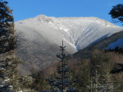
A zoomed view up to the crags ("the Gargoyles") on Franconia Ridge south of Mt. Lincoln.
After a late lunch, I headed up the slide. The firm, refrozen styrofoam snow ("neve") was ideal for climbing with MSR snowshoes. I was surprised by the amount of bare, frozen dirt along the sides of the slide, in February.
A slope meter I recently acquired measured a slope angle of about 32-33 degrees. This is a helpful device for assessing potential avalanche danger; the bars indicate the relative danger of various slope angles, with the bulls-eye at around 38 degrees. With the firmly compacted snow, danger was minimal this day. (This picture was taken back down at the base.)

I continued up the slide past the rock on the right, then exited into the woods on that side as a steeper pitch and then a mix of frozen dirt and icy ledges loomed above.
Looking down from that exit point.
Side view.
I came back out to the slide halfway up, where there was a marvelous view of the Dry Brook ravine headwall with Mt. Lincoln to the left.

Some climbers refer to this as "Guy's Slide," in honor of the late Guy Waterman, legendary bushwhacker and passionate wilderness advocate, for whom this climb was a favorite.
More slides on the north side of the ravine. On the way out I aimed to ascend to the lowest open patch on the left-hand slide.
Zoom on the gravel patch on the right-hand slide, an old one.
Peering down the narrow snowy chute on this part of the 2017 slide.

The impressively steep upper half of the slide.
The styrofoam snow on the lower part of the slide would have been fine for descending, but I played it safe and went down through the open woods alongside it.
Parting shot.
After descending a short distance below the base of the big slide, I ascended ~150 ft. in elevation up this narrow slide on the north side of the ravine.
A vista back to South Kinsman and distant Mt. Moosilauke.
A different perspective on the upper half of the 2017 slide.
After following my tracks partway back down the drainage and up the steep slope to exit it, I continued up to the crest of Carpenter's Ridge and used that as my route of descent, avoiding the sidehilling and small conifers on the old logging road. Though there were quite a few blowdowns on the ridge, the going was mostly open and it proved to be a better route.
Post-sunset glow in the hardwoods on the lower part of the ridge.