Tuesday, August 29, 2017

EAST PONDS LOOP: 8/28/17


Carol and I enjoyed a leisurely jaunt to East Pond and Little East Pond on her last day of summer vacation. On this beautiful afternoon we saw no other hikers on the 5-mile loop.

Late summer wildflowers on the East Pond Trail.


The south shore of East Pond is a wonderful spot to relax.


East Scar Ridge, a rather miserable bushwhack peak on the NH 100 Highest list.


The remains of a dam used during the Tripoli Mill operation. From 1912-1919 Charles Henry, son of lumber baron J.E. Henry, oversaw the dredging of diatomaceous earth from the bottom of the pond. This material, consisting of fossilized diatoms (microscopic algae), is used as a polishing agent among other things. The material was transported down to the processing mill (near the East Pond/Little East Pond Trail junction) via a pipeline. Due to difficulties in separating the diatomaceous earth from other sediments, the operation shut down after just a few years. However, Henry's daughter Katherine held onto ownership of an 11-acre parcel around the pond until 1994, when it was finally acquired by the WMNF.


Summer skies.


Ridge reflections.


Hello there!


This is one of our favorite trails, meandering through a variety of wild forests along the southern flank of Scar Ridge.


Along the East Pond Loop.


Ferns and birches - a touch of The Kilkenny. There's not much of this kind of good bushwhacking woods on Scar Ridge.


Little East Pond has a fine view up to Scar Ridge (left) and Middle Scar Ridge (right center). This spot has a real backcountry feel. Here we heard and then saw a Belted Kingfisher, which was surprising given the very shallow depth of this pond.

A wonderful old gnarled red maple on the shore of Little East Pond.


Ledges on Middle Scar Ridge. Up there you get a great bird's eye view of the pond.


A massive blowdown on the Little East Pond Trail.


Clear Brook at the trail crossing.


Easy walking on the bed of the Woodstock & Thornton Gore Railroad (1909-1914).


Sunday, August 27, 2017

GREELEY PONDS: 8/24/17


On a cool, almost fall-like day I joined my brother Drew and my nephew Mike and his girl friend Joy (who live in NYC) for a hike to these old favorites. It was Mike's first visit to Greeley, and Joy's first hike ever in the Whites. They liked it!

Mike and Joy are both excellent photographers and stopped to take some shots of the Hancock Branch North Fork.


On the Greeley Ponds Trail, approaching Mad River Notch.


An oddball birch atop a boulder that we had to calculate the weight of for an "Earthcache" (a virtual geocache).


A peaceful scene at Upper Greeley Pond.


The west knob of Mt. Kancamagus and the K2 Cliff.


Across Upper Pond to the cliff-faced NE arm of East Osceola.


A nice shoreside grassy area for relaxing.

Taking it all in.


Looking south to the sprawling mass of East Osceola.


Happy hiking trio.


The north end of Lower Greeley Pond.


Beavers have raised the water level and submerged a shoreside gravel bar that was a nice hangout spot.


View from the south end of the Lower Pond.


Saturday, August 19, 2017

MOUNT CARDIGAN: 8/17/17


Carol and I enjoyed a sunny, breezy geocaching hike on the iconic peak of west-central New Hampshire. With a crack o' noon start, we ascended via the West Ridge Trail, the easiest and busiest route up Cardigan. Our ascent was leisurely, with nine geocaching stops along the way.


Cliff's Bridge, which spans a tiny stream.


Breaking into the open on the upper part of the trail.


Ascending the mountain's vast granitic ledges, bared by an 1855 forest fire.


Looking out to Smarts Mountain and Mount Cube.


Into the great wide open.


Approaching the summit fire tower.


Prominent veins cutting through the bedrock, vast horizons beyond.


Cardigan has that top-of-the-world feeling.


Hikers taking in the view towards Firescrew, Cardigan's northern spur, and distant Mount Moosilauke.


Northern vista.


A busy summit, even on a Thursday.


Important junction of West Ridge Trail and Clark Trail near the summit. Their two trailheads are 35 miles apart by car.


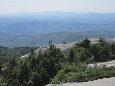
 Hikers on a Cardigan crag.


Hikers descending steep but grippy ledges on the Clark Trail.


Long views to the south.


Carol makes her way down the ledges.


We headed along the ridge on the scenic South Ridge Trail, enjoying this view back to Cardigan's summit from the South Peak.


This ledge just off the trail had a fine vista across a valley to Orange (Gilman) Mountain.


Along the South Ridge Trail.


Hanging out on the ledges of Rimrock, with wide western views.


The trail junction at Rimrock. Skyland -- what a wonderful name for a ridgecrest trail.


Nice woods on the Skyland Trail, descending back to the West Ridge Trail. From there, we descended a mile to complete our mellow 3 1/2 mile loop (1300-ft. elevation gain), with a total of 12 geocaches found.