On a warm early fall day I teamed up with Thom Davis for a memorable trek on Mt. Moriah. From the end of a short, unofficial trail to the picturesque Shelburne Basins, we bushwhacked up the long, narrow valley of Pea Brook to the foot of the mile-long slide that surged down the north slope of Moriah during the 2017 Halloween storm. We enjoyed a leisurely scramble up the slide over many clean exposures of metamorphic bedrock, with wide if hazy views to the north. From the top of the slide we bushwhacked steeply up through the conifers to the junction of the Kenduskeag Trail and Carter-Moriah Trail, just below the summit of Mt. Moriah. After a summit stay shared with a trio of Gray Jays, we descended the Carter-Moriah Trail, navigating the lower 2.5 miles by headlamp. A walk along the pipeline swath parallel to Route 2 returned us to our vehicles after a 12-hour trek.
A row of boulders marks the start of the unofficial trail (on WMNF land) to Shelburne Basins on the south side of Route 2. There is limited parking on either side of the bridge over Pea Brook.
The Shelburne Basins are a series of cascades, pools and potholes along a ledgy section of Pea Brook.
The largest basin is a beauty, reminiscent of the much more famous Basin in Franconia Notch.
Crystal-clear pool. The unofficial path, about a mile long, ends just beyond here. Time to begin the ~1.75 mile bushwhack to the foot of the slide.
We made the first of several crossings of the brook to avoid steep sidehills and came to this gorgeous cascade.
Farther up the valley was this stretch of mossy, ledgy brookbed.
An old yellow birch watches over the brook, deep in the valley.
Thom makes his way along the brook-edge. Many of the rocks in the brook were slippery. Drainage bushwhacks are generally slow going.
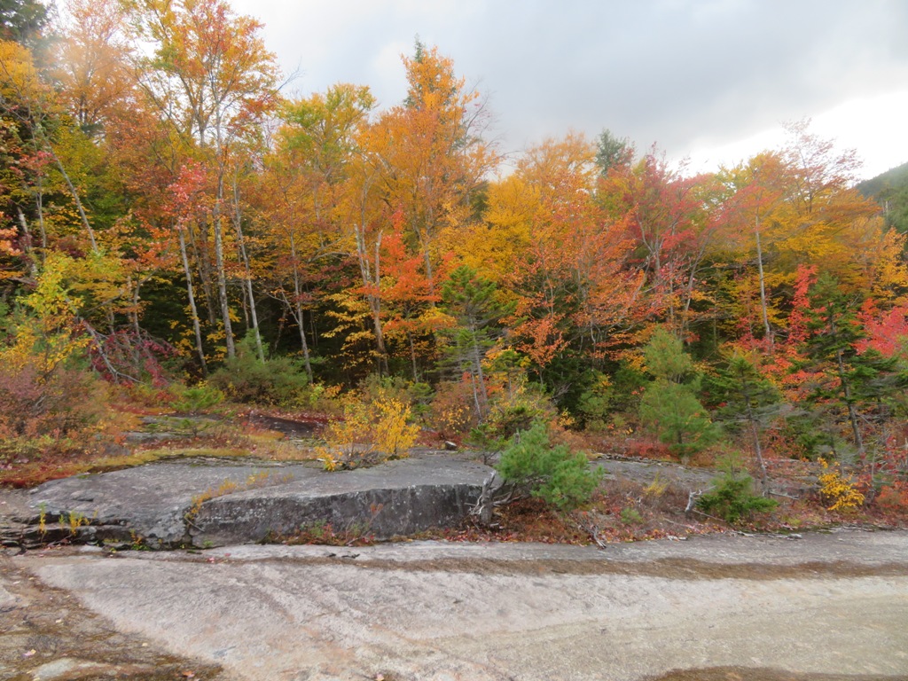
The final approach to the foot of the slide led through fine open hardwoods on a slope above the brook.
At ~1900 ft. we encountered the unmistakable bottom of the slide, marked by a massive tree jam. Emulating river drive loggers of old, who delighted in posing on precarious lofty perches atop logs, Thom clambered up among the tree trunks for a photo-op.
Looking at the tree jam from the other side. Yikes!
The open slide track starts here.
The recent drought made the going easier on the slide, as there was very little running water and nearly all the rock was dry. In a wet season there would likely be a cascade here.
An open rock highway ahead.
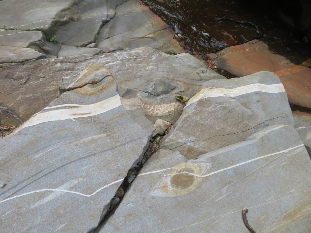
This slide has vast exposures of metamorphic bedrock, a geologist's dream. And I happened to be climbing with a geologist! Here an aplite dike of intrusive granitic rock cuts across the parent bedrock.
Another ledge step that would bear a healthy cascade in a wetter season.
Tiers of bedrock invite us onward and upward.
An ever-changing gallery of ledges.
Neat rock formations looking down the slide.
Starting to get some hazy foliage-tinted views out to the north.
Time for a break on one of the many rock shelves on the slide. Thom points out a large tree limb that was hung high and dry by the surge of the slide.
This is one of the "cleanest" slides I've been on in the Whites. The rock is quite grippy when dry.
Easy scrambling ahead. Most of the slide is low-angle, though there are a few tricky spots to navigate.
Thom scrambles carefully along the left edge of a small canyon.
Peering into the canyon.
Path of destruction.
Three years on, revegetation is underway on rubbly parts of the slide.
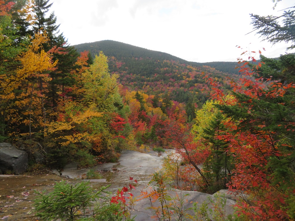
A long swath rises ahead towards the ridgeline.
The bedrock takes a different tint here.
Rugged.
Approaching a split in the slide at ~2600 ft. On the left side is a steep ledge headwall.
The right fork is decidedly uninviting. The headwall, though a bit intimidating, is the better way.
Thom leads the way up the headwall.
He emerges at the top.
Side view of the headwall.
Down-look. A fairly tricky scramble was required to reach the top of the headwall.
Easier going above. The dry rock made for delightful slide-climbing.
Looking back.
Thom studies the scene.
Upward.
A nearly perfect bulls-eye intrusion.
A second headwall rises ahead. We briefly took to the woods to get around it.
Thom pops out at the top.
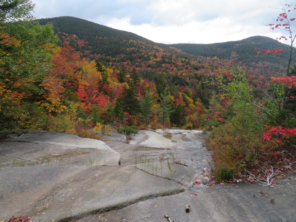
Here, on the widest part of the slide, at 2900 ft., was a comfortable shelf. Time for a long break to savor the scene.
This boulder rests in place against the trees it toppled during that violent event in 2017.
A commanding perch with a wide view out to the Kilkenny peaks, Black Crescent Mountain and the southern Mahoosucs.
While relaxing on the shelf, we considered our options. Continuing up to the top of the slide and bushwhacking up to the Carter-Moriah Trail near the top of Mt. Moriah was more appealing than the three-mile return bushwhack down the valley. So up we went. The upper finger of the slide is steeper, yet rubbly with stones and packed dirt. Much less bedrock is exposed here.
There was still 400 ft. of climbing up the slide from our perch on the shelf.
Thom noted granitic cobbles strewn amidst the churned-up glacial till.
Looking down and out.
The top of the slide is in sight.
Thom makes a somewhat dicey climb to the ultimate trigger point of the slide at 3300 ft.
Side view of the trigger point.
View from the top.
Into the woods.
Steep and treacherous terrain, with lots of boulders and holes.
With alot of bobbing and weaving, it took nearly an hour and a half to gain 700 ft. of elevation. We originally intended to hit the trail to the NW of Moriah's summit, but better woods and terrain pushed us upward and to the east.
We skirted the imposing cliffs of the Moriah summit block.
We came out right by the Kenduskeag Trail/Carter-Moriah Trail junction, and made the steep scramble up the latter trail towards the summit.
A welcome sight!
Summit benchmark.
The Carter Range in silhouette.
The "Bugs Bunny Slide" from Tropical Storm Irene, where Thom and I had ventured the previous week.

Clouds kissing the Presidentials.
Hello there!
We took the luxury of a half-hour break on this fine summit before starting the 4.5 mile descent to Gorham.
Last sun illuminates Shelburne Moriah.
A mile down the trail we passed Quimby's Pillow, named after professor Elihu T. Quimby of Dartmouth College, who led a
survey party that occupied the summit of Moriah in 1879 for the U.S.
Coastal Survey. Moses Sweetser's late 19th century White Mountain
guidebook gave its dimensions as 25 feet high and 15-20 feet square,
with a weight of 500-600 tons.
Headlamp time, with the lights of Gorham in the distance.