Morning rain showers and various errands led to a crack o' noon start, so I opted for a leisurely hike into Tunnel Brook Notch from the north. On the agenda were visits to several of the attractive beaver ponds and short climbs to the lower sections of three slides - two on Mount Clough and one on Mount Moosilauke.

The first 0.7 mile of Tunnel Brook Trail follows a decommissioned section of road that suffered severe washouts during Tropical Storm Irene in 2011. Parts of this are quite pleasant, but it is brushy and morning dew or rain will lead to wet feet.

The next 1.6 miles are on a gravel road that has been maintained to use for logging. The walking is easy through a tunnel of trees.

Foamflower seemed to be blooming everywhere this day.

The trail ducks into the woods at a hairpin turn in the road, 2.3 miles from the trailhead.

An attractive stretch of trail alongside Tunnel Brook. The two crossings of the brook along the trail were easy, despite an inch of rain the night before.

Ridges of Mount Clough seen from a wetland near the trail.

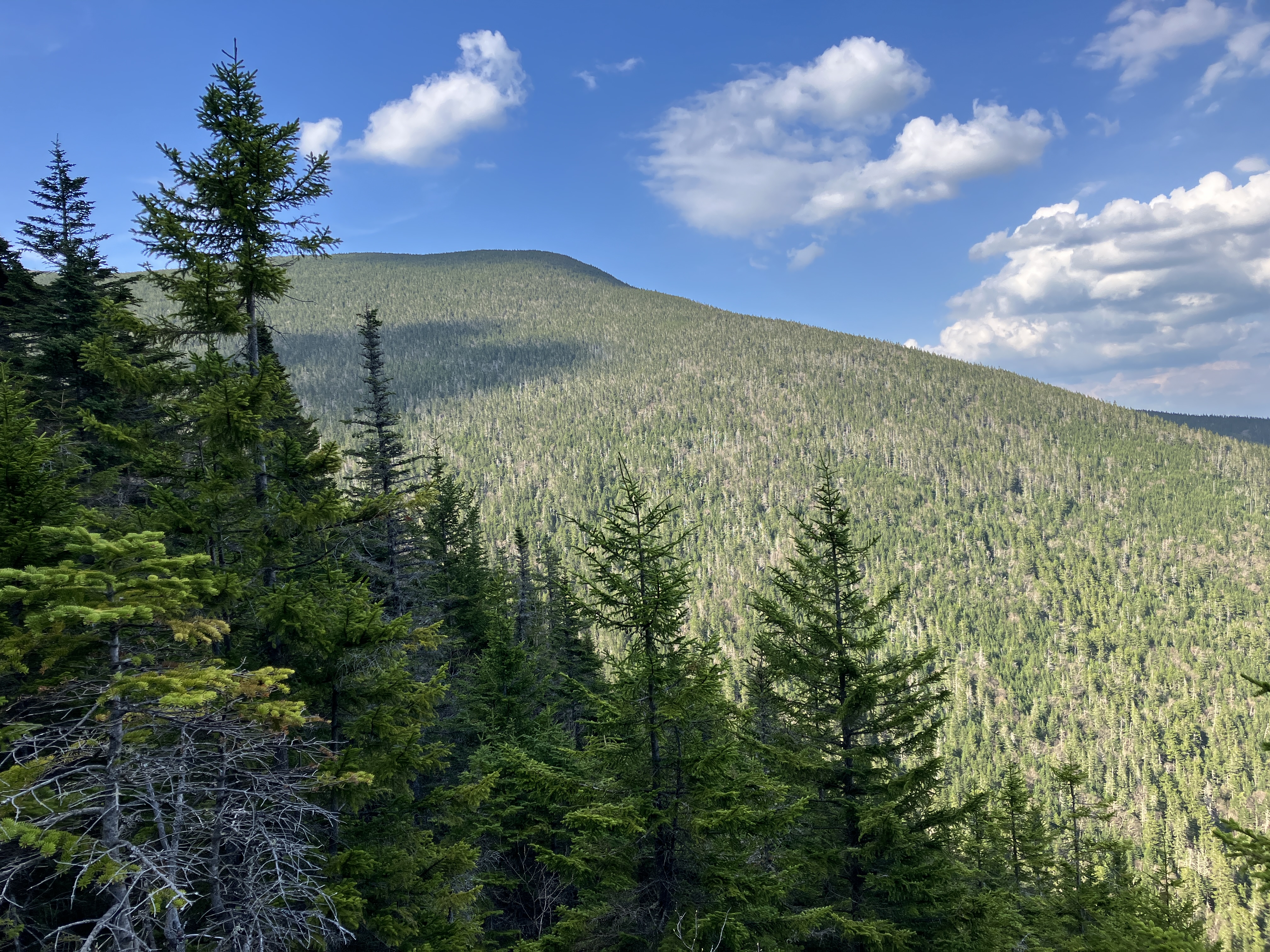
Farther along, I left the trail and climbed partway up the northernmost of the nine slides on the steep east face of Mount Clough. This one, which fell in 1927, has a wide band of gravel deposits at its base. The dark triangle of spruce seen on the opposite slope is the revegetated track of the 1927 slide on the west side of Mount Moosilauke (see below).

A bit of Rhodora in bloom.

Slide resident, taking a nap.

View up to the NW ridge of Mount Moosilauke, which the Benton Trail follows in its upper section.

I continued up to the first set of steep ledge slabs on the slide. The horizontal lines on the rock may be glacial striae - gouges scraped into the bedrock by the continental glaciers.

Looking across to the South Peak of Mount Moosilauke in the distance.

Down-look.

I came back down to the trail by this artful cairn that has stood watch here for many years.

Beautiful hardwood forest approaching the second crossing of Tunnel Brook.

Solid work by the trail adopter - thank you!

On the east side of the first beaver pond in the notch I ascended partway up the revegetated track of a 1927 slide on the western flank of Moosilauke, visiting one of only two remaining small open patches. This raised bed of rocks looked like a typical debris flow levee along the edge of a slide track.

One part of the track has become a mossy swath.

This still looks "slidey," even under a canopy of spruce forest.

One of the small remaining open patches. This slide reportedly fell during the storm of November 1927. Several descriptions from the early and mid 1930s reference slides having fallen on both sides of Tunnel Brook Notch, from the slopes of Mt. Moosilauke and Mt. Clough. Together they dammed up a small water body that became known as Slide Pond. In describing the Old Tunnel Road through the notch, (which was originally opened by 1805, then long abandoned, reopened in 1903, and permanently closed for vehicle travel by the 1927 slides), the 1932 DOC Handbook instructed hikers to “clamber over great heaps of rock to pond” when heading south. This ancient road is now the Tunnel Brook Trail. Though the 1927 slides on the Mt. Clough side of the notch still display extensive ledge outcrops, the slide on the lower west slope of Moosilauke is almost completely revegetated with spruce.


Like the northernmost Clough slide, this one has a gravelly slope at its lower end.

Nice evening view up to South Peak and the big slide in Slide Ravine.


Checking out another beaver pond on the way back north along Tunnel Brook Trail. There was an enthusiastic chorus of spring peepers holding forth here.