On the longest day of the year I joined Dan Newton and Leila Mellen for the longest hike of the season, a bushwhack off the North Twin Trail up the Little River valley to a slide in a remote drainage on the east side of South Twin Mountain. It was a day to remember.
In the parking lot I chatted with some Student Conservation Association workers who are developing a USFS relocation of the North Twin Trail to the east side of the Little River, bypassing the first two river crossings. The reroute will partly utilize the existing herd path while several sections will follow newly built trail. The new sections are not yet fully completed and are not officially open, but we got the OK to check them out for guidebook purposes. These reroutes bypass eroded sections of the herd path by climbing a bit on the slope above.

In places the existing trail follows the grade of the Little River Railroad, a logging line that operated in this valley from 1893-1900.
Dan checks out a view of the Little River along the trail.
At the river crossing the water was running too high for rock-hopping, so we all waded in our Crocs. I had recently heard about a double tree trunk crossing just upstream, but we investigated and found nothing. We figured it must have been swept away by a recent storm.
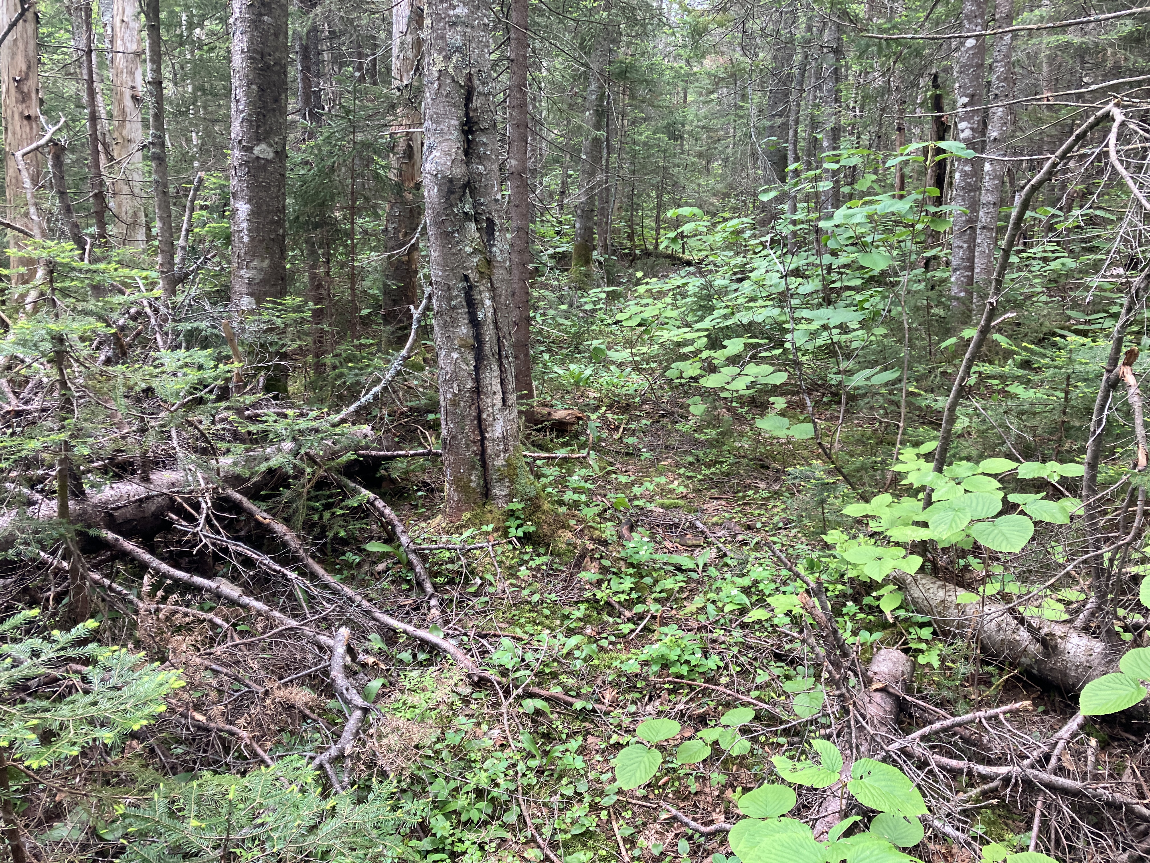
We left the trail after climbing a bit above the river and set our course up the valley. I had hopes that we would find open woods and that we would be able to follow the old railroad bed much of the way. The open woods failed to materialize for a long distance, as there were blowdowns seemingly strewn throughout the forest along the river, mixed with a healthy population of hobblebush. Progress was painfully slow. We did come upon occasional passable stretches of the railroad bed, but they didn't last long.
The grade apparently crossed the river a couple more times in this area. You can see the corridor picking up diagonally on the far bank here.

There were some pretty good log jams along the edge of the river.
Blowdowns all over the place.
We appreciated the occasional short stretches of good going.
Then, more blowdown.
It took us quite a while to reach the tributary stream that drains the big east slide on North Twin. It was running pretty high, and the rocks were slick.
A few up and down detours were necessary to bypass high washed-out banks.
On one of these banks Dan spotted a possible logging era artifact, a moss-cloaked enamel bucket. Oddly, buried right next to it were two weathered items of modern trash - a Folger's coffee container and a spray container of Off!

Bird's eye view of the river from one of the high banks, with a shoulder of South Hale looming across the valley.
A bit farther along another bank with a flat top provided us with a nice break spot looking across at the South Hale shoulder.
Among the plants growing on this washed-out slope was the invasive coltsfoot, gone to seed. To this point it had taken us nearly two hours to travel about 0.7 mile, putting us less than a third of the way to our slide destination. We figured if the woods did not soon improve, we would have to abandon our quest.
As luck would have it, not far beyond our rest spot the woods opened up, the blowdown decreased, and we were able to pick up the railroad grade and follow good stretches of it. From the 1930s to the 1950s the grade served as part of the the route of the WMNF Little River Trail, which continued all the way up the valley and climbed the headwall to the Twinway near Mt. Guyot.
Some sections of the railroad grade were swampy.
On the good stretches, it felt great to actually be able to walk for a while.
Even where overgrown, the railroad grade was better going than what we encountered earlier in the whack.
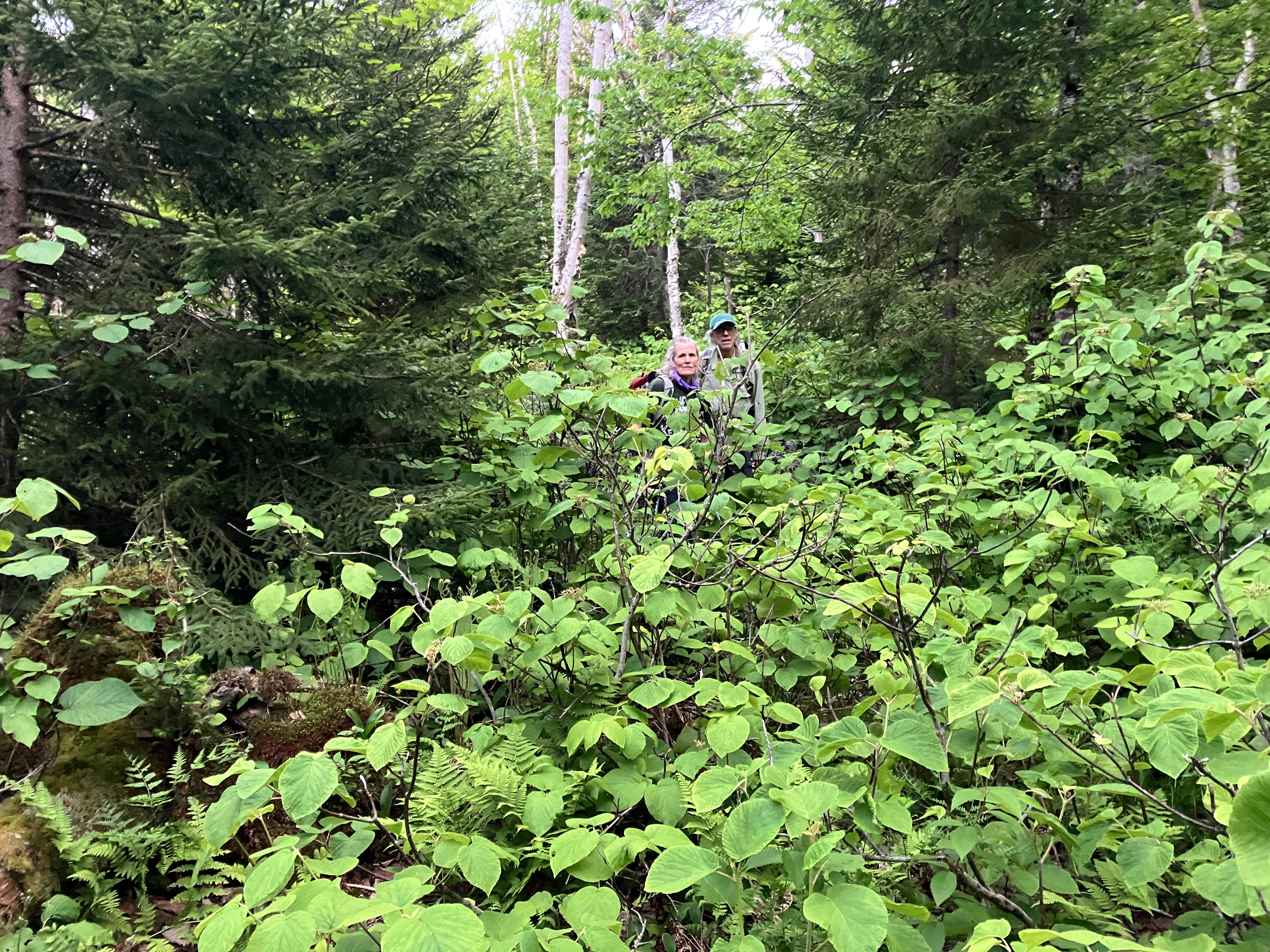
At 2:20 pm we reached a point where it seemed advantageous to head into the large drainage on the east side of South Twin. This is home to our target slide on the north side of the ravine and three more slides farther up on the south side. The condition of the woods on this ~0.8 mile section of whacking was unknown to us - part of the adventure of bushwhacking. As we started up the gentle slope, we were delighted to find an open mix of birch and conifer - a pleasant salt-and-pepper forest.
The "good woods" extended for quite a distance up the slope, and we made rapid progress compared to our earlier pace.
We passed through some fine fern glades.
Dan and Lelia, happy to be in the "good woods" for a while.
As we got closer to the slide, the slope steepened. Shortly after this photo was taken, the woods thickened, the blowdown returned and the terrain got gnarly. We knew this was coming, and the last short bit of distance to the slide took a half-hour to traverse.
We finally broke out onto the base of the slide after 3:30 pm.
Dan points out the emerging view of Zealand Mountain and its great talus slope.
Looking up the lower part of the slide, which is partly revegetated. It's possible that this may have fallen during Hurricane Carol in 1954, as it is not present in a 1939 aerial photo but does show up in a photo from 1964.
Ascending the relatively mild 29-degree slope.
As we climbed higher, we were rewarded with views of the two wedge-shaped slides higher up on the south side of the ravine.
Closer look. After the long and rather difficult journey to get out to this spot, we appreciated the deep sense of remoteness in this hidden ravine.
Zoomed. These slides look fresh in the 1939 aerial photo, suggesting that they were triggered by the November 1927 storm or perhaps the September 1938 hurricane. They are an alluring objective, but would be significantly harder to reach than the slide we were on, due to the extra distance and the steep-sided drainage that leads up to them. Master bushwhacker J.R. Stockwell, who has been there, had this to say about these slides: "You really have to want to go there."

Higher on the slide, the view of the Zealand talus really opened up. A wild nook of the mountains!
Closer look.
One patch of Rhodora was still in bloom on the slide.
We continued climbing to the upper section of the slide.
Dan and Lelia take in the views.
After a while Dan set up his folding camp chair, which he had lugged all the way in. It was late in the afternoon, and we knew we had a long trip out, but we lingered for an hour to savor this supremely secluded place.
I climbed nearly to the top of the slide, where the view opened up some more and included Mt. Willey in the distance (on the far left).
Top of the slide, which reaches to about 3950 ft.
We headed out around 5:00 pm and pushed through jail cell woods at the edge of the slide.
Going down, steeply.
Looks like we're about to drop into some bad stuff.
Yup.
Looking back up from a brief opening. On the way down from here we weaved and clambered through another round of blowdown, but eventually we reached the good salt-and-pepper woods.
Back to the floor of the main Little River valley at 6:30 pm.
Evening sun in the wild woods.
We took a much-needed break at our high-bank rest spot, with golden light on the shoulder of South Hale.
Looking upstream along the Little River.
For the last section of whacking we took a higher route than we used on the way in, and it was a little better. Still plenty of blowdown and high hobblebush to contend with. We made it to the North Twin Trail at 8:40 pm, thus avoiding any bushwhacking in the dark. Dan leaned down and kissed the rocks on the trail. Headlamps went on after the ford of the river, and we emerged at the trailhead around 10:30 pm. The next day I calculated that for our five miles of bushwhacking we averaged about 0.6 mile per hour. It was a memorable trip, but not one any of us plan to repeat!