Saturday, January 28, 2023

Mt. Pemigewasset via East Ledge: 1/27/23


I abandoned plans for a fairly long bushwhack after driving around and checking snow conditions at several trailheads. Tough sledding in the woods with heavy mealy snow under a breakable crust layer. Not up for a mile and a half of that each way. My fallback was an afternoon jaunt up Mt. Pemigewasset, with a shorter bushwhack to a view ledge on the east side of the mountain, and then on to the summit.

It was a fine afternoon in the hardwoods along the Mount Pemigewasset Trail. Though it's not that evident under the snow, this trail has seen great improvement in erosion control and footbed thanks to the dedicated work of the Trailwrights over the last several years.


About 3/4 of the way up the trail, I headed south into the woods, which looked both inviting and daunting.


Snow depths in Franconia Notch had increased significantly with three storms over the previous week.


As anticipated, the snow conditions were abysmal. Slow and steady wins the day.


There are some neat gnarled old trees out here.


From the hardwoods into the spruces.


I blundered into some sketchy terrain and had to do some pushing, pulling and stretching to get up through it.


I was a bit dismayed to discover it had taken me an hour to cover the 0.3 mile to the ledge. I hadn't been to this spot in 10 years and hoped it still offered a fine view of the Franconia Range - a vista that was once available on the east side of Mt. Pemi's summit but is now almost completely overgrown.


Yup, still a good view here.


A great look directly across at Flume and Liberty, with probably the best view anywhere of the Flume Brook valley.


I could see my car down in the Flume Visitor Center parking lot.


Zoom on Flume. Those slides!


The big three: Lafayette, Lincoln and Little Haystack.


After taking in the views for a while, I continued up to the summit through mostly open woods, weaving around rock bands and blowdown patches.


Summit forest.


I emerged on the eastern summit ledge, where the view of Flume and Liberty is quite restricted, and the view of the upper range is nonexistent.


Around the corner is a nice view SE, including Mt. Tecumseh, the Loon ski trails and the slides of Scar Ridge.


Around to the spacious main ledge area, where the sun was breaking through heavy cloud cover over Mt. Wolf.


Wild southeastern spurs of South Kinsman.


Looking back to Scar Ridge and the Osceolas.


Down the Pemigewasset valley.


Moody sky over Mt. Wolf and the ghostly ridges of Moosilauke.


Wednesday, January 25, 2023

East Osceola Slab: 1/24/23


The recent snowfall promised some good snowshoeing both on and off the trails, something that has been in short supply so far this winter. I first went up to the Old Bridle Path trailhead in Franconia Notch and though there was a nice snowshoe track on OBP, the cover was still rather thin with rocks poking up, and there was no base off-trail in the woods. I knew from my hike up North Hancock last week that there was plenty of snow out along the Kanc Highway, so the next choice was the Greeley Ponds Trail, parking at a pulloff 0.2 mile up the road from the unplowed trailhead.  At the pulloff I chatted with Robert from Littleton, who had snowshoed in to the Greeley Ponds. Out by the ponds he had met a skier who was scouting the East Osceola slides for a possible run.


Plenty o' snow out here, a consistent two feet or more.


Robert had laid down a beautiful soft, powdery track through the snow-draped conifers.  Thanks!


Something rare so far this winter - a snow bridge over the South Fork of Hancock Branch.


When I got to the Mount Osceola Trail junction, I decided to do some trail breaking up that route, hoping to make it up to the big rock slab beside the trail at 3300 ft. Laying down fresh tracks in the powder is one of the deep pleasures of winter hiking.


I always enjoy this hardwood glade where the trail swings left to traverse beneath the East Osceola cliffs.


Here I encountered the first of many drifts in the next half-mile.


Bustin' through.


More drifts. Pretty slow going through here.


A peek up at the impressive East Osceola cliffs.


There are boulder caves in there.


Looking back along the steep climb to the slab.


Emerging at the base of the huge snowy slab after a 1 1/2 hour climb from Greeley Ponds Trail.


This is the most open remaining part of a large slide that fell in 1891 or 1892; the Mount Osceola Trail crosses the upper part of this slide at ~3700 ft. The pitch of this slab is almost 45 degrees! In 1893 William Morse Cole, an economics professor at Harvard, made a hair-raising ascent of the new slide and spent the night on the summit of Mt. Osceola. His account of the trip, “Alone on Osceola,” was published in New England Monthly magazine in 1895. Perhaps he referred to this slab when he wrote,  “Now and then I came to a pitch so sharp and smooth that I could not cling, even though I lay flat and pressed hard with both feet and hands.”


In the past I've snowshoed up along the right edge of the slab for a view out towards Mt. Tripyramid. But with avalanche danger rated as "considerable" this day by the Mt. Washington Avalanche Center, it was prudent not to venture out on this slope, which had a pretty good snow load atop a hard crust.


Another look at the East Osceola cliffs while descending the steep pitch down to 3000 ft.


On the way down I got to enjoy the fruits of my labor.


Back through the heavy drifts.


Got snow, with more soon to come!


Friday, January 20, 2023

North Hancock: 1/19/23

On this morning I decided to head out to Hancock country, where snow depth maps showed a foot or more on the ground. If trail conditions looked good, I thought I might bushwhack to a small slide west of the Arrow Slide, or climb North Hancock via the trail. I was pleased to find that the Hancock Notch Trail was a solidly packed snow sidewalk. This condition continued all the way to the loop junction on Hancock Loop Trail, except for several open brook crossings and a bunch of assorted open rocky drainages, which deterred me from putting my snowshoes on. Better to beat up on the Micropsikes, and I wasn't even denting the trail.

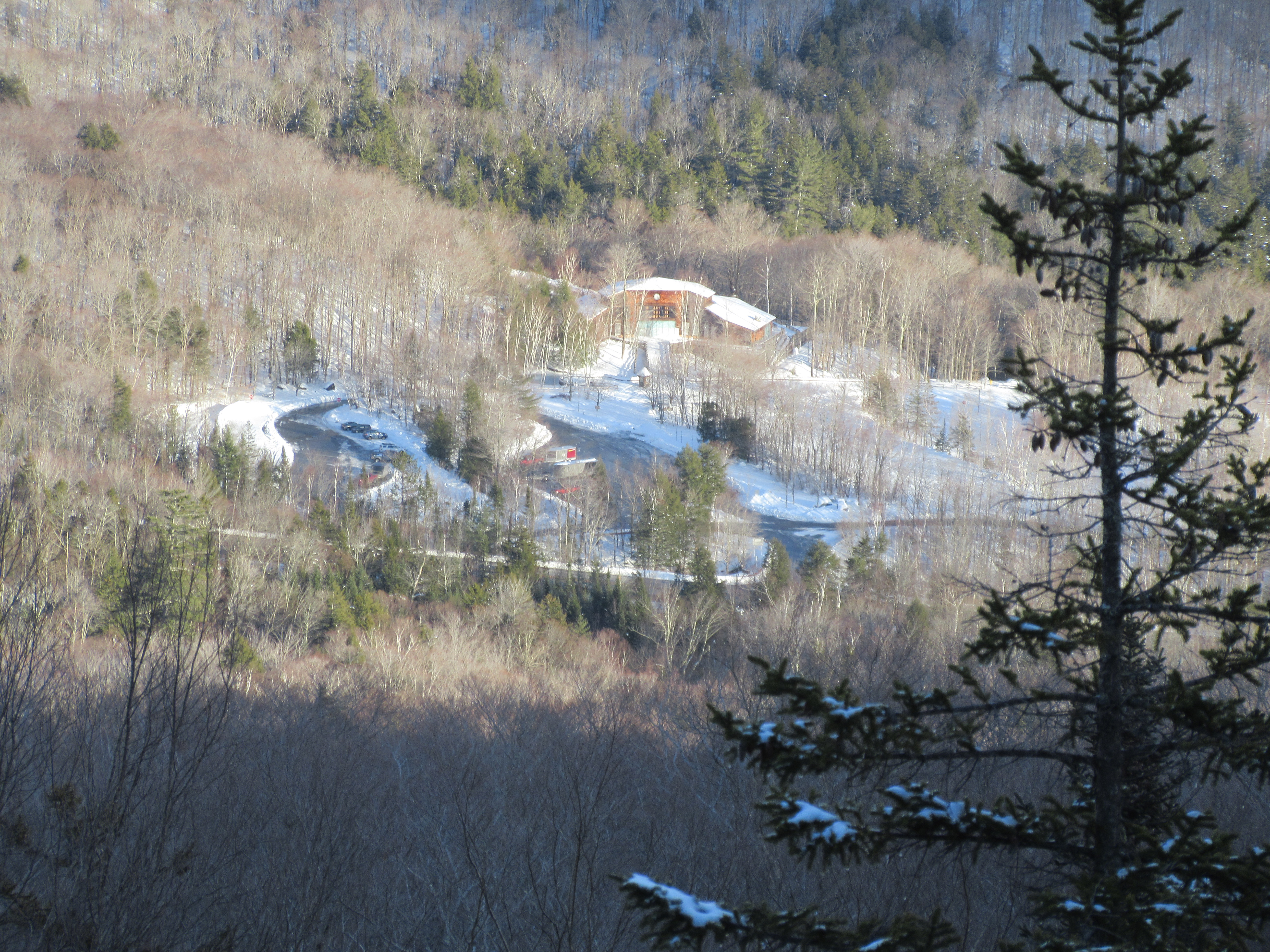
This spot on the Hancock Notch Trail offers a nice view over the North Fork of the Hancock Branch to part of Mt. Hitchcock. Here I noted fresh snowshoe tracks dropping down the steep bank below, crossing the North Fork on tenuous ice bridges, and heading into the woods on the far side - perhaps bound for a grueling bushwhack up to the south peak of Mt. Hitchcock?


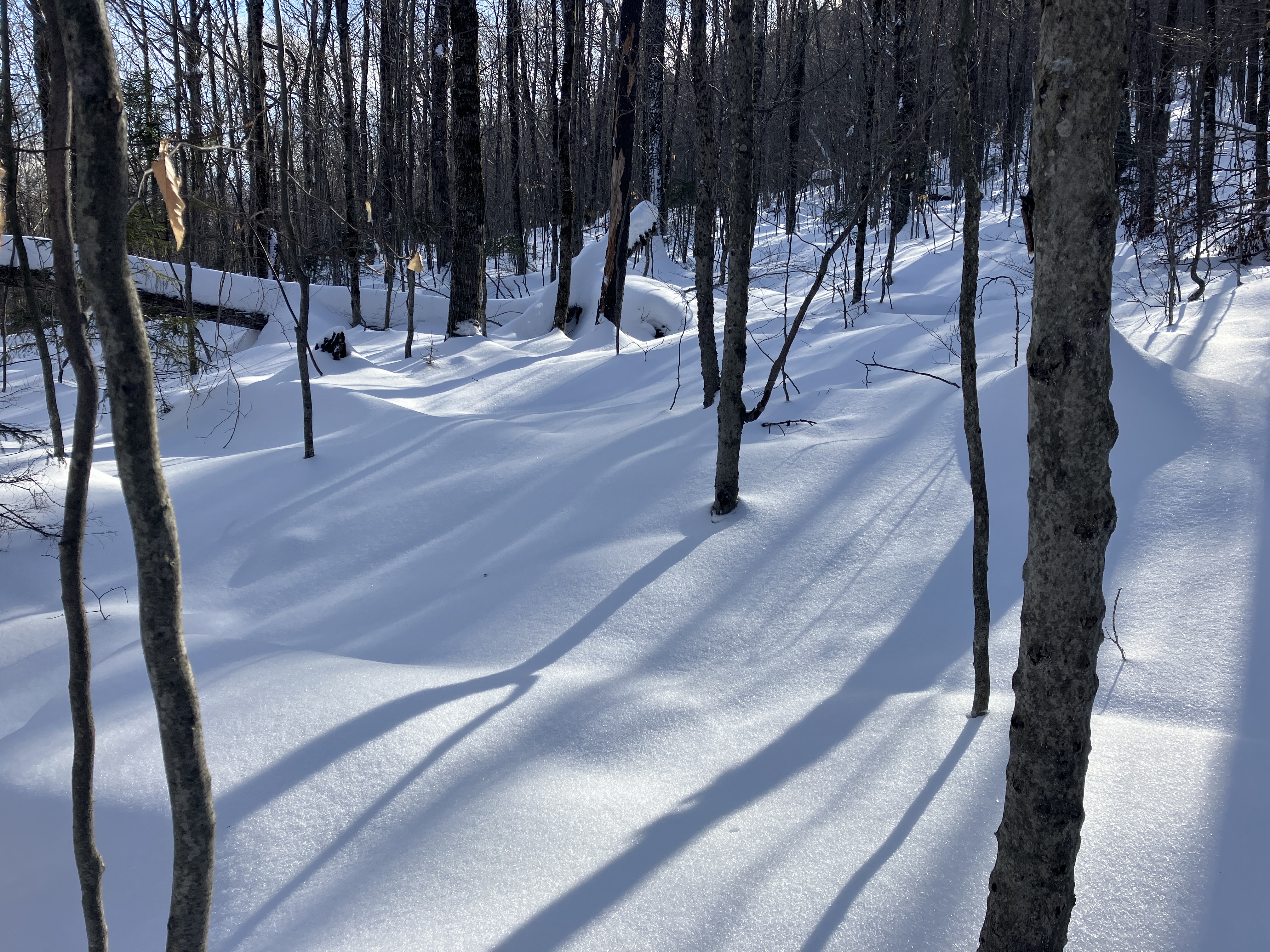
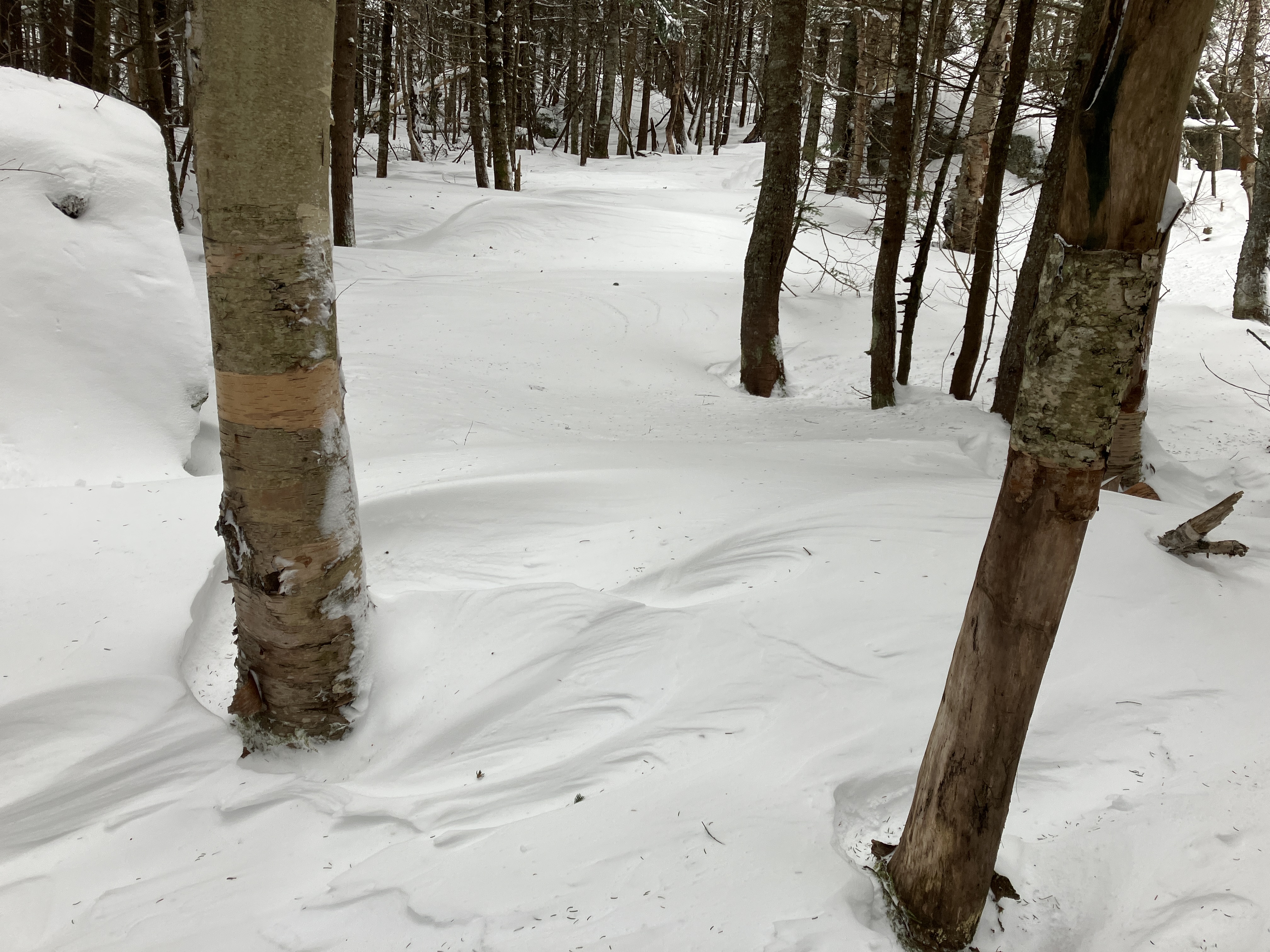
Beautiful open spruce woods on the Cedar Brook Trail.


Sidewalk conditions.


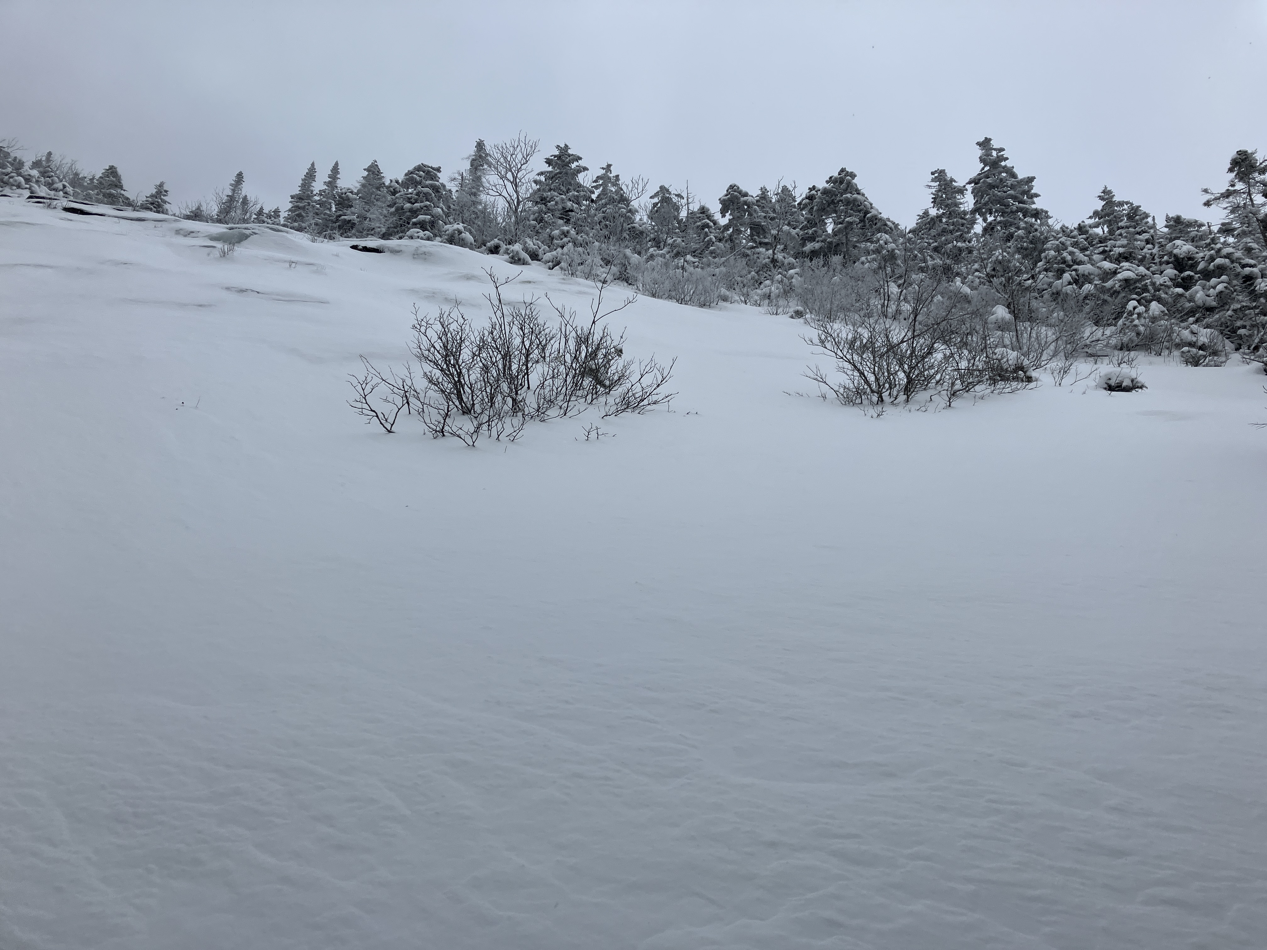
Unlike some areas in the western and northern Whites, there was plenty of snow here.


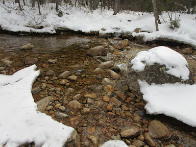
The North Fork crossings were open and rock hoppable.


These signs have been moved since my last visit here.


Imposing view of the Arrow Slide as the North Link of Hancock Loop Trail drops down to a flat spot before commencing the long, steep climb up North Hancock. Plenty of ice bulges up there. The Arrow Slide was used as the ascent route by two AMC groups - the first led by noted winter trip leader Robert L. Collin and the second including the renowned mountaineers Robert and Miriam Underhill - for the first known winter circuit of the Hancock peaks on March 6, 1960. “There were ice cliffs in the middle of the slide,” wrote Nancy L. Collin in Appalachia. “In places the snow-cover over base rock and ice was thin and the footing tricky. A few ice steps had to be cut and many steps were whacked through the crusty snow.”


The flat spot at the bottom of the pitch. After testing the snow off-trail, I decided against bushwhacking to the "Baby Arrow" slide. The snow was soft and wet with a promise of numerous blowdowns and spruce traps.


I switched out 'spikes for my MSR Evo Ascent snowshoes for the start of the steep climb to North Hancock, figuring to take advantage of their superb traction and televators. But as the grade steepened the track became crusty and choppy, quite awkward for snowshoes. As I was pondering a switch out to Hillsounds, up the trail came Cartsen Turner, who blogs as the "Protean Wanderer," making quick work of the climb with his Kahtoola K-10s. We had a good chat, then he continued up on his January grid climb for the Hancocks and I donned my recently purchased Hillsound Trail Crampons.


Rising 1100 ft. in 0.6 mile, this is one of the more relentless steep climbs in the Whites.


At ~4100 ft., the trail opens up for a peek back at South Hancock.


Near the top the grade eases and the trail passes through a fir wave.


A snow platform improves the views from the fir wave.


Summit signs.


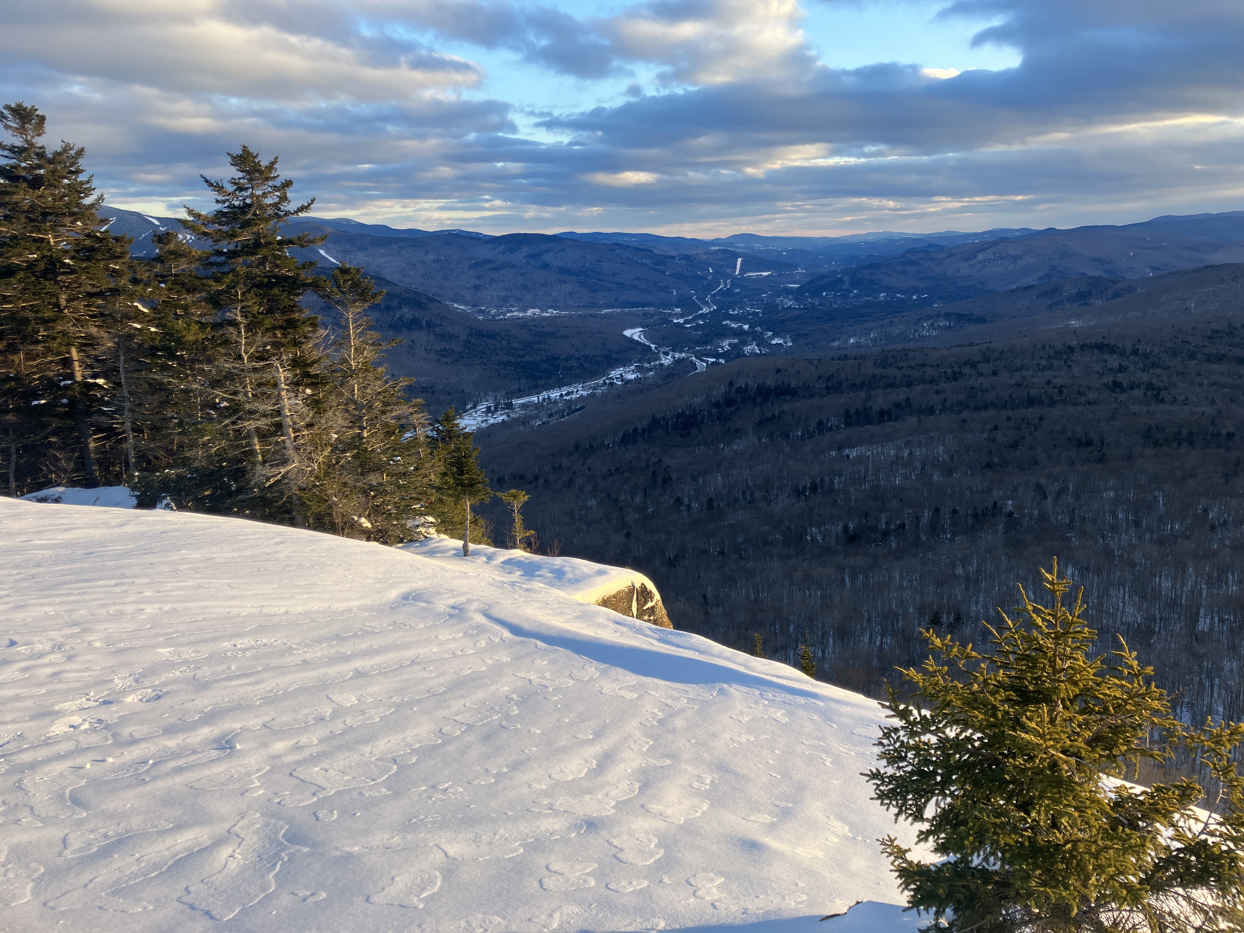
From the North Hancock outlook: Winter days with a high gray cloud deck provide some of the best views of the stark, darkly wooded peaks and ridges rolling to the horizon. On a sunny day this south-facing vista would be shadowed and backlit.


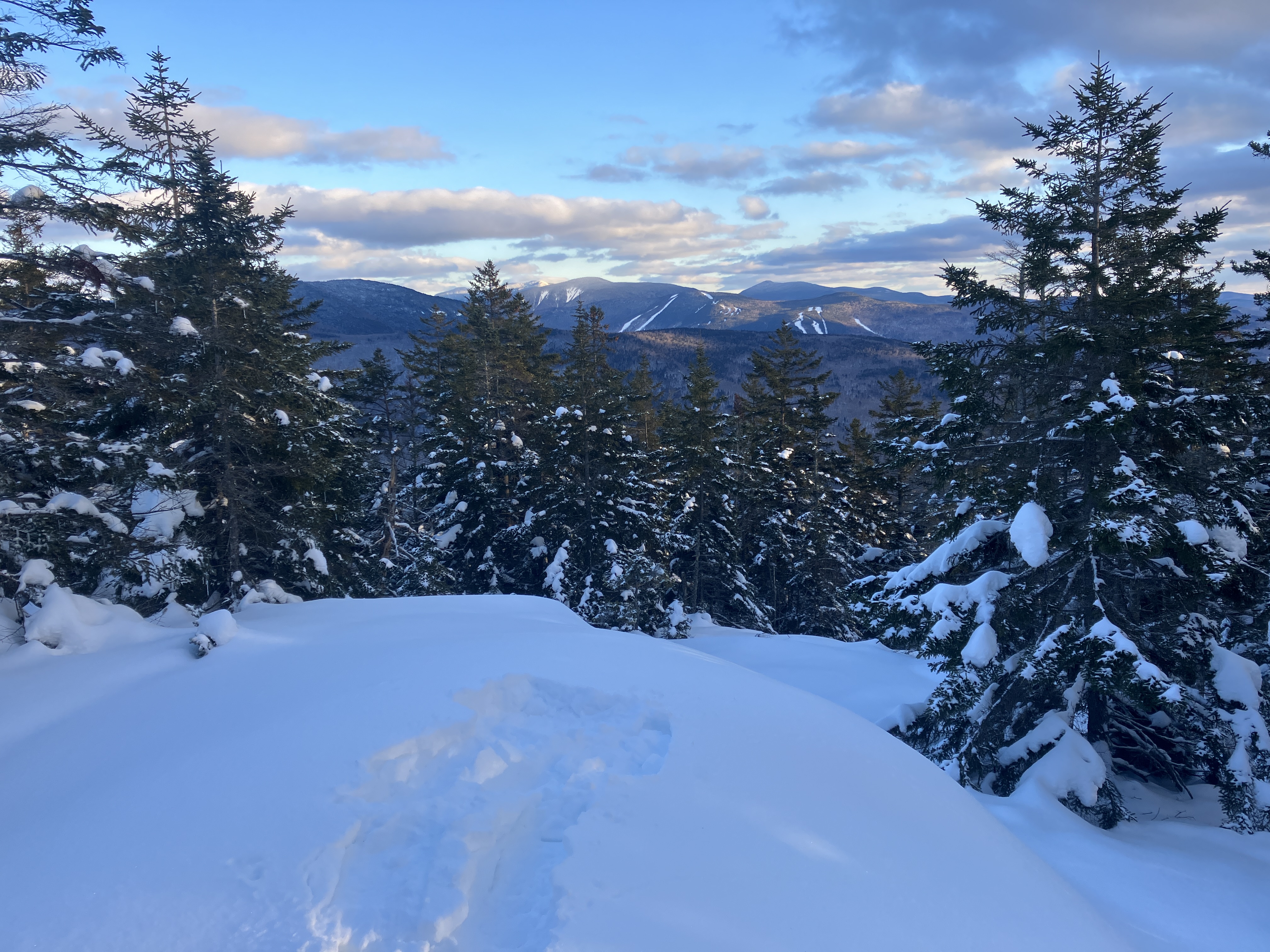
Mts. Passaconaway, Whiteface and Tripyramid behind South Hancock.


Tripyramid's great North Slide stands out in winter.


Perhaps the finest Hancock vista: the Osceolas with their many slides beyond the broad valley of the North Fork. The temperature was near 30 up here and there was zero wind, allowing me to spend a comfortable 45 minutes savoring the views, which extended as far as Stratton Mountain in southern Vermont.


Parting shot of the outlook. The descent on the steep, crusty trail to the loop junction was slow and careful, with the Hillsounds proving their worth. From there it was an easy 'spike cruise out to the hairpin.