VIEWFEST ON THE SISTERS: 8/29/12
It was one of the most spectacular days of the summer - cool, sunny, great distant visibility - and a big view was in order. Mt. Chocorua and its northern spurs, the Three Sisters, have far-flung and greatly varied views, in the top rank among White Mountain summits. At busier times such as August, when Chocorua is swarming with hikers ascending from all directions, I prefer to go to First Sister for my views. The range of vistas is just as good from First Sister, plus part of the view is looking at the dramatic horn of Chocorua. And it is a much quieter summit: there might be one hiker on the Sisters for every hundred on Chocorua.
The Champney Falls trailhead was a pretty busy place on this Wednesday morning. The sign's statement about meager flow at the falls was in effect with typically low late summer water levels.

I opted to bypass the falls on the way up and see them along the descent. Above the falls loop the Champney Falls Trail climbs moderately for a long ways up the valley, with rocky footing and many stone steps.

At the 2.4 mile mark the trail starts a series of switchbacks up the steep slope, sometimes angling along the base of sloping ledges.

After three miles I turned L onto the Champney Falls Cutoff (aka Middle Sister Cutoff). This is a delightful, lightly used trail that cuts across the face of the First Sister and makes a loop hike possible over that peak. In 0.1 mi. it emerges on an open ledge with great views north and west. Mt. Carrigain is prominent in the center of the photo below. As predicted, visibility was superb! I took a long lunch break here.

My favorite view from Chocorua and the Sisters has always been the look west along the wild, twisting peaks and ridges of the Sandwich Range.

Looking into the heart of the Sandwich Range - Paugus in front, and Sandwich Dome, Whiteface, Passaconaway and the Tripyramids in back.

A close-up of the cliffs on the northern spur of Mt. Paugus. Osceolas in the distance.

The return view from the Paugus cliffs to the Sisters and Chocorua.

Good spot for a boot shot.

Leaving the outlook ledge.

Mossy bank along the cutoff trail.

From the junction of Champney Falls Cutoff with Middle Sister Trail in the col between Middle and First Sisters, I went up to Middle Sister first, getting this peek at Chocorua's cone as I ambled up the ledges.

The foundation of the old fire lookout station atop Middle Sister. Built in 1927, it was originally slated to be located on the summit of Chocorua. But that potential intrusion on the skyline didn't sit too well with hikers, summer folks and others, and opposition led by the Chocorua Mountain Club, AMC, and Society for the Protection of NH Forests led the Forest Service to select this alternate location. The station was designed by Boston architect C. Howard Walker, who had designed several summer homes around nearby Chocorua Lake. The Forest Service now uses the foundation to house a radio repeater.

Great view of the Sandwich Range from Middle Sister. I didn't stay long here, as I prefer the somewhat more open summit of First Sister for an extended viewing session.

On First Sister, there are two rock knobs from which you can enjoy 360-degree views, including the nearby horn of Chocorua. With binoculars, I could see strings of hikers making their way up and down the cone.

The long-range views were phenomenal this day. To the south, over the eastern spur of Red Hill (in the center of the photo below), Mt. Monadnock could be seen, 86 miles away. Squam Lake is seen on the R.
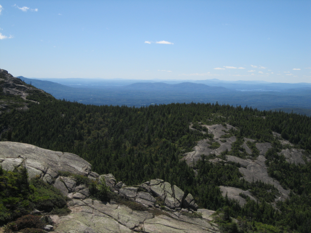
Looking SE to Silver Lake and Ossipee Lake. Green Mountain is seen beyond Silver Lake. To the ESE (not shown in this photo), the buildings of Portland, ME were clearly visible on the coast.

From First Sister there is a visual feast in every direction. Here the cliffs of Table Mountain are seen under the Wildcats and Iron Mountain.

Looking north out over the Champney Brook valley to many peaks, including Huntington, the Kinsmans and Franconias, the Hancocks, Green's Cliff, Carrigain, the Nancy Range, Owl's Cliff, Tremont, Field & Willey.

The Presidentials, Wildcats and Carter Dome beyond Bear, Table and Big Attitash. All told, I counted the summits of 33 NH 4000-footers as visible from this perch.

I spent two hours taking it all in on this ledge, the northern of two summit knobs on First Sister. I had the place to myself for all but about five minutes. What a day!

Cool angle on the precipitous rocky slopes of Chocorua, with the mountain's SE ridge trailing away to the L.

Trail signs in the col S of First Sister. Here it is called the Champney Brook Trail.

Just a little way down on Champney Falls Trail, a side path leads to a ledge with a look back up at the steep ledges of First Sister. This ledge also has excellent distant views to the north and west.

Good rock step work along the switchbacks.

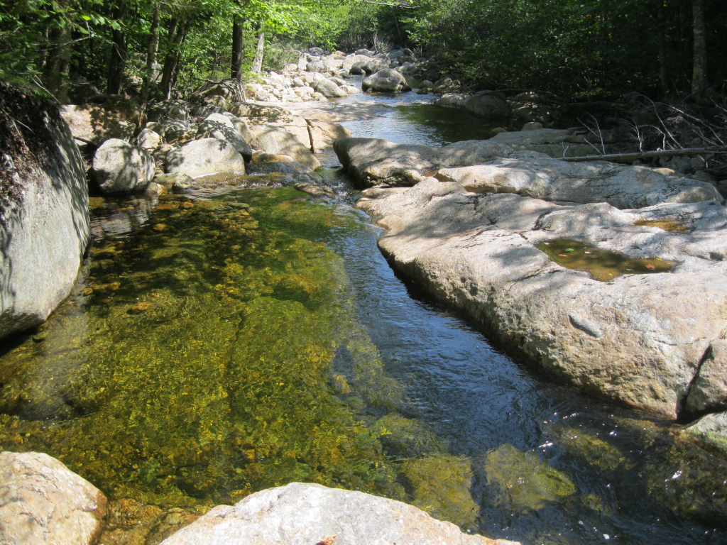
On the way down I made the side loop down past Champney Falls. From the ledgy brook above the falls, there's a view to Owl's Cliff and Mt. Tremont.

Cool overhanging ledges above the falls.

The birch-lined upper part of Champney Falls. The loop trail is steep as it descends alongside these cascades.

The lower drop of Champney Falls. Not very impressive today.

Right next door is the flume into which Pitcher Falls drops. Not much water action here, either, but it's a beauty when in good flow. Champney and Pitcher Falls make for a pleasant hike (3.2 mi. round trip, 600-ft. elevation gain) if you're looking for an easier outing. It was a nice way to cap off a grand day up on the Sisters.