Wednesday, November 30, 2022

Old Mount Braley Slide: 11/29/22

Chose a comfortable late November day for a return visit to an old, mostly overgrown slide on the steep east face of Mount Braley, a southeastern spur of Mount Moosilauke, located along the Blue Ridge just south of Mount Waternomee. This 3770-ft. peak is informally named for Warren Braley, a prominent member of the Dartmouth Outing Club in the early 1930s. Braley was instrumental in building the DOC's Jobildunc Cabin in Jobildunc Ravine, after obtaining permission from Sherman Adams, head of the Parker Young Co., which owned the land at the time. The cabin was abandoned after the 1938 hurricane wreaked havoc in the ravine.

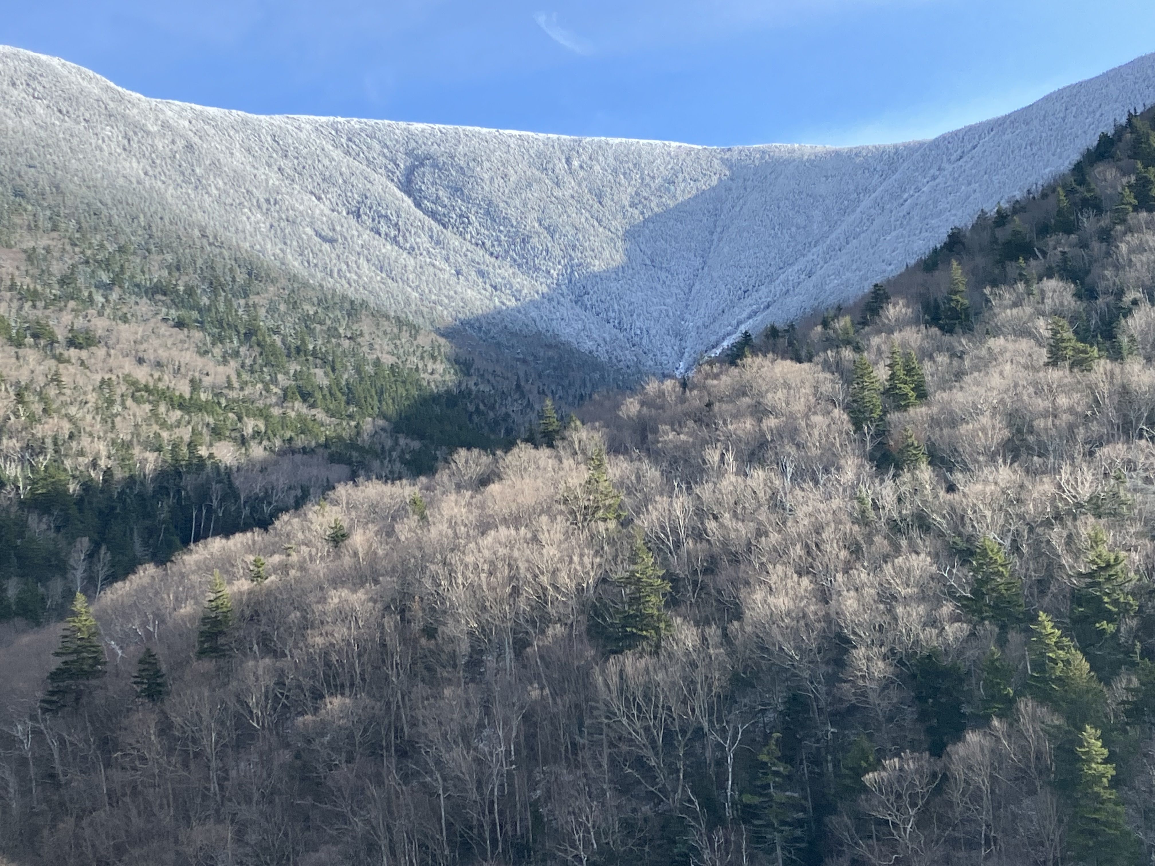
The best spot from which to view this slide is from the frozen surface of Elbow Pond in midwinter. The age of this slide is unknown, though it certainly fell before 1960. It is almost completely revegetated with red spruce, but, as I discovered on my previous visit in 2014, there are still two open patches that reveal unique views.


The approach route for this bushwhack was the Walker Brook logging road off Rt. 118 at the Woodstock end of that highway. This also serves as the approach for the unofficial path to the 1942 B-18 bomber crash site, which is on the slope to the north of the old slide at about the same elevation.


At an open logging yard at the end of the gravel road, a cairn and small American flag mark the start of the bomber crash path.


I continued ahead across the north branch of Walker Brook and began bushwhacking up the ridge between the north and south branches of Walker Brook.


The slopes drop off steeply to the ravine of the south branch.


The middle part of the whack ascended through a huge 1980s clearcut, now grown to saplings with lots of down junk wood.


In the woods there was crunchy, punchy snow perhaps two to three inches deep, making for somewhat tedious travel.


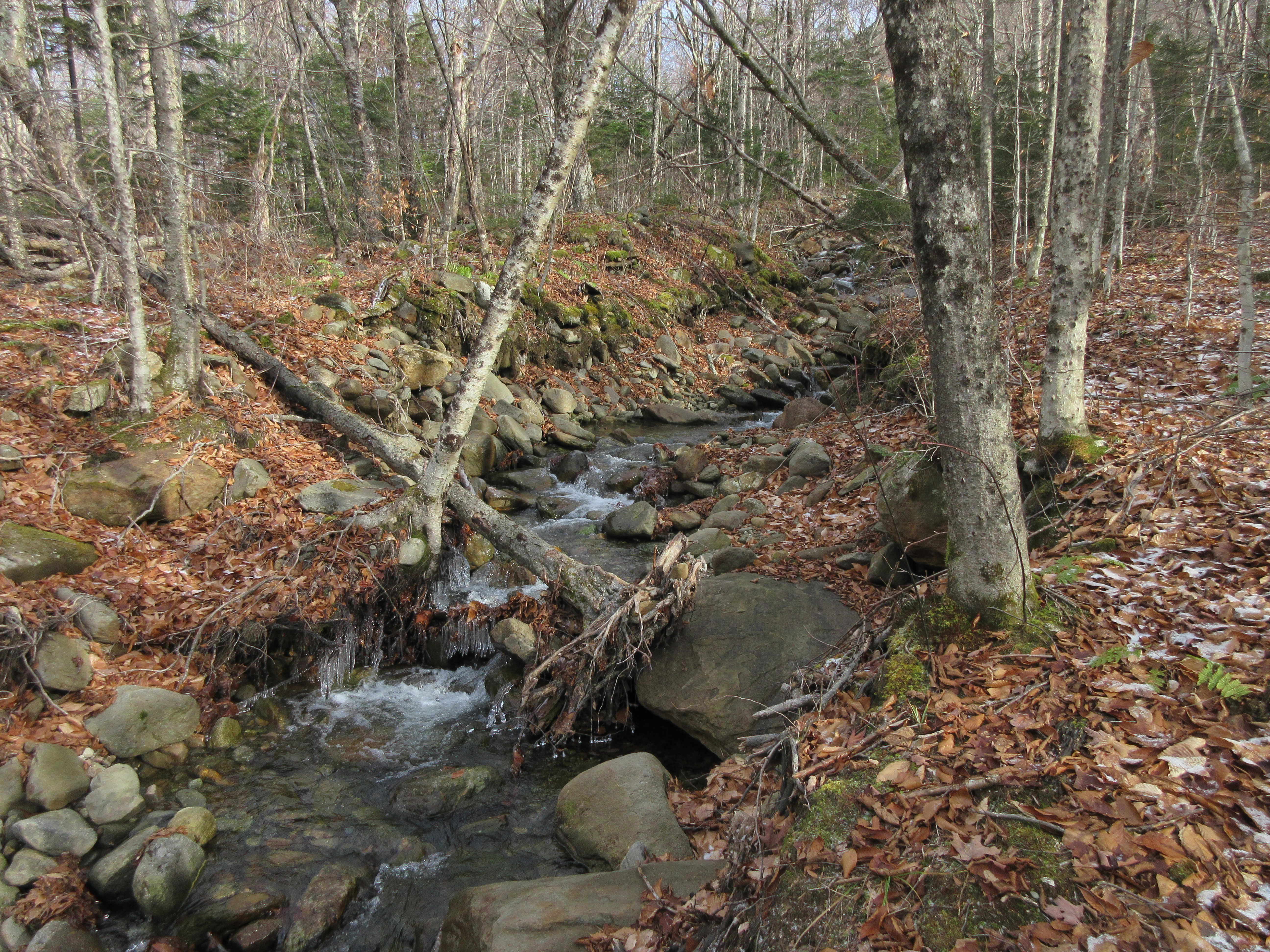
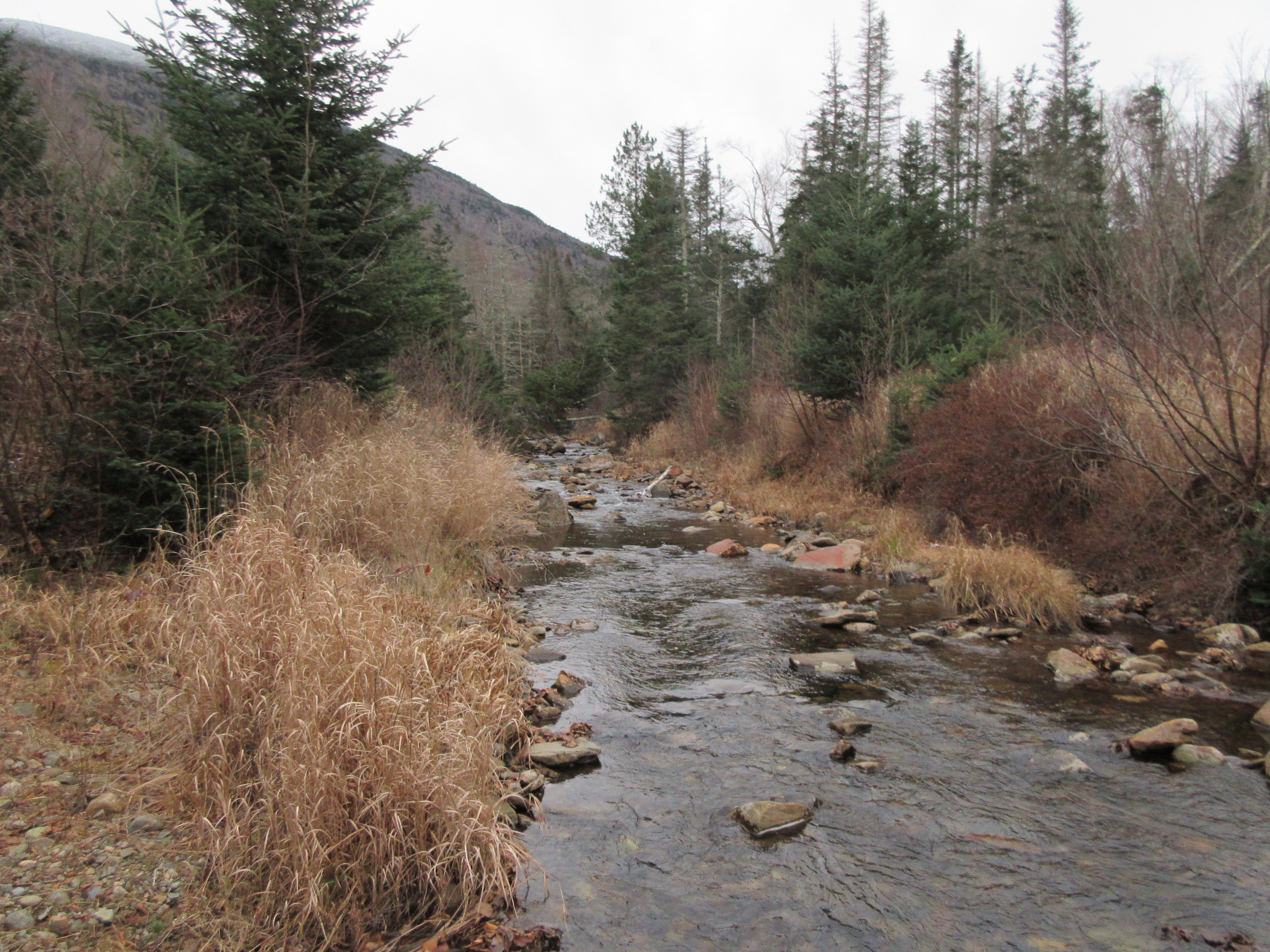
One of the feeder streams of the south branch, high up on the slope.


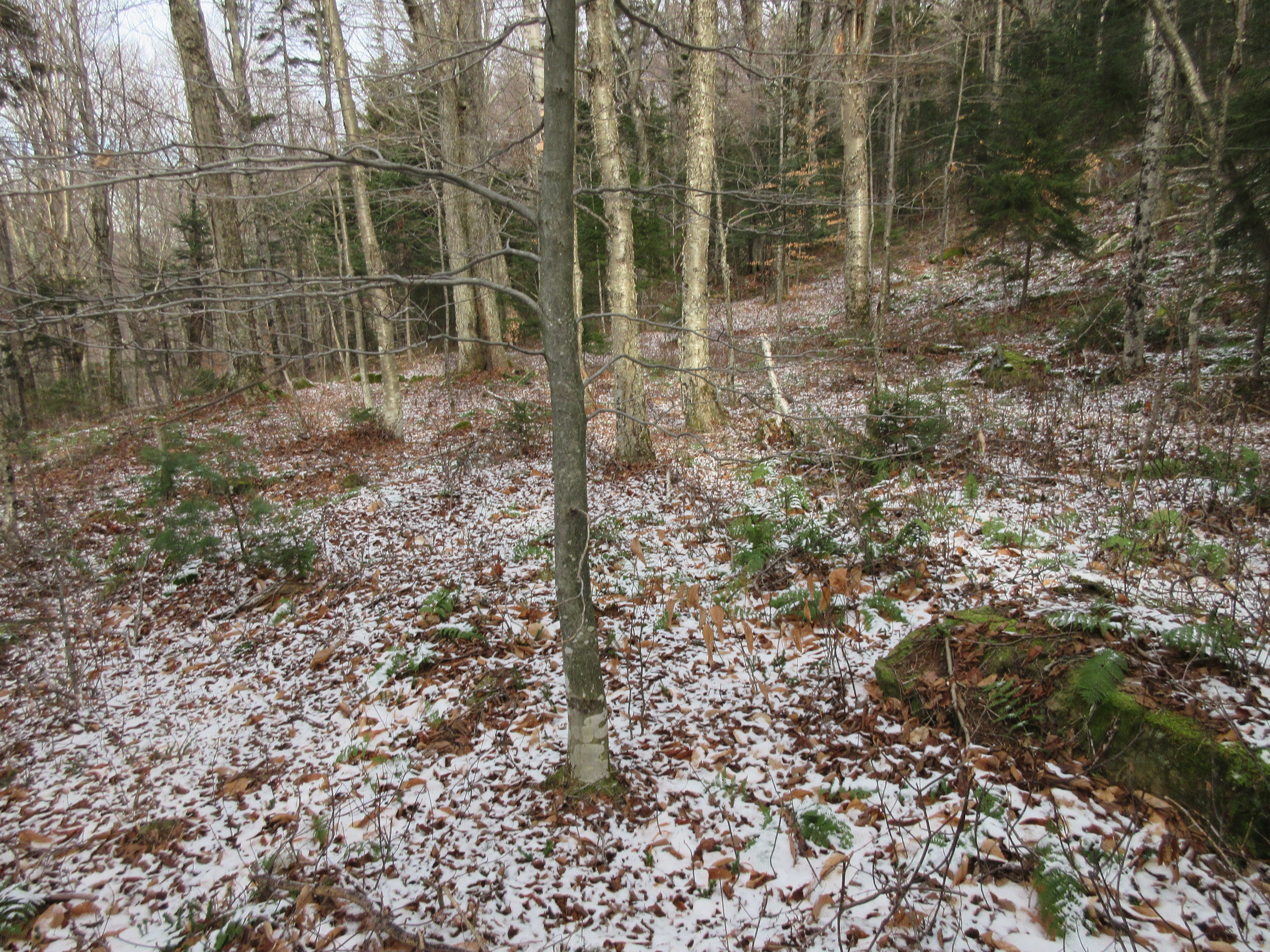
I remembered this fine open hardwood glade on a shelf at 2600 ft., just below the slide.


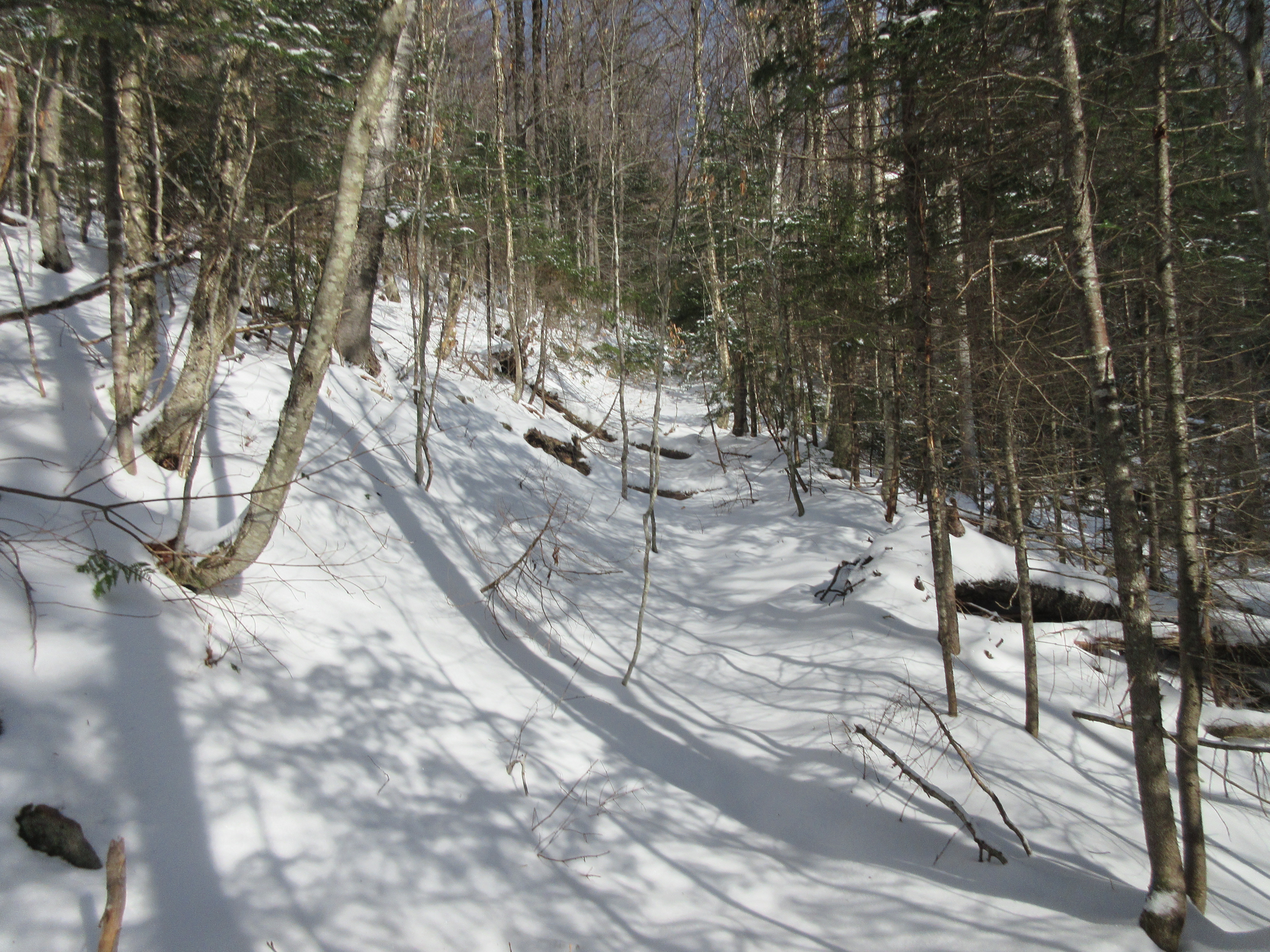
Nearby is one of the runout tracks of the old slide.


I followed this track upward.


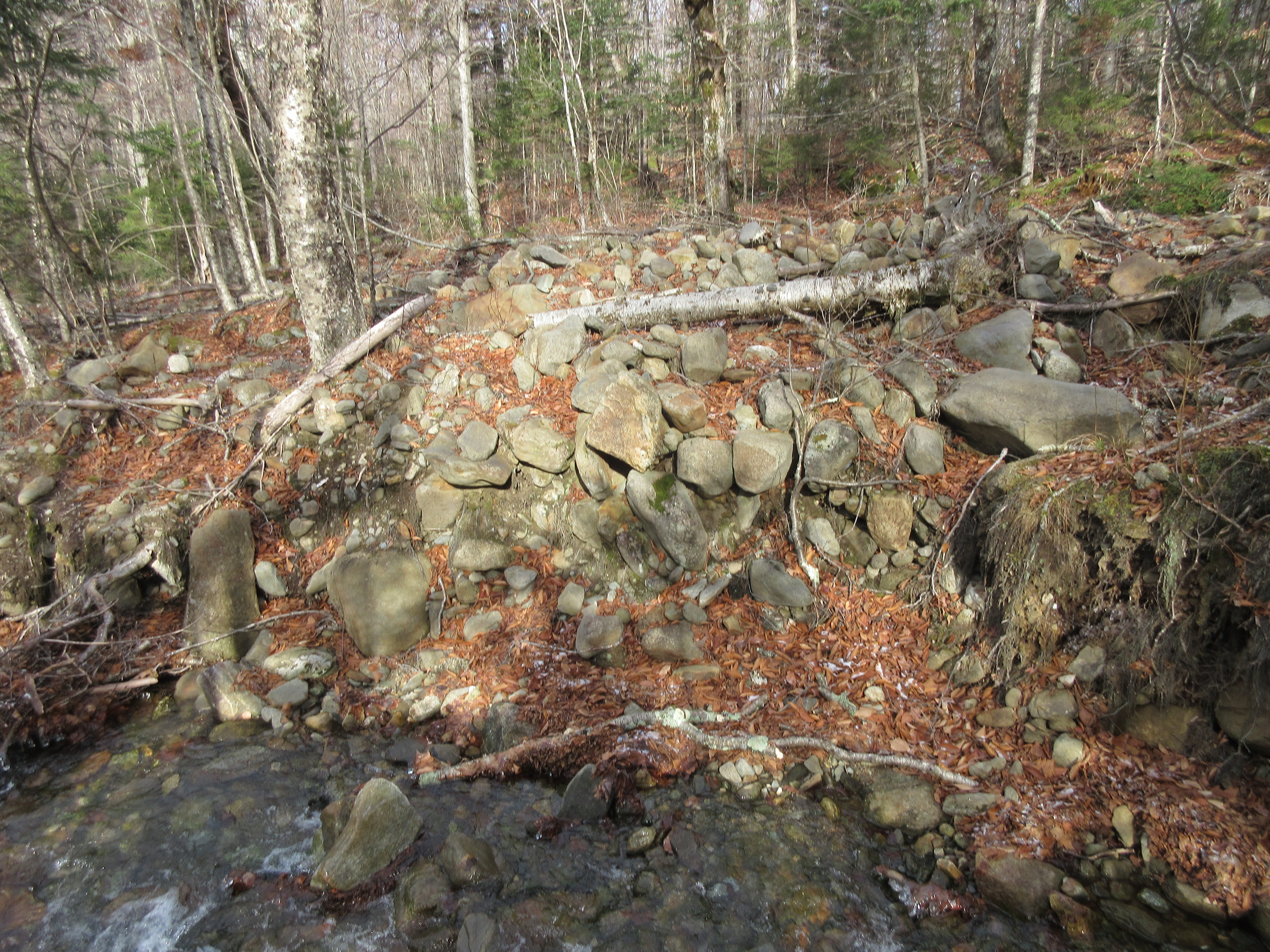
One of the few ledges on the slide track.


At the lower of the two remaining open patches, the southeastward view was still good.


Unique to this vantage point is the bird's-eye view of Elbow Pond, with Sandwich Dome beyond.


The upper end of this open patch.


The spruces close in above.


Grouse tracks.


The upper open patch, at 3050 ft.


Looking out.


An even better view over the pond up here. Nice spot for a long lunch break.


Zoom on Elbow Pond.


Descending steeply through the woods alongside the slide.


Hardwood dreams.


During this bushwhack I crossed tracks several times with what I assume was a wandering bear. No sightings, though.


Homeward bound, following more critter tracks down the long slope.


Saturday, November 19, 2022

Avalanche Ravine Winter Preview: 11/18/22


After an exceptionally warm early November, a couple of snowfalls and plummeting temperatures brought the winter vibe to the Whites in a hurry. Time to break out the winter boots, gaiters, extra layers in the pack, traction etc. It always takes me a hike or two to acclimatize to winter conditions, and one of my regular treks this time of year is up the mellow, usually ice-free Livermore Trail and into Avalanche Ravine on the NW side of Mt. Tripyramid. When conditions permit, I like to go partway up the North Slide for a view.

There were a couple of inches of crunchy snow in the woods at the Livermore trailhead. Despite thin cover on the first couple miles of Livermore Trail, some early-season skiers had been out.


White Cascade on Slide Brook, now looking whiter.


A large metal artifact at Avalanche Camp, used by Parker-Young Company loggers in the 1930s and 1940s, gets ready for perhaps its 80th winter.


Rodent road map.


The way to North Tripyramid.


From the junction with the north end of Mount Tripyramid Trail, I followed a favorite bushwhack route along an old logging road on the north side of Avalanche Brook.


In the woods here there was up to 6" of snow with a crunchy layer on top.


An open sugar maple glade near a tributary that flows down under the south side of Scaur Peak.


"Breaking trail" for the first time this season. Almost enough for snowshoes.


Avalanche Brook.


Bushwhacking up the broad floor of the ravine, between the brook and the Mount Tripyramid Trail.


I cut over to the trail and followed it up to the lower part of the North Slide.


Following the trail corridor parallel to a deeply gullied section of the slide. It's steeper than it looks. Someone had descended the North Slide after the initial snowfall. Those frozen bootprints, and the crunchy nature of the snow, made it relatively easy to go up and down the steep pitch. Powdery snow atop ice would have been far trickier.


I ascended to a favorite spot at 3000 ft., above which the slide gets trickier. I fashioned a seat from my pack and had lunch while admiring the somewhat fuzzy view out to the Osceolas and a socked-in Mt. Moosilauke beyond.


A closer look at Breadtray Ridge, Mt. Osceola (with the tip of the Southwest Slide visible), and the summit of East Osceola.


Steep terrain.


After descending back to the base of the North Slide, I continued up the ravine to the little meadow at the base of the slide's East Fork.


The pool at the base of the East Fork had iced over, but the stream above was still flowing.


On the floor of Avalanche Ravine.


The North Slide looks imposing from down here.


Gnarled yellow birches near the entrance to the ravine.


Homeward bound.


Wednesday, November 16, 2022

Tunnel Ravine Views: 11/15/22

November is a fine time for lower elevation bushwhacks, while the ground is still free of snow. For this trek I made a return visit to a clifftop ledge on a northwestern shoulder of Mt. Moosilauke that offers a unique view into the huge basin known as Tunnel Ravine or Benton Ravine. I first went to this ledge on a late November probe into the ravine in 2014 with John "1HappyHiker" Compton. We marveled at the view, but could stay only briefly due to the lateness of the hour.  I went back in summer two years ago and spent an hour lounging in the sun. With the higher ridges caked in new snow, today's trip promised a different look for the imposing ravine headwall.

The approach involved a three-mile walk up the Tunnel Brook Trail. Along the decommissioned road section of the trail there was a nice view of the wide brook, flowing strongly from recent rains.


I left the trail at a hardwood glade where rocky rubble from Tropical Storm Irene's floodwaters is strewn through the forest. Right here I had a sighting of a white-tailed deer, and farther along in the bushwhack I saw many deer prints punched into the soft duff.


The nameless stream that drains the ravine carved quite a channel during that 2011 storm.


Side view of the rubble.


Partway up the ravine I crossed the brook, which seems get larger as you head up the drainage.


I then ascended the long slope towards the shoulder and the ledge, at first through nice open woods. There was a dusting of snow, but not enough to make the footing too slippery.


The climb soon became steep, with a few obstacles to work around, such as this ledge...


...and some areas of blowdown.


The slope remained steep, though the woods were reasonably open until I reached the wind-tangled scrub at the precipitous edge of the shoulder.


I visited several ledges along the edge, seeking the one that had the best perch and view. Between the ledges the scrub was dense.


Found it! This is one of those needle-in-a-haystack spots.


The ledge is hidden, and well-guarded by, intertwined mountain holly scrub.


 Here there is a down-look to the winding lower floor of the ravine.


To the southwest is the slide-streaked face of Mt. Clough, overlooking Tunnel Brook Notch. I could see at least part of eight of the nine slides on the mountain's steep eastern face.


The view up to the headwall of Tunnel Ravine did not disappoint.


Part of the massive 2011 slide can be seen at the bottom right of the headwall. According to geologist P. Thompson "Thom" Davis, this is one of four glacial cirques on Mt. Moosilauke, the others being Jobildunc Ravine, Gorge Brook Ravine and Little Tunnel Ravine. I layered up and sat here for quite a while in the sun, absorbing this wild scene.


Before heading down, I probed a little farther up along the edge of the shoulder for possible additional views.


The woods here were rather prickly.


A blowdown opening revealed a higher perspective on the headwall, with more of the base revealed.


Back down to the attractive brook after a steep descent.


Descending through a fine sugar maple glade, with Mt. Clough beyond.


Bear feeding nest in a beech tree.


I made a short bushwhack to a beaver meadow along Tunnel Brook before heading out and reaching the trailhead just before dark.