Monday, December 30, 2013


CHRISTMAS WEEK WALKS

I wasn't able to get any longer hikes in this week, but I had a chance to enjoy several fine shorter walks. First up was a Christmas Eve hike to Little Round Top at the Slim Baker Conservation Area in Bristol, NH while en route to Cape Cod for a family Christmas visit. The Slim Baker Conservation Area is just outside downtown Bristol and offers several trails leading to the open summit of Little Round Top. The walk was suggested by Clay Dingman, who is on the Slim Baker Foundation board. He and his wife Sandra Heaney have done much improvement work on these trails. The trails have been freshly blazed, and there is new signage in the works.


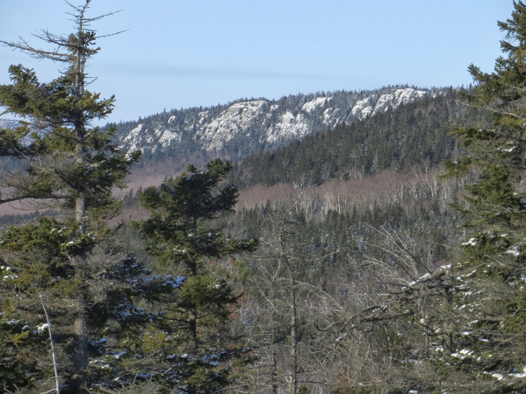
 I made the short (0.2 mi.) climb on the Worthen Trail to the open area known as Inspiration Point near the summit of Little Round Top.


The northern view includes the Ossipee Range, Mt. Chocorua and Mt. Moosilauke seen beyond nearby hills.


Mt. Cardigan and Firescrew are seen to the NW.


I descended by the longer leg of the Stephens Trail, which makes a 0.8 mi. loop over Little Round Top. Loops can also be made with two other trails. Trail descriptions and a map can be found at at http://slimbaker.org/trails  This is a neat little area!


Down on the Cape, the morning after Christmas Carol and I did one of our favorite loops on the Red Maple Swamp Trail (partially closed due to damaged boardwalk) and Fort Hill Trail in the Cape Cod National Seashore. A gnarled old red maple leans over the boardwalk on the swamp trail. Except for the snow, one could almost imagine being in Louisiana.


A glacial erratic used as a sharpening stone by Nauset Indians. It was moved from its original location in the marsh to this perch atop Skiff Hill.


The open fields of Fort Hill. The Outer Cape was originally inhabited by the Nauset Indians, who cultivated the rich soil and reaped the bounty of marsh, pond and bay. The first white settlers arrived in the 1600s, and around 1672 the Fort Hill area became the property of Rev. Samuel Treat. Over the years these gentle slopes were converted to agricultural use - corn, rye, pasture and hay fields. Today the National Park Service continues to maintain these as open areas offering long vistas.


Nauset Marsh from the Fort Hill Trail.


We always like to scramble up on this glacial erratic for a good view.


A local resident at the "summit" of Fort Hill (elevation 45 ft.). We looked for Snowy Owls out on the marsh and dunes but didn't find any today.


The whale jawbone at the Captain Edward Penniman House, near the Fort Hill trailhead, is a mandatory photo-op. The house was built in 1868 by an Eastham whaler who sailed several times around the world..


I made a stop at Coast Guard Beach in Eastham for a quick ocean fix.


Looking south down Coast Guard Beach, rain moving in for the afternoon.


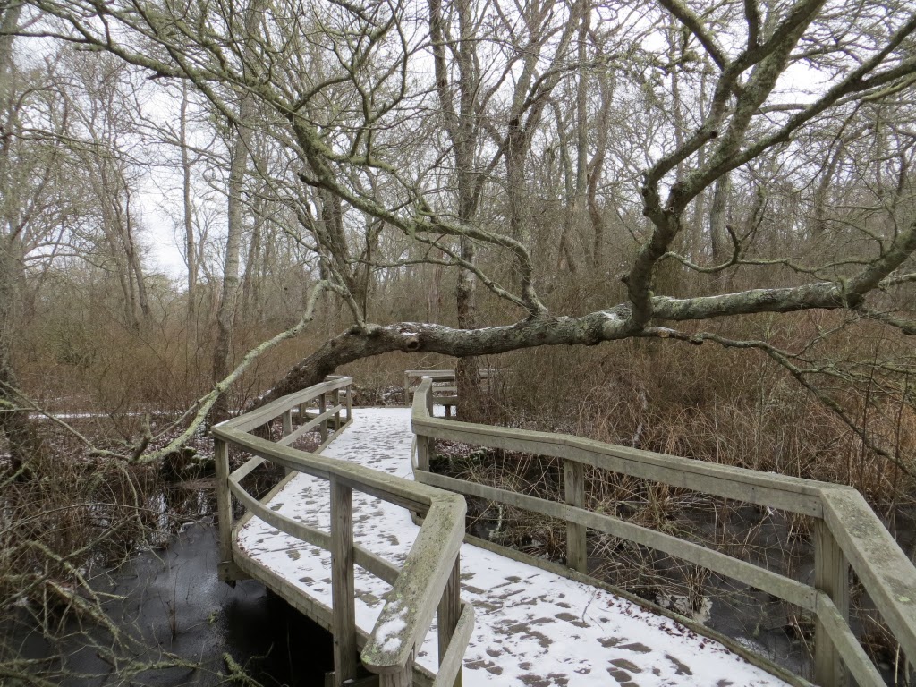
The next day we took a walk in little-known Hawksnest State Park in Harwich, just off Exit 11 on Route 6. We followed old roads to a spot on the shore of beautiful Hawksnest Pond.


The sandy shore of Hawksnest Pond.


An unnamed trail through oak and pitch pine woods in Hawksnest on a gorgeous Cape winter day. Soft footing, no ice, and the famous "Cape light."


A look at Black Pond through the trees.


There's one small private camp on Hawksnest Pond, surrounded by state land - a little slice of heaven.


Olivers Pond, another gem at Hawksnest. This 236-acre park has seen a sad lack of maintenance, but a volunteer group, the Friends of Hawksnest State Park, are working to improve the situation. We'll be back on our next visit to the Cape.


Friday, December 20, 2013


 FIRST TRACKS TO THE SCAUR: 12/19/13

I was anxious to sample the nice early season powder in the woods before the forecasted rain messed things up during the coming weekend. I headed down to Waterville to snowshoe to an old favorite, the 2230-ft. rocky nubble known as The Scaur. The hike began, as always, with a shuffle up the wide groomed Livermore Trail. Approaching the Depot Camp clearing, The Scaur can be seen poking up on the L with Flume Peak on the R.


Looking up the Mad River from the bridge on the Livermore Trail.


A bonus on this hike was the chance to snowshoe a nice relocation on Kettles Path completed this year by the Waterville Valley Athletic & Improvement Association and Student Conservation Association NH Corps. Great sidecut work, ideal for 'shoeing. It bypasses two very steep pitches.


Looking down into one of the Kettles, dry bowl-shaped hollows left after chunks of glacial ice melted away.


There was 12-15" of unbroken snow on the trail. It was nice to settle into the plodding pace and slightly swaying gait of the trail-breaking snowshoer. Gives you plenty of time to contemplate the forest.


A respectable snow depth for pre-Christmas.


The steep eroded section of the Scaur Trail from this junction down to the Greeley Ponds Trail has been closed.


The upper .25 mi. of the Scaur Trail is steep! It might be considered good training for snowshoeing the Hancocks or other steep-trailed peaks.


This ledgy slot just below the top is a bit tricky on snowshoes. Took a couple of minutes to claw up though here.


Approaching the open ledges of The Scaur.


One of our favorite spots in the Whites - a great payoff for a 4-mile round trip with only the short section of steep climbing near the top.


A great panorama of Sandwich Dome and its Acteon Ridge.


The view towards the wild and remote Lost Pass region.


A nice place to hang out for a while, even on a grey December day.


From the top of a steep ledge on the west side, there's an unusual view of Mt. Tecumseh and Thornton Gap.


Good view up to the Osceolas here as well.


The main summit of Osceola.


Middle and South Tripyramid, with West Sleeper peering out on the R.


After a good stay on The Scaur, I headed out along the gradual ridge that extends a long way to the E. I'd bushwhacked along this ridge a couple of times before. There was a "Scaur to Flume Trail" on this ridge in 1915, shown on A.L. Goodrich's map of Waterville Valley (shown below; thanks to Joe Jalbert for posting it on his White Mountain Lost Trails website). But this route was soon obliterated by logging and was not reopened.


This approximate route will be reopened next year by the WMNF as the new route to the Waterville Flume, replacing the severely damaged Flume Brook Trail. For a map of the proposed new trail, click here. Early on, the route passes by a ledge with a view of Mt. Tecumseh beyond part of the Scaur cliffs...

 
...and this interesting small cliff in the woods. 


A snow-capped glacial erratic.


The gently-graded ridge is a mix of open hardwood, as shown here, and darker spruce woods. This will be a fine remote ridge walk when the new trail is opened next fall.


Where the trail drops off the ridge, the description in the WMNF project documents says, it "enters thick softwoods on the north-facing slope and passes an outlook with amazing views north to the Greeley Ponds Scenic Area and Mad River Notch." I didn't find this spot today, but on a bushwhack a few years ago I made my way down to a ledge farther east along the ridge with a neat view of the Osceolas beyond the Flume Brook valley. The view from the new trail should show more of Mad River Notch itself. Can't wait til it opens next fall!


Saturday, December 14, 2013


BLUEBERRY MOUNTAIN (BENTON): 12/12/13

On a very cold but sunny and gorgeous day I headed down to Glencliff for a ramble up 2662-ft. Blueberry Mountain in the Benton Range, one of my favorite smaller mountains. The crest of this gentle peak features many open sloping ledges mixed with forests of spruce and red pine. Blueberry's views are not panoramic, but they are pleasing, and among them is perhaps the best vista anywhere of Mt. Moosilauke.

I parked on the shoulder at the junction of High St. and Long Pond Rd. and donned my Stabilicers, which proved ideal for the day's footing of two inches of powder atop dirt surfaces, granite ledges, and hidden ice flows. From my parking spot I had a neat view of Webster Slide Mountain and its great cliff face.


In winter you must walk 0.7 mi. up Long Pond Rd. to the eastern trailhead for the Blueberry Mountain Trail. The first 0.1 mi. of this road walk is part of the Appalachian Trail.


Some fairly extensive logging over the last couple of years has made the lower half-mile of the trail less attractive.

View of Mt. Moosilauke from a clearcut along the trail.


Open sunny hardwoods above the logging cuts.


At 2075 ft. there's an abrupt transition to snow-covered spruces.


A peek back at Moosilauke from the first ledges.


This gentle ledgy, piney ridge has a very peaceful feel to it.


I followed bobcat tracks much of the way up the trail.


The one fairly steep pitch on the climb, with some ice hidden under the snow - careful footwork required.


I took a long break on a south-facing ledge shelf 20 ft. left of the trail, 1.5 mi. up from the road. Though the temp was only around 10 or 12 above, it was quite comfortable in the sun.


Carr Mountain is one of the dominant features of the view.


Part of Wachipauka Pond is seen under Mt. Mist. Webster Slide Mountain, with a snow plume, is to the R, and Smarts Mountain looms beyond.


Mt. Kineo can be seen from the trail itself.


In another 0.1 mi. I spent some time at my favorite spot on Blueberry, a gently sloping ledge with a wonderful view of the western side of Moosilauke.


The Moose was really snow-caked on this December day.


Great view into Slide Ravine, where I had explored back in October.


The summit ledge of Blueberry, reached by a side trail. There was a Dartmouth Outing Club shelter near here from 1930 into the 1940s.


Still following the bobcat, across the broad crest of the ridge.


In 35 years of hiking, I've never seen a bobcat.


Approaching the western view.


From a large ledge opening 0.3 mi. past the summit spur, there's a nice wide view NW into Vermont with many Green Mountain peaks visible on a clear day.


To the north you can see three other ledgy peaks of the Benton Range: Sugarloaf, Black Mountain and The Hogsback.


The quartzite cliffs of The Hogsback.


Sugarloaf, showing some great ledge perches.


Heading back down the mountain with Stinson Mountain visible in the distance.


The moon riding high over Moosilauke late in the afternoon. Blueberry is a great little hike! Click here for more on Blueberry Mountain.