Thursday, January 25, 2024

Wandering at Lincoln Woods: 1/24/24

After snow removal duties in the morning, Carol and I spent the afternoon wandering along the east side of the East Branch of the Pemigewasset River at Lincoln Woods. We traced the route of the northern section of the abandoned Pine Island Trail and observed many signs of storm destruction along the river.

A happy snowshoer in snow-covered confers along the Pemi East Side Trail.


What used to be Pine Island Brook, a medium-sized stream, is now a river unto itself. The 2017 Halloween storm diverted a major portion of the East Branch's flow into this stream, rendering the two crossings along the Pine Island Trail essentially impassable.


We saw some interesting ice formations as we bushwhacked alongside this stream.


Mother Nature's artistry. Note how the water is flowing at a higher level, above the ice, at the top of the picture.


This crossing would be a nightmare.


We bushwhacked along the stream to the northern section of the Pine Island Trail. We were the adopters of this trail for several years starting in 2011. The trail was closed after Tropical Storm Irene washed parts of it away that August. Those sections were relocated and the trail was reopened. Then the 2017 Halloween storm caused more washouts and created the hazardous stream crossings, resulting in the trail's permanent closure.


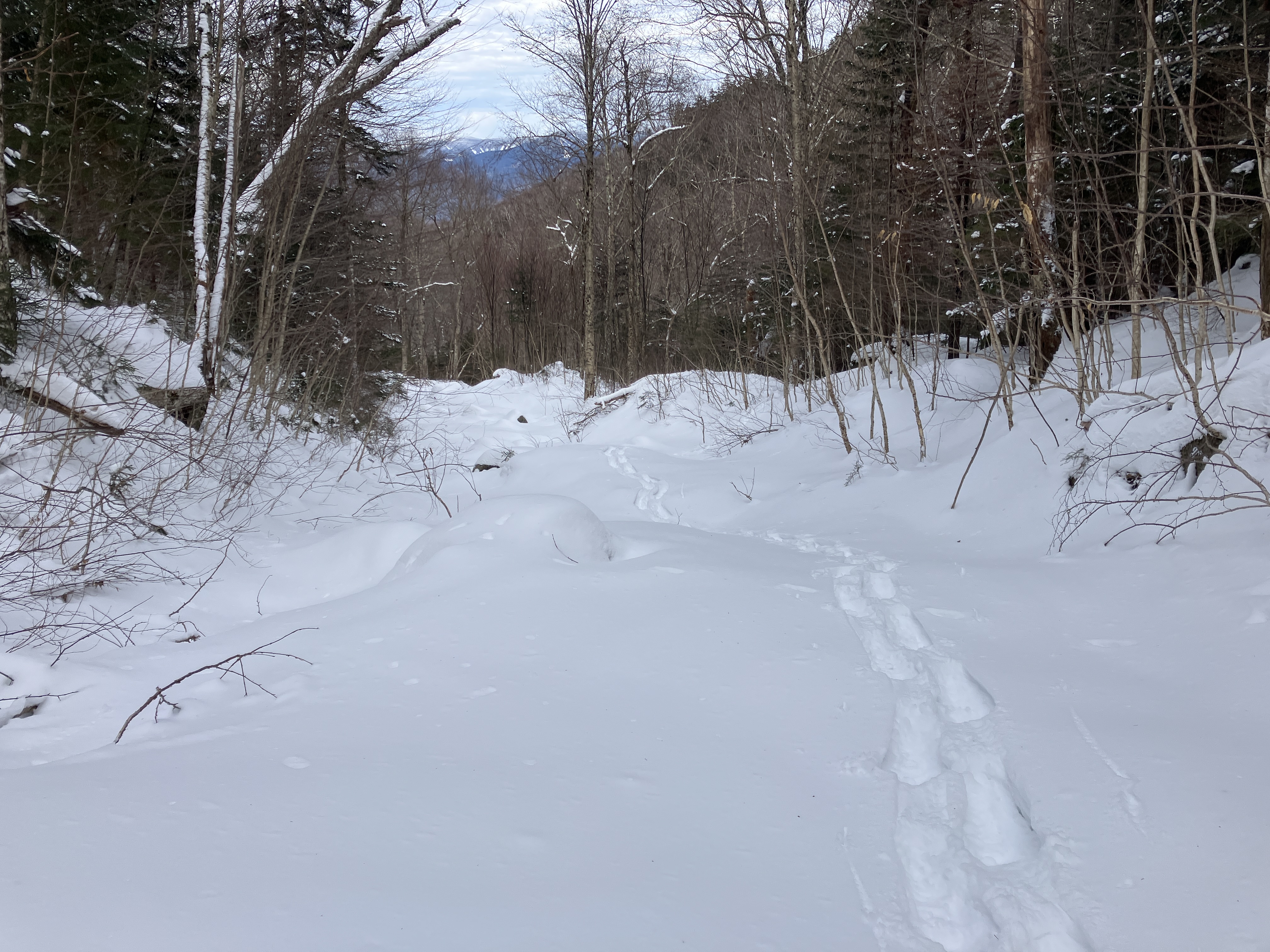
We had to weave around several blowdowns that have blocked the trail corridor.


Carol breaking trail on a short open section of the trail corridor.


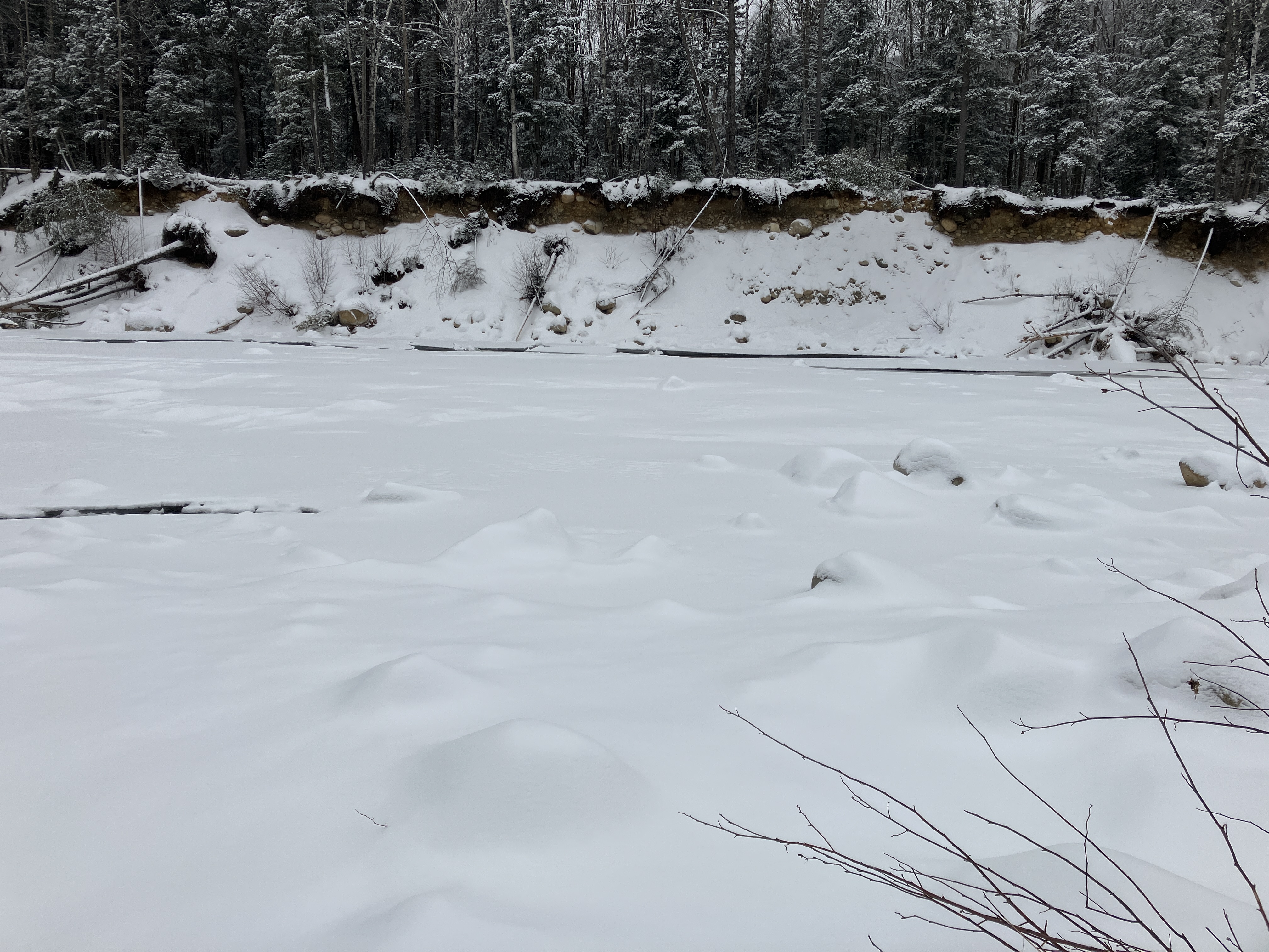
View across a wide stretch of the East Branch, with "Peak 2675," shrouded in mist, in the background.


This tangle looked recent, and likely was created by the big rainstorm of 12/18/23.


This spot was originally breached by the 2017 Halloween storm, and appeared to have been expanded by the storm last month.


Preparing to dip into the trench.


Weaving a path through the destruction.


Yikes!


Long view upstream. The low clouds obscured the fine mountain views found along the edge of the river.


The north end of Pine Island Trail is away from the river and still in good shape.


We followed a spur path down to one of our favorite spots, a vast sandbar created by Tropical Storm Irene. We call it "The Beach" and there is a geocache here if you are so inclined.


Looking south down The Beach. On a clear day there would be a fine view of Scar Ridge.


To the north of the beach is an area of rock cobbles and scrubby trees. The snow was deep here.


White cedar and white pine, side by side.


Looking across the East Branch to a bank that was cut away by Tropical Storm Irene. There is always much to see on an excursion along this magnificent wilderness river.


Tuesday, January 23, 2024

Northwest Slides, Scar Ridge: 1/22/24

Chose a fine relatively warm (but not too warm) winter day for a return visit to the lower reaches of the two Northwest Slides on Scar Ridge. This would be my fourth snowshoe bushwhack in the last six years out to this interesting nook of the mountains. These two  lofty, ledgy slides plunge off the steep northwest face of the main Scar Ridge summit into a deep ravine between Scar Ridge and Black Mtn., a northern spur of the Scar Ridge-Loon ridgecrest. These slides, with an upper elevation of 3,300-3,400 ft., are prominent from many viewpoints to the north, and can be viewed from the deck of the ranger cabin at the Lincoln Woods trailhead and from various points along the edge of the wide East Branch of the Pemigewasset River. The narrow lower tracks of the two slides join at 2100 ft. on a terrace forested with northern hardwoods.

I approached the bushwhack via a one-mile snowshoe on the groomed East Ridge X-C/Snowshoe trails maintained by Loon Mountain (no fee, limited parking).


Heading into the woods for the two-mile bushwhack.


Much of the route to the slides leads through hardwood forest, with fewer dense conifer stretches than many such bushwhacks.


The snow depth in the hardwoods seemed to average 12-14," largely unconsolidated, though some areas had a crusty base beneath.


Vivid skies overhead.


Deep in the big valley between Scar Ridge and Black Mountain is one of my favorite hardwood glades.


On the west side the trees march steeply up towards the crest of Black Mountain.


Looking back.


Farther along I followed the trace of an old logging road, likely from the J.E. Henry era, paralleling the brook that drains the valley.


Crossing the branch of the brook that comes down from the Scar Ridge-Black Mountain col.


Heading up the fork of the valley that leads to the slides.


The mostly-buried brook that comes down from the slides.


The tops of the two slides are in sight at the head of a great amphitheater.  The slides are apparently at least a century and a half old, as they were noted by geologist Warren Upham in an article in the February 1878 issue of the AMC journal Appalachia. Upham recalled that in 1871, while obtaining a rock specimen from the top of one of the slides (in so doing probably making the first recorded ascent of Scar Ridge), his hammer flew off its handle and “went off, bounding merrily down, tick, knock, whack, clink, to the bottom, hundreds of feet below. It was not searched for, but a liberal reward will be cheerfully paid to the finder.” (How cool would it be to find that hammer!)


Mature hardwoods cloak the inner sanctum at the base of the slides.


Approaching the base of the western slide, a wild cliff looms ahead on a spur of Scar Ridge.


Snowshoeing up the track of the western slide.


Looking up to the icy slabs at the head of the western slide. This is a seldom-visited ice climbing route known as "Long Way Home."


A solitary white pine at the edge of the slide.


After a detour through the brush, I emerged on a bank overlooking the start of the ledgy section of the slide.


Here I dropped back onto the slide beside rugged ledges.


Heading up a little way. In summer the ledge slabs under here are dangerously slick.


Looking back.


Ahead rises a very steep ledge step.


In summer the ledges here have a remarkable scalloped look.


An excellent view of the Pemigewasset Wilderness can be accessed a short distance above the top of this ledge step. I'd made it up there twice before on snowshoes along the left side, so I started up that way again, stomping my snowshoes through a powder layer into the hard crust beneath.


Drawing even with the ice formation near the top of the ledge. Above this point the traverse up and across the lip of the ledge proved to be too icy beneath to safely navigate.


A careful retreat was made back down along my tracks, with a butt slide at the bottom.


I settled in on a flat spot at the foot of the ledge step for a late lunch and a screened view out to the peaks of the Pemi.


The slides on the Twin-Bond Range show up well in winter.


Looking back as I depart the western slide.


I bushwhacked across through the woods at the base of the ridge that divides the slides, then climbed to an open area on the lower part of the eastern slide.


There are icy slabs at the top of this slide as well.


Looking up the long snowy swath. A few years ago I snowshoed about two-thirds of the way up before the terrain got uncomfortably steep and I ran out of gas.


Looking back at Black Mountain and its craggy south ridge.


Descending along the lower track of the eastern slide, lined with slender yellow birches.


Farewell to the amphitheater.


Homeward bound.