Walked in to Dickey Notch and bushwhacked up and around the west side of Dickey Mountain. Saw many interesting sights along the way.
Pleasant walking on the Dickey Notch Trail (aka Brown Ash Swamp Mountain Bike Trail), though there were a few wet spots.
One of several small beaver ponds in Dickey Notch.
Beaver ponds.
Hardwood whacking up out of Dickey Notch.
First of many ledges today.
Cone Mountain and its cliffs, on the SW side of Dickey Notch.
Towering oak.
Inseparable couple.
Beautiful spring day in the hardwoods.
Random boulder.
Into the spruces.
Nice sloping ledge.
Big west-facing ledge.
Snow-capped Mt. Moosilauke.
Went looking for and found a long rock wall with interesting caves that Cath Goodwin and I had stumbled upon duiring a snowshoe bushwhack a few years ago.
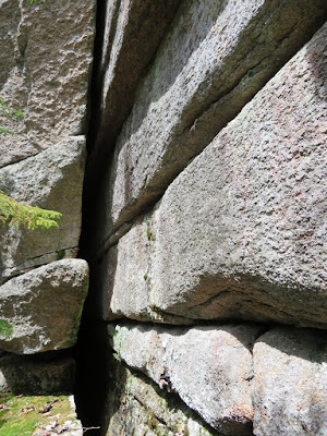
Almost as if cleaved by an axe.
Stepping in.
Looking out.
Overhang cave. Too icy to sit in today.
Another crevice.
The rock wall continues on...
...and on.
Around the corner.
Emerging at another ledge. When traversing these areas, bushwhackers should place steps carefully to avoid disturbing mosses and lichens.
Dickey is a mountain of huge ledges and wide views.
What's an April trip without a few postholes. But this trek was 99.8% snow-free.
Spruce whacking.
Came out on the Welch-Dickey Loop Trail at one of the expansive ledges high on the mountain.
Peering down at the Dickey Cliff.
One short bit of remnant monorail in the summit woods.
View north to the Tecumseh range from the summit.
Sprawling ridges of Sandwich Dome.
Sandwich Range from Scaur Peak to Mt. Whiteface.
Tripyramids.
Welch Mountain with Sandwich Notch and the Belknap Range in the distance.
Followed the somewhat obscure side path out to Dickey's massive north ledge.
Sweeping views from here.
Looking northeast.
Ghostly Franconia Ridge.
View of Campton Range while descending along the trail.
Side view of Welch.
Always stop to admire the mysterious stone circle.
Descending along the Dickey Cliff.
Looking back at the streaked slabs on the face of Dickey.
Impressive rock step work on the steep descent into the hardwoods.


