Tuesday, November 30, 2021

Snows Mountain: 11/30/21


After picking up some guidebooks in Waterville Valley, I had the afternoon free and made a four-mile loop over Snows Mountain, starting at the south end. The trail proper begins at this classic WVAIA sign at the upper end of a driveway, after a 0.3 mile climb up Snows Mountain Road. Thanks to the homeowner who allows access here.


Most of the moderately graded climb (1250 ft. total elevation gain) is through hardwood forest. Stabilicers (remember them?) worked well on the shallow packed snow on this ice-free trail.


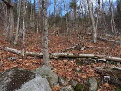
For nearly a half-mile the trail follows a fine old logging road cut into the slope.


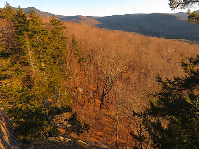
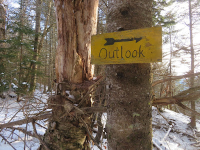
Near the top of the ridge a sign points to a SW-facing viewpoint.


Nice spot to take a break, though it was a mite chilly today.


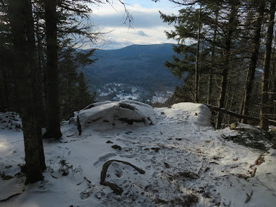
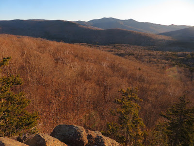
Mt. Tecumseh rises beyond the town center of Waterville Valley.


A long view down the Mad River valley.


This twisted tree is a landmark by the loop junction at the top of the ridge (2780 ft.). Here a spur leads 0.1 mile east to a mostly overgrown view ledge looking towards Sandwich Dome. The 3060-ft. summit of Snows is another mile east along the ridge, off-trail.


A short bushwhack on the north side of the ridge led to a nice framed view of South Tripyramid.


Adding Middle Tripyramid to the view.


There are  many cool old trees on the upper ridge of Snows.


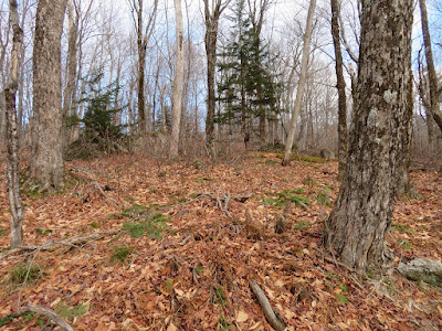
Nice glade behind the spur viewpoint, just inside the Sandwich Range Wilderness.


This wide-spreading yellow birch lords it over a col a short way down the north loop of the trail.


Twilight view of Osceola from the top of the old Snows Mountain Ski Area, where the Elephant Rock Trail diverges into the woods.


Saturday, November 27, 2021

Waterville Wanderings II


On the day before Thanksgiving I returned to Waterville Valley for another exploration on the ridge east of The Scaur. For this trip I teamed up with Waterville sage Dan Newton, longtime stalwart of the Waterville Valley Athletic & Improvement Association. Dan had set up a camp somewhere off the Livermore Trail and was hauling in supplies with his bike in preparation for a Thanksgiving dinner at the camp with his son. Per usual, Dan's canine companion, Friday, came along for the hike.


After dropping off his gear, Dan led the way up an old logging road, heading for the base of the ridge to the north.


There were several bear feeding nests in beech trees near the road.


A variety of bear claw marks on this beech.


When we reached the base of the ridge, we found and followed an older logging road that traverses up and across the slope.


There are many interesting ledges along the flank of this ridge.


Dan and Friday take a break.


Farther across the slope we came to a big cliff hidden in the forest, which Dan had visited previously. After checking out the top, Dan and Friday descended a chute next to the side face of the cliff while I remained above.


Peering down at Dan and Friday from the front edge of the cliff.


I worked out a different route to the base of the cliff, passing this side view along the way.


Down below, I traversed along the base of another cliff. This area is full of surprises!


An ice-draped ledge between the cliffs.


Approaching the big cliff from below.


The west side of the cliff is an almost sheer face. From here, Dan headed back down to his camp to work on his set-up, and I made a very steep climb back to the slope above the cliff, using the chute Dan and Friday had descended.


From there, I made a traversing bushwhack up across the side of the ridge, meandering through boulder-strewn hardwood forest....


...and some darker, chillier spruce woods.


Back into hardwoods, I crossed this random dry streambed running down the slope.


My kind of November whacking.


I worked my way up to the gorgeous sugar maple glade I had passed through the day before.


Today I stayed a while to appreciate these woods and the views of surrounding ridges seen through the trees.


Skyward vista.


Leaving the glade, looking back.


I bushwhacked westward to Irene's Path and followed it down the north side of the ridge to its stellar viewpoint peering into Mad River Notch.


A great angle on the shadowed Osceolas.


A zoomed view through Mad River Notch reveals Owl's Head (Pemi Wilderness) in the distance.


Two sets of cliffs are seen on the western side of Mt. Kancamagus.


Zoom on the wild and ragged K1 Cliff. Watervillians cut a short-lived trail up there in the early 1900s.


I reached The Scaur as the sun was about to set behind the south ridge of Mt. Tecumseh. This view looks south past Snows Mountain to Sandwich Dome and sharp Jennings Peak.


Looking southeast to Lost Pass and Mount Tripyramid. Time to head for home!


Friday, November 26, 2021

Waterville Wanderings I

I spent two fine November days exploring the long ridge that rises east from the ledgy nubble of The Scaur in Waterville Valley. Eventually, after 2 1/2 miles, this ridge culminates in Scaur Peak, the NW spur of North Tripyramid.
 
On the first trip I headed out on Livermore Trail and then up the historic Kettles Path, opened around 1890 by Arthur L. Goodrich. It its upper section (originally part of the Scaur Trail),  there is some excellent rock work.


A short, steep spur path leads to the viewpoint at The Scaur (2230 ft.).


It's one of the great spots in Waterville Valley, and I visit here several times a year. Sandwich Dome and its several spurs dominate the view to the south.


Middle and South Tripyramid and West Sleeper rise to the east.


Mt. Tecumseh closes in the valley on the SW.


Peering down at the hardwood forest below.


From a rather precarious perch on the west side, East Osceola and the Painted Cliff loom large.


Mt. Tecumseh and Mt. Osceola guard Thornton Gap, through which Tripoli Road passes.


Profile of Osceola. The tip of the big Southwest Slide can be seen on the far left.


On to Irene's Path, opened in 2014 to  replace the storm-damaged Flume Brook Trail.


Waterville Valley's Rock of Gibraltar looms over the trail.


Great trail design by the OBP Trailworks pro crew.


An interesting ridge walk.


Nice feeling of remoteness in the Waterville backcountry.


After 0.6 mile Irene's Path drops north off the ridge down towards the Waterville Flume. I continued off-trail, eastward along the crest, passing through this open sugar maple glade.


This shelf at the base of a very steep shoulder might have been a high old logging road.


I skirted to the south to avoid some dense spruce and ascended the steep slope through hardwoods, switchbacking to cut the grade.


Reaching the broad crest of the upper ridge at 2750 ft.


Spooky view of Tripyramid.


Tentacles.


North Slide peek-a-boo.


Ridgetop erratic.


Open glade.


After whacking a mile or so along the ridge, I reached the Livermore Trail just south of the Old Skidder Trail junction and began the easy 4 1/2 mile walk back to the trailhead.


Walking into Tripyramid.