A
bluebird day for these old favorites, with a side jaunt along the lower
part of the Arrow Slide. I always approach a Hancocks trek with a sense
of wonder, thanks to their ruggedness, their wild aura, and their
storied past in the early days of peakbagging.
Morning sun on the Osceolas from the Hancock Overlook.
The
good walking on the first 1.5 miles of Hancock Notch Trail is owed to
one of the early lines of J.E. Henry's East Branch & Lincoln
Railroad, dating back to the 1890s.
View over the North Fork of Hancock Branch to a spur of Mt. Hitchcock, courtesy of Tropical Storm Irene.
A familiar junction.
Nice ledgy spot on the North Fork.
Open spruce forest on a relocated section of Cedar Brook Trail, cut in 2015.
A placid North Fork where the Cedar Brook Trail crosses.
Loop junction.
The
Arrow Slide, which was often used as a route to ascend Hancock before
the trail was opened in 1966. Back in 1988 I climbed North Hancock via
the Arrow Slide with Vin Spiotti, now an AMC manager. I thought the
upper part of the slide was very sketchy with gravel and loose rock
sprinkled atop smooth, steep slabs of granite. A slip would be
disastrous. I bushwhacked through dense scrub along the edge
to bypass the trickiest area. I had foolishly brought a walking stick,
which prevented me from using both hands for balance on the slabs. Vin
saved the day by securing the stick under his fanny pack, then
continuing up what he called 5.4 friction climbing. Today I just wanted
to get out on the slide at some point for a look and some views.
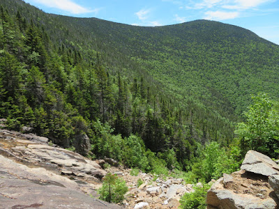
I went a short way up the trail to North Hancock, then bushwhacked across to the rubbly lower part of the slide. It's in a steep-sided gully, so it was ncessary to continue up alongside it until it was feasible to get down on it.
For several hundred feet of elevation the slide is a scramble up rocks and boulders, some of which are loose.
The slabs of the upper slide in sight above.
Looking back.
Reaching the base of the lower slabs, you are confronted by the ledges from hell. The loose rubble on the left is the way around.
Even the dry slabs look polished and perhaps not very grippy. There is some very dangerous terrain on this slide.
Looking across.
South Hancock looms.
I had hoped to get to the top of the lower slabs, where there appeared to be a safe way to go back across, but, flying solo, I turned back at this steep, treacherous pitch of gravel and loose rock.
The upper slabs seen above.
I picked my way back down to the base of the lower slabs, then bushwhacked back up through dense woods on the other side, and popped out for a view of the Osceolas.
A slide-to-slide vista.
Looking across to where I had ascended on the other side.
The 0.15 mile whack back to the trail gave a taste of pre-trail Hancock climbing.
Got back to the steep, eroded trail at about 4000 ft.
A fir wave offers some trailside views just below the summit.
North Hancock summit signs.
North Hancock outlook ledges. A nice spot, though tight quarters with more than a handful of hikers.
Great look at the Sandwich Range high peaks and Osceolas beyond South Hancock and Mt. Huntington.
Southeastern vista.
Leaving North Hancock, the trail corridor is tight, like an Adirondack herd path.
The trail winds through an area of massive blowdown, perhaps from the 2017 Halloween windstorm.
Bushwhacking nightmare.
Might be the champion balsam fir of the Hancock ridge.
Ferny col.
Bog bridges funded by donations made to the AMC Four Thousand Footer Club.
South Hancock summit.
Wide easterly view from the "enhanced" South Hancock viewpoint.
Mt. Carrigain and Signal Ridge.
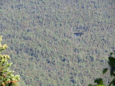
A
remote beaver pond down in the valley. In the 1990s a memorable
snowshoe bushwhack took me to this pond and to a much larger one hidden
on the floor of the cirque above.
This little gem of a pond is off-trail in the main Sawyer River valley.
Summit resident.
A peek through the trees down at Juno Peak, the steep-faced southern spur of South Hancock.
A recent slide on the wild east ridge of Hancock.
It appeared that the jay on the right was a youngster, with a parent on the left.
Looking back at North Hancock.
Descending South Hancock is slow work on a steep and heavily eroded trail bed.
Evening light in the spruces on Cedar Brook Trail.


