If you're looking for a wilderness trail with a capital "W," the Dry River Trail fits the bill. This rough-hewn footpath leads up the long, remote, steep-sided valley between the Southern Presidentials and Montalban Ridge. The area has long held an aura of remoteness and mystery, dating back to Nathaniel Hawthorne's short story, "The Great Carbuncle." From 1892-1898 the valley was logged by crews working for the Saco Valley Railroad.

The old logging railroad crossed the river 13 times because of the
steep, canyon-like terrain. When it was opened in the 1930s along the bed of the railroad, the Dry River Trail also had numerous
crossings. But after two hikers drowned in 1971 in this misnamed river,
which rises fast and furious during storms, a bridge was built at the first crossing and
numerous relocations were made to eliminate most of the other crossings.
As a result the trail already sported many rough ups and downs, making it much more
difficult than a typical valley trail.
Then came the ravages of two epic storms: Tropical Storm Irene in August 2011 and the "Halloween Storm" of October 2017. The prodigious rainfall of these events essentially doubled the width of the river in many locations and gouged out several sections of the trail bed, necessitating more steep up-and-down relocations, making the trail rougher than ever. There are still a few stretches of good railroad grade walking, but overall this trail beats you up, and takes significantly longer to walk than the stats would suggest. The USFS sign in the photo is truth in advertising. There is perhaps no other trail in the Whites that better demonstrates the power of raging water.
At the entry point into the Presidential Range-Dry River Wilderness, 0.7 mile from the trailhead on US 302, the 2017 Halloween storm fashioned a new open area of ledges and cascades...
...with a nice pool below. This is a nifty destination for a short, easy hike.
A small but deep washout a bit farther along the trail.
The only crossing of the Dry River in the first 5.6 miles is made via this suspension bridge, reached at 1.7 miles after a steep up and down section of trail.
View upstream from one of the steep up-and-down relocations made by the WMNF Saco District trail crew after Tropical Storm Irene.
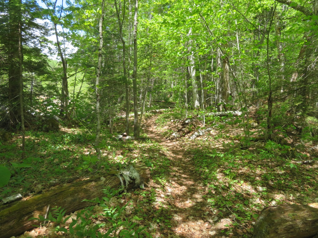
One of the few remaining stretches of easy walking along the old logging railroad grade.
Because of the steep terrain, the relocations up and over washouts are rough.
Cairns mark the way at uncertain points around relocations, washouts, and brookbeds. Bill Robichaud and Rachel Lewis adopted the Dry River Trail from the suspension bridge to the Crawford Path two years ago - a daunting task! They have been plugging away at defining the trail with cairns, brushing, and removing blowdown. Big thanks to them!
View downstream with Mt. Bemis in the distance.
Signs at Mount Clinton Trail junction.
The Mount Clinton Trail makes a long diagonal crossing of the river and the dry rocky bed on the far side. Not to be attempted in high water.
Not far beyond on the Dry River Trail is one of several USFS-designated Wilderness tentsites along the trail.
Nice area for a tentsite.
"Not a walk in the park."
Among the benefits of the relocations above the washouts are frequent views of the rock-bound river.
A legacy of the Halloween storm is this very sketchy crossing of a loose dirt and gravel slide not far beyond the Mount Clinton Trail junction. Great caution and attention to footing is needed here.
Looking down from the crossing. I believe this is the spot where a hiker took a tumble in 2019 and had to be carried out.
A short distance beyond the gravel slide I was looking down, watching my footing on the trail, as you must do most of the time, and saw some fresh glistening moose poop. Then I looked up and saw this. Hello there!
It was not an ideal spot for a moose encounter, with a dropoff to the river on one side and a steep slope on the other. I backed off a few steps and scrambled up the slope to a rock seat and quietly waited for her to saunter by. After maybe twenty minutes she slowly ambled far enough down the trail for me to scramble down past her.
Another railroad grade section provided a respite from the rough-and-tumble terrain.
Cairns show the way across a wide, rubbly tributary brookbed.
A beautiful spot with a ledgy outcrop slipping into a golden pool.
Cutaway gravel banks are a frequent sight along the lower 4+ miles of the trail.
Trail junction deep in the valley - the road less traveled to Mt. Isolation.
Dry River Falls, reached by a steep, muddy side path at the 5.4 mile mark, is one of the highlights of the valley. It was rocking this day. The water flow in the river was higher than I expected given the prevailing dry conditions. My theory was that there was still snowmelt coming from the high, flat softwood-covered floor of Oakes Gulf.
Another angle.
View from the top of the falls, reached by another, very obscure side path.
This marvelous pothole pool is just above the falls.
The trail crosses the river in another 0.2 mile. Normally this is a fairly easy crossing, but I had to dunk a boot this day.
A half-mile before Dry River Shelter #3 the trail crosses another gravel slide. This crossing is much less precarious than the one down the valley.
View from the gravel slide.
Approaching the shelter, the trail is reminiscent of the soggy Isolation Trail on the east side of Montalban Ridge.
Dry River Shelter #3 looked to be in good shape. At 6.3 miles from the road, it's one of the more remote shelters in the Whites. Shelters #1 and #2 are long gone; I spent a night in #2 with a friend back in 1979.
When I came back through late in the afternoon, Mrs. Moose had moved only a hundred yards south from where I had encountered her on the way in. Time for another bushwhack up and over a steep slope to get around her.
Evening light on Mt. Washington at the viewpoint on a bluff 1.5 miles from the road. Number of hikers encountered in 12.6 miles: 0. Every trip deep into the Dry River Valley is an experience!