
The forecast was a tad iffy with clouds, wind and a slight chance of showers, but crisp temperatures and a northwest wind held potential for far-reaching views. I lean toward old favorite Mt. Moosilauke on such days, when spotting the distant Adirondacks is a possibility. I chose my favored approach, from the NW up the Tunnel Brook Trail and the historic and beautiful Benton Trail.
A 1.5 mile walk up the decommissioned Tunnel Brook Road, now part of the Tunnel Brook Trail, leads to the start of the Benton Trail.


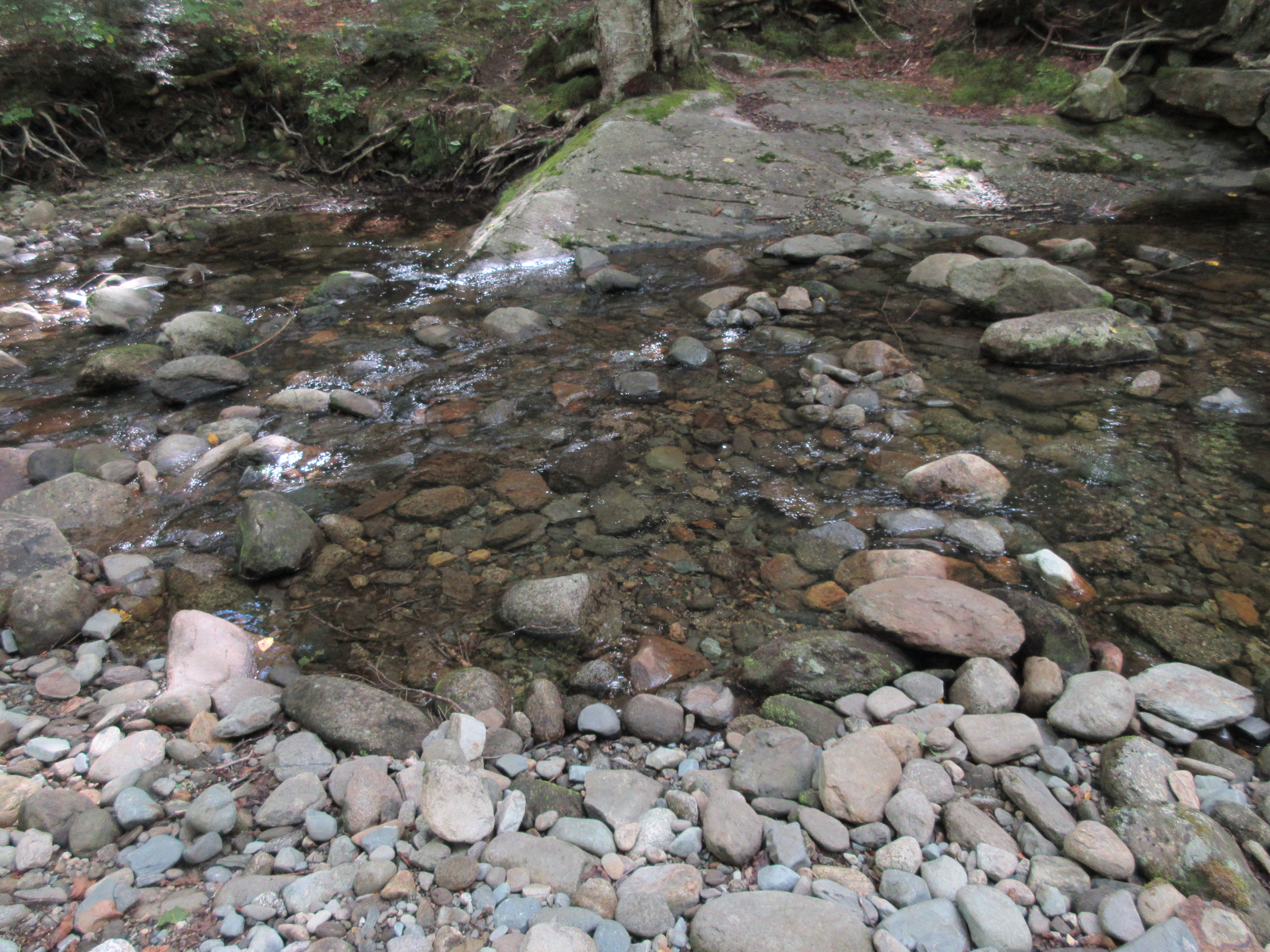
The crossing of Tunnel Brook was easy this day.
The lower part of the trail passes through a fine hardwood forest that has been paint-marked for logging right beside the trail since at least 2015. No logging here yet, maybe the USFS will relent and create a suitable buffer along the trail.

After entering conifers, the trail passes an outlook into wild and trailless Little Tunnel Ravine.

Nice footing as the trail ascends above the outlook. It is admirably maintained by adopter Per Frost.

The upper section of the trail passes through beautiful boreal forest.

This shoulder at 4100 ft. is one of my favorite spots on a White Mountain trail.

Gorgeous!

I thrashed around at the edge of the ridge and found a partial view of the great 2011 slide in Tunnel Ravine.

Approaching treeline on the Beaver Brook Trail.
It was cloudy, windy and chilly, but the ridge was in the clear!

Off to the NE, the Franconia and Presidential Ranges were engulfed in clouds.

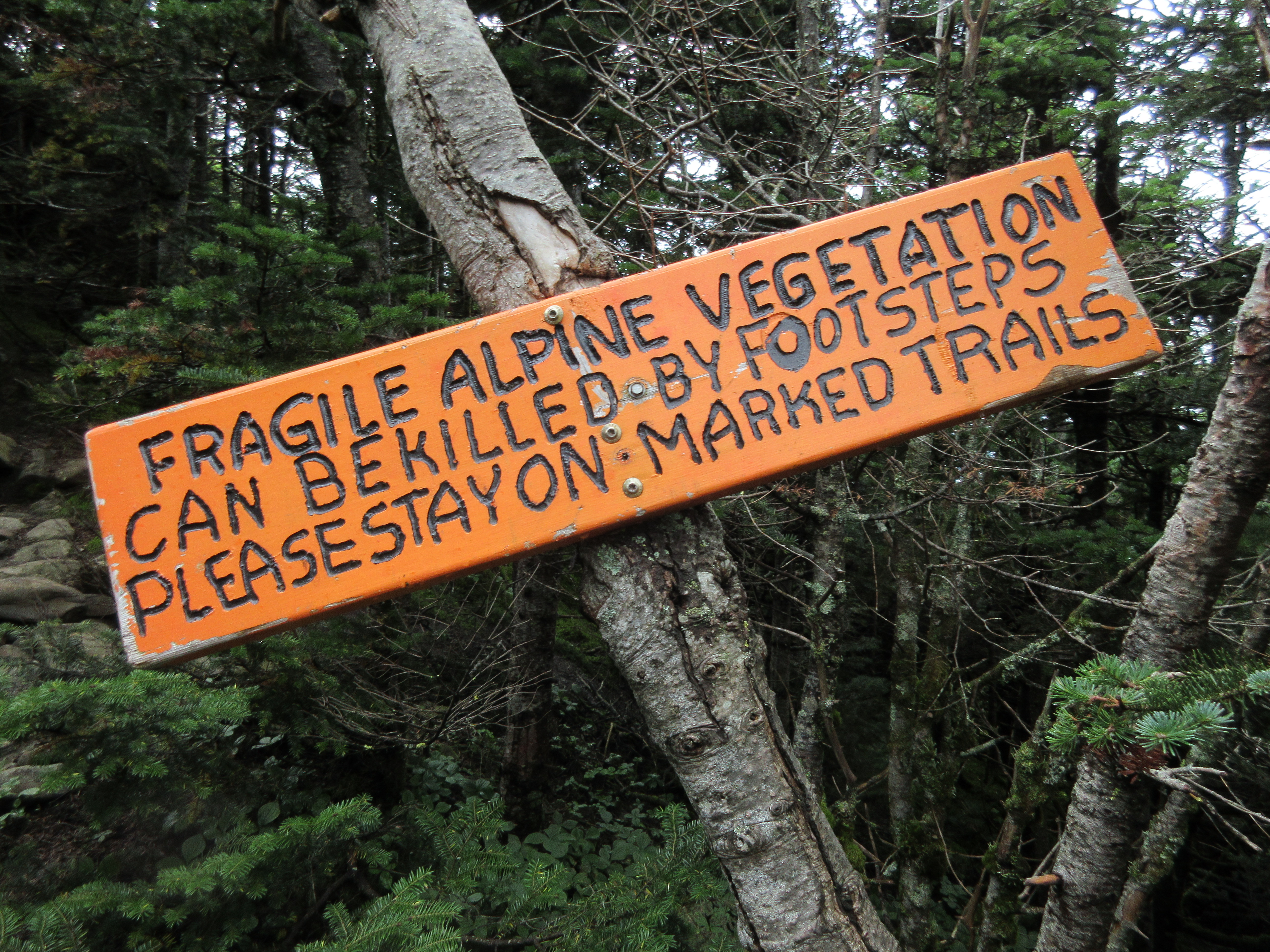
New signage to hopefully prevent people from walking in the sedges and other fragile vegetation parallel to the trail to avoid the rocky footing.

It was an Adirondack day! Seen through Lincoln Gap, the peaks include the flat-topped hulk of Dix on the left, Marcy's pyramid in the center, Algonquin's cone farther to the right, and Rocky Peak Ridge & Giant on the far right.

A prime ridge walk.

Long Pond and Black Mountain nearby to the west.

Summit view looking out over the upper Gorge Brook Trail and East Peak.

Tripyramids through Thornton Gap.

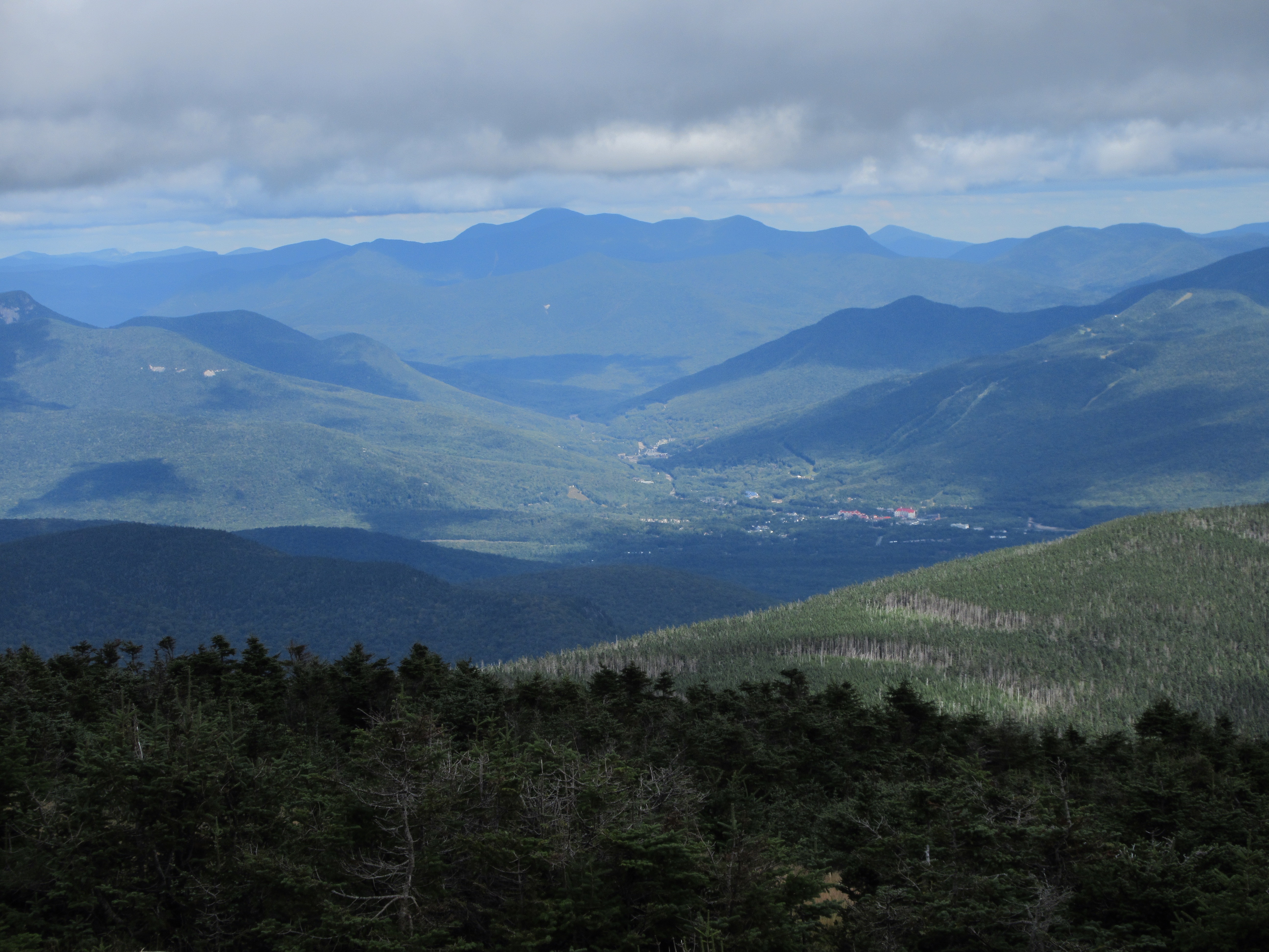
The town of Lincoln nestles in the East Branch valley, with Mt. Carrigain, Mt. Hancock, Kearsarge North and Mt. Huntington beyond.
A break of sun lights up the alpine zone.

Vast horizons beyond South Peak.

A trio of thru-hikers heads north towards Beaver Brook Shelter.

The summit.

Looking north along the ridgecrest.

Sandwich Range and more to the east.

A glider was playing in the wind.

Heading north down to treeline, with the sedges bending in the strong breeze.

Partway down the trail I made an hour-long bushwhack diversion to fir waves along the edge of the ridge, looking for views.

This looked promising.

Good angle on the Mt. Clough slides in Tunnel Brook Notch.

And an unusual view of the Tunnel Ravine headwall and the 2011 slide.

A closer look at the slide, which came surging down during Tropical Storm Irene.

Evening light on the Kinsmans, from the Little Tunnel Ravine outlook. Another great day on the Moose!


No comments:
Post a Comment