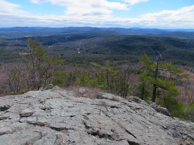
A long bushwhack on a gorgeous spring day - across the spur of the Moat Range known as Haystack, visiting a number of ledges and cliffs, and up to the Moat Mountain Trail between Middle and South Moat, with descent by trail. There was much of interest on this backcountry journey.
The whack began with a climb through the sapling forest of an old clearcut.
Into better woods.
The first of many crags on Haystack.
Looking down on a slightly tricky scramble I made to get up on the crest of the ridge. One can easily get "cliffed out" in this area.
First view, looking off to the Green Hills of Conway.
More scrambling.
Looking up the ridge to the "Haystack."
Long view to the south.
Chocorua.
The south face of the Haystack ridge is lined with cliffs.
The views keep coming.
Ledgy ramp to the sky.
In keeping with bushwhacking LNT, I avoided stepping on fragile lichens, staying on rock or resilient blueberry scrub.
First view across to South Moat, the day's ultimate objective.
The impressive upper cliffs.
Looking down a ramp.
Relaxing on a perch at the edge of the cliffs.
Another viewpoint, with a fine perspective on the Sandwich Range.
Whiteface & Passaconaway.
A pleasant col along the ridge.
Emerging at the northeastern ledges.
Looking into the interior of the Moat Range: Southwest Moat, Big Attitash and North Moat beyond a spur ridge of Middle Moat.
Southwest Moat is a wild-looking peak, with dark woods and crags.
I hadn't visited Haystack in ~20 years, and had forgotten how good the views were.
Mt. Carrigain behind Mt. Tremont and Bartlett Haystack.
From here I could study my planned route up to the Moat ridge.
The Sandwich Range, the Osceolas and Bear Mountain.
The traverse to the base of the main Moat ridge led through a variety of forests and a confusing terrain of bumps and drainages at the head of the Dry Brook basin. These woods definitely felt "out there."
By chance, I traversed along the base of this outcrop.
I postholed across a deep gully where the snow was lingering.
Better going in these scruffy hardwoods.
A Ruffed Grouse was here.
I was aiming for this isolated ledge area on the flank of the Moat ridge. (Thank you, Garmin.)
One of the more secluded spots on the Moats. The northeast ledges of Haystack are seen to the left of Chocorua.
From here, it was a straightforward climb to the Moat ridgecrest.
There was more snow than expected on this south-facing slope.
Starting the final steep pitch to the ridge.
The crest was guarded by a jumble of rocks.
Emerging on the ridgecrest, atop the bump between South and Middle Moat. I rock-hopped my way across to the trail.
Heading for South Moat.
Though it tops out at just 2772 ft., South Moat offers big-time views.
The snow-splotched Presidentials beyond Middle and North Moat.
Wildcats and Carter Dome.
Jumble o' peaks in the central Whites.
Vast lowlands to the south.
East over North Conway to Kearsarge North, the Green Hills and western Maine.
Looking down on the Haystack ridge. It was nice to sit and contemplate the day's route.
Descending over ledges on the Moat Mountain Trail.
This big ledge is the last viewpoint on the way down, or the first on the way up.
A serious mountain runner blew by on his way up to the summit, and before long cruised by again on his way down. His footwork was something to behold.
Beautiful red pines line much of the trail.
A steep and rough section - this trail climbs 1670 ft. in the upper 1.3 miles to the South Moat summit.
The lower 1.3 mile section is wide, graded and a pleasure to walk - courtesy of an excellent relocation crafted by the trail crew of the USFS Saco Ranger District a few years ago.
Haystack lives up to its name in this view from Passaconaway Road.
And again behind Red Eagle Pond.


No comments:
Post a Comment