A gorgeous spring day for a bushwhack to ledges and wetlands on the broad western shoulder of Mt. Chocorua.
The classic Chocorua Lake vista.
In Chocorua Mountain Club country.
Big step stones make this Bolles Trail crossing of Paugus Brook simple except in high water. This was a joint effort of the Wonalancet Out Door Club, Chocorua Mountain Club and Trailwrights.
A reminder about leaving historic artifacts where found.
The big sawdust pile at the site of the early 1900s Paugus Mill operation
Red Trillium.
Strolling along the Bolles Trail under tall hardwoods.
Found a geocache, last found in 2014, still in good shape.
One of two big snowmobile bridges over Paugus Brook.
More easy walking on Bolles Trail.
The site of Mason's logging camp from the Paugus Mill days.
Pieces of a wood stove hidden in leaf litter.
A rusted shovel blade.
Bushwhacking through open young hardwoods, freshly greening, on the way to the west ridge.
The good woods continued.
This area was burned over in the early 1900s, and the woods have a sparse look to them.
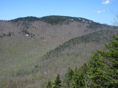
Emerging at the first view ledge, looking across at Mt. Paugus.
Arriving at the main destination, a huge granite crag that juts out from the side of the mountain. I took a long break here in the sun and refreshing breeze.
Wide view to the south, all the way to Mt. Monadnock.
This perch has a unique view of the trough-like Paugus Brook valley.
The northern part of the valley.
The head of the Paugus Brook valley, with the cliff-faced NE spur of Mt. Paugus beyond.
There are several interesting features in this hollow on the east side of Mt. Paugus.
The top of this huge slab has an amazing view of the valley and Mt. Chocorua.
I visited this unusual overhanging ledge in 2015. Trip report.
What a spot! It was hard to leave.
Side view of the crag.
Scrambling up to more ledges above.
Another fine view of Paugus.
View north to a number of peaks, including Mt. Washington.
Looking east up to Mt. Chocorua.
Looking down on the first of several wetlands tucked onto this broad shoulder.
Wetland #2.
Wetland #3.
Scruffy hardwood forest on the ridge.
A random antler - looks like deer.
This tiny pond was named "Bear Wallow" on a 1940s Chocorua Mountain Club map crafted by Arthur C. Comey.
From the west edge there's a peek at Chocorua.
One more wetland. Not sure if these would be designated as swamps, bogs or fens.
Found this lovely fern glade along the south edge of the ridge.
Descending towards the Bee Line Trail.
The nameless brook that the Bee Line Trail follows and crosses.
Birches along the Bee Line, one of the most secluded and least-travelled of the trails on Chocorua.


No comments:
Post a Comment