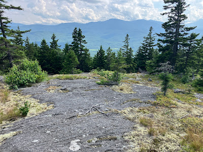
Last fall, at this clearing (with a view of Bald Cap Peak), STC volunteers relocated the Scudder Trail off an overgrown, tick-infested section of the road into the adjacent woods.
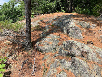
The half-mile relocation passes by this interesting perched boulder.
Pleasant climbing on a soft new footbed.
The trail rejoins the original route and climbs to this junction near the low point between Mount Cabot and Mount Ingalls.
Just 0.1 mile up Scudder Trail from this junction (and 1.4 miles from the trailhead) is one of the finest view ledges in the Shelburne area.
Last fall the STC, with permission from the private timber company landowner, hired a professional logger to cut a handful of trees below this cliff top to open up the view. It's a sweeping prospect to the south, here looking SE towards Speckled Mountain, the Royces, and the east end of the Moriah range.
Perhaps the nicest vista is looking south to the sprawling masses of Shelburne Moriah and Middle Moriah Mountains. There's also a good look SW to the Presidential Range, but at this point they were still buried in clouds.
The outlook is located on a neat east-west ledge shelf that the trail follows for 0.2 mile.
Scudder is a fun trail to hike as it winds its way up the south ridge of Mount Ingalls at varying grades, including some short seriously steep pitches. This is one of the mellower stretches. There is also a nice variety of forests.
Farther up the ridge is another outlook that looks SW to the Moriahs and the Presidentials.
A ledgy stretch were I found a few early blueberries.
There are some old spruces on this ridgecrest.
As the trail approaches the summit of Mount Ingalls, it leads across an expansive area of ledge with good views.
Before settling on the ledges for a long break, I continued on to the wooded summit...
...and beyond on a spur path that descends 0.1 mile to a tiny ridgetop pond.
Swirls of green algae gave Ray's Pond a curious look.
Then I headed back to the ledges to relax for an hour or so.
Mounts Washington, Clay, Adams and Madison were emerging from their cloudbanks.
Another good look at the Moriahs.
Beautiful spruce forest heading back down the ridge.
Next up was a check on the 0.4 mile side trail to little Judson Pond. This turned out to be a bit of an adventure.
This trail is very lightly used, and without the yellow blazes it would be quite difficult to follow as it descends into a hardwood bowl.
The only stream crossing of the day, over Ingalls Brook.
As it climbs through a logged area, the trail becomes completely overgrown for a stretch.
In its current state, for experienced hikers only.
I retraced my steps from the pond and then climbed the Ingalls-Cabot Connector to the broad, mossy top of Mount Cabot.
A short jaunt on the Red Trail led me to the 1512-ft. summit, where there is this old foundation.
I went a short way down the Blue Trail to a northeastern outlook.
Here there is an intriguing look at the wild and inaccessible Bear Mountain massif in the eastern Mahoosucs.
On the south side of the summit a short loop leads down to an excellent view ledge.
The STC arranged for this view to be opened up last fall, as was done for the lower view ledge on Scudder Trail. The tools and supplies were packed up by llamas. Another fine place to lounge for a while.
I headed down the steep upper part of the Red Trail on a needle-cushioned footway.
Once down into less steep terrain in the hardwoods, the trail passes by extensive areas of recent logging. Much of the Shelburne trail system on the north side of the valley passes through private timberland under conservation easement. Thanks to the landowners for allowing public access on these trails.
A newly relocated section descends through an attractive hemlock grove.
At the bottom of the relocation the trail crosses a large open logging yard that was used during recent winters.
STC signs show the way at both ends of the crossing. From here I continued out on the lower Red Trail, the Yellow-Red Trail Connector, the Yellow Trail, and the lower 0.1 mile of Scudder Trail, completing an interesting 7 mile loop. Thanks to the Shelburne Trails Club for their excellent work maintaining these trails!
A dusk view of Mounts Madison and Adams from a pulloff along Route 2 in Randolph.


No comments:
Post a Comment