After randomly reading a snippet about Jefferson Notch Road in the 1936 edition of the AMC White Mountain Guide, I had a plan for a late afternoon/evening bushwhack on the Dartmouth Range. From that edition through the 1969 edition, the guide mentioned Jefferson Notch Road as providing access to Mt. Mitten and the "Mt. Mitten slide." I had never heard of this slide, which has long since been revegetated. But on a 1955 aerial photo there it was, a light strip on the steep east slope of this obscure 3058-ft. peak. With a 3:00 pm start, the one-mile, 1000-ft. whack to Mitten via the old slide track was the choice on this warm sunny day.
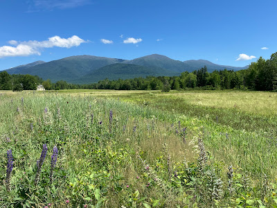
I took Valley Road to reach the north end of Jefferson Notch Road, stopping for photos of the Northern Presidentials and Mt. Washington seen across this expansive field.
Mt. Adams and Mt. Jefferson, with Mt. Bowman down low between them.
I found a parking spot (fairly scarce on this narrow, winding road) near my planned launch point and headed up a steep slope through abundant hobblebush.
The first half of the whack was nearly all hardwoods.
Along the way I explored a natural mountain meadow that I had spotted on Google Earth.
To my delight, it offered views of the mountains, here looking at Mt. Jefferson (L) and Mt. Washington (R).
Zoomed, with the Castellated Ridge partially visible on the left.
Heading up the slope through gorgeous open hardwoods.
Fern gardens.
I knew I had reached the old slide track when I clambered over a train of boulders known as a "debris flow levee," typically deposited along the edge of a slide.
The slide is fully "treed in," but the track is plain to see.
Though steep - approaching 33 degrees in its upper section - the old slide track provided a good climbing route with widely spaced trees and stable footing.
More debris flow levee. These line both edges of the slide track.
The good whacking continued high on the slope.
The steep upper section of the slide track at ~2900 ft.
The slope eases on the broad summit plateau.
Wild woods up here on Mount Mitten. The mountain reportedly received its curious name after an incident in 1771 when explorer Timothy Nash, while tracking a moose, climbed a tree to get his bearings. In doing so, he spotted the deep gap of Crawford Notch, and also lost a mitten.
Plenty o' blowdown.
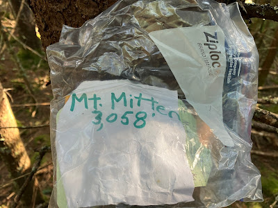
It took a bit of wandering around the flat summit area to find the register.
There it is!
Mitten does not have enough prominence to be a "list" 3000-footer. Thus it is seldom visited. There were only four entries since the register was placed in 2018, the last being renowned bushwhacker Zachary Porter ("Cold River Camp Cook") in September 2023.
A peek at Mount Dartmouth, Mitten's higher neighbor, from a blowdown patch near the summit.
I explored some open fern glades NE of the summit that were revealed on Google Earth.
A neat area.
Only very limited views from these glades.
As I started my descent, I saw daylight below through another blowdown patch.
With some maneuvering I found a good view of Mount Jefferson, including the V-shaped scar of two slides that run across The Link between Caps Ridge Trail and Castle Trail.
Love these ferny hardwoods.
Lots of moose sign, including this bed amidst the ferns.
A magnificent yellow birch.
The Castles in silhouette, back down at the mountain meadow.
Mount Jefferson and Ridge of the Caps. A fun exploration in a little-known corner of the Whites!


I love the Dartmouth Range. Wild and beautiful!
ReplyDelete