I had two things in mind for a hike up the Daniel Webster Scout Trail on the east side of Mount Madison: check out the improved state of the trail, thanks to the work of dedicated adopters in the last couple of years, especially the blazing on the talus along the upper part of the trail; and poke around the revegetated track of a slide that fell right along the edge of the trail during the September 1938 hurricane. As it turned out, I ended up climbing to the top of Osgood Ridge and descending via the Osgood Trail, Great Gulf Trail and Great Gulf Link Trail. Due to the time spent exploring the old slide track, there was not enough time to go up to the summit of Madison, but that was OK as the views along Osgood Ridge were spectacular.
The Scout Trail - opened in 1933 by Boy Scouts from the New Hampshire's Daniel Webster Council, and now maintained with assistance from current Boy Scouts - starts along the main access road in the WMNF Dolly Copp Campground.
The lower part of the trail rises at easy to moderate grades through nice hardwood forest.
The old slide track is to the south of the trail as it climbs through conifer forest up onto a small buttress.
Squeezing through a prickly "pick-up sticks" forest.
This mossy brookbed is part of the old slide track. This slide was among those studied by Edward Flaccus for his 1958 dissertation, Landslides and Their Revegetation in the White Mountains of New Hampshire.
Mossy ledges.
A deer track punched into the moss.
As I bushwhacked back and forth up the old slide track, I mused about the remote possibility of finding a white pine that might have seeded in while the slide was still open, perhaps in the 1940s or 1950s. Then I saw on the ground -- clusters of pine needles!
Looking up, I beheld a good-sized white pine thrusting up through the canopy of scrawny spruce and fir.
While far from a giant, this is a sizeable white pine at an elevation of 3000 ft.
From a small opening along the track, I caught a glimpse of Carter Dome and its 1960s vintage Northwest Slide.
After ascending partway up the slide track, I had to push through some gnarly terrain to return to the trail.
The Scout Trail takes a turn to the wild as it slabs up and across the eastern slope of Madison.
Looking more like the Northern Presidentials.
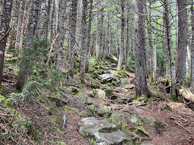
Farther up, the trail really gets down to business. Steep, rough and rocky is the rule from here on up.
At ~3900 ft. the trail starts to break into the open on patches of jumbled talus.
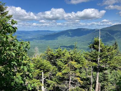
A glorious summer day! Here looking east to Mount Moriah.
Quartz boulder.
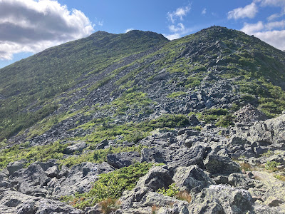
The jumbled rocks of the upper Scout Trail make for slow going as careful attention to footing and balance is needed.
Expanding views.
A faded treeline warning sign.
The adopters have done an excellent job blazing on the rocks.
Breaking more into the open.
Looking back down to the point where the trail emerges from the scrub onto the main area of talus. An important spot for descending hikers.
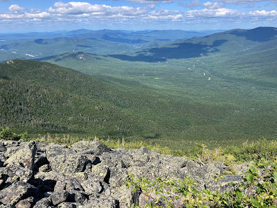
I found a flat rock and settled in for a while to take in the views east and north.
Great perspective on the Carter Range and Carter Notch.
Zoomed.
After a good mid-afternoon break, I decided to continue up to the crest of Osgood Ridge, 700 ft. above, and descend the Osgood Trail. I slowly made my way up the steep talus.
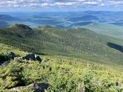
Howker Ridge and distant northern horizons.
I can see for miles and miles.
The talus climb goes on and on...
Looking back. This section is particularly tedious to descend.
Looking back down at a strenuous little scramble.
Another perspective on Howker Ridge, with endless horizons beyond.
Welcome to the jumble.
The last pitch.
The Scout Trail leaves Osgood Junction (4822 ft.) at the blue-blazed cairn.
Osgood Junction signage.
Having spent nearly an hour and a half exploring off-trail to the old slide, I did not have time to make the rough 500-ft. climb to and descent from the summit of Madison. It looked pretty daunting from here anyway. That is one massive cairn.
Changing perspectives looking back at Madison while heading down wide-open Osgood Ridge. It's one of the premier ridge walks in the Whites.
Superb views peering into the Great Gulf backed by Mts. Washington and Clay, with Mount Adams on the right.
Osgood Trail leads over a series of little rocky peaks.
As befits a Northern Presidential trail, the footing is rough.
More views to the north.
Looking down to the next shoulder.
Madison receding in the distance.
Adams and John Quincy Adams soaring above the cliffs on the Madison Gulf headwall.
Plunging into the scrub.
Could this really be the Northern Presys? It didn't last.
From ~4200 ft. down to 3000 ft., the descent on Osgood Trail is steep/rough/rocky, though there are no tricky scrambles.
Some nice rock step work.
I was happy to reach this junction.
Down to the valley floor.
Did the last mile back to Dolly Copp by headlamp, concluding a most interesting day on the slopes of Mount Madison.












No comments:
Post a Comment