
With an unsettled forecast calling for a chance of showers, I opted for a slide visit with only a short bushwhack: the Gale River Slide on the northern flank of Garfield Ridge, which fell during Hurricane Carol in 1954. This would be my fourth visit to this slide, which I first climbed in 1995; my most recent visit was last winter. I hoped to find some Rhodora still in bloom on this partly revegetated slide.
I approached the slide with a 3.2 mile walk along the Gale River Trail, catching this view of the North Branch of the river about halfway along.

A mile-long relocation constructed by the WMNF in 2011 passes through some fine forest after it crosses a tributary known as Garfield Stream.

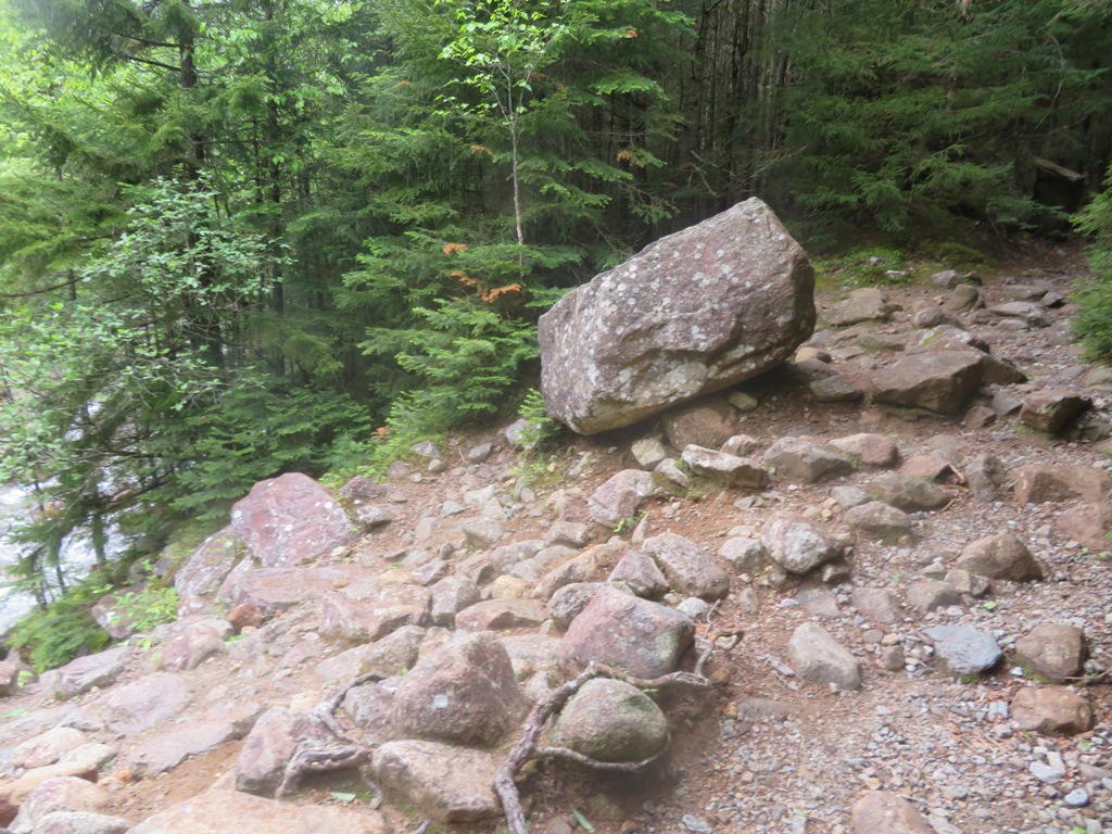
This gravelly, stony area with a perched boulder marks the lower end of the Gale River Slide. When it fell on August 31, 1954, the debris from the slide created a
temporary dam on the river, which subsequently let go, sending a huge
surge of water down the valley. At the time, Ben Bowditch, assistant
hutmaster at Galehead Hut, was hiking up the trail. He heard a strange
noise and saw the water surge coming down through the woods. He grabbed
onto a tree and held on for an hour as the water rose as high as his
waist. After the surge receded somewhat, he went back and forth along
the trail, finding the river crossings still impassable, and eventually
bushwhacked back to the trailhead, where he was met by concerned fellow
hut crew members.
The slide track is grown to dense conifers above the trail. A heavy rain
shower hit just after I began heading up to the slide, making for
dripping wet bushwhacking and slick footing on the rocks. This steeply sloping gravel bank, where vegetation struggles to gain a foothold, is the only open area remaining on the lower part of the slide.

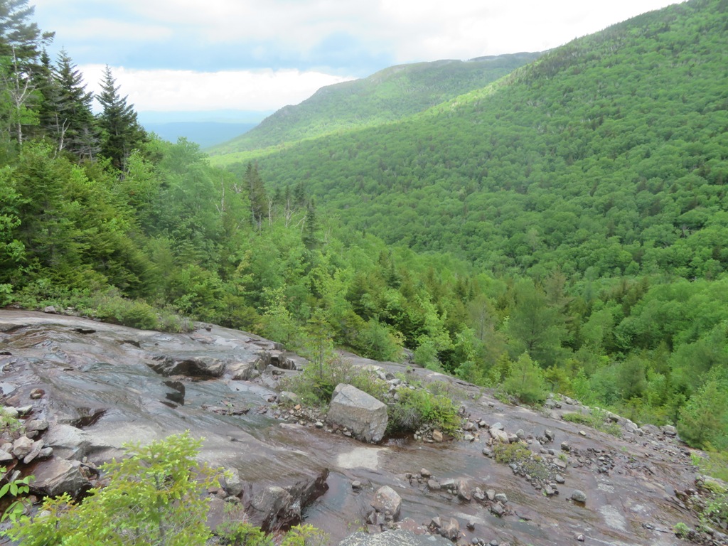
First views across the valley to the high ridges of North Twin. Intermittent breaks of sun helped dry things out before the next shower came through.

After bushwhacking up through tight woods on the north side, I reached the ledgy area of the slide, and could see that most of the rock was too wet and slick to climb

Had to work around the edge of this steep footwall.

The broad, massive summit of North Twin had emerged from the clouds.

Still too slick to climb directly up.

Nope.

A little higher up, some dry rock, and a shelf for a nice hangout spot.

Down-look.

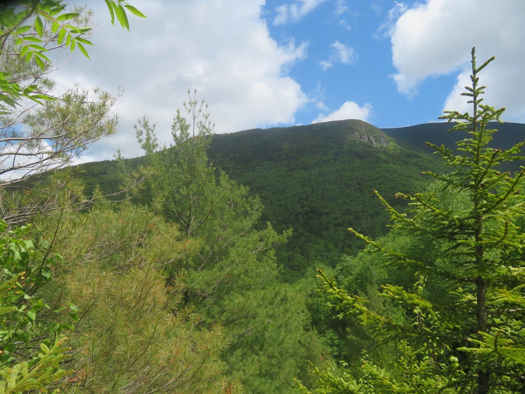
Great view up to North Twin here.

Wild and inaccessible cliffs on a western shoulder.

Looking north to distant horizons in Vermont's Northeast Kingdom.
A nice shelf here.

Labrador Tea was blooming in many soil-retaining crevices on the slide.

Close-up.

Another rain shower moved through, which I waited out under my trusty umbrella.

After the shower cleared out, I headed farther up the slide.

One of two well-developed tamaracks (aka larches) that I saw on the slide. This tree was not observed on any of the 22 slides surveyed by Edward Flaccus for his 1958 dissertation, Landslides and Their Revegetation in the White Mountains of New Hampshire.

A mix of ledge and varied vegetation.

A mini-headwall.

Expanding northern views in an area of low conifer scrub.

The Rhodora blooms had gone by on the lower part of the slide, but on the upper part, at 2900-3000 ft., I found several still in flower.

Scrubby swath.

Top o' the slide.

I passed by this nifty perch on the way back down.

Descending to my earlier perch.

I found some dry rock to descend partway on the south side of the slide.

I went down and around the lower part of the slide on the south side through some ugly woods, with many boulders and hidden holes, and was thankful to get back to the Gale River Trail!

Postscript:
In 2009 and 2010, Alex MacPhail, an AMC
hutman in the early 1960s and a keen amateur naturalist, spent many days
at the Gale River Slide studying its revegetation and soil development.
He documented his research in his excellent blog, White Mountain Sojourn.
Of particular interest is the entry for 11/19/10, which contains
photos of the slide from 1968 and 1973. In another post (9/23/09),
MacPhail noted the good-sized white pine seen left of center in the photo below, along with several
smaller white pines, and wondered how they got here as this tree is
generally not found this high up in the valley. As my friend Thom Davis,
an old hutman himself, has noted, Alex set a record for an extended
version of the Hut-to-Hut hike (Madison-Carter-Pinkham-Lakes-Lonesome)
in 1963, with a time of 12 hours and 11 minutes; see his blog post for
8/28/10. Sadly, Alex passed away in January. In White Mountain Sojourn he left a wonderful legacy for those who love the White Mountains.

No comments:
Post a Comment