TO THE 'DACKS: 6/13/22
With good weather predicted, Carol and I headed over to New York's Adirondacks for a brief hiking and geocaching getaway. As always, the most enjoyable part of the 4 1/2 hour journey to Lake Placid was the ferry ride across Lake Champlain, with several ADK High Peaks in view.
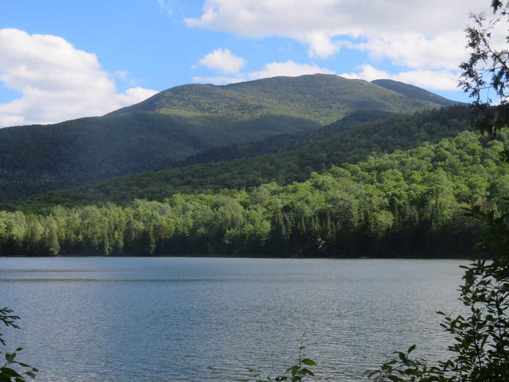
My primary hiking objective was to climb to the summit of Dix Mountain, the massive peak on the right in this photo, or explore some of the slides on its north side.
Upon arriving in the mountains, we drove down to the Adirondack Mountain Club's major High Peaks facility, Adirondak Loj, and hiked an easy loop around picturesque Heart Lake.

Wright Peak in the MacIntyre Range, with Algonquin Peak (at 5114 ft. the second highest in NY) peering over in back.
Zoom on Mt. Marcy (5344 ft.), highest peak in the ADKs.
Adirondak Loj has offered lodging and meals to hikers since 1927. After our walk, we enjoyed excellent sandwiches from the Hungry Hiker cafe, located next to the High Peaks Information Center; then we headed to our lodging in Lake Placid..
DIX MOUNTAIN: 6/14/22
I headed out early for this long hike while Carol stayed in Lake Placid for some walking and geocaching. I was happy to find several open spaces in the small lot for the Round Pond-Dix Mountain trailhead on Rt. 73, south of Keene Valley, as other parking options for this trailhead are very limited. I had hiked the other four peaks in the Dix Range back in 1986 with Mike Dickerman, and have long wanted to climb this, the highest peak in the range and sixth highest in the ADKs. It is an impressive mountain, scored with more slides than any other ADK peak, and on clear days I have seen it on the horizon from several White Mountain summits. This route entails a six-mile easy to moderate approach, with a few ups and downs, followed by a brutal one-mile climb to the summit.
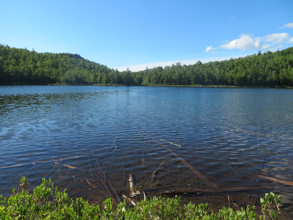
A short climb and shorter descent brought me to the shore of beautiful Round Pond.
Into the High Peaks Wilderness we go.
After climbing over a notch, the trail comes beside the North Fork of the Boquet (pronounced bo-ket) River.
This generally flat section has some nice smooth walking in places.
A scenic stillwater.
A very short diversion into a beaver meadow earned me a surprise view of Dix Mountain. After 3+ miles of hiking it still looked very far away.
Here there was a good look at the array of so-called Finger Slides on the north slope of the mountain.
Nice walking through hardwood and birch glades. This valley was seared by fire in 1903 and 1913.
At 4.6 miles I passed the Boquet River Lean-to, tucked back in the woods.
The trail crosses the North Fork here.
An old yellow birch at the start of a mile and a half of steadier, rockier climbing to the base of the Wrist Slide, the bottom of which the trail crosses.
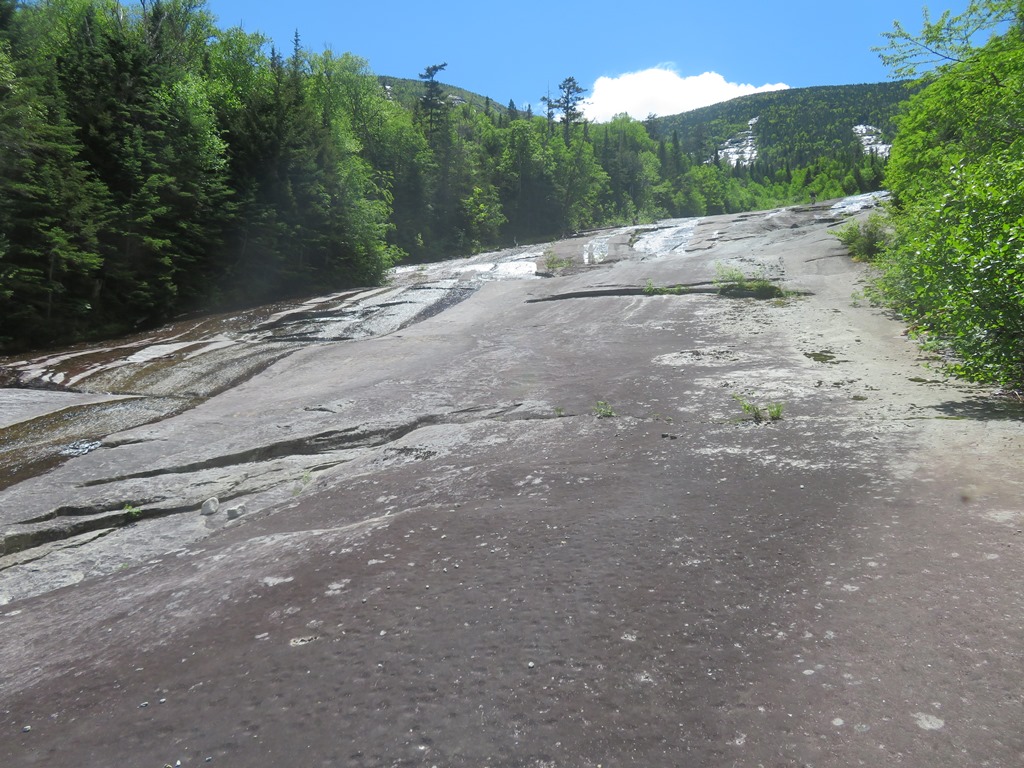
Six miles in, the trail emerges at the base of the Wrist Slide, at ~3250 ft.
The trail briefly climbs along the slide, then ducks back into the woods at a cairn.
I continued up the slide on nice low-angle, grippy rock.
Views back to Noonmark (L) and Giant (R) Mountains.
Giant, displaying several of the big slides triggered on its west face by a 1963 rainstorm. These slides - each with a descriptive name - are popular climbing destinations. On the right is the largest and most famous, the Eagle Slide. It reportedly borders on technical climbing with huge exposure and a 40-degree pitch.
Heading up a rocky swell on the Wrist Slide. The tops of the Index (L) and Thumb (R) Slides are in sight ahead. The lower tracks of several of the Finger Slides converge above the Wrist Slide.
Revegetation is extremely slow on these bared bedrock slides. White cedar is one colonist I have not seen on a White Mountain slide.
Side view. The Wrist Slide has a slope generally only in the low 20 percent range.
Dial Mountain, one of the ADK 46, comes into sight on the L.
Baby ferns.
At the top of the open swath of the Wrist Slide, two of the Ring Slides come into view.
These are massive sweeps of anorthosite bedrock. Click
here for a report on climbing these slides by Kevin "Mudrat" MacKenzie, a renowned ADK climber and backcountry explorer with a particular passion for slides. He has an amazing collection of slide reports and photo mosaics
here.
It was tempting to continue up this connecting swath to explore the lower parts of some of the Finger Slides. Research had suggested I could comfortably climb and descend probably halfway up these slides to the point where their slopes ramp up to the mid to high 30s. But I don't get over here often and climbing Dix (#27) and taking in its phenomenal views took precedence.
The whack back to the trail was short but slightly gnarly. Then it was time to suck it up for the steep, rough, eroded climb. In its last mile from the base of the Wrist Slide, the trail gains 1600 ft. in elevation.
For a minute I thought I was climbing East Osceola from Greeley Ponds Trail.

The grade moderates briefly before the junction with the trail from Hunters Pass, then resumes its rough ascent, though not quite as steeply as below.
The trees shrink and views start to appear.
One of several minor scrambles on this upper section.
Increasing views NW to the Great Range beyond nearby Nippletop Mountain.
The summit crest of Dix is long and narrow, with several excellent ledgy viewpoints.
The summit ledge (4857 ft.) bears a bolt from the Colvin Survey placed here in 1873. Dix was first climbed in 1807 by a surveyor named Rykert, who was tasked with laying out town boundaries. Verplanck Colvin was Superintendent of the 1870s Adirondack Survey and explored all around the mountains; epic hikes and nighttime descents were regular fare in his surveying reports. He was also instrumental in the establishment of the Adirondack Forest Preserve in 1885. A 4057-ft. peak (2 1/2 miles NW of Dix) is named for Colvin. Dix Mountain was named in 1837 for John A. Dix, who was a Governor of New York, U.S. Secretary of the Treasury, and a Union general during the Civil War.
The views from this lofty summit are phenomenal, among the best in the ADKs. To the SW, beyond Elk Lake, endless waves of blue mountains ring the horizon.
To the NW beyond Nippletop, the Great Range and several other high peaks.
Skylight, Haystack (in front) and Marcy.
Distant Santanoni and Panther, with the scar of the recent (2019) slide on Santanoni clearly visible.
Nearby to the SE is the ledgy ridge extending from Grace Peak (East Dix) down over Spotted Mountain. Lake Champlain and the Green Mountains are in the distance.

Close-up of Grace Peak showing the Great Slide (on the R), which is sometimes used as an approach to this summit via a 5-mile herd path up the Boquet River valley. The slide on the L is known as the Zipper.
The knobby crest of Macomb Mountain extends to the south.
Giant Mountain and Rocky Peak Ridge seen beyond a NE spur of Dix.
I especially enjoyed the dramatic down-look into the eastern cirque of Dix. Would love to explore this wild, remote basin some day. Farther east I spotted several ledgy knobs and small ponds I have bushwhacked to on past visits. The eastern side of the Dix Range, with vast birch forests, cascades, beaver ponds and numerous patches of bare rock, is a marvelous area for bushwhacking.
Heading back across the crest with more views to the SW.
Many mountains seen beyond a wild basin on the west side of the mountain.
Nice look at the cirque on the east side of Nippletop. It was hard to leave these spectacular ledges, but it was a long way back to the car. During my extended stay I had the summit to myself.
A slow and careful descent on the steeps, mindful of the precarious footing.
Watch the loose stuff!
Late day sun on the slides. Six miles to go, with the last bit by headlamp. At Round Pond I sat on a rock and listened to a cacophony of trilling toads and squawking tree frogs. The round trip hike to Dix via this route is 14 miles with ~3700 ft. of elevation gain.
6/14/22: MOOSE POND
A leisurely day, with some geocaching at Winter Olympics sites and an afternoon stroll to beautiful Moose Pond in the McKenzie Mountain Wilderness, north of the town of Saranac Lake.
The unsigned and unmarked (but maintained) trail crosses the placid Saranac River on a sturdy footbridge.
This must be one of the easiest hikes in the Adirondacks, with gentle grades and smooth footing for the entire 1.5 mile walk to the pond.
The trail ends at the SW shore of the pond, where there is a fine view of Moose Mountain (3899 ft.) on the L and McKenzie Mountain (3861 ft.) on the R.

A prominent slide scars the NW face of Moose Mountain. It's a long whack into the base. Maybe someday...
Far off to the east are the sharp cone of Mt. Whiteface (R) and the flattened profile of Esther Mtn. (L).

Carol was happy in her bug suit as we hung out at the pond's shoreside ledges for an hour.
OWEN POND: 6/16/22
For a getaway walk we chose the short trail to Owen Pond in the Sentinel Range Wilderness, a few miles north of Lake Placid. We found the geocache at the trailhead and then headed in on the somewhat rocky and rooty trail.
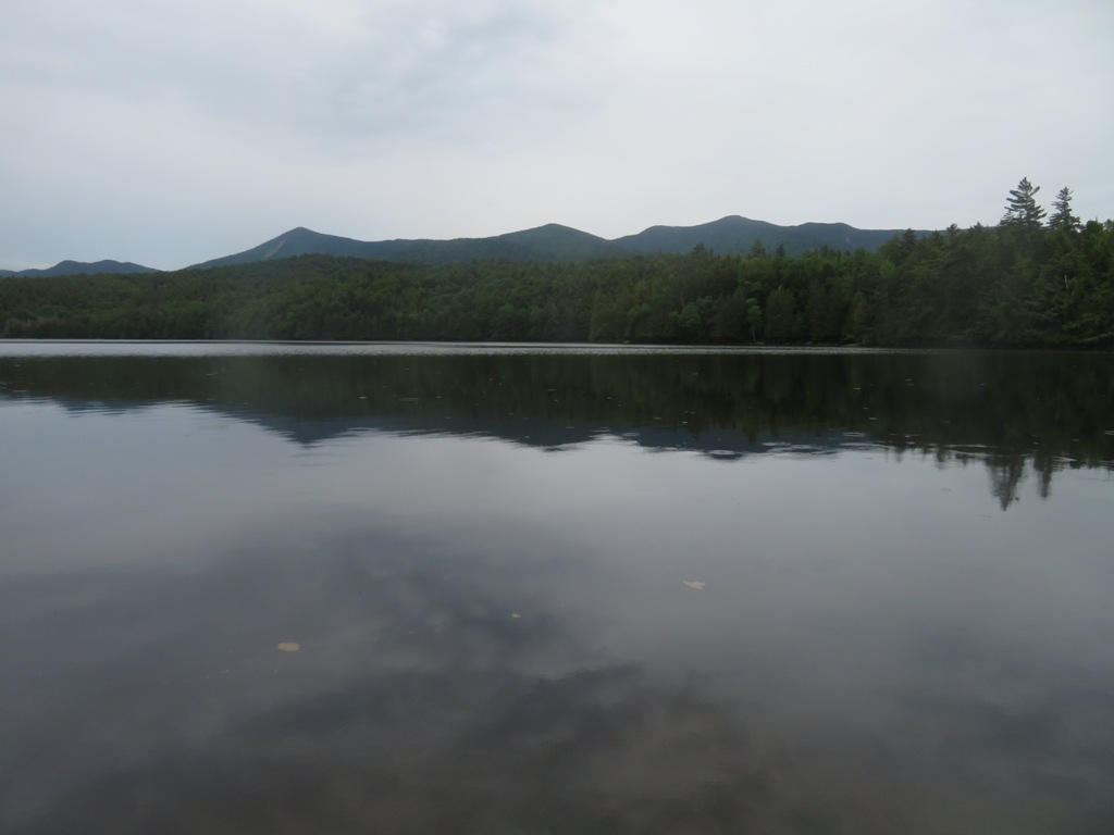
Owen Pond is a typically beautiful and peaceful Adirondack pond. We could not find the geocache listed there, but we did see a loon out on the water, and an osprey cruising overhead.
A spur of wild, trailless Kilburn Mountain rises beyond, with the top of the 1995 Kilburn Slide (which I climbed with John Compton/1HappyHiker a few years ago) just visible.

We had lunch at a beautiful picnic area beside the Ausable River in Keene Valley, made a mandatory stop at The Mountaineer shop for a couple of book purchases, then headed for home.


Steve, I enjoyed every word and photo of your Dix report. I did that hike (with an overnight at the leanto) in 1971, then again as a day hike about 2000. The Wrist Slide looked different on the latter hike - perhaps it fell, or refell, in between? And I've never known how to pronounce Boquet till now! - Will Scott
ReplyDeleteThanks, Will - Dix is an impressive mountain. The Wrist Slide was likely enlarged when some of the other slides fell during a storm in 1993.
Delete