
On a March-like day with temps rising into the high 30s in the valleys I snowshoed up the Gale River Trail into the Gale River valley and ascended to the open section of the Gale River Slide, which came crashing down off the slope of Garfield Ridge during Hurricane Carol in August 1954. The only place this slide can be readily seen is at the west outlook at the summit of North Twin.

Sunshine was abundant as I meandered up the long, gentle hardwood corridor on the lower part of Gale River Trail.

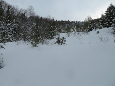
Nice softwood forest on the relocated section along the west side of the Gale River's North Branch.

I always stop for a look at North Twin's version of the Giant Stairs.

Snowbound Garfield Stream.

Nice woods on the next section of trail.

A remote feeling as you get deeper into the Gale River valley.

For 2 1/2 miles I was smoothing out divots barebooters had left in the soft snow.

Posthole worthy of a gold medal.

Then I was passed by two snowshoers going to Galehead Mountain. Thankfully snowshoers were the last ones out and we left the track in good shape.

Inviting corridor approaching the base of the slide.

This open spot on the trail, with a view of some ridges of North Twin, marks the point where the 1954 slide came down to the North Branch during the torrential rains of Hurricane Carol. The debris from the slide created a temporary dam on the river, which subsequently let go, sending a huge surge of water down the valley. At the time, Ben Bowditch, assistant hutmaster at Galehead Hut, was hiking up the trail. He heard a strange noise and saw the water surge coming down through the woods. He grabbed onto a tree and held on for an hour as the water rose as high as his waist. After the surge receded somewhat, he went back and forth along the trail, finding the river crossings still impassable, and eventually bushwhacked back to the trailhead, where he was met by concerned fellow hut crew members.

As soon as I headed off-trail to access the remaining open part of the slide, I knew the short climb would be a struggle in the deep, soft snow.

Oh, boy.

Three feet deep or more in places.

I emerged at the base of the lower open part of the slide, a steep-sided gravel swath in summer. With the deep snow, I didn't like the double fall line here, so I bushwhacked in the scrub and woods beside it.

This was the worst stretch, riddled with spruce traps. Progress measured in feet per minute.

I popped out at the edge of the gravel swath near its top, and was glad I didn't try to ascend it directly.

Into prickly woods to reach the main part of the slide. One of the special pleasures of winter bushwhacking is that every tree you bump drops a refreshing snow clump on your head and back.

Re-emerging at the bottom of the main open part of the slide.
Though the Mount Washington Avalanche Center rated avalanche danger as Low for this day at elevations below 3000 ft. in the Presidential Range, I exercised caution and circled around the steeper pitches. Measurements on CalTopo and NH Granit websites showed this slide to be relatively low angle on the average, at about 26 degrees.

Alder is a shrub frequently found on revegetating landslides. In his authoritative 1958 dissertation, Landslides and Their Revegetation in the White Mountains of New Hampshire, Edward Flaccus observed either mountain alder or speckled alder on 12 of 22 slides he examined.

In 2009 and 2010, Alex MacPhail, an AMC hutman in the early 1960s and a keen amateur naturalist, spent many days at the Gale River Slide studying its revegetation and soil development. He documented his research in his excellent blog, White Mountain Sojourn. Of particular interest is the entry for 11/19/10, which contains photos of the slide from 1968 and 1973. In another post (9/23/09), MacPhail noted the good-sized white pine shown here, along with several smaller white pines, and wondered how they got here as this tree is generally not found this high up in the valley. As my friend Thom Davis, an old hutman himself, has noted, Alex set a record for an extended version of the Hut-to-Hut hike (Madison-Carter-Pinkham-Lakes-Lonesome) in 1963, with a time of 12 hours and 11 minutes; see his blog post for 8/28/10. Sadly, Alex passed away in January.

Heading up the widest part of the slide, where it measures 100 ft. across - a big open snowfield.

Climbing by long switchbacks, I chose a route angling up to the left of the small trees.

Four conifer species in view here: right to left, white pine, balsam fir, red spruce (just poking up from the snow) and tamarack or larch. The latter tree seems unusual and was not observed on any of the 22 slides surveyed by Edward Flaccus.

Gaining a distant view out to northern Vermont beyond a rugged northwestern spur of North Twin.

Mountains of the Northeast Kingdom.

Switchback.

Side view.

At a little shelf I fashioned a seat and enjoyed a leisurely late lunch.

Under graying skies, the view of North Twin's broad summit and its cliff-faced western spur from my lunch spot.

Heading farther up.

A different look in summer, at about the same spot.

Another switchback.

Zoom on the several cliffs of North Twin's northwestern spur. I once snowshoed to the lower set and found some unusual views of Mt. Garfield, the Gale River valley and the Twins.

Down-look.

Above here, the slide is more grown-in, after 67 1/2 years.

The sun returned and illuminated North Twin.

The cliffs on the western spur look wild and inaccessible.

Back down through the prickly woods.

Near the bottom, last view from the slide.


No comments:
Post a Comment