On Friday, October 22nd four of us enjoyed a cool, cloudy fall day (with a bit of sun) for the 33rd annual
White Mountain Crop Hunger Walk, a "hike for hunger" that benefits the
programs of Church World Service. This year's participants included Thom
Davis, Roger Doucette, Gary Tompkins, and this
correspondent. We missed Dennis Lynch and Mary Ann McGarry, who weren't able to join us this year. Our route was a 10.8 mile loop in the Squam Lake area, taking us over West Rattlesnake and the Squam Range peaks of Mt. Morgan, Mt. Percival, Mt. Squam and Doublehead Mountain. Trails walked included the Col Trail, Ridge Trail, Old Bridle Path, Mt. Morgan Trail, Crawford-Ridgepole Trail, Doublehead Trail and the new Eastman Brook Trail.
The Church World Service CROP program began in 1947 and the first CROP Hunger Walk was held
in 1969. Each year walks in more than 500 communities raise more than $6 million for CWS hunger programs. For more information see
www.cwsglobal.org.
Ours is the only Crop Hunger Walk that takes place on mountain trails. Since its beginning in 1989 our walk has raised more than $93,000 for
the anti-hunger programs of Church World Service, with more than $23,000
of that provided to local food pantries in the western White Mountains.
We owe the success of our walk to the consistent generosity of our
sponsors. The CROP Hunger Walk theme is “Ending hunger, one step at a
time."
To make a donation for our walk, visit events.crophungerwalk.org/2021/event/lincolnnh , or mail a check made out to
"Church World Service" to Steve Smith, PO Box 485, Lincoln, NH 03251.
Thanks!
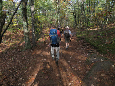
Heading out on the first trail of the day, the Col Trail leads us up to the saddle between West and East Rattlesnake.
Ascending the Ridge Trail to West Rattlesnake.
Gary takes in the scene atop West Rattlesnake as fog swirls over Squam Lake.
The summit of West Rattlesnake is a Natural Area owned by the University of New Hampshire.
Descending the extremely popular Old Bridle Path.
Across the street, some nice color on the Mt. Morgan Trail.
Staircase on upper part of Mt. Morgan Trail.
Junction with the alternate "ladder route" up to the summit ledges of Morgan.
Gary was up for the challenge of this "Terrifying 25" route. The rest of us went around on the main trail.
Gary takes in the Squam Lake view from the Mt. Morgan ledges. Great place for a long lunch break.
An obliging hiker took the traditional group photo for us.
Thom checks out the Museum of Science benchmark on the true summit of Morgan.
A 0.8 mile walk along the rugged, ledgy Crawford-Ridgepole Trail brings us to the open summit of Mt. Percival.
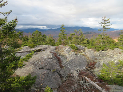
Part of the fine view from Mt. Percival.
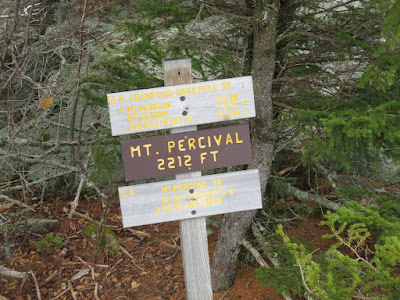
Summit signs.
Leaving Percival, heading north on Crawford-Ridgepole Trail towards Mt. Squam and Doublehead Mountain.
The northern half of the Crawford-Ridgepole Trail is
surprisingly rugged. From a distance it appears as a long, flat ridge
with a few insignificant bumps. But it has many short, steep ups
and downs, often involving rugged ledges with awkward and slippery
footing. These are true mountain miles.
Blueberry color.
This section of Crawford-Ridgepole Trail is wild and lightly-traveled.
Some of the countless knobby ledges along the ridge.
Steep ledge at the east summit of Mt. Squam.
Roger checks out the ledgy pools known as Uncle Paul's Potholes.
In this area there are good views north to the Sandwich Range. On this day the peaks were smothered in dark clouds. Our original plan for the Crop Walk was a loop over the Crescent Range in Randolph, but with a gloomy and potentially wet forecast for the North Country we opted for our more southern backup route. Seeing these ominous clouds to the north, we agreed that we had made the right choice.
Another nice vista along the Crawford-Ridgepole Trail.
The very steep, ledgy drop to the Squam-Doublehead col is one of the most challenging spots along the trail.
Looking up from the bottom of the down-scramble.
Onto the Doublehead Trail for the descent off the ridge.
The best viewpoint on Doublehead - and one of the finest on the entire Squam Range - is a big ledge 0.1 mile down off the ridge on the Doublehead Trail. After a steep descent below the ledge we continued down Doublehead Trail to gravel Thompson Road. A short stroll along the road brought us to the Eastman Brook Trail, a new 1.2 mile connector opened in 2020 by Squam Lakes Association. We negotiated this meandering route by headlamp back to our vehicles at the new parking area off Rt. 113, and another great Crop Walk was in the books.


No comments:
Post a Comment