
With fall foliage coming on strong, I made a second late September visit to the beautiful, hardwood-rich Wild River Wilderness. I started from the trailhead at the end of Wild River Road and followed the Wild River Trail and Black Angel Trail four miles into the central part of the Wilderness, then made a leisurely bushwhack loop over the lower half of Mt. Hight's long NE spur ridge. Along the way I returned to a half-dozen view ledges I had visited in 1996. On this trip I extended the bushwhack up the ridge to a 3245-ft. peak and discovered gorgeous high-elevation hardwood glades and unique vistas up to the high summits of the Carter-Moriah Range.
The Wild River Trail is a 9.7 mile pathway to adventure.

A colorful fringe along the rocky Wild River.

Tropical Storm Irene in 2011 and the Halloween storm in 2017 gave some rough treatment to the lower section of Wild River Trail. This blowout is next to the junction with Moriah Brook Trail.

I made a short side trip to look at the river crossing on Moriah Brook Trail, where the storm-damaged suspension footbridge was removed by the USFS in 2016. With the current low water conditions, the crossing looked fairly easy. In high water, forget it.

Just beyond, the Wild River Trail enters the 23,700 acre Wild River Wilderness, designated by Congress in 2006.

A zoomed view of distant Mt. Hight from the river's edge. Though not an "official" 4000-footer due to lack of 200-ft. topographical prominence, Hight is an impressive peak and is the best viewpoint on the Carter Range.

A riverside vista of Middle Carter.

The first 4 1/2 miles of Wild River Trail follows the grade of the Wild River Railroad, whose crews logged heavily in the valley from 1891-1903. The intact portions of the grade provide easy, smooth walking. Other sections have been washed out and the footway either detours around them or tightropes along the edge.

The most extensive washout begins about a mile from the trailhead with this rocky, rubbly section.

Just beyond, the old grade has been totally washed away.

The trail goes up this loose rocky slope...
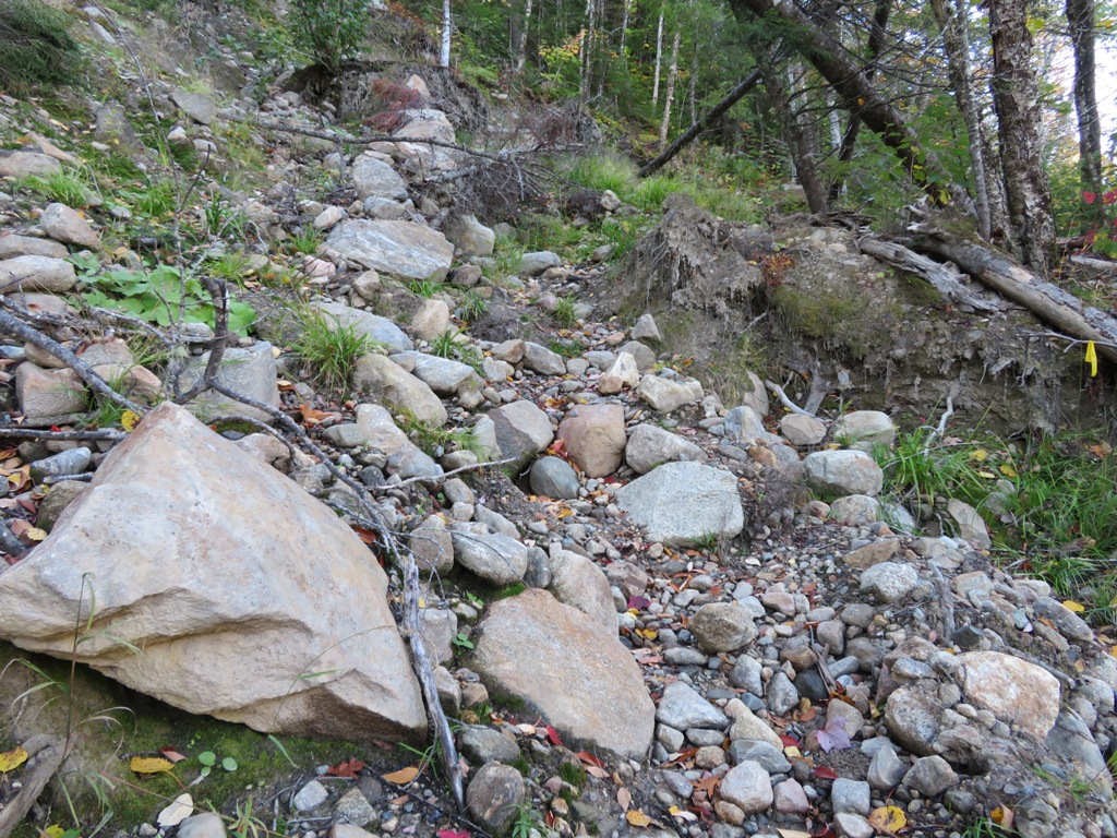
...and snakes along a steep narrow sidehill. Caution needed here. The trail is in much better shape after this section.

River reflections.

Farther along, a short side path drops down to a ledge-fringed pool.

A small cascade feeds into another pool.

An abutment remains from the former Spider Bridge, which was destroyed by an earlier storm and not replaced.

Just beyond, the Black Angel Trail joins from the left and the combined Wild River/Black Angel Trail makes a rock-hop crossing of the river, easy today with the low water.

From the crossing there is a long view (zoomed) downstream to the ledgy SE ridge of Mt. Moriah.

There's a four-way junction on the west side of the Wild River. From here I headed west on the Black Angel Trail. This lightly-used route to the Carter Range is a joy for those who relish long woods walks with solitude. It was opened in the late 1920s by the USFS and was named by USFS worker Alva Richardson, who helped build the trail. While working on the trail, Richardson and his co-workers found a blackened tree stump (presumably left from the great 1903 Wild River forest fire) that resembled an angel. (This nomenclature tidbit was revealed by "Puck" on a Views From the Top thread about interesting trail names.)

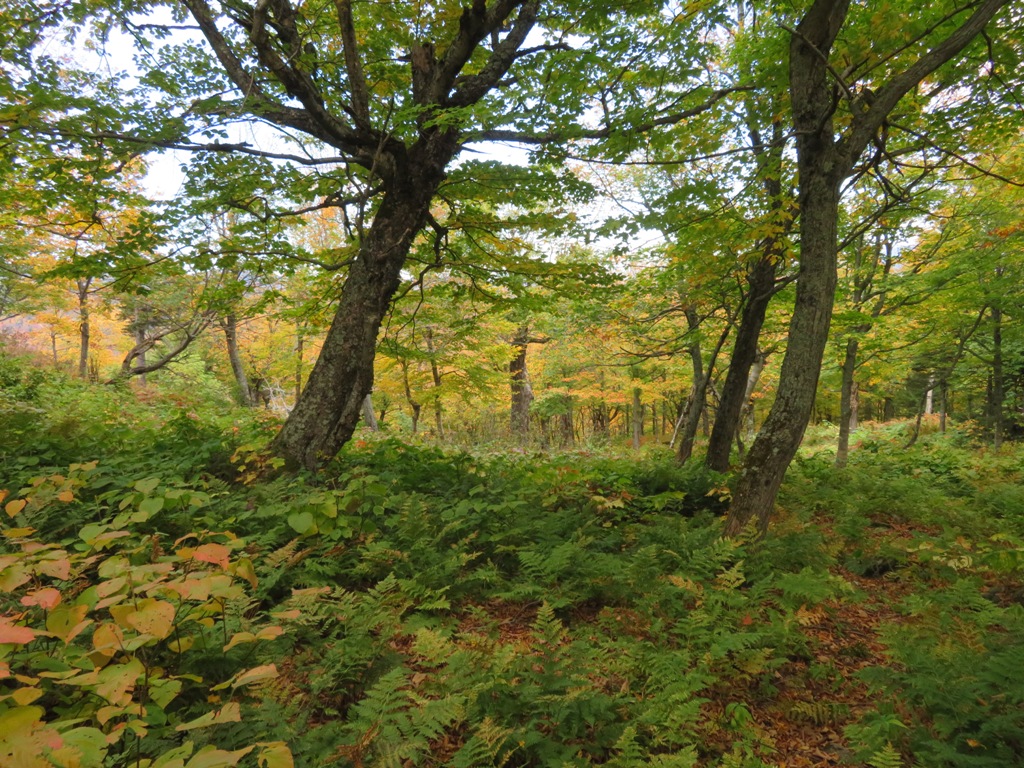
The lower couple miles of Black Angel Trail are a hardwood dream.

The east side of the Carter-Moriah Range - the essence of the Wild River Wilderness - is one of the wildest and most interesting areas in the Whites. The valleys of Spruce, Cypress, Moriah and Bull Brooks - each four miles long - are enclosed by massive, sprawling ridges descending off the high peaks. There's a feeling of vastness to the woods along the Black Angel Trail, mainly the haunt of redliners and backpackers. Not many peakbaggers are looking for a 16-mile round trip to Carter Dome.

I made a short bushwhack to a long-abandoned beaver pond on the south side of the trail.

A beaver historic artifact.

There are frequent reminders that this is major moose country.

Farther along, I started bushwhacking up onto the ridge.

Pretty good hardwood whacking, with thickets of beech saplings in places.

Starting to look ledgy.

The lowest ledge doesn't quite look over the treetops.

Higher ledges beckoned above. I placed steps carefully to avoid trampling lichens.

Nice vista to the NE, taking in Peabody, Gammon and Caribou Mountains in the distance and West Royce closer in.

A variety of fall colors.

A band of ledges leads across the ridge.

From a ledge farther up the ridge, a dreamy view of North Baldface.

To the south I could see Black Mountain (on the left) and one of the rocky knobs I visited the previous week on the east side of Carter Dome.

One of the few stretches of mildly scrappy spruce bushwhacking I encountered during the day.

The colors were popping at Wild River.

Looking up at the great SE shoulder of Mt. Hight.

Peering down into a steep-sided col.

Down in the col was this neat rock overhang.

Another scene in the col.

From another ledge, North Baldface, Sable Mountain, West Baldface, and the tip of Chandler Mountain.

On the flank of North Baldface, a dark cap of spruce and ledge amidst a sea of hardwoods.

Breaking out of the spruce, I headed up the ridge into birch and hardwood. This was new territory for me.

These glades were similar to those encountered in the Red Brook area the previous week.

One of several moose beds seen on the ridge.

Higher up, I came upon a magical area of park-like hardwood glades, a wonderful surprise.

Wow...

I took a stroll out to the north rim of the ridge....

....where moose had wandered...
...to a glade with a view.

Mt. Moriah and its ledgy SE ridge on the left, Shelburne Moriah and its eastern spurs on the right. In the foreground is a section of the l-o-n-g ridge that descends east off Middle Carter into the Wild River valley. Down below is a bit of the floor of the remote, trailless Cypress Brook valley.

Zoomed look at the rocky SE spur peak of Mt. Moriah.

Orange-framed vista towards West Royce.

A gnarled old yellow birch points the way back through the glade.

Glade bushwhacking continued up the steep slope.

Golden birches.

Distant northern view.

After skirting a ledgy wall, I followed a moose path up towards the top of the 3245-ft. peak.

The summit is mostly an open blowdown patch.

Spurs of Mt. Hight, speckled with gold.

The summit of Mt. Hight rises beyond a birch graveyard.

On winter trips up to the Carters, I had noted a snowy open patch on the back side of this little peak. Where there's snow, there may be views.

As I suspected, there is a fir wave here with a view up to the main Carter ridge: (L to R) South Carter, Middle Carter, Mt. Lethe and North Carter.

The northern of two cirque-like bowls at the head of Cypress Brook could be seen to the left of Middle Carter. Back in 1996 the late Creston Ruiter, my longtime bushwhacking buddy, and I made a lengthy October bushwhack up Cypress Brook and visited the small slide visible on the headwall, just under the curving birch limb.

An old moose shed on the summit.

A moose bed with a view.

I took a different route down the ridge, following well-worn moose paths through still more open glades.

This looked like a rut pit (aka wallow) dug up by a bull moose seeking a mate.

The glades go ever on.

Late in the day I paid visits to three ledges on the steep face of the ridge, this one looking SE across the broad lower valley of Spruce Brook to North Baldface, Sable and Chandler.

The next ledges looked more to the NE.

A late peek of sun provided some day-glo color.

I had to traverse some distance across the slope before I could drop below this long wall of rock.

Down through the hardwoods and back to the trail for the 4 1/2 mile walk out, the last part by headlamp.On two 11-mile foliage treks in the Wild River Wilderness five days apart, including a total of 16 miles of trail hiking, I did not encounter another hiker.


Beautiful pictures Steve, we love those hikes when you don't see a soul!
ReplyDeleteYa, great photos, love those glades
ReplyDelete