Late fall is a great time for bushwhacking in the largely leafless woods at lower elevations. On this day of high clouds and moderate temperatures I returned to a favorite locale - the nameless pass, or height-of-land, between Mt. Chocorua and Mt. Paugus, which is traversed by the lightly-travelled Bolles Trail. Off-trail ledges on either side of this high pass provide interesting and unusual views.
The Bolles Trail is named after the naturalist Frank Bolles, an avid explorer of the Chocorua-Paugus region in the late 1800s. With assistance from local Tamworth residents, he reopened this historic route through
the valleys between those two peaks in 1891, when he called it the "Lost
Trail." A chapter titled "Following a Lost Trail" gives a fascinating description of this route in his
classic 1892 book, At the North of Bearcamp Water. Today the Bolles Trail is a quiet and pleasant trail, with only a tiny fraction of the hiker traffic seen on the neighboring Champney Falls Trail.
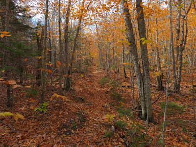
Fallen leaves carpet the hemlock-hardwood forest along the lower part of the trail.
Until the final climb to the height-of-land, the trail is never far from Twin Brook. It makes 9 crossings of the brook, plus one of a western tributary. Counting the crossing by the trailhead on the Champney Falls Trail, there are 22 of them on a round trip to the pass! These crossings are generally easy unless the water is high; in the upper valley the stream is quite small.
Hobblebush abounds in the upper valley.
Climbing through a hardwood corridor to the pass.
The pass is a very broad, flat height-of-land at 2200+ ft. When Frank Bolles and Tamworth farmer and woodsman Nathaniel Berry came through here in 1891, blazing trees as they went, they found this broad saddle strewn with "tangled masses of wrecked forest," due to a severe hurricane. Through the pass they battled through the "harricane" damage, in local parlance. With great effort they made their way down to the Albany Intervale, then came back over the pass and down to Tamworth. A few days later the path was thoroughly cleared by a contingent of locals, and the "Lost Trail" had been reopened.
The Sandwich Range has three named mountain passes: Lost Pass, Livermore Pass, and Paugus Pass. To the north there is Kancamagus Pass, and farther west are Mad River Notch and Thornton Gap. It would seem fitting to bestow the name "Bolles Pass" to the saddle between Paugus and Chocorua.
On the west side of the pass is a boundary for the Sandwich Range Wilderness.
I scrambled up the steep west wall of the pass....
...and after some traversing found a "needle-in-haystack" projecting ledge.
Here there is a wild vista of Mt. Chocorua and its long western spur ridge rising beyond the crest of the pass.
Mt. Chocorua and the First and Middle Sisters under a pastel sky, the only sunny interval of the day.
A hazy look at the Ossipees to the south.
Off to the east, I could see the day's primary objective - a huge sloping granite slab reached by a fairly significant bushwhack. This would be something like my 9th or 10th visit to this ledge over the years. On separate trips I have brought two friends, my nephew Mike and my wife Carol to this special spot.
But first I wanted to check out a potential view spot on the SW side of the pass. The going was scruffy and scrappy along this sideslope.
As expected, the view was restricted, but I did gain a nice perspective looking south down the long valley of Paugus Brook, which is traversed by the southern three miles of the Bolles Trail.
I bushwhacked back down into the pass and across the trail and soon passed a familiar mountain wetland meadow.
Beech-whacking east along the crest of the pass.
An attractive glade at the top of a nascent ravine.
Rocky terrain. In places there were thickets of hobblebush, or "tangle-foot," as it was called by Frank Bolles' companion, Nathaniel Berry.
From a ledgy spot above my destination ledge, a view of Mt. Passaconaway looming beyond the NE ridge of Mt. Paugus. This ledge, or another in this vicinity, may be the viewspot visited by Frank Bolles and Nathaniel Berry on their southward return over the pass in 1891. The view from the ledge - which was likely more open in those days - was described by Bolles in his chapter on the "Lost Trail."
I soon arrived at what I refer to as "Paugus View Ledge." From here, the entire elongated, ledgy, lumpy mass of that interesting mountain can be seen beyond the remote upper basin of Paugus Brook.
This huge granite slab is rippled with erosion channels.
Cliffs on the NE spur of Mt. Paugus.
To the north, beyond the pass, I could see Mt. Carrigain, Green's Cliff and part of Mt. Hancock. Through the col in the distance are Bondcliff and West Bond.
A smaller ledge on the east side of this spur looks up at Mt. Chocorua and First Sister peering over the upper headwall of the Paugus Brook valley.
A pair of hikers atop Chocorua's pinnacle.
Steep terrain at the lower end of this spur ridge.
A late burst of color.
Mt. Paugus beyond a rock face.
Cliffs near and far.
This was a hard place to leave.
Parting shot.
Spruce woods in the pass.
Heading back through the pass on the Bolles Trail.
Artifact along Twin Brook from what appeared to be the T. White logging camp of the Swift River Railroad (1906-1916).
.


Aye for Bolles Pass!
ReplyDelete