
Views and bugs abounded on a trek to Mt. Percival, Mt. Squam and some
off-trail ledges on this low but surprisingly rugged range.
The trails on the Squam Range are well-maintained by the Squam Lakes Association (SLA).

In its easy-graded first mile the Mt. Percival Trail crosses four old stone walls.

Crossing Smith Brook.

Higher up, the trail cuts across a rough talus slope.

Fine rock step work by the SLA trail crew.

The last third of the Mt. Percival Trail is steep. This little pitch is a bit tricky.

Just below the summit there is the option to go through the caves to the left or take the regular trail to the right. Having squeezed through the caves a couple of times previously, I chose the regular trail.

This route is rugged enough. As an old SLA trail guide notes, "The upper part of the trail is precipitous."

A good ledge scramble.

Neat open stretch "along the rim."

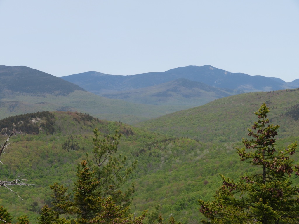
Looking down the Squam Range to Mt. Morgan and Mt. Webster.

First view of Squam Lake.

The classic view of the big lakes from the open, ledgy summit of Mt. Percival (2212 ft.). Up here I ran into Bruce Richards, dedicated maintainer of the Mt. Kinsman Trail and volunteer coordinator for the WMNF Pemi Ranger District. Accompanied by a friend, it was Bruce's first time on this hike and he was liking it.

The loop over Mt. Percival and Mt. Morgan is by far the most popular hike on the Squam Range. I was heading the other way on the Crawford-Ridgepole Trail, towards Mt. Squam, and I didn't see another hiker the rest of the day.

First-timers on the northern half of the Crawford-Ridgepole Trail are often surprised by its ruggedness. From afar it looks like a long, flat ridge with a few insignificant bumps. But it has countless short, steep ups and downs, often involving rugged ledges with awkward and slippery footing. These are mountain miles.

Cool trailside tree.

A moose-haunted ridge.

I made a short, thick bushwhack to an interesting ridgetop bog.

There is a lot of ledge walking along the ridge, here looking back at Mt. Percival.

A peek out at Squam Lake.

Coyote scat?

Typical rough metamorphic ledges of the Squam Range.

The trail crosses this steep ledge face at the east summit of Mt. Squam (2223 ft.).

The pointy summit.

Another lake view -- Squam from Squam.

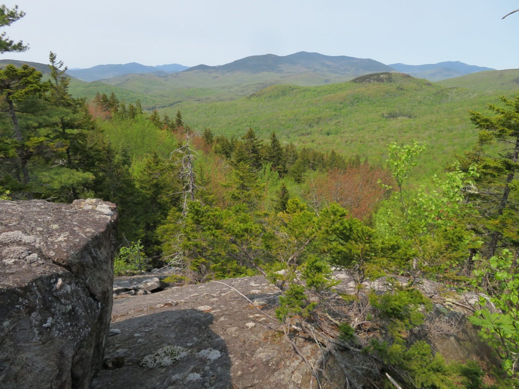
Beyond the summit of Squam the trail descends to a spot known as "Uncle Paul's Potholes."

Here there are good views to the north from open ledges just north of the trail. Franconia Ridge is seen in the distance on the left beyond Mt. Tecumseh and the Osceolas.

A great perspective on Sandwich Dome.

East Sleeper and Mt. Whiteface (above South Flat Mountain).
I bushwhacked a ways down to expansive ledges on the northern slope of Mt. Squam.

This turned out to be an excellent viewpoint looking north over a remote basin in the Beebe River Headwaters Tract, a 5,000 acre area purchased a few years ago by the Conservation Fund. The ledges from which this photo was taken are part of that tract, which extends up to the ridgeline of the Squam Range.
Would like to check those ledges out someday. A pretty wetland rests at the base of that knob.

The "spring foliage" was vivid this day.

Back on the trail, returning to Mt. Percival, I paused to admire this nice cluster of Painted Trilliums.

I went down off the summit of Mt. Squam to look for a geocache.

This was the first time it had been found in three years.

Pale Corydalis in a small mountain meadow.

Quiet evening back at the summit of Mt. Percival.

Unfortunately the worst winged horde of the day descended here, and the mosquitoes hounded me all the way down. Bug season is upon us.


A unique hike! Trees must have blocked the Tri's. I wonder if Mt. Prospect(a favorite mountain in the 1800's) is seen from there. I say bring back the Mt. Prospect fire tower-views from there would be so interesting!
ReplyDeleteThe Tris are blocked by Sandwich from that angle. I've never been up Prospect which, as you noted, was in the top rank of viewpoints back then. Apparently it still has a view to the east. The only place I've gotten a view of Prospect on the Squam Range was an obscure outlook on Mt. Webster.
DeleteUnder the proposed "Mt. Prospect restoration and economic development act of 2021", which I will sponsor as soon as I become a NH resident and am duly elected to the legislature, Mt. Prospect will have a hut and firetower with unmatched views of Plymouth, Squam lakes and all points North, East and West as well! More seriously, I'm guessing a large part of the charm of Prospect's view was the uncommon mixture of lakes, village and possibly close to 40 4000 footers.
DeleteSteve
ReplyDeleteWe hiked all the Squam Range as 3 hikes last May and June. They are quite rugged, always going up or down. For 2000 footers they are a good work out.
We once did the whole range as a day hike and it was a long day! The Squam Range looks deceptively easy from a distance.
Delete