
Morning fog burned off for a spectacular day to hike a pair of the
Adirondack 46 high peaks. By ADK standards, a moderate hike, but the
upper part of the herd path was rough and fairly slow going both up and
down. Well worthwhile for the magnificent wilderness view from a
southern outlook on Street.
Wright Peak from the shore of Heart Lake by the Adirondak Loj, the starting point for the hike.

The first mile and a half is a mellow walk, partly on the Old Nye Ski Trail, descending gently to Indian Pass Brook.

Indian Pass Brook is a large stream and can present a tough crossing in times of high water. The water was pretty low today.

The herd path leading to Nye and Street passes a series of beaver ponds and meadows in the next quarter-mile.

Artifacts from an old lumber camp are seen at the second crossing of a tributary brook.

Parts from an old stove.

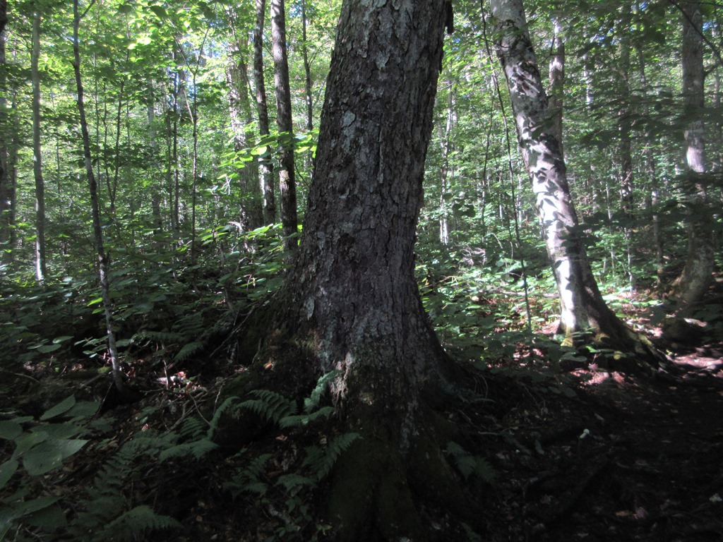
The path ascends along the brook through fine hardwood forest with some large old yellow birches and sugar maples. The hardwoods extend up to 2700 ft.
Higher up, in typical ADK fashion, the herd path gets steeper and rougher. At 3300 ft. it squeezes by this outlook rock.

Standing atop this rock you peer out at the MacIntyre Range on the R and the Phelps-Tabletop group on the L, with some of the Great Range beyond.

From
here up to the ridgecrest the herd path is steep and rough with
blowdowns, mini-washouts and plenty o' slippery mud. There was formerly a
maze of confusing herd paths leading up to Nye and Street, making it
one of the more challenging 46er hikes due to difficult navigation
through dense brush and blowdown. As with the other "trailless" high
peaks, a decade or so ago the ADK 46ers and DEC officially
designated one herd path as the route, though with minimal marking and
maintenance, and the other herd paths were closed and brushed in. In
summer this designated herd path is very easy to follow, though it does
get braided in a few places where hikers try to detour around muddy
spots (thereby creating more muddy spots).

In its upper reaches the path cuts through extensive areas of "cripplebrush," an old ADK term for incredibly dense balsam growth laced with bony, prickly blowdown. In the early days, before the herd paths had formed, it required considerable fortitude to climb these mountains.

It's considerably easier today, though still not a cakewalk. This hike proved somewhat harder than I thought it would be, based on the stats of ~8.5 miles round trip and 2700 ft. of elevation gain.

A full body workout, in a few places.

The junction on the ridgetop where the paths to Nye and Street diverge.

Per ADK custom, I headed to the closer, lower and mostly viewless Nye first. Here the path is one hiker wide through cripplebrush.


The "trailless" peaks once bore summit canisters, but these were discontinued and removed a few years ago, and the high points are now marked by DEC signs. Few hikers will list Nye among their favorite ADK peaks.

A short path leads to a hint of a view, about the best you can find near the summit of Nye.

Coming down off Nye, Street is briefly in sight ahead.

A healthy helping of ADK mud in the col.

The path to Street ascends through a nice mossy fir forest.

Another wooded summit.

But 80 yards to the south, via a beaten path, is a small opening with one of the wildest views I've seen in the 'daks. This, despite Street's rep as a dud of a viewpoint.

To the south, beyond nearby Lost Pond Peak, the distant view stretches out to the Snowy Mountain range near Indian Lake and peaks in the Siamese Ponds Wilderness. Closer in, Mt. Marshall is to the L and MacNaughton Mountain to the R.

Looking
SW, beyond spurs of Street, the remote Cold River valley sprawls
between the Santanoni Range on the L and the Seward Range on the R.

The Seward Range: Emmons, Donaldson and Seward, with Seymour in front.

On the far R, the trackless wilds of the Sawtooths.

The Macs and the Indian Pass Brook valley on the far L.

An hour and a half lounging in the sun, and no one came by, though I did encounter about 15 hikers total during the day. It was a hard place to leave.

Another path leads to a clearer view of the Macs.

Nice light on the Macs from the herd path viewpoint down at 3300 ft.

What a day!

Heart Lake, still a couple hours away, seen under Big Slide Mountain. After a three-year absence, it was good to be back in the 'daks.


I remeber i was on Iroquois the day you were on Colden...time flies. Henry
ReplyDelete