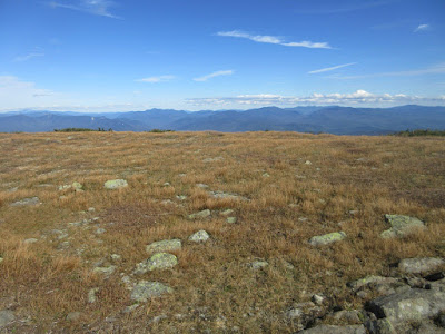
There's no better place to be on a day of 100-mile visibility. Did the
quiet longer loop up the Asquam-Ridge Trail and Beaver Brook Trail and down the
Carriage Road and Snapper Trail.
Following the lower Ridge Trail up the Baker River valley.
A recent relocation around a washed-out section.
A relic probably from the Parker-Young logging days in the 1940s.
Hitch 'em up! This marks the upper end of Traps Turnpike.
Relic at the site of a Parker-Young logging camp.
A Dartmouth Outing Club (DOC) footbridge over the Baker River.
The river was surging out of Jobildunc Ravine after 2 inches of rain the night before.
Nice birch stand along the Ridge Trail.
Typical easy gradient along much of the Ridge Trail, though the footing has become rockier in recent years, probably more from torrential rainstorms than heavy use.
The Asquam-Ridge Trail is a quiet, mellow route meandering up through lovely high mountain forests, such as these open firs along the slope of Mt. Waternomee.
A mossy section ascending Mount Jim.
Along the wooded summit crest of Mount Jim. The high point is a few yards to the right of the trail on a herd path.
View ahead to Mount Blue from a fir wave along the trail.
Onto the Beaver Brook Trail and the AT.
Trailside view down into Jobildunc Ravine and out to the south. Up to this point I had not encountered another hiker, and would not see anyone until up on the flank of Mount Blue.
Beaver pond on floor of Jobildunc Ravine.
Blue skies over Mount Blue.
Necessary signage.
A perfect, nearly windless day for savoring several hours above treeline.
DOC Trail crew and volunteers have effectively filled in a parallel path through the alpine vegetation that had been trampled by careless hikers.
Endless views today, here looking west past Long Pond and ledgy Black Mountain. The Green Mountains were visible end-to-end - from Stratton and Mount Snow to the Jay Peaks. Though the Adirondacks were partly clouded in, I did get peeks at Haystack, Marcy, Algonquin and Lyon.
Good to know! AT hikers do sometimes end up on the wrong trail when descending Moosilauke.
Looking north. Kinsmans on the right.
Tundra and sky.
Sprawling ranges of the Whites. The view takes in 34 of the NH 4000-footers.
Franconia, Twin-Bond and Presidential Ranges.
Summit benchmark.
From the summit outcrop, looking out over the "East Peak" and Gorge Brook Trail.
Summit signs.
Hikers heading north.
The town of Lincoln tucked into the East Branch valley. Mt. Carrigain, the Hancocks, Kearsarge North and Mt. Huntington beyond.
Finely crafted cairns mark the trails above treeline.
Looking back up the Carriage Road.
South Peak ahead. The views from the main summit were so fine I didn't leave enough time for the side trip to South Peak.
Good rock step work by the DOC trail crew.
View SE over Gorge Brook Ravine from a spot along the Carriage Road.
Looking back at the summit.
Orange is the favored DOC color.
Rocky footing on the old Carriage Road.
Whenever descending this way, I pay a visit to the collapsed remnants of the Wadchu Shelter, built in 1935 by DOC members at the top of the famous Hell's Highway ski trail. It was leveled by the 1938 hurricane and never rebuilt. History of trails and shelters on Moosilauke: https://docs.google.com/
A bit of early color along Gorge Brook.
Black-Eyed Susans at the DOC Ravine Lodge.


No comments:
Post a Comment