
MOUNT PASSACONAWAY: 1/7/16
This spectacular sunny early winter day called for big views, and the impressive monarch of the Sandwich Range, named for a great Penacook sachem of the 1600s, delivered. From online reports I knew that the Dicey's Mill Trail from the Ferncroft trailhead in Wonalancet was well-packed, and the conditions were ideal for Microspikes.
Before setting off, I paused to peruse this interesting display on the hiking history of the area.

Trail signs with the trademark Wonalancet Out Door Club (WODC) blue color.

It was a beautiful morning at Ferncroft, perhaps the most picturesque trailhead in the Whites, rivaled only by Breezy Point (Moosilauke Carriage Road). Mount Whiteface is seen on the left, Mount Wonalancet on the right.

A different angle also showing Hibbard Mountain and Wonalancet Hedgehog.

The Wonalancet River seen from a bridge that links the Dicey's Mill Trail with the Blueberry Ledge Cutoff.

Just beyond, the trail enters the WMNF and the Sandwich Range Wilderness.

For more than a mile the trail led through sunny hardwoods. In here I had a brief chat with uber-hiker and trail runner Ryan Welts, who was out for a morning loop run over Mount Whiteface. He was gone so fast I didn't get a picture. Ryan holds the winter speed record for the NH 4000-footers.

A glimpse of some cliffs on the eastern flank of Whiteface. I visited these while breaking trail through deep snow up the Tom Wiggin Trail in 2007. For an account of that hike and several other Wonalancet adventures that season, see A Wonalancet Winter.

The trail passes through an especially fine area of mature hardwoods after passing the Tom Wiggin Trail junction. This is within The Bowl Research Natural Area, a glacial cirque notable for the stands of old-growth hardwoods on its broad floor. The area within the cirque proper was never logged. Some of the forest in the valley to the east was cut when Dicey's Mill - located near the trail's crossing of the east branch of the Wonalancet River - was in operation in the late 1800s.

The crossing of the east branch of the Wonalancet River. I used rocks rather than trying to balance across the log in Microspikes.

From here to the junction with the Rollins Trail is a moderate ascent of 1.4 miles along the side of a southern spur of Mount Passaconaway. The lower part has mostly easy grades through hardwoods.

Higher up the woods darken and in places the grade is steeper, though never for very long. This trail was laid out in 1891 by Charles E. Fay, one of the early leaders of the Appalachian Mountain Club, and local farmers.

After passing the Rollins Trail, the Dicey's Mill Trail crosses this small high-elevation brook.

I thought about making a loop up to the summit via the East Loop and Walden Trail, but the East Loop had only some unappealing choppy tracks on it.

Looking a little more like winter.

The Dicey's Mill Trail makes some mellow switchbacks as it ascends the steep cone of Passaconaway.

There is much open fir forest on the cone.

After a sudden 0.3 mile burst of steep climbing, the trail emerges on the NW viewpoint, which offers a sweeping panorama to the standing hiker.

The Tripyramids are especially impressive from this angle. At the middle left is a recent (Tropical Storm Irene) slide on the flank of West Sleeper.

South and Middle Tripyramid with Mount Moosilauke beyond.

East Sleeper, with Killington/Pico, Smarts Mountain and Carr Mountain beyond.

The Franconia Range and Mount Garfield.

The wooded high point of Mount Passaconaway.

On to viewpoint #2, on the east side of the summit plateau. This lofty perch provides especially good looks at the eastern Sandwich Range peaks and down into the upper Oliverian Brook valley.

Mount Chocorua, anchoring the east end of the range.

The Presidentials, Wildcats and Carters line the northeastern horizon.

Mount Washington soars above Mount Tremont/Owl Cliff.

Looking across the Albany Intervale to Bear Mountain (scarred by clearcuts) and the Moat Range.

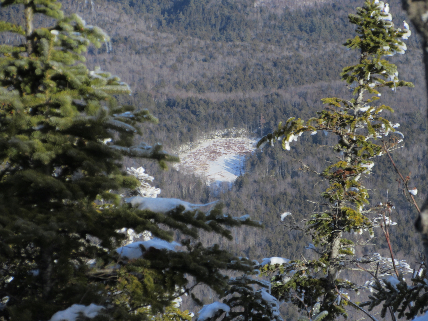
Peering down to a beaver pond in the Oliverian Brook valley.

Mount Whiteface rises from the depths of The Bowl.

Whiteface with Sandwich Dome peering over its shoulder.

How often can one do this at 4000 feet in January?

Going back up the steep pitch on the Walden Trail.

A quick visit to the east viewpoint on the way back.

Back to the NW viewpoint for a parting shot of the Hancocks and Mount Carrigain. There wasn't time to make the 0.6 mile round trip down to the fabulous north viewpoint, but between the other three I logged nearly two hours of viewing time, and spotted all 40 NH 4000-footers and 34 "52 With a View" peaks that are visible from Passaconaway, along with distant peaks such as Mount Mansfield in Vermont, Mount Monadnock in southern NH, and Saddleback Mountain in Maine.

Leaving the NW viewpoint.

A small SW vista at the start of the descent.

This ledge scramble was a bit tricky.

On the way down I made a scrappy little bushwhack to a ledge on the south slope of the summit cone.

It had a little different angle on the south view.

Just above the brook crossing, late afternoon sun lights the top of Mount Wonalancet. It was a day well-spent on one of my favorite mountains.


No comments:
Post a Comment