On a cool and sunny Wednesday I enjoyed a long and very interesting trek in the wild and remote Dry River Valley, checking out some of the new relocations on the Dry River Trail, then climbing to Mount Eisenhower for gorgeous evening views.
I started off at 9:15 am at the trailhead on Route 302 in Crawford Notch.
Many sections of the Dry River Trail were washed out by Tropical Storm Irene in 2011. Over the last several years the Saco Ranger District trail crew cut some rough relocations around the washouts. I had done a long hike in the valley a month before Irene, but this would be my first return since that epic storm. As I discovered, the re-opened trail is as advertised...
A half-mile in, the trail picks up the grade of the Dry River logging railroad, which skinned the timber from the valley in a few years during the 1890s.
This valley is now wilderness with a capital W.
One of the first scenes of Irene destruction seen along the trail.
A yellow birch leaning for the light.
Mt. Washington, Mt. Monroe and the headwall of Oakes Gulf from a bluff on the Dry River Trail, 1.5 miles in.
The suspension footbridge over Dry River. The old logging railroad crossed the river 13 times because of the steep, canyon-like terrain. Likewise, the Dry River Trail had numerous crossings. But after two hikers drowned in 1971 in this misnamed river, which rises fast and furious during storms, a bridge was built here and numerous relocations were made to eliminate most of the other crossings. As a result the trail has many rough ups and downs and is much more difficult than a typical valley trail.
The bridge was disabled by a storm a few years ago (before Irene), but was replaced by this new heavy-duty span.
One of the new relocations - steep, rough, and muddy, but there's not much choice due to the terrain.
Another relo. This has always been the kind of trail that beats you up a bit, even more so now.
A big washout widened the river here.
There are still a few sections of nice railroad grade walking, but fewer than before Irene.
New trail signs.
The second part of the diagonal river crossing on Mount Clinton Trail.
Cutaway bank courtesy of Irene.
Yes, that's the trail - a tricky spot!
More bank erosion on an outside curve in the river.
Trees stacked up by Irene floodwaters.
Some nice wtaerfront ledges.
Where the trail used to go.
Isolation Brook, true to its name, five miles in.
This western section of the Isolation Trail suffered damage from Irene. No time to go up there on this trip.
A few designated tentsites are scattered along the Dry River Trail.
The impressive Dry River Falls was rocking from recent rains.
Looking down from the top of the falls.
This gorgeous pothole pool above the falls might be my favorite spot in the valley. Great setting for a late lunch.
The pool from above.
It was mid-afternoon, but I still wanted to climb Mount Eisenhower to enjoy some views on this spectacularly clear day. I wasn't sure how the river crossing would be on the Mount Eisenhower Trail, but it was manageable with one short jump.
The Mount Eisenhower Trail - part of the long (eight miles) way to Eisenhower - is a quiet gem, with mostly good footing, easy to moderate grades, and a back-of-beyond feeling.
Ascending through a stick forest on a long southern ridge off the ridgecrest between Eisenhower and Franklin.
A glimpse of Mount Eisenhower through the trees.
Near the top the trail breaks out of the trees for the first view back down the southern ridge and the Dry River Valley. At this spot I heard the sweet whistle of a singing Fox Sparrow, and observed him for about 10 minutes. The nesting range of this bird is normally far north in Canada, but in the last few years a handful have been hanging out in the high-elevation Whites.
Side view of Mount Franklin.
The heart of the Dry River Valley, with Mount Isolation in the center.
Looking across at Mount Eisenhower.
All was quiet on the Crawford Path at 6:00 pm.
Approaching the bald dome of "Ike."
The last link of the climb.
Red Pond, which hasn't been a real pond for quite some time.
Mountain avens on Mount Eisenhower Loop.
Ascending the Mount Eisenhower Loop.
Looking north along the Presidential ridgeline.
Eisenhower's summit view towards the Sandwich Range, Carrigain and Hancock.
Evening sun lights up Mts. Jackson, Webster and Pierce.
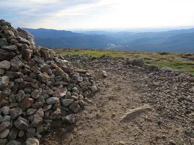
Cairn shadow and the Presys.
North to the Pliny and Pilot Ranges.
The summit viewing circle, looking towards Bretton Woods. Peaks of the Green Mountains were super sharp on the horizon.
Weird light on the lower Montalbans.
Heading back down the Mount Eisenhower Loop.
The shadow of Eisenhower engulfs the Dry River Valley.
Evening sun on the steep flank of Mount Franklin.
Talus on the top of Edmands Path.
Alpenglow on the "stone gateway" at 4000 ft. on Edmands Path. Big thanks to Carol who drove up from Lincoln to save me a long, dark road walk and hitchhike from the Edmands Path trailhead back to my car down in Crawford Notch.


Some of your best photos!
ReplyDelete