
A RAMBLE ALONG THE EAST BRANCH: 6/18/12
A summer tradition for Carol and me is a longish, leisurely walk into the valleys of the Pemigewasset Wilderness, most often up the main valley of the East Branch of the Pemigewasset River. That was the plan on this sunny, comfortable June day, using the Pemi East Side Trail. This trip always rewards with river and mountain views, fine woods, and great spots to lounge in the sun. This year we would also have a chance to see much damage and stream rearrangement from Tropical Storm Irene.
The Pemi East Side Trail is also known as the East Branch Truck Road, for it was originally constructed in the 1940s to haul timber out of the valley by logging truck. At that time the Pemi area was National Forest land, but the Parker-Young Co. (successor to the J.E. Henry Co.) retained timber cutting rights. Today the first 2.8 miles is still a narrow gravel road, occasionally traveled by a Forest Service vehicle, while inside the Wilderness the road is now mostly a narrow footpath.

A mile in, Irene washed out a large culvert at a brook crossing, and cut the road in two. The Forest Service plans to build a bridge here.

Just beyond is a badly eroded stretch of the old road, which must have had its own stream running down it during Irene.

A nice birch-lined stretch.

At one spot I made a short bushwhack to a high bank, where I found a good view up the valley to the handsome peak of West Bond. Irene opened some neat views, but view-seekers should stay back from the edge as the banks are severely undercut.

Zoom on West Bond.

Just before you reach the Franconia Brook tentsites, an opening beside the trail offers a view west from atop a high, steep bank. In this photo you see the ridge traversed by the Osseo Trail on the L (can you guess where the ladders are?) and Mt. Flume on the R. From here you can also see Whaleback Mountain and some of its cliff-faced spurs.

Right before the gate and sign marking the Pemigewasset Wilderness boundary, a short spur road drops to the East Branch opposite its confluence with Franconia Brook. There were once some large step stones here, and the river crossing was marked and sanctioned by the Forest Service, but Irene swept away the step stones and gave the entire area a whole new look. The Forest Service no longer encourages crossing here. Carol watched a group of young backpackers ford the river here; one young man was in the water up to his waist.

This is what that crossing looked like, pre-Irene.

We returned to the trail and headed into the Pemi.

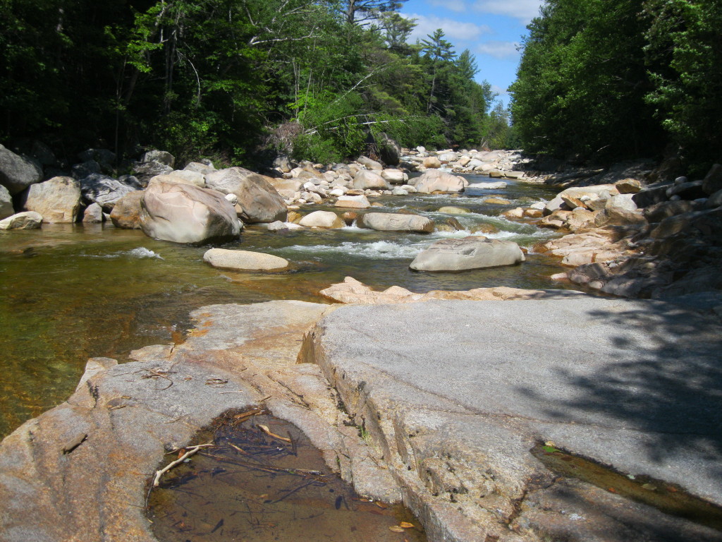
Our next stop was one of our favorite spots, the "Ranger's Pool," where there are ledges, old cedar trees such as those shown here, and a beautiful pool in the river.

The ledges are in the shade in the morning.

Downstream you can see Whaleback Mountain and its spurs. We spent a lazy hour here; Carol did some wading in her Crocs.

Continuing on the trail, we soon passed this interesting boulder.

Major bank erosion from Irene.

Riverside ledges right along the trail - another great spot.

Downstream to Whaleback.

Irene did a major rearranging at the crossing of Cedar Brook.

Hiking deep into the Pemi woods.

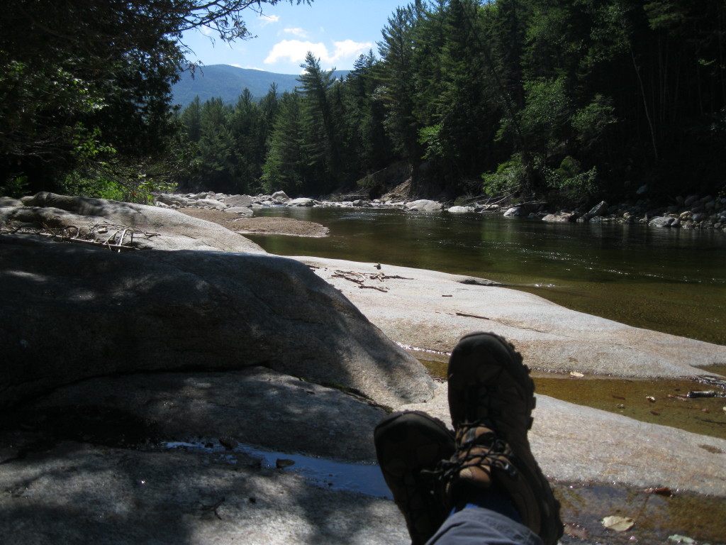
Farther down the trail, we went out to a neat rocky outwash spot along the river.

Carol had fun wading around out here.

A stark sentinel along the shore.

Eventually we headed back along the East Side Trail. At one point I made a short bushwhack to a favorite view of Bondcliff and its sharp southern spur.

More ledges sloping into the East Branch.

We returned to the Ranger's Pool for another sojourn. There was a sweet breeze here, with many Tiger Swallowtail butterflies fluttering by. On both visits here, we were puzzled as to what happened to the small ledgy cascade that used to be here. Was it demolished by Irene?
Here is the cascade, pre-Irene.

No cascade here now.

Summertime, and the livin' is easy...
A very peaceful place.

On the way back, we followed the Pine Island Trail, which parallels the East Side Trail along the river and provides some very nice walking. Carol and I had adopted this trail last July, but Irene placed two sections of it into the river. It is currently closed, but is scheduled to be reopened this summer when two relocations are completed. The relos are marked by blue flagging, those sections are bushwhacks right now.

Owl's Head Mountain in the distance.

Flood debris in the woods along one of the relocations.

Several sections of the trail survived the storm just fine.

One of the spots where the trail was taken by the river.

Another spot where the trail used to go; South Twin Mountain is seen in the distance. We'll be happy to see this very attractive trail reopened.


Hi Steve,
ReplyDeleteYou and Carol had a beautiful day for a beautiful ramble off the beaten path. Or actually, I guess for parts of your journey, you were trekking along the "battered path", courtesy of little Miss Irene!
Once the Forest Service completes their work on the storm-damaged Pine Island Trail, I assume you and Carol will resume your role as Trail Adopters.
Loved reading the tidbit of history at the beginning of your report, and also reading about some of the new views that were opened up as result of Irene.
John
Thanks, John - battered path, indeed! We're looking forward to doing some brushing and blowdown removal when the trail is reopened. Will need some blazing, too.
ReplyDeleteThere are certainly some interesting new views out there!
Steve
Thanks for the intel Steve - I've been meaning to walk that section of trail and check out the pemi crossing. Waist high fording is a bit too high for my tastes. Looks like a lovely long walk - glad you both had a nice time.
ReplyDeleteThanks, Philip - right now the water is pretty low and it looked like there would be a better crossing a little ways upstream from where the backpackers crossed, appeared to be shallower with more rocks.
ReplyDeleteSteve
Thank You for a wonderful refresher on the beauty of the Pemi. Reminds me of a spot after the fire gate that we called "Archies Place" after meeting a woodsman named Archie hanging out in his off-trail campsite. Having spent a night or two tucked in a rustic hideaway, my brother in law and I have great memories of the Pemi and it's environs.
ReplyDeleteThanks, Jimmy - the Pemi is a special place for many folks.
ReplyDeleteSteve