POTASH MOUNTAIN: 6/7/12
With a somewhat iffy forecast for the afternoon, it made sense to get out in the morning on a shorter hike for some views. Potash Mountain, with its great close-up of the high Sandwich Range peaks, is an old favorite. It would also provide a good look at a slide that fell on the side of West Sleeper during Tropical Storm Irene. I had spotted this fresh gravelly gash from Table Mountain a few weeks ago.
The mosquitoes started in as soon as I got out of the car at the UNH/Potash/Downes Brook trailhead. In my experience, the Albany Intervale has always been a bad area for skeeters in June.
I was a little worried about the crossing of Downes Brook on the Mt. Potash Trail, as the streams had been running pretty high. I brought crocs but didn't need them, just had to make a long step onto an underwater rock.
After crossing a logging road and climbing gradually through hardwoods, the Mt. Potash Trail enters a deep hemlock forest and climbs by switchbacks.
Higher up the trail is worn down to bedrock and roots.
The first view is from a big steep ledge on the NE shoulder of the mountain. Mt. Passaconaway and Mt. Whiteface rise steeeply out of the Downes Brook valley.
Hedgehog Mountain is close by to the SE. The summit of Square Ledge can be seen above the Hedgehog-Passaconaway col.
Beyond the outlook, the trail traverses through fine spruce woods.
Nice axe work on this spruce blowdown.
The trail becomes quite rough and rocky as it works around the east side of the cone.
Ledges on the SE side offer a view of Hedgehog Mountain, Mt. Paugus, and a socked-in Mt. Chocorua.
This steeply angled slab is a little tricky to negotiate.
The trail climbs steeply up ledges on the south side of the cone.
"X" marks the highest spot on the 2700-ft. summit.
Nearby is a survey marker for the boundary of the Sandwich Range Wilderness, which runs across the summit.
Ledges around the summit provide a nice variety of views. I ended up spending two hours enjoying the vistas, despite swarms of black flies and a few light rain showers.
The northern view is dominated by the Hancocks and Mt. Carrigain.
Green's Cliff is to the R of Carrigain, with the Nancy Range and Mt. Willey beyond. Mt. Tom is seen through Carrigain Notch.
The view west to Scaur Peak, the Osceolas, and Mt. Kancamagus, with the northern spur of the Fool Killer in front.
A down-look into the Sabbaday Brook valley.
Looking up to the remote headwaters of the Downes Brook valley, with a large slide on the western slope of Mt. Whiteface's north ridge.
My favorite view from Potash: the Sleepers, the Tripyramids and the Fool Killer rising above the Sabbaday Brook valley.
From Potash you get a good look at the new slide on West Sleeper.
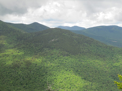
Looking up the ridge from Potash, with the Downes Brook valley on the L and Sabbaday Brook valley on the R. The dark spruce cone in the center has been called "South Potash." An epic bushwhack would be to follow this ridge from Potash all the way up to East Sleeper.
From a trailside ledge down below the summit, a fine view of Mt. Passaconaway, perhaps the handsomest peak in the Sandwich Range. At 4.4 miles round trip with 1450 ft. of elevation gain, Potash has a big payoff for the effort.


I think that axework is mine :) I've taken on this trail and will be giving up Piper next year. I'm keeping West Side (chocorua) because I really like that little trail.
ReplyDeleteThanks, Chris - nice to have you as a "neighbor" adopter!
DeleteSteve