CASTLE RAVINE: 6/7/11
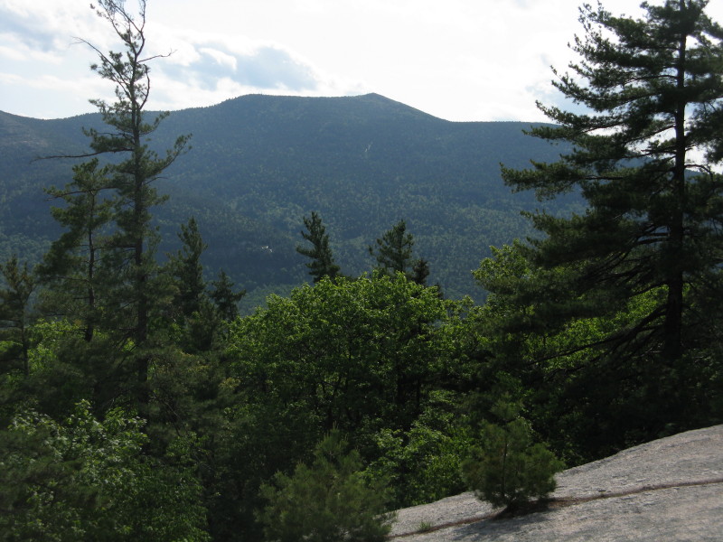
My favorite of the great glacial cirques on the Presidential Range is Castle Ravine, the striking bowl on the NW side of Edmands Col, clasped between Jefferson's Castellated Ridge and Israel Ridge on Mt. Adams. This is a really wild ravine: it has a fairly long, curving trail approach, and there is no road, railway, hut, camp or crowd nearby. The view below is from Emerald Bluff, a great viewpoint along the Emerald Trail.

One of the reasons I wanted to go back into the valley was to see the damage from an avalanche that fell in the winter of 2010 and ran across the Castle Ravine Trail down below the headwall. I could see this narrow brown strip from the Castles on a hike last summer.

Late on a sunny morning, I started off from the Castle Trail parking area off Route 2 in Bowman. I expected an immediate insect assault, but to my surprise, and delight, bugs were a non-issue on this hike with the exception of two spots up higher.

For the first 100 yards, the Castle Trail coincides with the Presidential Range Rail Trail.
 At 0.4 mi. you cross the Israel River. A caveat for the hike into Castle Ravine is that it's best done in low water. There are numerous stream crossings, and few of them are easy even at low to moderate water levels. Even with the current low water levels, most crossings on this hike involved stepping on at least one or two underwater rocks.
For the next mile the Castle Trail is a gentle uphill stroll through a leafy hardwood tunnel.
 At 1.3 mi. you bear L onto the Israel Ridge Path, one of many interesting and lightly-traveled trails maintained on the Northern Presidentials by the Randolph Mountain Club.
After a double crossing, this trail follows alongside the Israel River. This is a hike that is rich in stream scenery.

At 1.7 mi., where the Israel Ridge Path veers L to begin climbing its namesake ridge, I stayed on the valley route along the Castle Ravine Trail.
 The first part is easy walking through a fine yellow birch forest.
 The first crossing of Castle Brook on this trail is perhaps the most awkward of the trip. I always end up sitting on my butt and using a long leg stretch to negotiate this one.
 One of many mossy cascades seen along this beautiful trail.
 A nice patch of foamflower along a dry streambed.
 This mini-Niagara Falls is just above another stream crossing.
 A ferny streamside glade.
 After another crossing, the trail climbs higher on the slope along the flank of Israel Ridge, through an open "salt-and-pepper" forest of birch and fir.
 About 3 miles in, the Link joins from the L.
 I took a break at a crossing above the Emerald Trail junction, with Castle Brook now much smaller.
 Farther up, the trail actually follows the brook itself for about 100 ft.
 Approaching the base of the headwall, the trail gets steeper and rougher.
 At about 3400 ft. the trail makes the first of two back-to-back crossings of the avalanche track, which left a long swath of destruction down the brookbed. At this crossing caution is needed as you balance on tree trunks and mats of branches.
 A short distance above, you cross back over. Here the avalanche opened a neat view up to the Castellated Ridge.
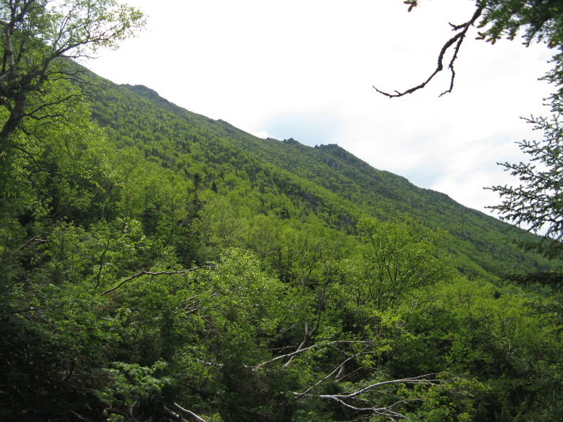 Looking up the avalanche track from the second crossing. I don't think I'll go snowshoeing in here.
After this crossing, the climbing gets pretty steep. Just below Roof Rock, you squeeze through this crevice.
 Roof Rock (3600 ft.) is a cool spot. You can easily duck under with your pack on.
 The trail becomes more boulder-strewn as you approach the open talus on the base of the headwall.
A toppled treeline warning sign.
 Typical ravine headwall boulder scrambling - use of hands required.
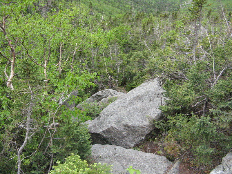 I emerged on the open rocks at about 3900 ft. With my late morning start, this was as far as I planned to go. I found a reasonably comfortable boulder perch beside the trail and settled in to enjoy the views. Above, the steep, rock-strewn headwall looms.
 A great view back down the ravine, with Castle Brook curving away under Mt. Bowman.
The vivid greens of late spring.
 On the R side of the valley is the steep slope of Israel Ridge, showing the little bump of Emerald Bluff. Mts. Starr King and Waumbek are in the back, and the more distant view looks into northern Vermont.
As mentioned earlier, there had been virtually no bugs on this hike - until I emerged on the talus. Here the black flies were swarming. Still, I managed to get a snooze in, with the Castellated Ridge as a backdrop.
 An interesting gully on the west side of the ravine, with a tiny snow patch at the top. This is occasionally skied by backcountry aficionados.
 The route of the trail up the headwall can be seen above, mostly over talus, much of it loose. It's a pretty grueling climb, and not recommended for descent.
 Looking back up the trail.
On the headwall, the trail is marked in orange. The arrow tells the story - it's down!
 Back down by the Emerald Trail junction, I found a peek up at Emerald Bluff.
 I made a loop return by following the Link across to the First Cascade and Israel Ridge Path.
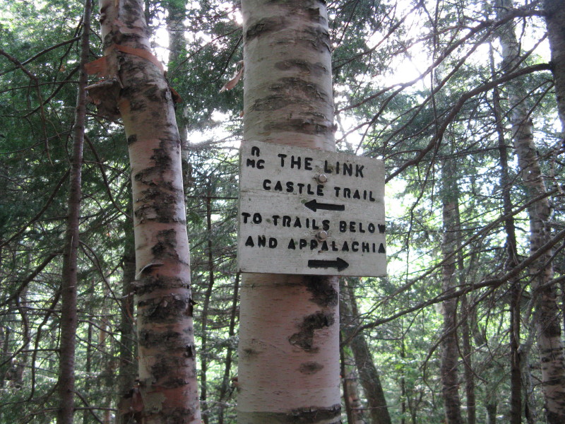 The Link has a horrible reputation due to its nightmarish rough, rooty, bouldery, hole-dotted, ankle-twisting sidehill sections between Caps Ridge Trail and Castle Trail, and again between Castle Trail and Castle Ravine Trail. Much of this section between Castle Ravine Trail and Israel Ridge Path is pleasant, almost Kilkennyish, with open woods and good footing - decidedly un-Link-like.
 As it approaches Cascade Brook and First Cascade, the Link reverts to form, such as this rough, roly-poly traverse across an old slide.
 First Cascade is a neat spot. In this vicinity the great trail-builder J. Rayner Edmands had his Cascade Camp, destroyed in 1927 by a landslide. The Link crosses the brook (which required shallow wading across a ledge) just above the top of the cascade. There's a great dry, flat sitting ledge where you can look down over the series of step-like waterfalls....
 ...and up at Mt. Bowman. This was the only other spot where black flies were a problem today.
There's no path to the bottom of the cascade to give you a look up at it from below. But leave it to my bushwhacking buddy John "1HappyHiker" Compton to find a way down there! John knew of my basic hike plan for today and started in two hours after me, but unfortunately our paths did not cross. John visited both the First and Second Cascades, and while at the first, he whacked steeply down to the base and took some photos looking up. One of these can be seen here on John's always-excellent blog.
 From First Cascade, I headed down the Israel Ridge Path. The first part was a rather tedious sidehill, then the footing improved.
Evening scene along the Israel River.
 A look back at Mt. Jefferson and the headwall of Castle Ravine. What a place!