Continuing on a Wild River Wilderness theme, I climbed the Stony Brook Trail to the col between Mount Moriah and Imp Mountain, scouted out my route from a ledge on the Carter-Moriah Trail, then dropped into the upper Moriah Brook valley on the Moriah Brook Trail and made a scrappy bushwhack to the expansive bare ledges on a southeastern spur of Moriah. I was rewarded with sweeping views over the Wild River Wilderness.
Despite the beautiful sunny, summer-like weather, mine was the only vehicle at the Stony Brook trailhead when I set out at 9:45 am.

A small flume seen from a footbridge a short way in from the trailhead.
There are frequent views of Stony Brook as the trail follows a rooty course through hemlock forest in its lower section.
The crossing a mile in was easy with the current very low water levels.
Beyond the crossing the grades are easy for a long way, though the trail seems to have suffered from erosion in recent years.
There are still some sections with good footing.
After a small brook crossing at 2.3 miles, the trail climbs more seriously.
There is gnarly footing in places along the upper part of the trail.
The final pitch leading up to the col and the Carter-Moriah Trail.
Junction signs and Appalachian Trail blaze.
Heading north, in just a minute or two the Carter-Moriah Trail reaches the first of two ledges overlooking the upper Moriah Brook valley and the ledgy southeastern ridge. The gold birch foliage was really popping.
The second ledge has a great view up to Moriah's south cliffs. The Carter-Moriah Trail runs across the top of those, affording excellent views.
When I first arrived here, I was a little tuckered out from the stiff ascent to the col, and I thought the whack to the ridgecrest ledges - seen at top center - looked daunting. Maybe it would make more sense to just continue up the trail to the summit of Moriah.
But after resting and replenishing, an adventure into the upper Moriah Brook valley was calling.
Into the Wilderness.
After the first steep drop from the col, the trail crosses a boggy area. Thanks to adopter Bill Robichaud and helper Fawn Langerman who cleared out and improved this section in August.
Here there is a peek up at the south cliffs.
I descended to the next level along the trail, then started the whack to the ledges, 500 ft. above.
When John "1HappyHiker" Compton and I snowshoed up to these ledges thirteen years ago, we found some nice birch corridors and not much thick going. Things sure have changed since then. Small scrubby conifers have filled in under the birches and the whack was scrappy pretty much from start to finish.
This was the only birch glade I came across on the ascent, and it was small.
I came up to a ledgy wall and had to make a quick scramble up at this spot.
I emerged on the first open ledges high on the flank of the ridge.
Looking across to Moriah's south cliffs.
After pushing upward through some dense scrub, I reached ledges near the ridgecrest, with views back to the Moriah-Imp col and the peaks of Madison and Adams.
A corridor through friendlier woods led me to the crest of the ridge.
Made it! Elevation here is 3300 ft.
The ledges are dotted with glacial erratics.
More erratics.
Looking up the ridge.
So much open rock! The bare ledges on this ridge are the legacy of a ca. 1895 forest fire that consumed 4,000 acres in the Moriah Brook-Bull Brook area, triggered in slash left by the Wild River Railroad logging operation.
The Carters rise to the south, with long ridges sweeping down into the Wild River Valley.
Adams and Madison behind Imp Mountain.
The Crescent and Pliny Ranges could be seen through the col.

Peering down into the lower Moriah Brook valley, with Meader Ridge and the Baldface Range beyond.
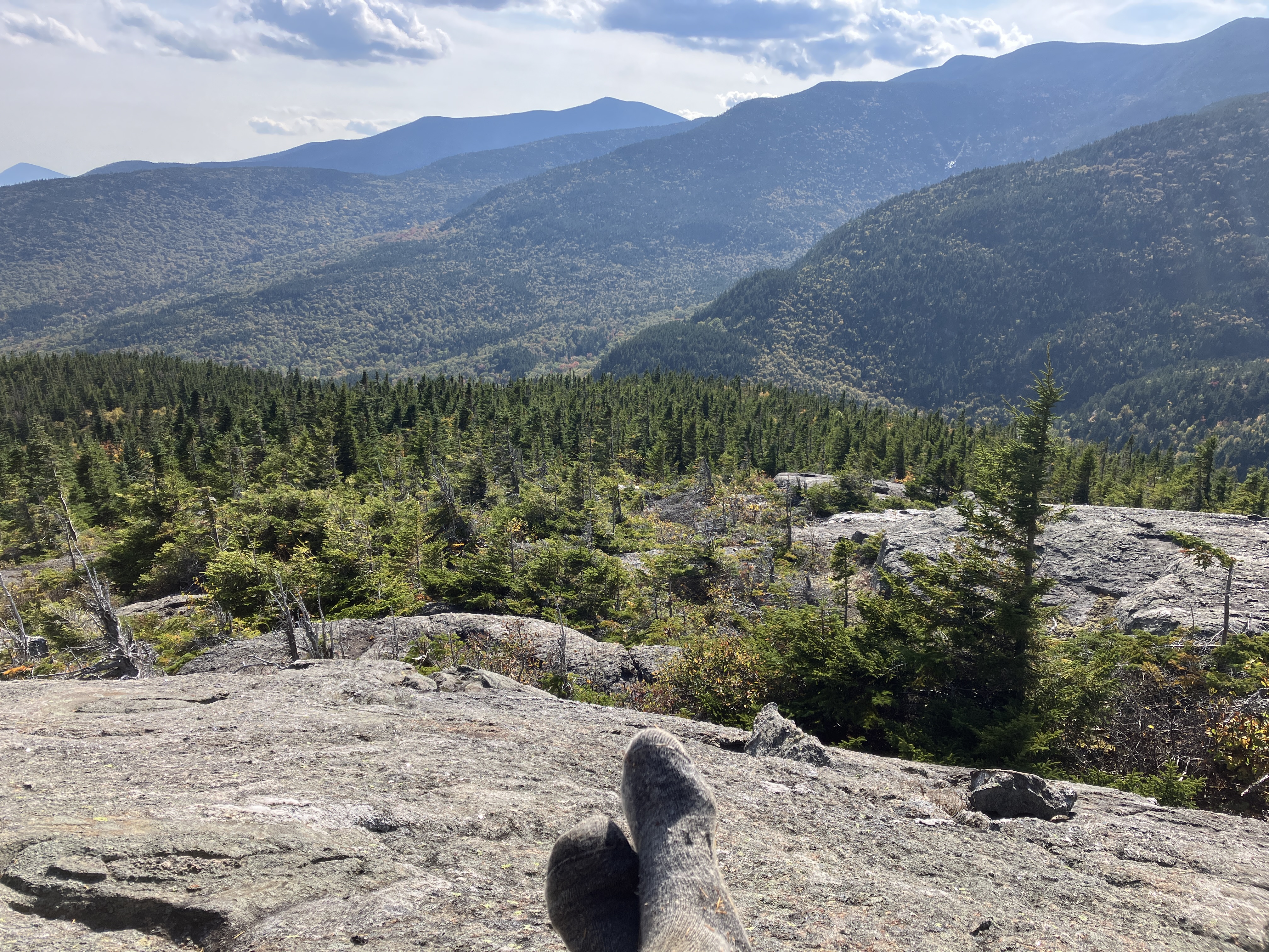
I spent more than an hour here lounging in the late summer sun.
I had hoped to get a good view of the 2011 "Bugs Bunny Slide" in the basin below Mount Lethe, and this perch had a good angle on it, but the September sun was too low and the slide was severely backlit and shadowed. You can just make part of it out under the peak of Middle Carter.
What a perch!
Almost 4 o'clock. Time to head down the ledges and drop back into the scrubby woods.
A couple of small white pines were eking out an existence at 3250 ft.
Looking back up.

Last look at the Carters.
Back into the thick of it. This was goggles territory, and blood was drawn on arms and legs.
I was happy to get back down to the Moriah Brook Trail, though the 350-ft. climb back up to the col was not thrilling.
I popped back up to the ledges on the Carter-Moriah Trail to contemplate where I'd been.
Birch gold aglow in the evening sun. With 3.7 miles to go, it was time to head down, the last mile by headlamp.


No comments:
Post a Comment