
Sunny skies prevailed south of the notches on this fine winter day, following several days of unseasonable warmth. The snowpack had firmed up overnight and with cooler temperatures this day, it looked to remain supportive for snowshoeing. There were numerous reports of trails badly postholed during the thaw, so I headed down to Waterville Valley and the familiar Livermore Trail, where I knew at least the first 2.2 miles would provide smooth snowshoeing. Beyond there I hoped to head out to the NW side of Mount Tripyramid in the Scaur Ridge/Avalanche Ravine area.

I wasn't surprised to find a chopped-up jumble of frozen postholes on Livermore Trail beyond the groomed section. Time to suck it up and weave through them or go along the edge.

White Cascade was sporting a different look after the thaw and refreeze.

Though there was still a bewildering mix of postholes and snowshoe tracks, the trail conditions were somewhat better after the junction with the south end of Mount Tripyramid Trail. The sun was pouring down in the expansive hardwood forest, but the snowpack was holding firm.

At 3.8 miles I turned onto the Scaur Ridge Trail, a longtime favorite that takes you high up on the flank of Scaur Peak.

A looming North Tripyramid welcomes you to the Wilderness.

For its first 0.9 mile the Scaur Ridge Trail follows an old logging road at easy to moderate grades. On this narrower trail snowshoers had coalesced onto a single track, which was quite firm if a bit choppy and peppered with a few postholes.

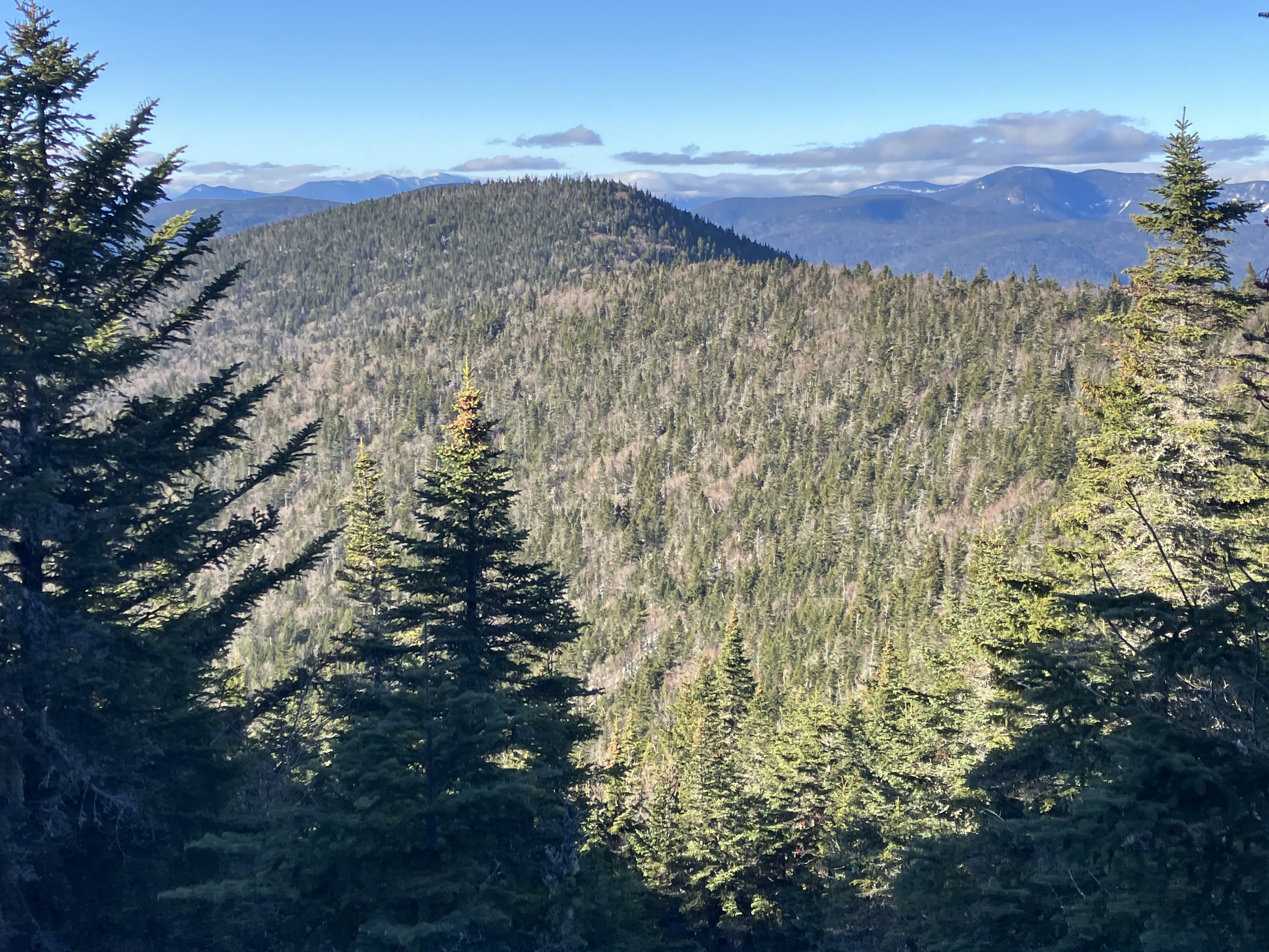
As it cuts across the slope through open hardwoods, the trail provides several looks at the imposing North Slide of Tripyramid, seen across a deep ravine.

At 3100 ft. the trail bends around the head of the ravine above an open glade of old yellow birches.

Climbing briefly towards the sun.

A steady climbs leads to the crest of the ridge.

This upper section was badly postholed.

Near the junction with the Pine Bend Brook Trail, I headed off-trail down to a favorite glade that opens views to the north when there is a decent snowpack.

Mount Carrigain and Carrigain Notch, with Mount Willey peeking over in back.

The Baldface Range beyond Owl Cliff and Bartlett Haystack.

This spot provides the widest view, including the Presidentials, Montalban Ridge, Green's Cliff, the Wildcats and Carters, and Mount Tremont.

Though the Southern Presidentials were mostly socked in, Mount Washington was clear and shining.

As expected, the well-used Pine Bend Brook Trail was a near-concrete sidewalk. A hiker I chatted with by the junction said some of the steep pitches on the cone of North Tripyramid were getting icy and were not pleasant coming down. I opted not to head to the summit, but instead followed the trail along the neat knife-edge ridge shown here, climbed a little way up the cone, then bushwhacked to an open slide patch on the headwall of Avalanche Ravine for more views.

From several previous visits, I knew that the woods were open on the bushwhack, and on this day the sugary snow was quite supportive.

Nice!

Unfortunately, no sun on the NW-facing slide. This is the upper of two remaining open strips on a slide that fell during the same August 1885 rainstorm that triggered Tripyramid's massive North Slide and several others in Avalanche Ravine (or more properly the Ravine of Avalanches).

There's a nice view here centered on Mounts Hancock and Carrigain.

Zoom on Hancock and Carrigain, with Bondcliff and West Bond peering over on the far left.

Nearly three feet of snow at this open spot at 3600 ft.

Flat-topped Scaur Peak rises across the ravine.
The Franconia Range is in the distance over the left side of Scaur Peak.

Afternoon shadows on the Osceolas.

Looking back at my tracks on the return trip to the trail.

Afternoon sun on the knife-edge ridge.

The postholes on the upper Scaur Ridge Trail were more of a hindrance on the descent.

I took a shortcut down through the woods to bypass part of that section.

Gnarled yellow birches at the head of the ravine.

North Tripyramid looking fine.

Golden hour in the hardwoods.

Homeward bound on the Livermore Trail. I navigated the last mile or so by the dim light of a crescent moon.

This hike is dedicated to the memory of my bushwhacking partner Mark Klim, who made frequent appearances in this blog. In the photo below, while en route to Mt. Osceola's Dogleg Slide, Mark had just fooled me by playing a recording of a Saw-Whet Owl and was relishing his prank. He was the best hiking companion you could ask for. RIP, my friend.


I never met Mark, but felt a certain kinship. My condolences!
ReplyDelete