Visiting the big north slide of North Twin Mountain in winter has been on my wish list ever since climbing it in summer three years ago with Cath Goodwin. The recent thaw-freeze cycle had set up some fairly firm snow conditions in the woods. It seemed like a good time to attempt the off-trail journey up the long valley that leads up to the slide.
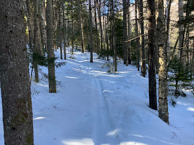
I parked at the Seven Dwarves Motel on Little River Road, left $10 with my planned route in the mailbox, and booted over to Haystack Road (FR 304). After a short jog on that road I put my snowshoes on and turned onto FR 304A, which leads to the lower end of the drainage between North Twin and Peak Above the Nubble. Not far along FR 304A I saw this combined snowshoe/ski track leading up the unofficial path to Peak Above the Nubble.
The snow conditions on FR 304A were excellent for snowshoeing, with a shallow soft layer atop a solid crust. The only downside of the road was the numerous drainage dips to maneuver across.
The brook that drains the long valley was not frozen and sported a tangle of blowdown atthe road crossing. I crossed on small rocks just upstream from the road.
Leaving the road, I bushwhacked up the slope seeking a much older logging road that leads partway up the valley. When I reached it, I found an old hard-frozen track left by backcountry skiers. The north slide of North Twin is skied fairly regularly by backcountry adventurers, and there are several videos of it viewable online. I assumed these skiers must have come in via the North Twin Trail and a crossing of the Little River. It appeared that I had lucked out - a packed track would make the 1.5 mile whack up the valley much more feasible.
The track soon passed a small bog with a view of Mount Hale.
I left the track at a point where it went into an ugly sidehill, but my route higher up the slope led into a lumpy area of boulders and blowdown, so I looped back down to the track and followed it through a nice section of the old logging road.
From a high bank above the stream there were several views of the imposing cliffs and slides on the eastern flank of Peak Above the Nubble.
Looking down into the drainage. Too rough to enter it yet.
At 2800 ft. the skiers' track led to these inscribed moose antlers, which have been a landmark of this valley for years.
Just beyond, the track dropped into the drainage and followed it upstream. Here the brook was locked in with ice and good snowpack.
The track soon led into an opening that marks the lower end of the open runout of the slide, which fell in an October 1995 rainstorm. Here I had the first glimpse of the slide itself, still far up the valley. And here the old skiers' track ended. Perhaps they just wanted to get a view of the slide, or decided it was too far away to continue. From here on I would have to earn my visit to the slide.
Closer look at the slide.
Unbroken snow ahead, which turned out to be soft and unconsolidated on top, but thankfully with a firm underlayer to prevent me from punching through into a waterhole.
A red squirrel dashed out onto the slide track, then scurried back into the dense scrub along the edge.
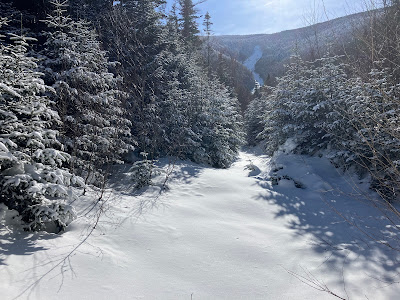
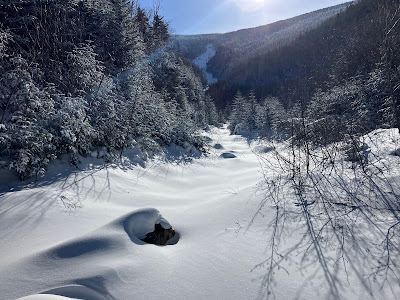
It was a gorgeous sunny day, and as I continued up the track I started to get views back to Peak Above the Nubble.
My progress slowed in areas with short, steep pitches mixed with weaving around boulders.
The long and winding road.
Big rock barring the way.
The slide doesn't seem to be getting much closer...
Sunny, snowy corridor.
Alder shrubs lined the corridor in many spots.
Long view ahead.
A nice open area with PATN in the rearview mirror.
From a bank along the edge I found a view of the older eastern slide that merges with the 1995 slide at its base. The upper part of this slide is a huge icy slab, sort of like Shining Rock on Franconia Ridge.
Final approach to the base of the slide.
Looking back.
A steep pitch at the end.
That was a workout. It took this slow old guy 1.5 hours to break trail the last 0.6 mile to the base of the slide, thanks to numerous little pitches and obstacles along the way.
The slide!
When Cath Goodwin and I climbed this slide in summer, these lower slabs were dangerously slick and we bypassed them through the woods.
A layer of crusty snow allowed safe passage alongside sheets of exposed ice.
A tiny white pine struggles for survival at 3400 ft., well above its normal altitudinal range.
Ahead on the right was a funnel that is steeper than it looks in the photo, a potential terrain trap. There were no signs of avalanche activity and the snow seemed quite stable, but caution must prevail.
Another white pine hanging out on the slide.
As I was climbing up the slide, I was startled to hear voices behind me. Two young backcountry skiers were coming up to take a run on the slide!
His name escapes me, but this skier was in my store recently and we engaged in some "slide talk."Among his recent descents are the Arrow Slide on Mt. Hancock, the Northwest Slides on Scar Ridge, one of the East Osceola slides, and the Dogleg Slide on Mt. Osceola.
I continued up the slide while the skiers took a break below to exchange skis for crampons.
Side view of the funnel that I bypassed.
Going higher.
The exhilaration of open spaces.
What a view!
Looking north to the Nash Stream mountains, the Pilot Range, Mt. Cabot above Cherry Mountain, and Mts. Starr King and Waumbek.
Happy to be earning his turns!
Up they go, continuing almost to the top of the slide at 4250 ft.
I climbed another 100 ft. to 3650 ft., from where I could see farther up the slide. It was tempting to keep going up, but it had taken a long time to get out here and I wanted to be back to the car before a predicted evening snowstorm moved in.
From this shelf the world dropped away.
Icefall.
Down-look.
At 2:30 I headed back down. From the base of the 1995 slide I made a short probe up the track of the older eastern slide. With another hour to spare, I would love to have climbed partway up for a look at the big icy slab.
Parting shot from the base of the 1995 slide.
Heading back down the slide track.
A good snowpack in here at 3000+ feet.
Looking back.
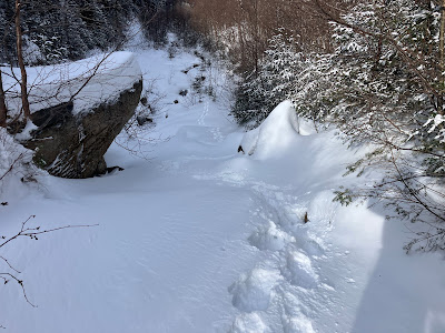
On the way down I wandered off the packed track for a while, weaving through beautiful open woods.
Farther down the valley I chatted with the two skiers. I was happy that they had a safe and enjoyable swoop down the slide.












Hi Steve,
ReplyDeleteAwesome write up and photos!! That was my brother and I up there yesterday. We had a sneaking suspicion we'd run into you as soon as we saw the lone snowshoe tracks heading up to the slide. Thanks for chatting with us! Such a cool area to check out and get some sweet skiing in!
Connor
Hi Connor,
DeleteThanks - it was great to run into you and your brother on the slide. Declan Kiley told me who you were. You guys have been doing some amazing skiing and I have enjoyed watching your videos on You Tube and Instagram - great stuff! I had been thinking about going to the Pea Brook Slide in winter, a friend and I did it in summer. Looks like it hasn't filled in well this winter. Were you able to find parking by the bridge over the brook? Looking forward to seeing more of your adventures!
Steve
Hi Steve, I completely missed this reply! Great to see you again yesterday. Yes, we were able to find space for a few cars over by the bridge! Heading up to ski Sleeper Slide tomorrow, hopefully the storm brings some good coverage!
DeleteConnor
Hi Connor, Great to see you and your mom. Sorry about your busted binding, looked like a pretty tough slog out. You can avoid those 3 crossings of Sabbaday Brook if you cross the brook on the highway, then drop into the woods and whack a quarter-mile south or a bit southwest and pick up an old logging road that you can pretty much follow all the way to Sabbaday Brook Trail just before the Wilderness boundary. It stays on the slope high above the brook as it skirts the side of Potash Mountain. To get to the slide, you can follow another old road from a spot where the trail turns right to descend to the fourth crossing of the main brook (this is just after crossing a tributary.) You cross a steep little drainage, then whack parallel to the main brook before turning left up into the side valley towards the slide, passing through some nice glades
DeleteHi Steve, great to see you too! Oh man that's so good to know!! If the rain doesn't wipe out a lot of the snow over the next few days we may have to get out again to try that approach. Thanks so much!
Delete