I had the pleasure of accompanying geologist Thom Davis into Tunnel Brook Notch, the deep and very scenic pass between Mt. Moosilauke and Mt. Clough, for a field research trip. Thom is mapping the surficial geology of the Mount Moosilauke USGS quadrangle for the State of NH Geological Survey. Along the Tunnel Brook Trail and on two of the eight (or nine, depending on how you count them) slides on Mt. Clough, he noted several interesting geologic features. After Thom headed out in the afternoon to attend a concert that evening, I continued south into the notch and visited three more slides for a variety of views.
Thom checks his notes at a spot where the Tunnel Brook Trail crosses an alluvial fan, an extensive stony outwash from flooding in Tunnel Ravine. Much of this occurred during Tropical Storm Irene in 2011, when a huge slide fell at the head of the ravine. Additional flooding likely occurred during the 2017 Halloween storm.

We bushwhacked a short distance up to the base of the northernmost slide on the steep east face of Mt. Clough, which fell during the November 1927 storm. I had been to this slide twice before. It has two features that Thom wanted to document: an extensive glacial till deposit at the base of the slide, as seen in this photo....
....and well-defined glacial striations on the ledges above. These scratches or gouges were created by glacial abrasion, where rocks and gravel embedded in the base of the continental ice sheet cut into the bedrock. They are oriented generally north to south, the direction in which the glaciers moved. The striations are well-preserved in this erosion-resistant metamorphic rock.

A granitic intrusion - a dike - cuts across the metamorphic ledge.
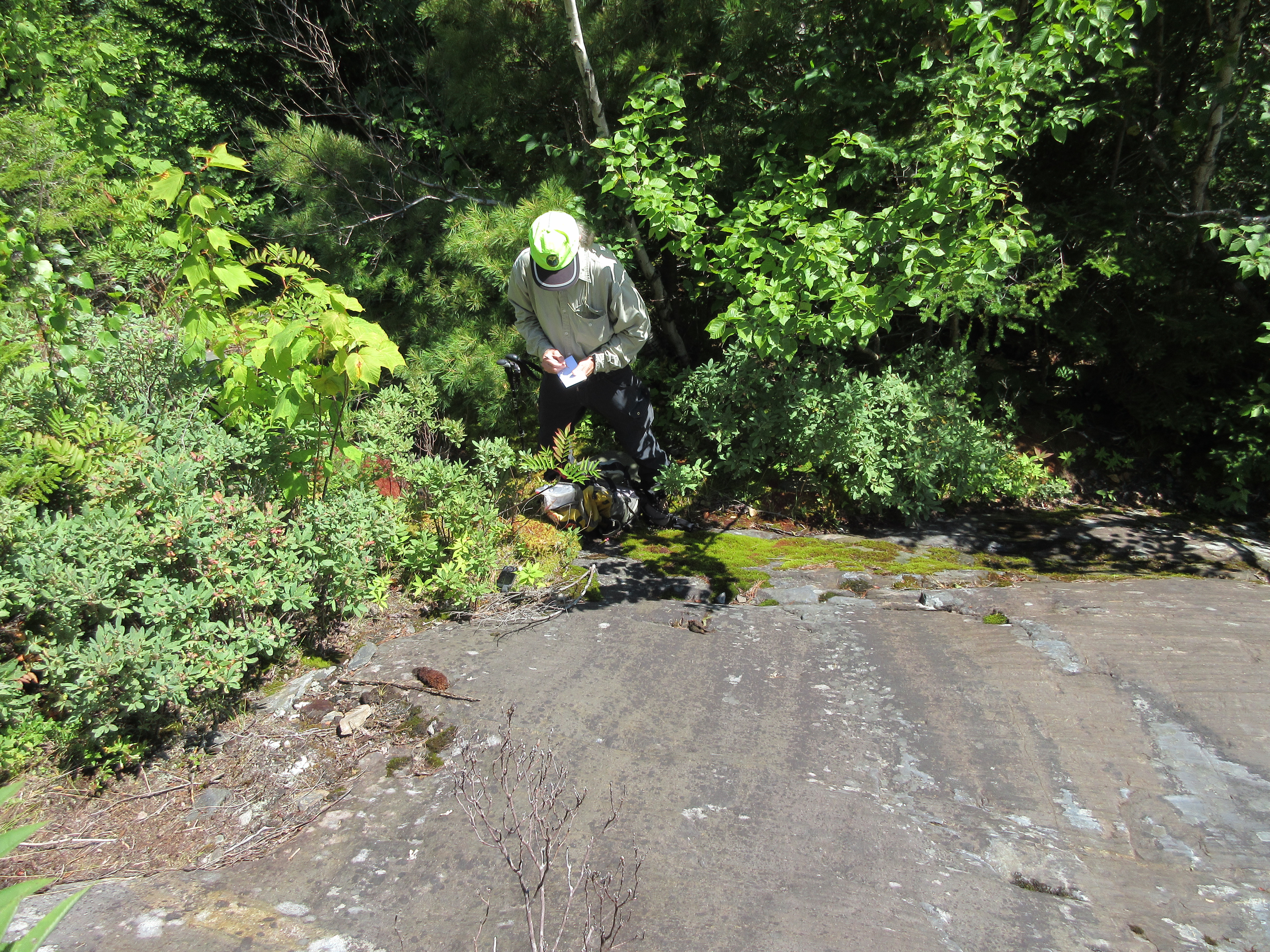
More notes for the log.
Descending over the glacial till deposit, with the NW ridges of Mt. Moosilauke looming beyond.
We continued south on the Tunnel Brook Trail to the northernmost of the beaver ponds strung along the floor of Tunnel Brook Notch. Down at the edge we had a view of several of the slides on Mt. Clough.
High on one of the slides is a striking contact between the dark schist of the Littleton Formation and the lighter Bethlehem granodiorite.
From here we had a good look at our next objective, one of only two Clough slides I had not yet visited. It only rises about 200 feet in elevation, but has plenty of steep exposed bedrock, promising an interesting climb.
After a whack across Tunnel Brook and up the slope beyond, we scrambled up a few ledges and emerged at the base of the main lower slabs of the slide. With its pitch of 35 degrees, we scrambled along the edge and skirted the upper part through dense woods.
Looking steeper.
Yikes!
Down-look from the top of the lower slabs.
The V-shaped wedge of dark woods on the lower west slope of Moosilauke marks the track of a 1927 slide that has grown up to spruce forest.
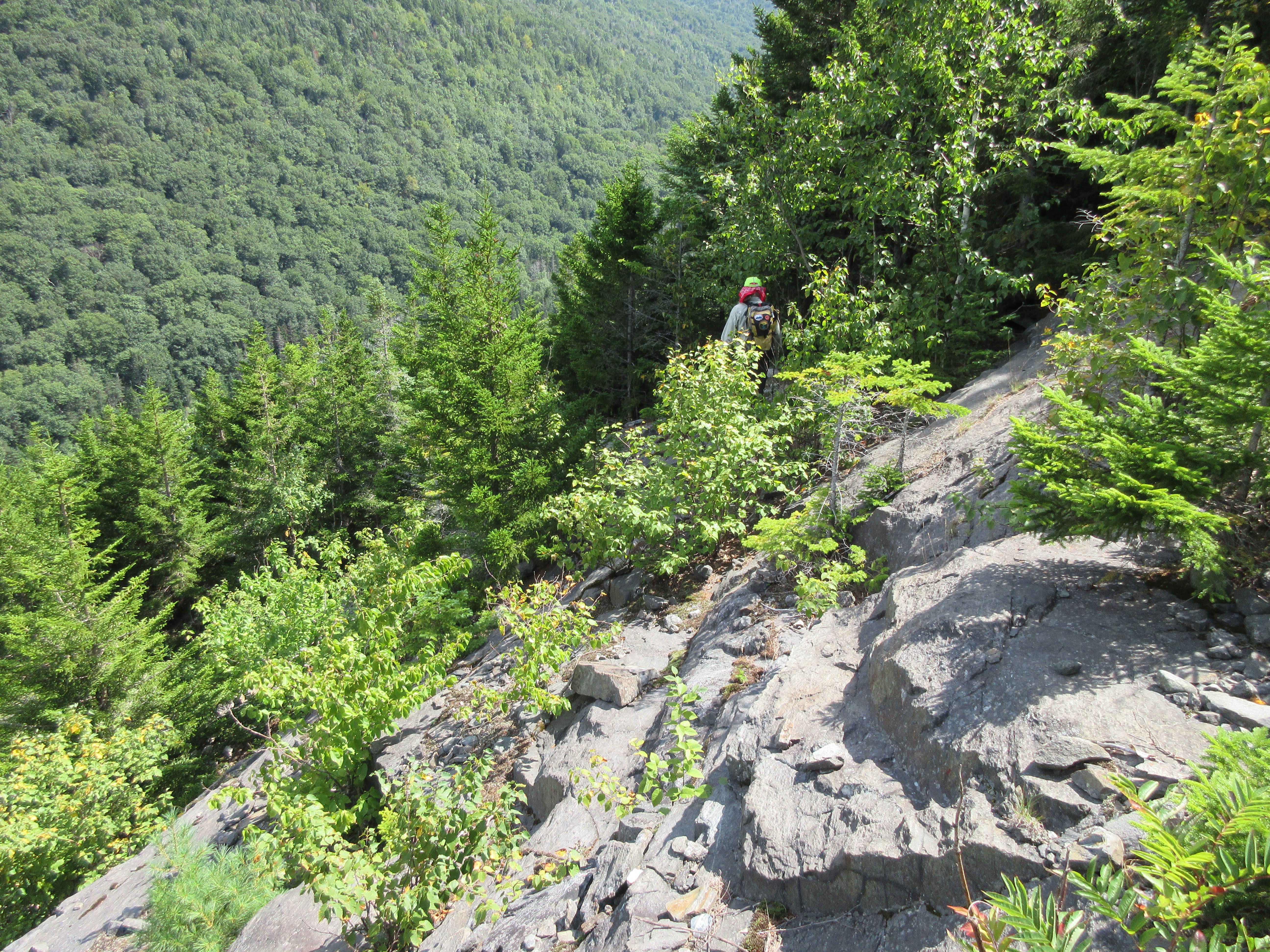
Thom leads the way up a brushy neck of the slide between the lower and upper slabs.
Emerging at the base of the upper slabs.
The rock on this slide was dry and grippy.
Another down-look.
Hazy view out to the north.
Thom heads out to descend to the trail and then home so he could attend the White Mountain Boogie N' Blues Festival.
I found a comfortable shelf and hung out for a while to enjoy the view.
Zoom on the northernmost beaver pond.
Top of the slide.
After a nice sojourn, I contoured south across the slope, through the woods and then out onto the next slide, the widest and most massive of the nine on Clough.
This slide is about 250 feet wide, and I was fortunate enough to emerge at a point where it was safe to traverse across, with a little weaving up and down.
Looking down to another beaver pond.
Another dike cutting across the ledges.
Blocky formations.
Looking back to the north.
Edging across the top of a steep slab.
Into the woods for a longer traverse to the next slide.
The next slide opens a view to Moosilauke's South Peak rising above the slides in Slide Ravine.
Zoom on the biggest slide, which is very steep and covered with loose broken rock. It offers great views out to the west and down into Tunnel Brook Notch.
Heading down the lower slabs of this slide, which rises very steeply above here as the highest of the Clough slides.
The point where bedrock gives way to glacial till.
I spotted a couple of tracks in the gravel from friends who ascended this slide earlier in the month.
Back down on Tunnel Brook Trail, I headed south past more beaver ponds.
A restful spot with a view up to South Peak.
From the trail there is a nice view across Mud Pond, the southernmost and largest of the beaver ponds, up to Slide Ravine and South Peak.
From here I whacked up to the lowest of three open slabs on the mostly revegetated southernmost Clough slide.

A fine view of Slide Ravine from the top of the slab, in late afternoon sun.
Heading home on the pleasant Tunnel Brook Trail.
A view of the Clough slides from a fir wave on a spur ridge of Mt. Moosilauke. The northernmost two slides apparently fell in November 1927, while the rest of the slides came down during storms in 1938 and especially 1942. Thom and I ascended to the lower two horizontal open strips on the slide farthest to the right, then dropped back to the trail, followed it south, and climbed the shorter slide just to the right of the prominent wedge-shaped slide. I traversed across the wedge slide, descended the lower part of the next slide to the left, then continued to the southernmost slide, not visible in this photo.

Another angle on the slides, taken from the South Peak of Moosilauke. Mud Pond is seen below the dark, spotted streak of the southernmost slide. A fascinating area!


No comments:
Post a Comment