
Two days earlier, due to unfavorable snow conditions after a recent thaw/freeze, I had abandoned a plan to bushwhack up the ravine of the north branch of Walker Brook to its headwall below Mt. Lafayette. A test with snowshoes had revealed a breakable crust with unconsolidated sugary snow beneath. But a cold couple of nights had firmed up the snowpack, so on this gorgeous sunny, warm March day I decided to give the bushwhack a try, hoping that it wasn't so warm that the snow would soften up again. The goal was to visit three slides in the long curving ravine, seen here in a view from Old Bridle Path. The first was the only open remnant of a 1938 slide, the white patch near the floor of the valley. The other two were old slides that join at the foot of the ravine headwall, visible as thin white lines.

It was a beautiful sunny morning in the hardwoods along Old Bridle Path.

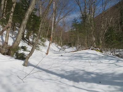
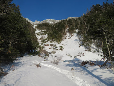
Heading off-trail for the drop into the ravine, the snow was supportive - it's a go!

On the steep south-facing slope that drops to the valley floor, the snow was soft, wet and shallow. I ended up taking my snowshoes off for this pitch and kicking steps in the snow.

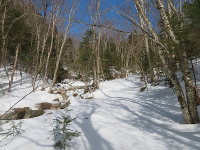
On the floor of the valley, I followed a familiar old logging road that backcountry skiers use to access the Lincoln's Throat slide. And indeed there were some old firm ski tracks through here.
In a half-mile I came to the fork where the two branches of Walker Brook unite. The skiers go up the right (south) fork. I was headed up the left (north) fork.
Access to the north fork requires a steep climb up to the start of the ridge that divides the streams. This was nasty on thin crusty snow, with a fair amount of tree-pulling.

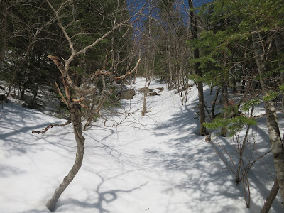
Once above this, the grade became easy through consistently open woods.

Along the way there were several glimpses up to the cliffs below the Old Bridle Path outlooks.

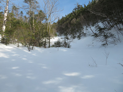
Fine open glades.

Along Walker Brook, approaching the 1938 slide.

Not bad for a low snow year.

Heading up one of the lower tracks of the 1938 slide.
Emerging on the open part of the slide, with a bit of Franconia Ridge seen above.

Bare gravel and rock! I found a seat on a boulder and spent a half-hour basking in the sun.

A hazy distant view to the SW beyond the Old Bridle Path cliffs.

A few young white pines were mixed in with diminutive balsam firs. The pines are not found on the floor of the valley - I wondered how they populate this remote opening.

The slope meter showed an angle of about 29 degrees next to my perch. The slope looked steeper just above.

Looking down.

I dropped back to the brook and continued up the valley along the south side, catching a glimpse up to the crest of Mt. Lafayette.

Open woods cloaked the broad valley floor, as far as I could see.

Amazing.

In this upper part of the valley the snow was softer and the breaking was heavy at times.

A glimpse of the little notch on the ridgeline atop the ravine headwall.

Eventually the walls of the valley closed in and the bushwhacking became more difficult.

This upper part of Walker Brook was an elongated crevasse.

Crawling under this blowdown was the only way to get through this spot along the brook.

The next stretch required a steep sidehill. Luckily the snow was soft enough for making good steps with my snowshoes.

I finally reached the fork where slide drainages come down from ahead and from the right. I had planned to go ahead first, but this snow bridge, with several feet of air beneath, gave me pause.

It looked doable, but I decided not to chance it.

An open wooded corridor beckoned as a route to the right-hand slide, which comes down from the steep slope below "Truman Peak," the rocky nubble between Mt. Lafayette and Mt. Lincoln.

I emerged on the slide at the base of a steep, broad ledge step, perhaps a cascade in summer.

The snow was good for making a zig-zag ascent. Low avalanche danger this day.

View from the top of the cascade. Part of the Agonies visible in the distance.

An inviting snowy slide corridor ahead.
In summer this is likely wet, dangerously slippery ledge slab, but it's a joy to ascend in late winter.

Looking back; Cannon Mountain on the horizon.

Icefalls lining the corridor ahead.

Wintry beauty around every bend.

Great conditions for slide 'shoeing.

My objective on this slide was the base of a wide swath of ledge slab at ~4000 ft., visible on Google Earth. Here I found a sun-washed shelf with a view up to a great ice cliff and rime-frosted Truman Peak rising beyond.
Zoomed.

I climbed a little higher to see the full extent of the ice cliff. Quite the spot!

Looking back to North Kinsman and Cannon.

It was well into mid-afternoon by the time I made a steep sidehill traverse through the woods to visit the central slide on the headwall.

As luck would have it, I came out at a spot where the slide was easily accessible.

Looking up the slide to the little notch on the ridgeline.

Debris from a recent avalanche?

Nice gentle spot from which to take in the headwall scene.
Looking out to the Kinsmans, with a bit of Lonesome Lake visible below.

Lafayette crags.

Zoom on the ridgeline notch.

Looking back while descending the slide.

Gnarly gully below, time to take to the woods.

The ridge that divides the two branches of Walker Brook.

I really lucked out with the woods on this trip.

Boulder cave along the lower part of the slide.

Last look up to the Lafayette crags. I believe the notch on the left, partly screened by branches, is part of what the late Guy Waterman called "Gateway Gully," a favorite route of his to the summit of Lafayette.

From the bottom of the central slide I found a passable crossing over the brook that drains the Truman Peak slide.

Heading back down the long valley into the late day sun. Did the last hour by headlamp, concluding
a memorable bushwhack.


That was exhilarating, Steve!
ReplyDelete