The Adirondacks are known for their many dramatic slides. Slide climbing is a thing in the 'dacks. There is even a book, The Adirondack Slide Guide, by Drew Haas, that features winter aerial photos of dozens of named slides, intended as a rough guide for backcountry skiers (but with no route descriptions; find your own way). There is an "Adirondack Slide Climbing" Facebook group, and a sub-forum on slide climbing on the ADK High Peaks Forum website. Kevin "Mudrat" MacKenzie, one of the most accomplished climbers in the 'dacks, has a wealth of information on Adirondack slides, including many photo mosaics, on his adirondackmountaineering.com website.
Having become a slide enthusiast in the Whites in recent years, I wanted to sample at least one of the "easier" slides in the 'dacks on this trip.(There are a number that are steep enough in places to be considered technical climbs.) One that struck my fancy was a slide on Wright Peak triggered by the massive rainfall of Tropical Storm Irene. Because it has a dogleg shape, it has been dubbed the "Wright Angle Slide." It is next to two older slides known as the Angel Slides.
I took the morning to relax after a full day and late exit on Jay Mountain the day before, and got a crack o' noon start from the major trailhead at Adirondak Loj, the High Peaks headquarters for the Adirondack Mountain Club. The approach to the slide was on the easy lower 2.3 miles of the Van Hovenberg Trail, the major approach to Mt. Marcy. Most of this section is a packed dirt surface with excellent footing, and part passes through a fine open hardwood forest. Trail crews from DEC and ADK have done much good work to improve this route.
The location known as Marcy Dam was formerly a pond, but Tropical Storm Irene destroyed the dam, so the opening is now a meadow. It's still an iconic High Peaks locale, a popular camping spot (in nearby lean-tos and at designated sites) and a dramatic photo-op looking up at Mt. Colden and several of its many massive slides.
From here I could study my objective. The Wright Angle Slide is on the right, the two Angel Slides on the left.
The big bright slide looked a little intimidating from here, I will confess, especially the big bulging footwall. The long lower track of the slide is hidden from here.
I launched the short bushwhack to the slide track from a secluded lean-to.
Easy going in open woods.
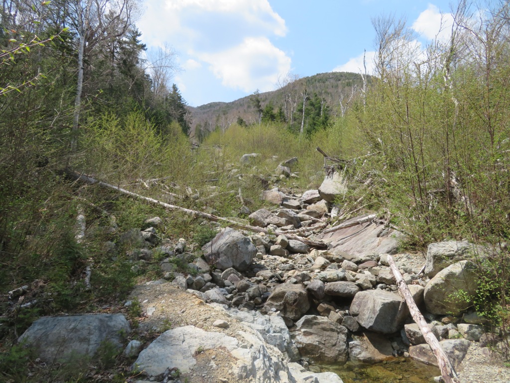
Onto the rubbly track at 2450 ft.
A mix of boulders and fractured ledges.
First views back to Phelps, Tabletop and TR Mountains.
Scene of destruction, ten years later.
Natural staircase.
The way was barred by this giant chockstone, with torn trees piled on top. I detoured around this through the woods.
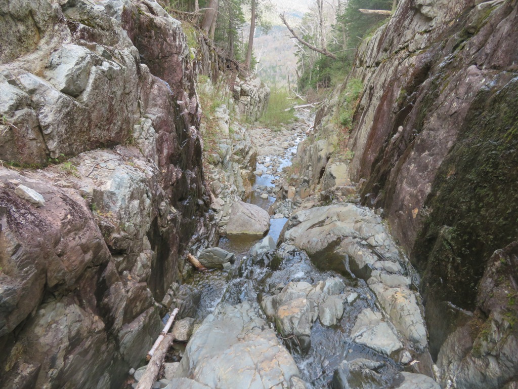
Farther up the track I came to one of the most interesting features of this slide: a flume-like canyon with high rock walls. I had seen this on a couple of trip reports and wondered how passable it would be for a non-climber.
Heading in - it actually looked like a fun scramble.
And it was! Looking back from the first pitch.
The canyon goes on for some distance.
View back from farther up.
The exit in sight ahead.
Exit scramble.
Cool ledges at the top of the canyon. Would have been something to see the slide come thundering down through here.
At ~2850 ft. there's a fork in the slide. The right fork was blocked by a tangle of tree trunks, so the left fork was the choice here.
Good going on the left fork.
Farther up I traversed over to the right fork, as a report had noted tough going on the upper part of the left fork. Here the slide had carved a gravelly gouge.
Bluets were blooming on this part of the track. As seen in the top of the photo, an interesting feature of this slide was the large number of cedar seedlings repopulating the gravelly areas. I don't recall ever seeing cedar revegtating a White Mountain slide.
I soon arrived at the base of the bulging footwall.
I chose a route up along the right side.
Looking back over the top of the footwall.
Above here the climbing was exhilarating on super-grippy slabs of anorthosite, the primary Adirondack High Peaks bedrock.
Into the great wide open.
Fun stuff!
Looking across the slabs to Mt. Marcy (on the right) in the distance.
The steeper top of the slide in sight above.
I continued partway up the steeper section to 3425 ft., about 300 ft. below the top. I reminded myself that I needed to be able to come down whatever I went up. Plus, the view was constricting a bit on this narrower part of the slide.
Steep enough.
Layered look.
Had I a full day it would have been neat to loop over the ledgy ridge close by to the left, as at least a few ADK bushwhackers have done, and gain some intimate views of the slide.
I went back down a bit to the widest part of the slide for a long break in the afternoon sun.
View without boots. Cascade and Porter Mountains are on the left. The clearing at Marcy Dam is in the center.
Zoom on Mt. Marcy.
Heading back down after an hour's sojourn.
Side view of the footwall.
Down near the fork I took to the friendly woods beside the slide, as I did not want to descend through the canyon, and it would be quicker and easier than working down through the rubble of the track below.
I continued down to the very bottom of the track, just below the terminal tangle of trees.
Below here was just a normal mountain stream.
Evening light on Mt. Colden.
Colden's Avalanche Pass slide, which fell during Hurricane Floyd in 1999, looked ominous. Don't think I'll be trying that one.


No comments:
Post a Comment